Category:Ardclinis
Jump to navigation
Jump to search
English: Ardclinis is a civil parish and townland of 355 acres in the Electoral Division of Ardclinis, in Civil Parish of Ardclinis, in the Barony of Glenarm Lower, in the County of Antrim
human settlement in Northern Ireland  | |||||
| Upload media | |||||
| Instance of | |||||
|---|---|---|---|---|---|
| Location |
| ||||
 | |||||
Subcategories
This category has only the following subcategory.
A
- St Mary's church, Ardclinis (3 F)
Media in category "Ardclinis"
The following 42 files are in this category, out of 42 total.
-

-
 A2 Road - geograph.org.uk - 5084899.jpg 640 × 480; 528 KB
-
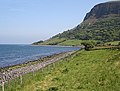
 Antrim Coastline east of Waterfoot - geograph.org.uk - 5750807.jpg 640 × 480; 422 KB
-
 Approaching Ardclinis, south of Glenariff - geograph.org.uk - 2585860.jpg 1,024 × 498; 89 KB
-
 Ardclinis - geograph.org.uk - 466925.jpg 640 × 485; 271 KB
-
 Ardclinis - geograph.org.uk - 466931.jpg 640 × 427; 280 KB
-
 Ardclinis - geograph.org.uk - 466938.jpg 640 × 402; 193 KB
-
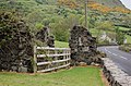
 Ardclinis Bridge - geograph.org.uk - 3884529.jpg 640 × 480; 278 KB
-
 Ardclinis Bridge - geograph.org.uk - 5084895.jpg 640 × 360; 419 KB
-
 Ardclinis Old Church - geograph.org.uk - 5844112.jpg 1,024 × 768; 222 KB
-
 Ardclinis, burn - geograph.org.uk - 5844092.jpg 1,024 × 768; 241 KB
-
 Ardclinis, disused bridge - geograph.org.uk - 5844104.jpg 1,024 × 768; 177 KB
-

-
 Boulders at the Galboly Chalk Quarry - geograph.org.uk - 3723831.jpg 918 × 1,024; 118 KB
-
 Chalk cliffs at Garronpoint - geograph.org.uk - 3308495.jpg 1,200 × 1,600; 1.29 MB
-
 Coast Road view - geograph.org.uk - 4016843.jpg 3,648 × 2,736; 4.35 MB
-
 Coastal Cottages - geograph.org.uk - 5750816.jpg 640 × 427; 278 KB
-
 Cois an Ailt - geograph.org.uk - 3884523.jpg 640 × 480; 321 KB
-
 Crags, Galboly - geograph.org.uk - 3883280.jpg 640 × 480; 338 KB
-
 Crags, Galboly - geograph.org.uk - 3883299.jpg 640 × 480; 299 KB
-
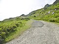
 Farm road - geograph.org.uk - 3884543.jpg 640 × 480; 331 KB
-
 Galboly - geograph.org.uk - 3883290.jpg 640 × 480; 293 KB
-
 Garron Plateau Escarpment - geograph.org.uk - 3884516.jpg 640 × 480; 285 KB
-
 Garron Road - geograph.org.uk - 3884564.jpg 640 × 480; 233 KB
-
 Glenariff, track - geograph.org.uk - 5843966.jpg 1,024 × 768; 208 KB
-
 Gorge, Ardclinis Burn - geograph.org.uk - 3884554.jpg 640 × 480; 276 KB
-

-
 Pasture beside the Ardclinis Burn - geograph.org.uk - 3884535.jpg 640 × 480; 214 KB
-
 Quarry road leading from the A2 at Galboly - geograph.org.uk - 3723835.jpg 768 × 1,024; 123 KB
-

-
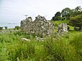
 Ruin - geograph.org.uk - 445193.jpg 640 × 424; 72 KB
-
 Ruin, Fallowvee - geograph.org.uk - 3883306.jpg 640 × 480; 307 KB
-
 Ruined church at Ardclinis - geograph.org.uk - 2585829.jpg 1,024 × 768; 176 KB
-
 Salmon cage frame - geograph.org.uk - 3884559.jpg 640 × 480; 241 KB
-
 Salmon Cages off the Antrim Coast - geograph.org.uk - 5750803.jpg 640 × 427; 298 KB
-
 Scree fan, Galboly - geograph.org.uk - 4038450.jpg 640 × 480; 315 KB
-
 The Cushenilt Gorge - geograph.org.uk - 3712008.jpg 1,024 × 754; 111 KB
-
 The Cushenilt Gorge near Glenariff - geograph.org.uk - 3712019.jpg 1,024 × 754; 102 KB
-
 The gorge of the Cushenilt Burn - geograph.org.uk - 2585804.jpg 1,024 × 768; 105 KB
-
 The hanging valley of Crearlagh Burn - geograph.org.uk - 3723828.jpg 1,024 × 768; 196 KB
-
 The old Ardclinis Bridge - geograph.org.uk - 2585823.jpg 1,024 × 675; 104 KB
-


