Category:Bacton, Herefordshire
Jump to navigation
Jump to search
village and civil parish in Herefordshire, UK  Eglwys Santes Ffaith, Bacton | |||||
| Upload media | |||||
| Instance of | |||||
|---|---|---|---|---|---|
| Location | Herefordshire, West Midlands, England | ||||
| Population |
| ||||
 | |||||
Cymraeg: Pentref a chymuned yn Lloegr ydy Bacton, Swydd Henffordd.
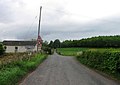
English: Bacton is a small village in the rural area of south-west Herefordshire, England. The parish church dates from 13th century and has a relatively long entry in Pevsner's survey of the county's buildings. Inside the church is Blanche Parry's memorial; Parry was Chief Gentlewoman of Queen Elizabeth’s most honourable Privy Chamber and Keeper of Her Majesty’s jewels.
Polski: Bacton – wieś w Anglii, w hrabstwie Herefordshire. Leży 16 km na południowy zachód od miasta Hereford i 200 km na zachód od Londynu.

Subcategories
This category has the following 2 subcategories, out of 2 total.
B
- Bacton Altar Cloth (5 F)
Media in category "Bacton, Herefordshire"
The following 91 files are in this category, out of 91 total.
-

-
 Abandoned machinery - geograph.org.uk - 4497408.jpg 800 × 600; 306 KB
-
 Autumnal oak - geograph.org.uk - 3753885.jpg 800 × 600; 293 KB
-
 B4347 crossing the Dore valley - geograph.org.uk - 6593187.jpg 480 × 640; 272 KB
-
 Bacton City Limits - geograph.org.uk - 3753879.jpg 800 × 450; 269 KB
-
 Bacton entrance sign - geograph.org.uk - 2404371.jpg 640 × 454; 53 KB
-
 Bacton Railway Station - geograph.org.uk - 5961295.jpg 4,096 × 3,072; 3.84 MB
-
 Bacton Village Hall - geograph.org.uk - 5391122.jpg 5,184 × 3,456; 7.57 MB
-
 Bacton Village Hall - geograph.org.uk - 5961238.jpg 3,648 × 2,736; 4.41 MB
-
 Bacton Village Hall - geograph.org.uk - 5961259.jpg 3,648 × 2,736; 4.21 MB
-
 Bacton Village Hall - geograph.org.uk - 6593109.jpg 640 × 480; 90 KB
-
 Bluebells in Lawn Wood - geograph.org.uk - 4936440.jpg 640 × 480; 156 KB
-
 Bread oven, Paradise cottage, Bacton - geograph.org.uk - 1193257.jpg 480 × 640; 94 KB
-
 Church Cottage, Bacton - geograph.org.uk - 6189464.jpg 3,323 × 2,209; 1.78 MB
-
 Church House (Bacton) - geograph.org.uk - 5961006.jpg 3,648 × 2,736; 4.86 MB
-
 Church House (Bacton) - geograph.org.uk - 5961231.jpg 3,648 × 2,736; 4.74 MB
-
 Dead tree in a field - geograph.org.uk - 2288359.jpg 1,024 × 680; 174 KB
-
 Driveway to Ford - geograph.org.uk - 6593176.jpg 640 × 480; 146 KB
-

-
 Farm track by Cwm-sais Wood - geograph.org.uk - 4497396.jpg 600 × 800; 281 KB
-
 Field edge path above a small pond - geograph.org.uk - 4935976.jpg 640 × 480; 102 KB
-

-
 Fields of gold - geograph.org.uk - 4497111.jpg 800 × 450; 243 KB
-
-
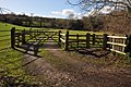 Gate and access track at Bacton - geograph.org.uk - 2289813.jpg 1,024 × 680; 293 KB
-
 Golden Valley Railway Line (Bacton) - geograph.org.uk - 5961289.jpg 3,648 × 2,736; 4.2 MB
-
 Hereford trail near Bacton - geograph.org.uk - 1194088.jpg 640 × 480; 115 KB
-
 Hereford trail near Bacton Manor - geograph.org.uk - 1194084.jpg 640 × 480; 69 KB
-
 Hillside above the Golden Valley - geograph.org.uk - 2288952.jpg 1,024 × 680; 150 KB
-
 Lane at Bacton, Herefordshire - geograph.org.uk - 4935998.jpg 640 × 480; 84 KB
-
 Lane at Upper Grange - geograph.org.uk - 3753893.jpg 800 × 600; 323 KB
-
 Lane to Bacton - geograph.org.uk - 3753895.jpg 800 × 600; 292 KB
-
 Lodge near Bacton manor - geograph.org.uk - 1194111.jpg 640 × 480; 78 KB
-
 Logging track in forestry - geograph.org.uk - 4925118.jpg 640 × 480; 89 KB
-
 Maentwlch in the Golden Valley - geograph.org.uk - 2289827.jpg 680 × 1,024; 138 KB
-
 Newcourt Farm - geograph.org.uk - 4497356.jpg 800 × 450; 279 KB
-
 Newcourt Farm, Bacton - geograph.org.uk - 1194068.jpg 640 × 480; 70 KB
-
 Newcourt Farm, Bacton - geograph.org.uk - 2289836.jpg 1,024 × 680; 166 KB
-
 Newcourt Farm, from above - geograph.org.uk - 4497360.jpg 800 × 600; 294 KB
-
 Newcourt Farm, Golden Valley - geograph.org.uk - 4497103.jpg 800 × 451; 287 KB
-
 Newcourt farmer - geograph.org.uk - 4497390.jpg 800 × 450; 269 KB
-

-
 Oak-lined lane - geograph.org.uk - 3753887.jpg 800 × 600; 335 KB
-
 Old Tap at Bacton - geograph.org.uk - 5961252.jpg 3,648 × 2,736; 4.82 MB
-
 On the Herefordshire Trail - geograph.org.uk - 4925326.jpg 640 × 480; 104 KB
-

-
 On the Herefordshire Trail in spring - geograph.org.uk - 4925144.jpg 640 × 480; 102 KB
-
 On the Herefordshire Trail in spring - geograph.org.uk - 4925153.jpg 640 × 480; 160 KB
-
 On the Herefordshire Trail in spring - geograph.org.uk - 4925169.jpg 640 × 480; 118 KB
-
 Paradise cottage, near Bacton - geograph.org.uk - 1193239.jpg 640 × 480; 102 KB
-
 Paradise Cottage, near Bacton - geograph.org.uk - 1228807.jpg 640 × 480; 115 KB
-
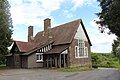
 Parish Hall at Bacton - geograph.org.uk - 391604.jpg 640 × 426; 101 KB
-
 Pasture near Apple Tree Farm, Bacton - geograph.org.uk - 6592730.jpg 640 × 480; 253 KB
-
 Pen-twyn - geograph.org.uk - 4925342.jpg 640 × 480; 68 KB
-
-

-
 Riverdale - geograph.org.uk - 206599.jpg 640 × 480; 57 KB
-
 Rolling Herefordshire countryside - geograph.org.uk - 1192575.jpg 640 × 480; 105 KB
-
 Stile in the hedgeline - geograph.org.uk - 4936401.jpg 640 × 480; 114 KB
-
 Stone disc in the stream - geograph.org.uk - 4925198.jpg 640 × 480; 76 KB
-
 Stream from the wooden footbridge - geograph.org.uk - 4925186.jpg 640 × 480; 141 KB
-
 The B4347 pastsing Bacton Stud - geograph.org.uk - 2289806.jpg 1,024 × 680; 324 KB
-
 The Golden Valley - geograph.org.uk - 4497431.jpg 800 × 600; 329 KB
-
 The rich red earth of Herefordshire - geograph.org.uk - 1557616.jpg 640 × 480; 91 KB
-
 Track in the wood - geograph.org.uk - 4925125.jpg 640 × 480; 115 KB
-
 Two walkers on the Newcourt Farm path, 1 - geograph.org.uk - 4497370.jpg 800 × 600; 292 KB
-
 Two walkers on the Newcourt Farm path, 2 - geograph.org.uk - 4497378.jpg 800 × 450; 253 KB
-
 Two walkers on the Newcourt Farm path, 3 - geograph.org.uk - 4497385.jpg 800 × 491; 244 KB
-
 Uphill approach to Pen-twyn farm - geograph.org.uk - 4925334.jpg 640 × 480; 51 KB
-

-
-

-
 Walking a pasture to the wood - geograph.org.uk - 4936425.jpg 640 × 480; 75 KB
-
 Waterfall near Bacton, Herefordshire - geograph.org.uk - 4935987.jpg 640 × 480; 151 KB
-

-
 Woodland and farmland, 1 - geograph.org.uk - 4497419.jpg 800 × 451; 204 KB
-
 Woodland and farmland, 2 - geograph.org.uk - 4497421.jpg 800 × 451; 218 KB
-
 Woodland edge - geograph.org.uk - 4497425.jpg 800 × 451; 194 KB
-
 Course of the old Golden Valley Railway - geograph.org.uk - 624716.jpg 640 × 426; 101 KB
-
 Entrance to Bacton Manor - geograph.org.uk - 206604.jpg 640 × 480; 65 KB
-
 Farmland to the west of Bacton - geograph.org.uk - 391590.jpg 640 × 426; 139 KB
-
 Footbridge in the Golden Valley - geograph.org.uk - 627501.jpg 426 × 640; 109 KB
-
 Hay Bales - geograph.org.uk - 206589.jpg 640 × 480; 46 KB
-
 Maentwlch in the Golden Valley - geograph.org.uk - 624641.jpg 640 × 426; 84 KB
-
 Motte and Bailey, Bacton - geograph.org.uk - 624704.jpg 640 × 426; 75 KB
-
 Newcourt Farm, Bacton - geograph.org.uk - 624707.jpg 640 × 426; 86 KB
-
 Sheep troughs near Maentwlch - geograph.org.uk - 627495.jpg 426 × 640; 102 KB
-
 Trees at Bacton - geograph.org.uk - 391597.jpg 640 × 426; 116 KB
-
 Two more dead trees - geograph.org.uk - 206585.jpg 640 × 480; 54 KB
-
 Weedy field - geograph.org.uk - 206582.jpg 640 × 480; 74 KB
-
 Wheat field - geograph.org.uk - 206594.jpg 640 × 480; 64 KB


_-_geograph.org.uk_-_5961006.jpg)
_-_geograph.org.uk_-_5961231.jpg)


_at_Bacton_Crossroads_-_geograph.org.uk_-_943415.jpg)


_-_geograph.org.uk_-_5961289.jpg)


