Category:Baie d'Auvernier
Jump to navigation
Jump to search
| Object location | | View all coordinates using: OpenStreetMap |
|---|
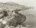
archaeological site in Colombier in the canton of Neuchâtel, Switzerland 20110831_1772_HDR.jpg) | |||||
| Upload media | |||||
| Instance of | |||||
|---|---|---|---|---|---|
| Part of | |||||
| Location | |||||
| Heritage designation | |||||
 | |||||
Media in category "Baie d'Auvernier"
The following 10 files are in this category, out of 10 total.
-
 Archives Milvignes Auvernier photographies aeriennes 20e siecle v.2019.16873 002.tif 5,575 × 4,384; 70.16 MB
-
 Auvernier Baie d'Auvernier (stations lacustres préhistoriques)20110831 1772 HDR.jpg 6,044 × 4,030; 16.19 MB
-
 Auvernier Baie d'Auvernier (stations lacustres préhistoriques)20110831 1777 HDR.jpg 6,046 × 4,031; 15.66 MB
-
 Auvernier Baie d'Auvernier (stations lacustres préhistoriques)20110831 1782 HDR.jpg 6,045 × 4,030; 13.1 MB
-
 Auvernier Baie d'Auvernier (stations lacustres préhistoriques)20110831 1786 HDR.jpg 6,046 × 4,030; 13.22 MB
-
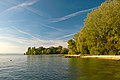
 Baie et plage d'Auvernier.jpg 2,272 × 1,704; 946 KB
-
 Colombier Baie d'Auvernier (stations lacustres préhistoriques)20110831 1771 HDR.jpg 6,044 × 4,030; 16.19 MB
-
 Colombier Baie d'Auvernier 20110831 1787 HDR.jpg 6,046 × 4,030; 15.67 MB
-
 Die Gartenlaube (1899) b 0030.jpg 963 × 1,179; 107 KB
-
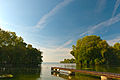
 Port de Robinson - panoramio.jpg 1,024 × 768; 211 KB
20110831_1777_HDR.jpg)
20110831_1782_HDR.jpg)
20110831_1786_HDR.jpg)

20110831_1771_HDR.jpg)

_b_0030.jpg)
