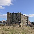
Category:Barkerend
Jump to navigation
Jump to search
inner city area in Bradford, England | |||||
| Upload media | |||||
| Instance of | |||||
|---|---|---|---|---|---|
| Location | Bradford, West Yorkshire, Yorkshire and the Humber, England | ||||
 | |||||
Barkerend is an inner-city area in the Bowling and Barkerend ward of Bradford District.
Subcategories
This category has the following 4 subcategories, out of 4 total.
Media in category "Barkerend"
The following 54 files are in this category, out of 54 total.
-
Allotments - Burnsall Street - geograph.org.uk - 424674.jpg 640 × 338; 77 KB
-
Barkerend Fisheries - Barkerend Road - geograph.org.uk - 438137.jpg 640 × 587; 107 KB
-
Barkerend Mills (16157124384).jpg 2,523 × 2,523; 5.07 MB
-
Barkerend Mills (16572158287).jpg 2,806 × 3,344; 4.4 MB
-
Barkerend Mills - geograph.org.uk - 757546.jpg 640 × 428; 69 KB
-
Barkerend Mills - geograph.org.uk - 757595.jpg 431 × 640; 84 KB
-
Barkerend Mills - off Barkerend Road - geograph.org.uk - 1545029.jpg 640 × 406; 78 KB
-
Barkerend Road Mosque - geograph.org.uk - 417094.jpg 640 × 352; 46 KB
-
Beech Grove Park - Palmer Road - geograph.org.uk - 1003105.jpg 640 × 471; 232 KB
-
Byron Primary School - Barkerend Road - geograph.org.uk - 693086.jpg 640 × 430; 50 KB
-
Children's Play Area - Maudsley Street - geograph.org.uk - 417109.jpg 640 × 584; 137 KB
-
Chimney of Barkerend Mills, Bradford - geograph.org.uk - 1843618.jpg 2,048 × 1,536; 738 KB
-
City Sports Centre - Feather Road - geograph.org.uk - 1573330.jpg 640 × 418; 81 KB
-
Cock and Bottle - Barkerend Road - geograph.org.uk - 587896.jpg 640 × 429; 34 KB
-
Costcutter - Barkerend Road - geograph.org.uk - 1573347.jpg 450 × 640; 88 KB
-
Footpath - end of Lonsdale Street - geograph.org.uk - 2170608.jpg 480 × 640; 48 KB
-
Footpath - Heath Terrace - geograph.org.uk - 2173338.jpg 480 × 640; 92 KB
-
Former Hanson School, Barkerend Road - geograph.org.uk - 37260.jpg 640 × 480; 121 KB
-
Frank Cooper - Barkerend Road - geograph.org.uk - 417104.jpg 640 × 510; 99 KB
-
Karmand Centre - Barkerend Road - geograph.org.uk - 438131.jpg 640 × 361; 70 KB
-
Khawaja Chicken Bar - Binnie Street - geograph.org.uk - 1573138.jpg 640 × 519; 107 KB
-
Lidl Store - Barkerend Road - geograph.org.uk - 417097.jpg 640 × 360; 40 KB
-
Lidl Supermarket - Barkerend Road - geograph.org.uk - 1003140.jpg 640 × 437; 190 KB
-
Lotus Takeaway - Barkerend Road - geograph.org.uk - 1573127.jpg 640 × 577; 96 KB
-
Mill Chimney - off Barkerend Road - geograph.org.uk - 446182.jpg 380 × 640; 34 KB
-
Monument outside the Gurdwara - geograph.org.uk - 2776270.jpg 1,024 × 768; 412 KB
-
New Otley Road - geograph.org.uk - 1476432.jpg 640 × 480; 72 KB
-
OS Cut Benchmark, 46 Garnett Street - geograph.org.uk - 5469783.jpg 1,600 × 1,200; 544 KB
-
OS Cut Benchmark, Butler Street East - geograph.org.uk - 5635557.jpg 1,600 × 1,200; 752 KB
-
Playground - Amberley Street - geograph.org.uk - 2173370.jpg 640 × 480; 71 KB
-
Post Office - Barkerend Road - geograph.org.uk - 438139.jpg 586 × 640; 110 KB
-
Rawal - Barkerend Road - geograph.org.uk - 1573119.jpg 640 × 552; 115 KB
-
Sarah Interiors - Barkerend Road - geograph.org.uk - 1573778.jpg 640 × 480; 60 KB
-
The Barkerend - Barkerend Road - geograph.org.uk - 587873.jpg 640 × 411; 29 KB
-
The Greenway - geograph.org.uk - 1476502.jpg 640 × 480; 72 KB
-
The Red House - Barkerend Road - geograph.org.uk - 587876.jpg 640 × 534; 28 KB
-
Bottom End of The Greenway - geograph.org.uk - 1481011.jpg 640 × 480; 90 KB
-
BP Filling Station - Barkerend Road - geograph.org.uk - 693112.jpg 640 × 387; 42 KB
-
Mill Chimney - geograph.org.uk - 598782.jpg 480 × 640; 84 KB


