Category:Belstone
Jump to navigation
Jump to search
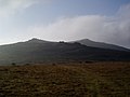
English: Belstone is a village in Devon, England best known for the Nine Maidens stone circle. It lies within the West Devon local government district.
village in the United Kingdom  | |||||
| Upload media | |||||
| Instance of | |||||
|---|---|---|---|---|---|
| Location | West Devon, Devon, South West England, England | ||||
 | |||||
Subcategories
This category has the following 7 subcategories, out of 7 total.
B
- Belstone spring (2 F)
- Belstone village stocks (3 F)
C
- Cullever cairn (2 F)
N
- Nine Stones (Belstone) (8 F)
R
- Rowtor Target Railway (7 F)
W
- Watchet Hill round cairn (3 F)
Media in category "Belstone"
The following 200 files are in this category, out of 268 total.
(previous page) (next page)-
 "Bernard's Acre" - geograph.org.uk - 1273443.jpg 640 × 427; 127 KB
-
 A bend on the upper Taw - geograph.org.uk - 1740722.jpg 640 × 480; 107 KB
-
 A field within field, Belstone - geograph.org.uk - 5194629.jpg 1,600 × 1,200; 841 KB
-
 A fine pair of bullocks, on Tor Down - geograph.org.uk - 1945995.jpg 1,600 × 1,200; 370 KB
-
 A site with many uses, Belstone - geograph.org.uk - 4484560.jpg 1,600 × 1,200; 1.53 MB
-
 A terrace of houses, Belstone - geograph.org.uk - 4484554.jpg 1,600 × 1,200; 1.53 MB
-
 A30 (T) Viaduct - geograph.org.uk - 935881.jpg 640 × 480; 96 KB
-
 A30 bridge over a minor road near Fatherford Farm - geograph.org.uk - 4484595.jpg 1,600 × 1,200; 1.7 MB
-
 A30 curving south west of Okehampton - geograph.org.uk - 3663863.jpg 1,806 × 1,156; 1.21 MB
-
 A30 Okehampton bypass and a lay-by - geograph.org.uk - 3386851.jpg 1,024 × 768; 120 KB
-
 A30 parking in half a mile - geograph.org.uk - 3663854.jpg 1,932 × 1,198; 1.32 MB
-
 A30 south of Stockley Hamlet - geograph.org.uk - 3224827.jpg 3,346 × 1,890; 1.04 MB
-
 Across the East Okement valley to East Halstock farmstead - geograph.org.uk - 6075028.jpg 1,600 × 1,200; 1.01 MB
-
 Andrews Cottage, Belstone (geograph 6727298).jpg 1,024 × 768; 212 KB
-
 Andrews Cottage, Belstone - geograph.org.uk - 2798489.jpg 2,592 × 1,944; 1.56 MB
-
 Apples at Eastlake - geograph.org.uk - 2118242.jpg 502 × 640; 97 KB
-
 Autumn leaves near Belstone - geograph.org.uk - 5195068.jpg 1,200 × 1,600; 849 KB
-
 Autumn trees west of East Okement river - geograph.org.uk - 5195062.jpg 1,600 × 1,200; 867 KB
-
 Barn at Eastlake - geograph.org.uk - 2118247.jpg 480 × 640; 98 KB
-
 Belstone - panoramio.jpg 1,536 × 2,048; 443 KB
-
 Belstone Cleave - geograph.org.uk - 1015512.jpg 640 × 480; 166 KB
-
 Belstone Cleave - geograph.org.uk - 1955224.jpg 1,600 × 1,200; 696 KB
-
 Belstone Cleave - geograph.org.uk - 6082892.jpg 1,600 × 1,200; 1.03 MB
-
 Belstone Cleave in the rain - geograph.org.uk - 4484552.jpg 1,600 × 1,200; 1.19 MB
-
 Belstone Common - geograph.org.uk - 1949994.jpg 1,600 × 1,200; 501 KB
-
 Belstone Common - geograph.org.uk - 2260027.jpg 2,288 × 1,712; 790 KB
-
 Belstone Common from Scarey Tor - geograph.org.uk - 6075035.jpg 1,600 × 1,200; 1.02 MB
-
 Belstone Common looking south - geograph.org.uk - 4484533.jpg 1,600 × 1,200; 1.33 MB
-
 Belstone EX20, UK - panoramio.jpg 1,536 × 2,048; 404 KB
-
 Belstone FC.jpg 408 × 502; 28 KB
-
 Belstone footpath - geograph.org.uk - 4396617.jpg 1,024 × 768; 357 KB
-
 Belstone Footpath 14 - geograph.org.uk - 327982.jpg 640 × 480; 76 KB
-
 Belstone Higher Tor - geograph.org.uk - 1555465.jpg 640 × 480; 77 KB
-
 Belstone Methodist Chapel - geograph.org.uk - 4396608.jpg 640 × 480; 95 KB
-
 Belstone Post Office - geograph.org.uk - 933893.jpg 480 × 640; 99 KB
-
 Belstone Post Office, Devon - geograph.org.uk - 1780182.jpg 800 × 568; 140 KB
-
 Belstone Pound - geograph.org.uk - 1273513.jpg 640 × 427; 118 KB
-
 Belstone Pound - geograph.org.uk - 5577814.jpg 3,648 × 2,736; 4.86 MB
-
 Belstone pound and the Old School Tearoom - geograph.org.uk - 5195093.jpg 1,600 × 1,200; 725 KB
-
 Belstone Tor - geograph.org.uk - 1519676.jpg 640 × 427; 54 KB
-
 Belstone Tor - geograph.org.uk - 1949932.jpg 1,600 × 1,200; 547 KB
-
 Belstone tors 1.jpg 2,048 × 1,536; 668 KB
-
 Belstone village - geograph.org.uk - 1945778.jpg 1,024 × 768; 170 KB
-
 Belstone Village - geograph.org.uk - 3658760.jpg 1,024 × 768; 287 KB
-
 Belstone Village Green - geograph.org.uk - 1273541.jpg 640 × 427; 97 KB
-
 Belstone Village Hall - geograph.org.uk - 1945375.jpg 1,024 × 768; 191 KB
-
 Belstone Village Hall - geograph.org.uk - 2646115.jpg 600 × 800; 433 KB
-
 Belstone Water Treatment Works - geograph.org.uk - 1519694.jpg 640 × 427; 78 KB
-
 Belstone, River Taw, Dartmoor (England).JPG 2,703 × 1,996; 2.36 MB
-
 Belstone, the east end of the village - geograph.org.uk - 1876686.jpg 640 × 460; 106 KB
-
 Bluebells, Belstone Cleave - geograph.org.uk - 1876355.jpg 640 × 480; 132 KB
-
 Boundary stone at Cullever Steps - geograph.org.uk - 2035970.jpg 640 × 480; 237 KB
-
 Boundary wall on West Cleave - geograph.org.uk - 4484500.jpg 1,600 × 1,200; 1.29 MB
-
 Brenamoor Common - geograph.org.uk - 5239422.jpg 1,024 × 697; 165 KB
-
 Brenamoor, Belstone - geograph.org.uk - 1945940.jpg 1,024 × 768; 169 KB
-
 Bridge and track at Cullever Steps - geograph.org.uk - 5194646.jpg 1,600 × 1,200; 741 KB
-
 Bridge at Cullever Steps - geograph.org.uk - 2035969.jpg 640 × 480; 285 KB
-
 Bridleway to Belstone - geograph.org.uk - 1878307.jpg 480 × 640; 117 KB
-
 Bridleway to Belstone - geograph.org.uk - 1878321.jpg 480 × 640; 131 KB
-
 Bridleway to the moor, Tors Park - geograph.org.uk - 4484565.jpg 1,600 × 1,200; 1.76 MB
-
 Bridleway to West Cleave on the moor - geograph.org.uk - 4484571.jpg 1,200 × 1,600; 1.81 MB
-
 Building belonging to South West Water - geograph.org.uk - 2646119.jpg 800 × 600; 349 KB
-
 Cattle grazing on Brenamoor Common - geograph.org.uk - 2646112.jpg 800 × 600; 393 KB
-
 Cattle Grid at edge of Belstone - geograph.org.uk - 2646118.jpg 800 × 600; 388 KB
-
 Cattle grid on Tor Down - geograph.org.uk - 4484573.jpg 1,600 × 1,200; 1.47 MB
-
 Cattlegrid by Restland House - geograph.org.uk - 5239420.jpg 1,024 × 715; 142 KB
-
 Chapel Ford - geograph.org.uk - 1878245.jpg 640 × 480; 131 KB
-
 Chapel Ford and Stepping Stones - geograph.org.uk - 5928065.jpg 4,032 × 3,024; 3.69 MB
-
 Chapel House, Belstone - geograph.org.uk - 5908269.jpg 1,024 × 768; 217 KB
-
 Churchyard - Belstone - geograph.org.uk - 5323114.jpg 800 × 600; 171 KB
-
 Churchyard - Belstone - geograph.org.uk - 5323115.jpg 800 × 600; 151 KB
-
 Churchyard - Belstone - geograph.org.uk - 5323116.jpg 800 × 600; 174 KB
-
 Churchyard - Belstone - geograph.org.uk - 5323117.jpg 800 × 600; 182 KB
-
 Churchyard - Belstone - geograph.org.uk - 5323118.jpg 800 × 600; 192 KB
-
 Commemorative stone, Belstone village - geograph.org.uk - 5195083.jpg 1,600 × 1,200; 791 KB
-
 Converted chapel in Belstone - geograph.org.uk - 2838323.jpg 480 × 640; 81 KB
-
 Coronation Stone, Belstone (geograph 6727308).jpg 768 × 1,024; 233 KB
-
 Cottages in Belstone village - geograph.org.uk - 2838328.jpg 480 × 640; 78 KB
-
 Cottages, Belstone - geograph.org.uk - 5908277.jpg 1,024 × 768; 156 KB
-
 Cottages, near Belstone - geograph.org.uk - 1955218.jpg 1,600 × 1,200; 642 KB
-
 Country House, at the edge of Belstone - geograph.org.uk - 1955197.jpg 1,024 × 768; 194 KB
-
 Countryside near Belstone - geograph.org.uk - 4107147.jpg 1,600 × 1,185; 474 KB
-

-
 Dagworthy cottage, Belstone - geograph.org.uk - 1945947.jpg 1,024 × 768; 195 KB
-
 Dartmoor ponies sheltering behind gorse.jpg 1,800 × 1,200; 623 KB
-
 Dartmoor Railway - geograph.org.uk - 16769.jpg 640 × 425; 99 KB
-
 Dead tree by the Tarka Trail - geograph.org.uk - 2925479.jpg 480 × 640; 83 KB
-
 Dead tree, Chapel Ford - geograph.org.uk - 1878252.jpg 480 × 640; 96 KB
-
 East Bowden - geograph.org.uk - 1982957.jpg 640 × 434; 91 KB
-
 East Okement River - geograph.org.uk - 1517105.jpg 640 × 427; 110 KB
-
 East Okement River - geograph.org.uk - 1517115.jpg 640 × 427; 107 KB
-
 East Okement valley - Dartmoor - geograph.org.uk - 78047.jpg 640 × 425; 92 KB
-
 East Okement valley - geograph.org.uk - 1982942.jpg 640 × 424; 74 KB
-
 East Okement valley - geograph.org.uk - 1982948.jpg 640 × 410; 72 KB
-
 East Okement waterfall - geograph.org.uk - 1740685.jpg 640 × 480; 182 KB
-
 East Priestacott - geograph.org.uk - 2118221.jpg 640 × 451; 118 KB
-
 Eastlake - geograph.org.uk - 2118238.jpg 640 × 431; 83 KB
-
 Fatherford Road, looking north - geograph.org.uk - 3438842.jpg 640 × 480; 222 KB
-
 Field east of Belstone - geograph.org.uk - 1878354.jpg 640 × 480; 90 KB
-
 Field near Priestacott - geograph.org.uk - 2118213.jpg 640 × 393; 53 KB
-
 Field near Tor Down - geograph.org.uk - 2118228.jpg 640 × 457; 62 KB
-
 Footbridge at Belstone - geograph.org.uk - 933917.jpg 640 × 480; 111 KB
-
 Footbridge over the East Okement River - geograph.org.uk - 4484494.jpg 1,200 × 1,600; 1.9 MB
-
 Footbridge, East Oakmount River - geograph.org.uk - 934296.jpg 640 × 480; 133 KB
-
 Footpath crossing fields on Tor Down - geograph.org.uk - 4484576.jpg 1,600 × 1,200; 1.52 MB
-
 Footpath gates in Belstone. - panoramio.jpg 4,000 × 2,672; 4.37 MB
-

-
 Ford across the Taw - geograph.org.uk - 3022756.jpg 640 × 480; 98 KB
-
 Ford at Cullever Steps - geograph.org.uk - 5924319.jpg 3,662 × 2,744; 1.98 MB
-
 Former Zion chapel - geograph.org.uk - 5323110.jpg 800 × 600; 137 KB
-
 Gate for bridleway onto West Cleave - geograph.org.uk - 4484512.jpg 1,600 × 1,200; 1.22 MB
-
 Gate, view and sky - geograph.org.uk - 4659455.jpg 1,280 × 857; 1.25 MB
-
 Grand view of Cosdon Hill - geograph.org.uk - 5323121.jpg 800 × 567; 119 KB
-
 Granite and wood stile on Tor Down - geograph.org.uk - 4484585.jpg 1,200 × 1,600; 1.8 MB
-
 Grazing land near Belstone - geograph.org.uk - 1273491.jpg 640 × 427; 61 KB
-
 Green in Belstone - geograph.org.uk - 5323111.jpg 800 × 604; 148 KB
-
 Higher Sticklepath - geograph.org.uk - 5908296.jpg 1,024 × 768; 215 KB
-
 Higher Tor - geograph.org.uk - 1517144.jpg 640 × 427; 78 KB
-
 Higher Tor - geograph.org.uk - 1519634.jpg 640 × 427; 47 KB
-
 Higher Tor - geograph.org.uk - 1845034.jpg 640 × 424; 237 KB
-
 Higher Tor - geograph.org.uk - 1949470.jpg 1,600 × 1,200; 439 KB
-
 Higher Tor - geograph.org.uk - 1949729.jpg 1,600 × 1,200; 457 KB
-
 Higher Tor - geograph.org.uk - 2126437.jpg 1,024 × 683; 210 KB
-
 Higher Tor - geograph.org.uk - 2798453.jpg 2,592 × 1,944; 1.29 MB
-
 Horseshoe Ford - geograph.org.uk - 4676048.jpg 6,000 × 4,000; 7.08 MB
-
 Horseshoe Ford across the Taw - geograph.org.uk - 6082885.jpg 1,600 × 1,200; 1.06 MB
-
 House in Belstone - geograph.org.uk - 5323124.jpg 640 × 480; 113 KB
-
 House on the edge of the moor - geograph.org.uk - 2838333.jpg 641 × 481; 129 KB
-
 Houses in Belstone - geograph.org.uk - 5323120.jpg 800 × 600; 192 KB
-
 Hydraulic ram - geograph.org.uk - 1518247.jpg 640 × 427; 119 KB
-
 Ice on the footpath - geograph.org.uk - 1015526.jpg 640 × 480; 145 KB
-
 Irishman's Wall - geograph.org.uk - 1519645.jpg 640 × 427; 54 KB
-
 Irishman's Wall Dartmoor - geograph.org.uk - 62900.jpg 480 × 640; 128 KB
-
 Irishman's Wall on Belstone Common - geograph.org.uk - 2843918.jpg 480 × 640; 103 KB
-
 Lamb in the East Okement valley - geograph.org.uk - 1878125.jpg 640 × 407; 111 KB
-
 Lane behind Belstone church - geograph.org.uk - 5323125.jpg 800 × 600; 173 KB
-
 Lane in Belstone Cleave - geograph.org.uk - 1876435.jpg 640 × 485; 130 KB
-
 Lane near Priestacott - geograph.org.uk - 2118201.jpg 640 × 480; 98 KB
-
 Lane near Tongue End Cross - geograph.org.uk - 5323129.jpg 800 × 550; 117 KB
-
 Lane near Tongue End Cross - geograph.org.uk - 5323132.jpg 800 × 588; 130 KB
-
 Lane over the A30 - geograph.org.uk - 5323130.jpg 800 × 551; 102 KB
-
 Lone tree on Belstone Common - geograph.org.uk - 2843902.jpg 640 × 480; 88 KB
-

-
 Looking down the track, towards Cullever Steps - geograph.org.uk - 1949114.jpg 1,600 × 1,200; 489 KB
-
 Looking towards Tor Down - geograph.org.uk - 347522.jpg 640 × 480; 111 KB
-
 Looking up, to Higher Tor - geograph.org.uk - 1949463.jpg 1,024 × 768; 222 KB
-
 Lower Priestacott - geograph.org.uk - 2118225.jpg 640 × 475; 65 KB
-

-
 Metering station on River Taw - geograph.org.uk - 6082889.jpg 1,600 × 1,200; 1.03 MB
-
 Methodist Chapel , Belstone , Dartmoor - geograph.org.uk - 62885.jpg 480 × 640; 113 KB
-
 Military flagpole on Watchet Hill - geograph.org.uk - 1517051.jpg 640 × 427; 60 KB
-
 Military flagpole on Watchet Hill - geograph.org.uk - 4484537.jpg 1,600 × 1,200; 1.18 MB
-
 Moorland and gorse on Watchet Hill - geograph.org.uk - 6075016.jpg 1,600 × 800; 660 KB
-
 Moorland edge - geograph.org.uk - 5908262.jpg 1,024 × 768; 137 KB
-
 Moorland scene, near Belstone - geograph.org.uk - 2798484.jpg 2,592 × 1,944; 1.79 MB
-
 Moss covering the wall by the road at Tors Park - geograph.org.uk - 4484568.jpg 1,200 × 1,600; 1.98 MB
-
 Mystery spring as Skaigh - geograph.org.uk - 4659491.jpg 1,280 × 857; 1.5 MB
-
 Mystery spring at Skaigh - geograph.org.uk - 4659500.jpg 1,280 × 857; 1.64 MB
-
 Old and new barns at Tors Park, Belstone - geograph.org.uk - 5195071.jpg 1,600 × 1,200; 842 KB
-
 Old Boundary Marker - geograph.org.uk - 6047972.jpg 474 × 637; 178 KB
-

-

-

-
 Old Ferguson tractor, Belstone - geograph.org.uk - 1955210.jpg 1,600 × 1,200; 535 KB
-
 On the A30 - geograph.org.uk - 4150913.jpg 4,000 × 2,664; 2.39 MB
-
 Open ground - Belstone - geograph.org.uk - 5323127.jpg 800 × 600; 192 KB
-
 Overgrown track on Tor Down - geograph.org.uk - 4484580.jpg 1,200 × 1,600; 2.09 MB
-
 Park where you can - geograph.org.uk - 5323112.jpg 800 × 600; 152 KB
-
 Parking by the road at Belstone - geograph.org.uk - 4484549.jpg 1,600 × 1,200; 1.76 MB
-
 Passing through Belstone - geograph.org.uk - 5236741.jpg 800 × 600; 171 KB
-
 Path to Belstone Common - geograph.org.uk - 1955193.jpg 1,600 × 1,200; 506 KB
-
 Perfect day, perfect pint - Belstone - geograph.org.uk - 5323122.jpg 800 × 585; 132 KB
-

-
 Pony grazing on Belstone Common, Dartmoor.jpg 1,800 × 1,200; 615 KB
-
 Pumping station on the River Taw - geograph.org.uk - 2843650.jpg 640 × 480; 87 KB
-
 Railway overbridge, east of Okehampton - geograph.org.uk - 1946016.jpg 1,600 × 1,200; 556 KB
-
 Resugga, Belstone - geograph.org.uk - 4210.jpg 640 × 424; 88 KB
-
 River Taw - geograph.org.uk - 4659441.jpg 1,280 × 857; 1.69 MB
-
 River Taw near the sheepfold - geograph.org.uk - 1274252.jpg 640 × 427; 115 KB
-
 Road and footpath sign north-west of Belstone - geograph.org.uk - 5194623.jpg 1,600 × 1,200; 815 KB
-
 Road through Skaigh Wood - geograph.org.uk - 2646111.jpg 480 × 640; 97 KB
-
 Road to Belstone, from Birchy Lake - geograph.org.uk - 1955222.jpg 1,600 × 1,200; 611 KB
-
 Road to Okehampton - geograph.org.uk - 5323131.jpg 800 × 587; 165 KB
-

-
 Rocks on Belstone Common - geograph.org.uk - 1982969.jpg 640 × 397; 78 KB
-
 Scarey Tor - geograph.org.uk - 436579.jpg 640 × 480; 85 KB
-
 Scarey Tor - geograph.org.uk - 5194641.jpg 1,600 × 1,200; 754 KB
-
 Sheepfold by the River Taw - geograph.org.uk - 1518082.jpg 640 × 427; 104 KB
-
 Sheepfold in the Taw Valley - geograph.org.uk - 2843638.jpg 640 × 480; 89 KB
-
 Shetland Pony on Belstone Common, Dartmoor.jpg 1,800 × 1,200; 705 KB
-
 Skaigh Ford - geograph.org.uk - 5924298.jpg 4,032 × 3,024; 4.98 MB
-
 Stream at Westlake - geograph.org.uk - 4484588.jpg 1,200 × 1,600; 2.12 MB
-
 Tarka Trail - geograph.org.uk - 1519558.jpg 640 × 427; 78 KB
-

-
 Taw River Dartmoor - geograph.org.uk - 62910.jpg 480 × 640; 97 KB
-
 Taw valley - geograph.org.uk - 1876698.jpg 640 × 480; 102 KB
-
 Taw valley - geograph.org.uk - 3022852.jpg 640 × 425; 77 KB
-
 Taw valley - geograph.org.uk - 3022886.jpg 640 × 414; 86 KB
-
 Taw Valley above Belstone Cleave - geograph.org.uk - 1741373.jpg 640 × 480; 154 KB
-
 Taw Valley water extraction facility - geograph.org.uk - 1518041.jpg 640 × 427; 120 KB


_Viaduct_-_geograph.org.uk_-_935881.jpg)


.jpg)


.JPG)


.jpg)


