Category:Bicol Region
Jump to navigation
Jump to search
Regions of the Philippines: Metro Manila · Cordillera · Ilocos · Cagayan Valley · Central Luzon · Calabarzon · Mimaropa · Bicol · Western Visayas · Central Visayas · Eastern Visayas · Zamboanga Peninsula · Northern Mindanao · Davao · Soccsksargen · Caraga · Bangsamoro
English: The Bicol Region, also designated as Region V, is a Philippine region in south-eastern Luzon.
Bikol Central: An Rehiyon Bikol (Bicolandia, Kabikolan o Rehiyon V) sarô sa 17 rehiyon kan Filipinas. Ini minaokopar kan Luzon.
Tagalog: Ang Kabikulan, tinatawag ding Rehiyon V, ay isang rehiyon ng Pilipinas na matatagpuan sa timog Luzon.
region of the Philippines  | |||||
| Upload media | |||||
| Instance of | |||||
|---|---|---|---|---|---|
| Location | Luzon, PH | ||||
| Capital | |||||
| Population |
| ||||
| Area |
| ||||
| Electorate |
| ||||
 | |||||
Subcategories
This category has the following 12 subcategories, out of 12 total.
Media in category "Bicol Region"
The following 34 files are in this category, out of 34 total.
-
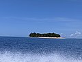 Aguirangan Island May 2022.jpg 4,032 × 3,024; 825 KB
-
 Bicol 1.jpg 640 × 480; 113 KB
-
 Bicol 116a.jpg 2,406 × 2,406; 4.13 MB
-
 Bicol 2.jpg 640 × 480; 75 KB
-
 Bicol 3.jpg 640 × 480; 87 KB
-
 Bicol Express at La Herencia Comida.jpg 4,608 × 3,072; 11.19 MB
-
 Bicol peninsula as seen from Burias Pass.jpg 4,000 × 2,256; 2.1 MB
-
 Bicol Region in Philippines.svg 1,871 × 2,468; 1.38 MB
-
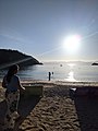
 Caramoan Gota Beach Front II.jpg 4,032 × 3,024; 1.18 MB
-
 Caramoan Gota Beach Front III.jpg 4,032 × 3,024; 2.32 MB
-
 Caramoan Gota Beach Front IV.jpg 4,032 × 3,024; 1.99 MB
-
 Caramoan Gota Beach Front V.jpg 4,032 × 3,024; 1.57 MB
-
 Caramoan Gota Beach Front VI.jpg 4,032 × 3,024; 2.33 MB
-
 Caramoan Islands Tugawe Cove.jpg 4,032 × 3,024; 2.16 MB
-
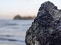
 Caramoan Rock Formation II.jpg 4,032 × 3,024; 2.76 MB
-
 Caramoan Rock Formation III.jpg 4,032 × 3,024; 3.08 MB
-
 Church of St. Gregorio the Great.jpg 800 × 600; 122 KB
-
 Heaven Is like a Place on Earth.jpg 3,000 × 4,000; 3.67 MB
-
 Heliotropium Arboreum.jpg 4,032 × 3,024; 2.93 MB
-
 Mayon at Rice fields.jpg 3,262 × 2,446; 3.53 MB
-
 Mayon Close Up.jpg 2,106 × 2,807; 1.45 MB
-
 Meer met bergen bij Sabang met op de voorgrond daken en schepen, RP-F-F01149-RA.jpg 2,500 × 1,596; 225 KB
-
 Mount Mayon, Philippines (41437510155).jpg 2,000 × 1,578; 2.99 MB
-
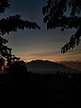 Mt Isarog Silhouette.jpg 3,120 × 4,160; 1.52 MB
-
 Perfect Volcano.jpg 2,048 × 1,536; 1,000 KB
-
 Peñafrancia Fluvial Parade Naga City.jpg 1,024 × 683; 683 KB
-
 Phoenix Sylvestris I.jpg 4,032 × 3,024; 3.18 MB
-
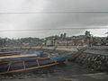
 Sabang Fish Port, Sabang, Calabanga, during lowtide.jpg 4,681 × 3,745; 5.55 MB
-
 The most generous photo of sunset in bicol 2014-05-08 03-31.jpg 320 × 480; 35 KB
-
 Tribo bikolano logo.jpg 720 × 251; 55 KB
-
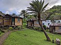
 Tugawe Cove Beach Front and Mountain.jpg 4,032 × 3,024; 2.87 MB
-
 Tugawe Cove Beach Front.jpg 3,024 × 4,032; 2.31 MB
-
 Tugawe Cove Infinity Pool.jpg 4,032 × 3,024; 2.4 MB
-
 Tugawe Cove, Caramoan.jpg 4,032 × 3,024; 3.91 MB


.jpg)


