Category:Boston, Lincolnshire
Jump to navigation
Jump to search
town and port in Lincolnshire, England, UK   | |||||
| Upload media | |||||
| Instance of | |||||
|---|---|---|---|---|---|
| Location |
| ||||
| Official language | |||||
| Population |
| ||||
| Area |
| ||||
| Different from | |||||
| official website | |||||
 | |||||
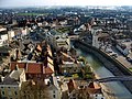
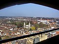
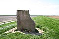
It received its charter in 1545. It is the main town in the local government district and borough of Boston. Its primary landmark is The Stump, the parish church with the highest tower in England, visible in the flat Fenlands for miles around. Residents of Boston are known as "Bostonians".

Subcategories
This category has the following 21 subcategories, out of 21 total.
B
- Boston, Lincolnshire in art (15 F)
C
- County Hall, Boston (2 F)
- Cowbridge, Lincolnshire (5 F)
F
H
M
P
S
V
- Views from the Boston Stump (19 F)
Media in category "Boston, Lincolnshire"
The following 200 files are in this category, out of 321 total.
(previous page) (next page)-
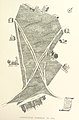 143 of 'Antique Views of ye Towne of Boston. (With plates.)' (11160118315).jpg 1,922 × 2,919; 1.29 MB
-
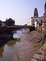
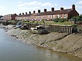
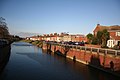
 Across the Haven - geograph.org.uk - 430183.jpg 640 × 477; 79 KB
-
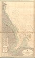
 Admiralty Chart No 108 The Wash, Published 1924.jpg 16,165 × 11,100; 77.83 MB
-
 Admiralty Chart No 1190 Blakeney to Flamborough Head, Published 1951.jpg 11,260 × 18,347; 72.75 MB
-

-
 Allotment architecture - geograph.org.uk - 1567555.jpg 640 × 426; 72 KB
-
 Allotment gardens - geograph.org.uk - 1567560.jpg 640 × 426; 112 KB
-
 Along the bank of the Welland - geograph.org.uk - 432369.jpg 640 × 477; 88 KB
-
 Antique views of ye towne of Boston (1882) (14583570188).jpg 3,172 × 1,856; 1.41 MB
-
 Baptist Chapel predecessor - geograph.org.uk - 1147643.jpg 640 × 426; 81 KB
-
 Basking seals - geograph.org.uk - 1494204.jpg 640 × 480; 45 KB
-
 Blackfriars Art Centre November 2023.jpg 5,354 × 4,015; 18.24 MB
-
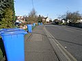 Blue bin day on Wyberton Low road - geograph.org.uk - 1211691.jpg 640 × 480; 77 KB
-
 Boston (England) Wikivoyage Banner.JPG 3,872 × 556; 1,009 KB
-
 Boston - Lincolnshire dot.png 417 × 599; 122 KB
-
 Boston - panoramio (10).jpg 2,816 × 2,112; 2.28 MB
-
 Boston - panoramio (16).jpg 2,816 × 2,112; 2.62 MB
-
 Boston - panoramio (17).jpg 2,816 × 2,112; 2.08 MB
-
 Boston - panoramio (18).jpg 2,816 × 2,112; 2.28 MB
-
 Boston - panoramio (20).jpg 2,816 × 2,112; 2.27 MB
-
 Boston - panoramio (5).jpg 2,260 × 2,095; 1.33 MB
-
 Boston - panoramio (6).jpg 2,816 × 2,112; 2.86 MB
-
 Boston - panoramio (7).jpg 2,816 × 2,112; 2.3 MB
-
 Boston - panoramio (9).jpg 2,816 × 2,112; 2.46 MB
-
 Boston - picture-framers on South Street (geograph 3248312).jpg 1,042 × 1,600; 432 KB
-
 Boston Lincolnshire (26744424428).jpg 6,000 × 4,000; 5.39 MB
-
 Boston Lincs - geograph.org.uk - 1462435.jpg 640 × 427; 50 KB
-
-
 Boston PE21, UK - panoramio (1).jpg 3,264 × 2,176; 3.66 MB
-
 Boston PE21, UK - panoramio (10).jpg 3,072 × 2,304; 2.6 MB
-
 Boston PE21, UK - panoramio (11).jpg 3,072 × 2,304; 2.57 MB
-
 Boston PE21, UK - panoramio (12).jpg 3,072 × 2,304; 3.63 MB
-
 Boston PE21, UK - panoramio (13).jpg 3,072 × 2,304; 2.43 MB
-
 Boston PE21, UK - panoramio (14).jpg 3,072 × 2,304; 2.79 MB
-
 Boston PE21, UK - panoramio (15).jpg 3,072 × 2,304; 2.91 MB
-
 Boston PE21, UK - panoramio (16).jpg 2,304 × 3,072; 3.85 MB
-
 Boston PE21, UK - panoramio (17).jpg 3,072 × 2,304; 2.81 MB
-
 Boston PE21, UK - panoramio (18).jpg 3,072 × 2,304; 2.52 MB
-
 Boston PE21, UK - panoramio (20).jpg 3,072 × 2,304; 2.87 MB
-
 Boston PE21, UK - panoramio (21).jpg 3,072 × 2,304; 2.25 MB
-
 Boston PE21, UK - panoramio (22).jpg 3,264 × 2,176; 3.37 MB
-
 Boston PE21, UK - panoramio (23).jpg 3,264 × 2,176; 3.37 MB
-
 Boston PE21, UK - panoramio (24).jpg 3,264 × 2,176; 3.4 MB
-
 Boston PE21, UK - panoramio (25).jpg 3,264 × 2,176; 3.29 MB
-
 Boston PE21, UK - panoramio (26).jpg 3,072 × 2,304; 2.86 MB
-
 Boston PE21, UK - panoramio (27).jpg 3,072 × 2,304; 2.75 MB
-
 Boston PE21, UK - panoramio (29).jpg 3,264 × 2,176; 3.69 MB
-
 Boston PE21, UK - panoramio (3).jpg 3,072 × 2,304; 3.08 MB
-
 Boston PE21, UK - panoramio (30).jpg 3,264 × 2,176; 3.35 MB
-
 Boston PE21, UK - panoramio (31).jpg 3,264 × 2,176; 3.38 MB
-
 Boston PE21, UK - panoramio (32).jpg 3,264 × 2,176; 3.53 MB
-
 Boston PE21, UK - panoramio (33).jpg 3,264 × 2,176; 3.5 MB
-
 Boston PE21, UK - panoramio (36).jpg 3,264 × 2,448; 2.47 MB
-
 Boston PE21, UK - panoramio (4).jpg 3,072 × 2,304; 2.59 MB
-
 Boston PE21, UK - panoramio (40).jpg 3,264 × 2,448; 2.46 MB
-
 Boston PE21, UK - panoramio (41).jpg 3,072 × 2,304; 2.99 MB
-
 Boston PE21, UK - panoramio (49).jpg 3,264 × 2,448; 2.41 MB
-
 Boston PE21, UK - panoramio (5).jpg 3,072 × 2,304; 2.33 MB
-
 Boston PE21, UK - panoramio (50).jpg 3,264 × 2,448; 2.4 MB
-
 Boston PE21, UK - panoramio (51).jpg 3,264 × 2,448; 2.43 MB
-
 Boston PE21, UK - panoramio (54).jpg 1,901 × 1,010; 629 KB
-
 Boston PE21, UK - panoramio (55).jpg 3,264 × 2,176; 3.66 MB
-
 Boston PE21, UK - panoramio (56).jpg 3,264 × 2,448; 1.76 MB
-
 Boston PE21, UK - panoramio (57).jpg 2,448 × 3,264; 1.58 MB
-
 Boston PE21, UK - panoramio (58).jpg 3,264 × 2,448; 1.3 MB
-
 Boston PE21, UK - panoramio (6).jpg 3,072 × 2,304; 2.29 MB
-
 Boston PE21, UK - panoramio (8).jpg 3,072 × 2,304; 2.29 MB
-
 Boston PE21, UK - panoramio (9).jpg 3,072 × 2,304; 3.03 MB
-
 Boston Sleeper Depot - geograph.org.uk - 2233597.jpg 800 × 531; 85 KB
-
 Boston sunset.jpg 2,293 × 3,056; 650 KB
-
 Boston unparished area UK locator map.svg 1,425 × 1,225; 479 KB
-
 Boston, Lincolnshire (England) (43462410301).jpg 7,647 × 3,969; 5.11 MB
-
 BostonStump.JPG 4,258 × 2,457; 1.69 MB
-
 Bucklegate Lane - geograph.org.uk - 1437002.jpg 640 × 426; 70 KB
-

-
 Burton Hall - geograph.org.uk - 718654.jpg 640 × 427; 82 KB
-
 Cemetery Church, Boston.png 865 × 1,268; 1.71 MB
-
 Cemetery entrance - geograph.org.uk - 262911.jpg 640 × 480; 140 KB
-
 Cemex concrete batching plant - geograph.org.uk - 1222459.jpg 640 × 480; 59 KB
-
 Challenger crawler tractor with plough, Boston, Lincolnshire.jpg 2,032 × 1,360; 1.32 MB
-
 Cockle Shell Mountain - geograph.org.uk - 581169.jpg 427 × 640; 116 KB
-
 Cockle Shells - geograph.org.uk - 581177.jpg 640 × 427; 114 KB
-

-
 Custom House Quay from Town Bridge - geograph.org.uk - 200134.jpg 640 × 427; 67 KB
-
 Daffodil picking - geograph.org.uk - 372906.jpg 640 × 427; 63 KB
-
 Daffodils at High Hill farm - geograph.org.uk - 372873.jpg 640 × 427; 92 KB
-

-
 Doughty Quay - geograph.org.uk - 997555.jpg 427 × 640; 75 KB
-
 DSC 3014-finish-little-green-men.JPG 3,872 × 2,592; 2.5 MB
-
 Emery Lane, Boston, Lincs - geograph.org.uk - 597747.jpg 480 × 640; 307 KB
-
 Evening Stir - geograph.org.uk - 471755.jpg 640 × 413; 62 KB
-
 Farm road by the sea wall - geograph.org.uk - 1024063.jpg 640 × 480; 95 KB
-
 Farmland at Earl Marsh - geograph.org.uk - 432265.jpg 640 × 477; 83 KB
-
 Farmland at Leake Commonside - geograph.org.uk - 406173.jpg 640 × 427; 59 KB
-
 Flying practice - geograph.org.uk - 431811.jpg 640 × 477; 30 KB
-

-
 Footpath closed - geograph.org.uk - 1222436.jpg 640 × 480; 77 KB
-
 Former Baptist burial ground - geograph.org.uk - 990186.jpg 640 × 427; 109 KB
-
 Former Baptist burial ground - geograph.org.uk - 990189.jpg 640 × 427; 86 KB
-
 Former Baptist burial ground plaque - geograph.org.uk - 990194.jpg 640 × 427; 112 KB
-
 Fracknall's Row - geograph.org.uk - 977215.jpg 640 × 427; 68 KB
-
 Franklin's Lodge - geograph.org.uk - 1147717.jpg 640 × 426; 82 KB
-
 Franklin's Lodge - geograph.org.uk - 1422899.jpg 426 × 640; 61 KB
-
 Frith Bank daffodils - geograph.org.uk - 372904.jpg 640 × 427; 93 KB
-
 Garfit's Bank - geograph.org.uk - 1147487.jpg 640 × 426; 64 KB
-
 Georgian doorway - geograph.org.uk - 1147503.jpg 426 × 640; 96 KB
-
 Georgian semis - geograph.org.uk - 1155870.jpg 640 × 426; 72 KB
-
 Gold Fen Dike - geograph.org.uk - 581255.jpg 640 × 427; 72 KB
-
 Grant's Lane - geograph.org.uk - 997326.jpg 427 × 640; 59 KB
-
 Halifax closed for the Queen's funeral.jpg 1,200 × 1,800; 610 KB
-
 Hatter Lane, Boston, Lincs - geograph.org.uk - 597746.jpg 480 × 640; 293 KB
-
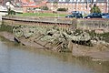 Haven hulks - geograph.org.uk - 990488.jpg 640 × 427; 90 KB
-
 Industrial tank - geograph.org.uk - 1222480.jpg 640 × 480; 44 KB
-
 Irby Place - geograph.org.uk - 977966.jpg 640 × 427; 60 KB
-
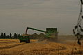
 John Deere T670i at harvest, Boston, Lincolnshire, 2011 a.jpg 3,872 × 2,592; 3.05 MB
-
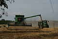 John Deere T670i at harvest, Boston, Lincolnshire, 2011 b.jpg 3,872 × 2,592; 2.95 MB
-
 John Deere T670i at harvest, Boston, Lincolnshire, 2011 c.jpg 3,872 × 2,592; 2.85 MB
-
 John Saul memorial - geograph.org.uk - 405577.jpg 640 × 427; 67 KB
-
 Killing the Green - geograph.org.uk - 476053.jpg 640 × 468; 81 KB
-
 Knight - panoramio (1).jpg 2,816 × 2,112; 2.07 MB
-
 Lambs Row - geograph.org.uk - 967131.jpg 640 × 427; 87 KB
-
 Land between the sea banks - geograph.org.uk - 1017697.jpg 640 × 393; 74 KB
-
 Last Bus - geograph.org.uk - 465649.jpg 640 × 414; 64 KB
-
 London Road - geograph.org.uk - 969000.jpg 640 × 427; 60 KB
-
 Macmillan Way sign - geograph.org.uk - 429870.jpg 477 × 640; 94 KB
-
 Main Ridge West, Boston (geograph 3676714).jpg 640 × 426; 74 KB
-
 Middlecott's Hospital - geograph.org.uk - 1436901.jpg 640 × 426; 88 KB
-

-
 Moated site - geograph.org.uk - 1567530.jpg 640 × 426; 88 KB
-
 National Terrace - geograph.org.uk - 997686.jpg 640 × 427; 73 KB
-
 Navigable channel^ - geograph.org.uk - 1521856.jpg 640 × 480; 76 KB
-
 Nearing Boston Town on the Witham - geograph.org.uk - 1494107.jpg 640 × 480; 52 KB
-
 New homes on hold - geograph.org.uk - 1147750.jpg 640 × 426; 68 KB
-

-
 Ordnance Survey One-Inch Sheet 114 Boston & Skegness, Published 1947.jpg 10,945 × 12,789; 14.8 MB
-
 Ordnance Survey One-Inch Sheet 114 Boston & Skegness, Published 1962.jpg 8,252 × 9,876; 8.89 MB
-
 Pedestrian Railway crossing - geograph.org.uk - 1198015.jpg 640 × 426; 76 KB
-
 Pilgrim Hospital, Boston (geograph 3242953).jpg 3,036 × 1,869; 2.66 MB
-
 Pilgrim Mansions - geograph.org.uk - 997526.jpg 640 × 427; 68 KB
-
 Pill box at Clamp Gate Bridge - geograph.org.uk - 498006.jpg 640 × 427; 64 KB
-
 Pilley's lane crossing - geograph.org.uk - 718569.jpg 640 × 427; 90 KB
-
 Port ahead - geograph.org.uk - 1492613.jpg 640 × 480; 34 KB
-
 Recumbent Sign - geograph.org.uk - 423465.jpg 640 × 506; 109 KB
-
 Recycling at Boston Docks - geograph.org.uk - 737100.jpg 640 × 480; 111 KB
-
 Richardson's Bridge - geograph.org.uk - 712845.jpg 640 × 427; 59 KB
-
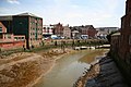
 River Haven and Boston Stump - geograph.org.uk - 734686.jpg 400 × 566; 168 KB
-
 River in Boston 05.JPG 1,920 × 2,560; 1.18 MB
-
 River in Boston 06.JPG 2,560 × 1,920; 1.19 MB
-
 River in Boston.JPG 1,920 × 2,560; 1.18 MB
-
 River Witham on the Boston approach - geograph.org.uk - 1208248.jpg 640 × 480; 77 KB
-
 Satellite dishes - geograph.org.uk - 997536.jpg 427 × 640; 82 KB
-
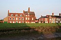
 Scott House (geograph 1795730).jpg 3,648 × 2,736; 2.12 MB
-
 Sea Bank - geograph.org.uk - 405576.jpg 640 × 427; 72 KB
-

-
 Silt Side Warehouse - geograph.org.uk - 968992.jpg 640 × 427; 72 KB
-
 Slow Crabs^ - geograph.org.uk - 429857.jpg 477 × 640; 70 KB
-
 South Forty Foot Drain footpath - geograph.org.uk - 1198022.jpg 640 × 426; 93 KB
-
 South Terrace, Boston - geograph.org.uk - 557078.jpg 640 × 480; 82 KB
-
 Spain Court - geograph.org.uk - 997660.jpg 640 × 427; 93 KB
-
 Spain Lane - geograph.org.uk - 997633.jpg 640 × 427; 69 KB
-
 Spain Lane, Boston-geograph-4219179.jpg 2,337 × 2,048; 1.05 MB
-
 St.Ann's Lane - geograph.org.uk - 1147753.jpg 640 × 426; 83 KB
-
 Start of Boston Rowing Marathon.jpg 3,872 × 2,592; 2.34 MB
-
 Swing Bridge Control Booth - geograph.org.uk - 749342.jpg 640 × 480; 83 KB
-
 Swing bridge control booth - geograph.org.uk - 968985.jpg 640 × 427; 61 KB
-
 Telegraph Poles, Boston - geograph.org.uk - 1206673.jpg 640 × 480; 61 KB
-
 Terraced house - geograph.org.uk - 1147523.jpg 426 × 640; 87 KB
-
-
 The banks of the lagoon - geograph.org.uk - 1454556.jpg 640 × 480; 83 KB
-
 The Cots at low tide - geograph.org.uk - 1432273.jpg 640 × 480; 94 KB
-
 The curious case of two Mr Hydes - geograph.org.uk - 1521813.jpg 640 × 480; 88 KB
-
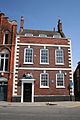 The Custom House - geograph.org.uk - 200124.jpg 427 × 640; 70 KB
-
 The end of the Silver Line - geograph.org.uk - 1521825.jpg 640 × 480; 80 KB
-
 The Haven, Boston - geograph.org.uk - 1549459.jpg 640 × 480; 28 KB
-
 The Old Corn Office, Boston - geograph.org.uk - 480616.jpg 480 × 640; 71 KB
-
 The Pink Cottage - geograph.org.uk - 581231.jpg 640 × 427; 57 KB
-
 The Road to 'Heaven' - geograph.org.uk - 797700.jpg 640 × 480; 60 KB
-
-
 Toot Lane Allotments - geograph.org.uk - 437683.jpg 640 × 427; 70 KB
-
 Trees across the Welland - geograph.org.uk - 432364.jpg 640 × 477; 85 KB
-
 Vag Dealers Boston - geograph.org.uk - 1763104.jpg 4,000 × 3,000; 2.28 MB
-
 View east from the pillbox - geograph.org.uk - 1396680.jpg 640 × 427; 58 KB
-
 View to Pilley's Lane - geograph.org.uk - 718577.jpg 640 × 427; 70 KB
-
 West Street, Boston (geograph 3779697).jpg 640 × 480; 85 KB
-
 West Street, Boston, Lincs (geograph 4219527).jpg 2,689 × 2,842; 1.23 MB
-
-
 Willoughby Road - geograph.org.uk - 679977.jpg 640 × 427; 45 KB
-
 Witham Bank East, Boston - geograph.org.uk - 777417.jpg 640 × 480; 88 KB
-
 Witham Bank East, Boston - geograph.org.uk - 777430.jpg 640 × 480; 104 KB
-
 Witham Bank East, Boston - geograph.org.uk - 777454.jpg 640 × 480; 146 KB
-
 Witham Bank East, Boston - geograph.org.uk - 777467.jpg 640 × 480; 87 KB
-
 Witham Bank East, Boston - geograph.org.uk - 777473.jpg 640 × 480; 82 KB
-
 Witham Bank East, Boston - geograph.org.uk - 777484.jpg 640 × 480; 86 KB
-
 Witham reflections - geograph.org.uk - 1425625.jpg 480 × 640; 78 KB
-
 Wormgate letterbox - geograph.org.uk - 977402.jpg 640 × 427; 118 KB
-
 Wyberton West Road - geograph.org.uk - 1567540.jpg 640 × 426; 61 KB
-
 Benington Ings - geograph.org.uk - 581158.jpg 640 × 427; 47 KB
-
 Beyond the bar - geograph.org.uk - 1435104.jpg 640 × 480; 25 KB
-
 Black Buoy Sand at high tide - geograph.org.uk - 1485157.jpg 640 × 480; 74 KB
-
 Boats on the Welland - geograph.org.uk - 432312.jpg 640 × 477; 69 KB
%27_(11160118315).jpg)


_(14583570188).jpg)


.jpg)
.jpg)
.jpg)
.jpg)
.jpg)
.jpg)
.jpg)
.jpg)
.jpg)
.jpg)
.jpg)


.jpg)
.jpg)
.jpg)
.jpg)
.jpg)
.jpg)
.jpg)
.jpg)
.jpg)
.jpg)
.jpg)
.jpg)
.jpg)
.jpg)
.jpg)
.jpg)
.jpg)
.jpg)
.jpg)
.jpg)
.jpg)
.jpg)
.jpg)
.jpg)
.jpg)
.jpg)
.jpg)
.jpg)
.jpg)
.jpg)
.jpg)
.jpg)
.jpg)
.jpg)
.jpg)
.jpg)
.jpg)
.jpg)
.jpg)
.jpg)


_(43462410301).jpg)


.jpg)


.jpg)


.jpg)


.jpg)


.jpg)
.jpg)


_Wikivoyage_Banner.JPG)