Category:Sadberge
Jump to navigation
Jump to search
English: Sadberge is a village in the borough of Darlington and ceremonial county of County Durham, England. It is situated between Darlington and Stockton-on-Tees. The village of Sadberge was once the Wapentake (capital) of the Viking settled area north of the Tees known as the Earldom of Sadberge which stretched from Hartlepool to Teesdale. Wapentakes were found in parts of England settled by Danes and continued to be important administrative centres through to medieval times. The word wapentake literally translated means `Weapon Taking' and refers to the way in which land was held in return for military service to a chief.
village in County Durham, England, UK   | |||||
| Upload media | |||||
| Instance of | |||||
|---|---|---|---|---|---|
| Location | Darlington, County Durham, North East England, England | ||||
 | |||||
Media in category "Sadberge"
The following 38 files are in this category, out of 38 total.
-
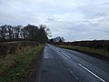
 A66 heading east - geograph.org.uk - 3284099.jpg 640 × 480; 48 KB
-
 Abbey Road in Sadberge - geograph.org.uk - 2747446.jpg 3,648 × 2,736; 1.98 MB
-
 Asian restaurant off the A66 - geograph.org.uk - 3284094.jpg 640 × 480; 56 KB
-
 Bridge carrying the A66 over Sadberge Road - geograph.org.uk - 2747443.jpg 3,648 × 2,736; 1.47 MB
-
 Buck Inn, Sadberge - geograph.org.uk - 2246687.jpg 640 × 480; 102 KB
-
 Bungalow on Hill House Lane - geograph.org.uk - 3284062.jpg 640 × 480; 96 KB
-
 Drive to Bumper Hall - geograph.org.uk - 2747440.jpg 3,648 × 2,736; 3.02 MB
-
 Eastbound A66 at Beacon Hill - geograph.org.uk - 3284053.jpg 640 × 480; 42 KB
-
 Eastern end of Norton Crescent in Sadberge - geograph.org.uk - 2747450.jpg 3,648 × 2,736; 2.24 MB
-
 Farmland off Hill House Lane - geograph.org.uk - 3227891.jpg 640 × 480; 68 KB
-
 Farmland off Sadberge Road - geograph.org.uk - 3283685.jpg 1,200 × 900; 276 KB
-
 Farmland, Beacon Hill - geograph.org.uk - 3284050.jpg 640 × 480; 75 KB
-
 Farmland, Saderge - geograph.org.uk - 3284086.jpg 1,200 × 900; 260 KB
-
 Filling station off the A66 (looks disused) - geograph.org.uk - 3284091.jpg 1,200 × 900; 266 KB
-
 Hill House Lane heading north - geograph.org.uk - 3284066.jpg 640 × 480; 91 KB
-
 Hill House Lane heading south - geograph.org.uk - 3227892.jpg 640 × 480; 53 KB
-
 Hillside Terrace, Sadberge - geograph.org.uk - 3284075.jpg 640 × 480; 61 KB
-
 Little Burdon Farm . - geograph.org.uk - 150921.jpg 640 × 479; 65 KB
-

-
 Norton Back Lane - geograph.org.uk - 2747453.jpg 3,648 × 2,736; 1.95 MB
-
 Norton Back Lane heading west - geograph.org.uk - 3293995.jpg 640 × 480; 62 KB
-
 Pond at Bumper Hall - geograph.org.uk - 404015.jpg 640 × 427; 121 KB
-
 Public footpath off Bishopton Lane - geograph.org.uk - 2580075.jpg 3,648 × 2,736; 3.31 MB
-
 Road Flooded - geograph.org.uk - 1600492.jpg 640 × 480; 56 KB
-
 Road into Sadberge from the A66 eastbound - geograph.org.uk - 2636043.jpg 3,648 × 2,736; 1.4 MB
-
 Roman Road north from Sadberge - geograph.org.uk - 2749824.jpg 3,648 × 2,736; 2.04 MB
-
 Sadberge Road - geograph.org.uk - 2747436.jpg 3,648 × 2,736; 2.41 MB
-
 Sadberge Road heading north - geograph.org.uk - 3283687.jpg 1,200 × 900; 261 KB
-
 Sadberge sewage works - geograph.org.uk - 167522.jpg 640 × 480; 80 KB
-
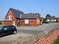 Sadberge Village Hall - geograph.org.uk - 167526.jpg 640 × 480; 75 KB
-
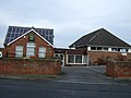 Sadberge Village Hall - geograph.org.uk - 3284057.jpg 1,200 × 900; 272 KB
-
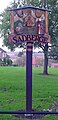 Sadberge village sign.jpg 778 × 1,613; 292 KB
-
 Salter Carr Farm - geograph.org.uk - 3293991.jpg 1,136 × 739; 148 KB
-
 St. Andrew's , Sadberge. - geograph.org.uk - 192538.jpg 640 × 290; 60 KB
-
 Stockton Road, Sadberge - geograph.org.uk - 3284079.jpg 1,200 × 900; 263 KB
-
 The Three Tuns pub, Sadberge - geograph.org.uk - 3284072.jpg 640 × 489; 58 KB
-
 Track to Cherry Tree Farm - geograph.org.uk - 3284055.jpg 1,200 × 900; 262 KB
-
 Sadberge village green - geograph.org.uk - 167524.jpg 640 × 480; 138 KB


_-_geograph.org.uk_-_3284091.jpg)


