Category:Boulder County, Colorado
Пређи на навигацију
Пређи на претрагу
Counties of Colorado: Adams · Alamosa · Arapahoe · Archuleta · Baca · Bent · Boulder · Chaffee · Cheyenne · Clear Creek · Conejos · Costilla · Crowley · Custer · Delta · Dolores · Douglas · Eagle · El Paso · Elbert · Fremont · Garfield · Gilpin · Grand · Gunnison · Hinsdale · Huerfano · Jackson · Jefferson · Kiowa · Kit Carson · Lake · La Plata · Larimer · Las Animas · Lincoln · Logan · Mesa · Mineral · Moffat · Montezuma · Montrose · Morgan · Otero · Ouray · Park · Phillips · Pitkin · Prowers · Pueblo · Rio Blanco · Rio Grande · Routt · Saguache · San Juan · San Miguel · Sedgwick · Summit · Teller · Washington · Weld · Yuma
City-counties: Broomfield · Denver
City-counties: Broomfield · Denver
Images related to Boulder County, Colorado in the United States

county in Colorado, United States .jpg)  | |||||
| Отпремање медија | |||||
| Је | |||||
|---|---|---|---|---|---|
| Названо по | |||||
| Локација | Колорадо, САД | ||||
| Престоница | |||||
| Настанак |
| ||||
| Насељеност |
| ||||
| Површина |
| ||||
| Различито од | |||||
| званични веб-сајт | |||||
 | |||||
Поткатегорије
Приказано је 13 поткатегорија; укупно 13.
Медији у категорији „Boulder County, Colorado”
Следећих 162 датотека је у овој категорији, од укупно 162.
-
 178376 Flagstaff Fire Boulder.jpg 1.936 × 2.592; 1,35 MB
-
 2009-05-30 - Ceran St. Vrain Trailhead Marker.jpg 3.456 × 2.304; 2,68 MB
-
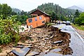
 2013 Colorado flooding 130918-Z-IT417-029.jpg 2.784 × 1.848; 2,15 MB
-
 2013 Colorado flooding 130918-Z-IT417-030.jpg 2.784 × 1.848; 2,19 MB
-
 2013 Colorado flooding 130918-Z-IT417-031.jpg 2.784 × 1.848; 2,17 MB
-
 2013 Colorado flooding 130918-Z-IT417-032.jpg 2.784 × 1.848; 2,24 MB
-
 2013 Colorado flooding 130918-Z-IT417-033.jpg 2.784 × 1.848; 2,59 MB
-
 2013 Colorado flooding 130918-Z-IT417-034.jpg 2.784 × 1.848; 2,15 MB
-
 2013 Colorado flooding 130918-Z-IT417-035.jpg 2.784 × 1.848; 2,04 MB
-
 2013 Colorado flooding 130918-Z-IT417-037.jpg 2.784 × 1.848; 2,38 MB
-
 2013 Colorado flooding 130918-Z-IT417-038.jpg 2.784 × 1.848; 2,78 MB
-
 2013 Colorado flooding 130918-Z-IT417-039.jpg 2.784 × 1.848; 2,49 MB
-
 2013 Colorado flooding 130918-Z-IT417-040.jpg 2.784 × 1.848; 2,67 MB
-
 2013 Colorado flooding 130918-Z-IT417-041.jpg 1.848 × 2.784; 3,46 MB
-
 2013 Colorado flooding 130918-Z-IT417-042.jpg 2.784 × 1.848; 2,36 MB
-
 2013 Colorado flooding 130918-Z-IT417-043.jpg 2.784 × 1.848; 2,28 MB
-
 2013 Colorado flooding 130918-Z-IT417-044.jpg 2.784 × 1.848; 2,56 MB
-
 2013 Colorado flooding 130918-Z-IT417-045.jpg 2.784 × 1.848; 2,38 MB
-
 2013 Colorado flooding 130918-Z-IT417-046.jpg 2.784 × 1.848; 2,09 MB
-
 2013 Colorado flooding 130918-Z-IT417-047.jpg 2.784 × 1.848; 2,14 MB
-
 2013 Colorado flooding 130918-Z-IT417-048.jpg 2.784 × 1.848; 2,26 MB
-
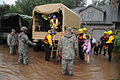 2013 colorado floods natl guard.jpg 3.000 × 1.991; 2,96 MB
-
 A Look Along the Continental Divide.tif 2.897 × 2.321; 19,26 MB
-
 A view of striations on Isabelle Glacier field.tiff 3.031 × 2.376; 20,63 MB
-
 Allenspark, United States (Unsplash).jpg 3.306 × 2.049; 1,71 MB
-
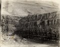
 Arapaho glacier from South Rim, 1904.tif 2.913 × 2.319; 19,35 MB
-
 Arapaho glacier, July 30, 1904.tif 2.906 × 2.317; 19,29 MB
-
 Arapaho glacier, photograph 19, 1904.tif 2.818 × 2.258; 18,23 MB
-
 Arapaho glacier, photograph 20, 1904.tif 2.231 × 2.769; 17,7 MB
-
 Arapaho glacier, photograph 21, 1904.tif 2.919 × 2.307; 19,29 MB
-
 Arapaho henderson 027.tif 2.771 × 2.285; 18,14 MB
-
 Boulder - panoramio (1).jpg 3.264 × 1.840; 1,89 MB
-
 Boulder between Blue Bind and North Boulder falls, Colorado, 1904.tif 2.915 × 2.331; 19,46 MB
-
 Boulder County Colorado (50518133737).jpg 4.231 × 2.380; 13,1 MB
-

-

-

-

-

-

-
 Boulder County, Colorado, United States (CAPELLA C08 SP GEO HH 20230610171815 20230610171836).tiff 22.631 × 22.403, 6 страница; 420,48 MB
-
 Boulder Flatiron 1.jpg 3.024 × 4.032; 4,49 MB
-
 BOW 19-79 - DPLA - 429c667393999cbcd136999a23af4cb7.jpg 1.024 × 803; 238 kB
-
 CAPELLA C08 SP GEC HH 20230610171815 20230610171836 - Thumbnail image.png 1.131 × 1.120; 344 kB
-

-
 Cloud deck at Isabelle Glacier September 1910.tif 2.951 × 2.371; 20,04 MB
-
 CO SH 7 St Vrain.jpg 3.577 × 2.683; 6,24 MB
-
 CO State Highway 170.jpg 4.000 × 3.000; 3,41 MB
-
 Colorado Fire Sept. 2010 01.jpg 3.888 × 2.592; 927 kB
-
 Colorado Fire Sept. 2010 02.jpg 3.888 × 1.628; 303 kB
-
 Colorado Front Range Flat Irons To Longs Peak (180674947).jpeg 2.048 × 542; 319 kB
-
 Colorado october.jpg 2.048 × 1.536; 1,44 MB
-
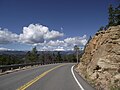 Colorado SH 72.jpg 4.000 × 3.000; 5,55 MB
-
 Colorado State Highway 128.jpg 1.280 × 960; 274 kB
-
 Colorado State Highway 42.jpg 1.280 × 960; 359 kB
-
 Colorado state highway 52.jpeg 2.048 × 1.536; 768 kB
-
 Continental divide seen from Gold Hill, Colorado.jpg 4.608 × 2.592; 4,77 MB
-
 Cottonwood near Gross Reservoir.jpg 6.000 × 4.000; 5,91 MB
-
 Creepy Tree At Rock Creek Farm (180474359).jpeg 2.048 × 1.365; 1,04 MB
-
 Disappearing fall tract to Arapaho glacier, 1904.tif 2.893 × 2.363; 19,58 MB
-
 DSCN2876 southbouldercreek e 600.jpg 600 × 391; 92 kB
-
 Effect of prevailing wind on trees near Arapaho Glacier, 1904.tif 2.898 × 2.327; 19,32 MB
-
 Fair Glacier in the Indian Peaks.tif 2.947 × 2.366; 19,97 MB
-

-
 Firetruck wildland Type 6.jpg 2.220 × 1.491; 532 kB
-
 Five guys in field with laundry.tif 2.940 × 2.385; 20,08 MB
-
 Flag Staff Fire Close Up from South Boulder at 1104pm.jpg 4.563 × 3.251; 1,94 MB
-
 Flag Staff Fire from South Boulder 104pm.jpg 5.760 × 3.840; 4,28 MB
-
 Flag Staff Fire from South Boulder 109pm.jpg 5.760 × 3.840; 3,35 MB
-
 Front Range south of Arapaho Peak.tif 2.906 × 2.322; 19,33 MB
-
 Frying Up Some Grub at Camp.tif 2.899 × 2.359; 19,59 MB
-
 Full sweep of the Arapaho Glacier.tif 2.904 × 2.312; 19,23 MB
-
 Glacial meltwater at glacier edge.tif 2.873 × 2.323; 19,12 MB
-
 Glacier edge looking East.tif 2.909 × 2.316; 19,3 MB
-
 Goose Lake from Albion Ridge, Colorado, 1904.tif 2.893 × 2.314; 19,17 MB
-
 Haystack Mountain - panoramio.jpg 3.456 × 2.304; 2,53 MB
-
 History and production of the gold fields of Boulder County, Colorado (IA historyproductio00monr).pdf 1.387 × 2.187, 52 странице; 4,29 MB
-
 Island lake, Colorado, 1904.tif 2.883 × 2.329; 19,23 MB
-
 Island Lake, Colorado, 1904.tif 2.890 × 2.313; 19,15 MB
-
 Jamestown, Colo., aerial evacuation 130914-Z-LY440-016.jpg 4.288 × 2.848; 2,84 MB
-
 Jamestown, Colo., aerial evacuation 130914-Z-LY440-035.jpg 4.288 × 2.848; 3,41 MB
-
 Jamestown, Colo., aerial evacuation 130914-Z-LY440-219.jpg 4.288 × 2.848; 3,41 MB
-
 Jamestown, Colo., aerial evacuation 130914-Z-LY440-231.jpg 4.288 × 2.848; 3,4 MB
-
 Jamestown, Colo., aerial evacuation 130914-Z-LY440-235.jpg 4.288 × 2.848; 3,38 MB
-
 Jamestown, Colo., aerial evacuation 130914-Z-LY440-513.jpg 2.848 × 4.288; 3,16 MB
-
 Jamestown, Colo., aerial evacuation 130914-Z-LY440-616.jpg 4.288 × 2.848; 4,47 MB
-
 Jamestown, Colo., aerial evacuation 130914-Z-LY440-640.jpg 4.288 × 2.848; 3,11 MB
-
 Jamestown, Colorado Cut Off by 2013 Colorado Floods.jpg 3.000 × 2.000; 5,33 MB
-
 Jerry McClearn, John DeFries and Nancy Founding IBG, Fall 1967.png 1.039 × 734; 1,03 MB
-
 Lake at foot of Arapaho glacier, 1904.tif 2.788 × 2.243; 17,92 MB
-
 Lake in Valley near Arapahoe Glacier.tif 5.917 × 4.616; 78,15 MB
-
 Langridge Dyke 01.jpg 6.000 × 4.000; 6,41 MB
-
 Langridge Dyke 02.jpg 6.000 × 4.000; 5,86 MB
-
 Langridge Dyke 03.jpg 6.000 × 4.000; 6,43 MB
-
 Langridge Dyke 04.jpg 6.000 × 4.000; 5,22 MB
-
 Large Crevasse in Glacier.tif 2.229 × 2.821; 18,01 MB
-
 Late September View of Isabelle Glacier.jpg 5.744 × 4.528; 3,1 MB
-
 Longs Peak And Flat Irons From Rock Creek Farm (180470767).jpeg 2.048 × 1.365; 766 kB
-
 Looking south from camp at Island Lake. 1904.tif 2.913 × 2.327; 19,42 MB
-
 Looking west from Washington Ave mine, 1904.tif 2.880 × 2.320; 19,14 MB
-
 Melting glacier on a cloudy day.tif 2.896 × 2.326; 19,29 MB
-
 MJR 20140111 0026.jpg 1.024 × 683; 797 kB
-
 Mont Alto CO by WH Jackson, 1900.jpg 632 × 445; 99 kB
-
 Mountain weather (9709127439).jpg 3.264 × 2.448; 1,74 MB
-
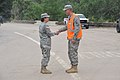
 Nebraska Task Force 1 Deployed to Assist in Colorado Response Efforts.jpg 4.256 × 2.832; 2,07 MB
-
 Niobrara shales near Arapaho glacier, Colorado, 1904.tif 2.911 × 2.316; 19,31 MB
-
 North Fork near Arapaho Glacier, 1904.tif 2.914 × 2.315; 19,32 MB
-
 Pinecliffe, CO sign.jpg 800 × 474; 109 kB
-
 Pinecliffe, CO.JPG 3.264 × 2.448; 2,06 MB
-
 Pinecliffe, CO1.JPG 3.264 × 2.448; 1,4 MB
-
 Pinecliffe, CO10.JPG 3.088 × 2.056; 2,46 MB
-
 Pinecliffe, CO11.JPG 3.088 × 2.056; 1,84 MB
-
 Pinecliffe, CO13.JPG 3.088 × 2.056; 1,6 MB
-
 Pinecliffe, CO14.JPG 3.088 × 2.056; 1,64 MB
-
 Pinecliffe, CO16.JPG 3.088 × 2.056; 1,41 MB
-
 Pinecliffe, CO17.JPG 3.088 × 2.056; 1,26 MB
-
 Pinecliffe, CO18.JPG 3.088 × 2.056; 925 kB
-
 Pinecliffe, CO19.JPG 3.088 × 2.056; 1,59 MB
-
 Pinecliffe, CO2.JPG 3.264 × 2.448; 2,2 MB
-
 Pinecliffe, CO20.JPG 3.088 × 2.056; 1,18 MB
-
 Pinecliffe, CO3.JPG 3.264 × 2.448; 3,79 MB
-
 Pinecliffe, CO4.jpg 2.448 × 3.264; 3,53 MB
-
 Pinecliffe, CO5.JPG 3.264 × 2.448; 3,78 MB
-
 Pinecliffe, CO6.JPG 3.088 × 2.056; 1,26 MB
-
 Pinecliffe, CO7.JPG 3.088 × 2.056; 1,37 MB
-
 Pinecliffe, CO8.JPG 3.088 × 2.056; 1,36 MB
-
 Pinecliffe, CO9.JPG 3.088 × 2.056; 1,82 MB
-
 Propane delivery truck.jpg 1.998 × 1.068; 292 kB
-
 Prospect from Lost Gulch 01.jpg 6.000 × 4.000; 5,02 MB
-
 Prospect from Lost Gulch 02.jpg 6.000 × 4.000; 5,24 MB
-
 Prospect from Lost Gulch 03.jpg 6.000 × 4.000; 4,96 MB
-
 Public restrooms on Boulder Creek Trail near Orodell.jpg 4.032 × 2.256; 3,5 MB
-
 Rainbow Lakes Trailhead Parking, Colorado (44792084685).jpg 7.791 × 5.197; 33,25 MB
-
 Red Rocks Park and North Boulder - panoramio.jpg 3.670 × 868; 702 kB
-
 Regina Nelson 0517.jpg 3.101 × 2.326; 679 kB
-
 Ridge near Gross Reservoir.jpg 6.000 × 4.000; 6,36 MB
-
 Rockies visible from CU Boulder.jpg 1.597 × 743; 232 kB
-
 Rocks (9709120923).jpg 3.264 × 2.448; 3,33 MB
-
 Rocky Mountains CO summer.jpg 1.904 × 1.391; 1,04 MB
-
 Rocky Mountains CO wide.jpg 2.046 × 970; 799 kB
-
 Ruches montenees in Albion camp, 1904.tif 2.890 × 2.316; 19,17 MB
-
 South Boulder Peak and Bear Peak GPS Track.jpg 2.000 × 1.388; 858 kB
-
 Standing Between A Giant Fissure in Glacier.jpg 5.725 × 4.528; 3,42 MB
-
 Step Valley Lake near Arapahoe Glacier.tif 2.811 × 2.212; 17,81 MB
-
 Sugarloaf Mountain in Colorado.jpg 2.048 × 1.365; 642 kB
-
 Sun setting over the Flatirons - panoramio.jpg 3.262 × 2.444; 1,04 MB
-
 Superior, Colorado.jpg 3.504 × 2.336; 6,67 MB
-
 Switzerland Trail above Sunset.jpg 1.384 × 828; 615 kB
-
 Tent in montane field site.tif 2.900 × 2.308; 19,17 MB
-
 Terminal moraine (terminus), Arapaho glacier, 1904.tif 2.744 × 2.212; 17,39 MB
-
 Terminal moraine near Arapaho Glacier, 1904.tif 2.855 × 2.216; 18,13 MB
-
 Terminal moraine, Arapaho glacier, 1904.tif 2.914 × 2.320; 19,36 MB
-
 ThomasEF.jpg 2.787 × 2.013; 1,09 MB
-
 Three Photo Glacier Montage Arapahoe.jpg 11.995 × 3.312; 6,37 MB
-
 Urban Search and Rescue canine assists with response efforts after 2013 Colorado floods.jpg 4.256 × 2.832; 1,67 MB
-
 USA Boulder County, Colorado age pyramid.svg 520 × 600; 8 kB
-
 USGS-UCAR-Aerial-2002.jpg 1.448 × 1.416; 2,17 MB
-
 Utility Infrastructure.jpg 4.032 × 3.024; 6,13 MB
-
 View from Mt. Sanitas - panoramio.jpg 5.309 × 864; 1,09 MB
-
 View from South Boulder Peak - panoramio.jpg 2.490 × 933; 574 kB
-
 Viewpoint at Flagstaff Road 01.jpg 6.000 × 4.000; 6,04 MB
-
 Viewpoint at Flagstaff Road 02.jpg 6.000 × 4.000; 4,87 MB


.jpg)
.jpg)
.jpg)


.jpeg)


.jpeg)


.jpg)


.jpg)


.jpg)


.jpeg)