Category:Bradfield, Essex
Jump to navigation
Jump to search
English: Bradfield is a village and civil parish in Essex, England. It is located about five kilometers (3 miles) east of Manningtree and is fifty-one kilometers (31 miles) northeast from the county town of Chelmsford. The village is in the district of Tendring and the parliamentary constituency of North Essex. There is a Parish Council.
Nederlands: * Bradfield
village and civil parish in Essex, United Kingdom  | |||||
| Upload media | |||||
| Instance of | |||||
|---|---|---|---|---|---|
| Location | Tendring, Essex, East of England, England | ||||
| Said to be the same as | Bradfield (Wikimedia duplicated page, civil parish) | ||||
 | |||||
Subcategories
This category has the following 5 subcategories, out of 5 total.
Media in category "Bradfield, Essex"
The following 87 files are in this category, out of 87 total.
-
 Arable land near the railway - geograph.org.uk - 2934789.jpg 3,648 × 2,255; 1.79 MB
-
 Bales by the Stour - geograph.org.uk - 6432316.jpg 1,024 × 681; 143 KB
-
 Bales in a field - geograph.org.uk - 6432315.jpg 1,024 × 681; 154 KB
-
 Barn off Harwich Road (B1352) - geograph.org.uk - 5370634.jpg 640 × 480; 59 KB
-
 Boundary between 2 crops - geograph.org.uk - 2934356.jpg 3,648 × 2,052; 2.09 MB
-
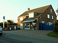
 Bradfield Heath Post Office - geograph.org.uk - 4575809.jpg 640 × 480; 78 KB
-
 Bradfield Methodist Church - geograph.org.uk - 4575840.jpg 640 × 480; 87 KB
-
 Bradfield train station 1872102 ee83b5c7.jpg 640 × 350; 125 KB
-
 Bradfield village sign - geograph.org.uk - 4058515.jpg 1,536 × 1,152; 803 KB
-
 Bridge - geograph.org.uk - 4475446.jpg 768 × 1,024; 303 KB
-
 Cansey Lane - geograph.org.uk - 5175638.jpg 640 × 480; 246 KB
-
 Clacton Road (B1035) heading north - geograph.org.uk - 2947424.jpg 640 × 480; 65 KB
-

-
 Coastal fields east of Bradfield - geograph.org.uk - 5370641.jpg 640 × 480; 79 KB
-
 Containers for Export - geograph.org.uk - 1015833.jpg 640 × 448; 64 KB
-
 Crop field south of Bradfield - geograph.org.uk - 5371387.jpg 640 × 480; 67 KB
-
 Crop field, Lonbarn - geograph.org.uk - 5370630.jpg 640 × 480; 62 KB
-
 Dairyhouse Lane, Bradfield Heath - geograph.org.uk - 4575815.jpg 640 × 480; 72 KB
-
 Dairyhouse Lane, Bradfield Heath - geograph.org.uk - 4575822.jpg 640 × 480; 120 KB
-
 Dairyhouse Lane, Bradfield Heath - geograph.org.uk - 4575834.jpg 640 × 480; 95 KB
-
 Dead Tree - geograph.org.uk - 5633167.jpg 768 × 1,024; 175 KB
-
 Down by the Stour nr Nether Hall - geograph.org.uk - 780831.jpg 640 × 418; 71 KB
-
 Empty ploughed field - geograph.org.uk - 6432318.jpg 1,024 × 681; 106 KB
-
 Essex Way Footpath - geograph.org.uk - 5370654.jpg 640 × 480; 69 KB
-
 Farm track meets Mill Road - geograph.org.uk - 2477951.jpg 640 × 480; 204 KB
-
 Farmland near the Stour - geograph.org.uk - 2934798.jpg 3,648 × 2,736; 2.59 MB
-
 Farmland, Horsleycross Street - geograph.org.uk - 2947421.jpg 640 × 480; 83 KB
-
 Field by the Stour - geograph.org.uk - 6432317.jpg 1,024 × 681; 115 KB
-
 Field by the Stour - geograph.org.uk - 6432324.jpg 1,024 × 681; 109 KB
-
 Field by the Stour - geograph.org.uk - 6432327.jpg 1,024 × 681; 100 KB
-
 Footpath Across A Field - geograph.org.uk - 5633170.jpg 768 × 1,024; 129 KB
-
 Footpath Marker Post - geograph.org.uk - 4475440.jpg 768 × 1,024; 233 KB
-

-
 Harwich Road (B1352) - geograph.org.uk - 5370633.jpg 640 × 480; 56 KB
-
 Heath Road - geograph.org.uk - 5633180.jpg 1,024 × 768; 268 KB
-
 Hedgeline - geograph.org.uk - 6432314.jpg 1,024 × 681; 148 KB
-
 High And Dry - geograph.org.uk - 4475452.jpg 1,024 × 768; 149 KB
-
 High tide at Jacques Bay, looking west - geograph.org.uk - 2934350.jpg 3,648 × 2,052; 1.85 MB
-
 Jacques Bay, Bradfield - geograph.org.uk - 492098.jpg 640 × 484; 94 KB
-
 Lake near Cansey Lane - geograph.org.uk - 5175624.jpg 640 × 480; 106 KB
-

-
 Mill Lane - geograph.org.uk - 5175604.jpg 640 × 480; 281 KB
-
 Mill Lane - geograph.org.uk - 5370658.jpg 640 × 480; 135 KB
-
 Mill Lane, Bradfield - geograph.org.uk - 5175609.jpg 640 × 480; 258 KB
-
 Mill Lane, Bradfield Heath - geograph.org.uk - 4575795.jpg 640 × 480; 83 KB
-
 No entry signs, Bradfield - geograph.org.uk - 4575852.jpg 640 × 480; 79 KB
-
 Older farm buildings near Ragmarsh Farm - geograph.org.uk - 2934801.jpg 3,632 × 2,245; 2.35 MB
-
 Part Of The Essex Way - geograph.org.uk - 4475433.jpg 1,024 × 768; 258 KB
-
 Ragmarsh Farm, Bradfield - geograph.org.uk - 798805.jpg 640 × 478; 76 KB
-
 Rail bridge over byway - geograph.org.uk - 2934287.jpg 3,648 × 2,736; 4.33 MB
-
 Rural housing - geograph.org.uk - 2477952.jpg 640 × 480; 206 KB
-

-

-
 Small bridge on road from Bradfield to Wix - geograph.org.uk - 4058808.jpg 1,536 × 1,153; 944 KB
-
 Small plantation west of Cansey Lane - geograph.org.uk - 5175634.jpg 640 × 480; 158 KB
-
 Steam Mill Road, Bradfield Heath - geograph.org.uk - 4575801.jpg 640 × 480; 90 KB
-
 Stour Estuary - geograph.org.uk - 6432312.jpg 1,024 × 681; 118 KB
-
 Stour Estuary - geograph.org.uk - 6432325.jpg 1,024 × 681; 106 KB
-
 The Essex Way 149 - geograph.org.uk - 2459440.jpg 640 × 425; 46 KB
-
 The Essex Way 151 - geograph.org.uk - 2459444.jpg 640 × 425; 68 KB
-

-
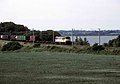
 The Stour Estuary - geograph.org.uk - 5194354.jpg 640 × 426; 41 KB
-
 The Street, Bradfield - geograph.org.uk - 4575859.jpg 640 × 480; 81 KB
-

-
 Track to Nether Hall - geograph.org.uk - 2934279.jpg 3,648 × 2,736; 3.96 MB
-
 Trackside trees - geograph.org.uk - 6432310.jpg 1,024 × 681; 260 KB
-
 View over the Stour Estuary - geograph.org.uk - 5194356.jpg 640 × 426; 38 KB
-
 Windmill Road, Bradfield Heath - geograph.org.uk - 4575788.jpg 640 × 480; 78 KB
-
 Windmill Road, Bradfield Heath - geograph.org.uk - 4575803.jpg 640 × 480; 74 KB
-
 Windmill Road, Mistley Heath - geograph.org.uk - 5175600.jpg 640 × 480; 155 KB
-
 Wix Road - geograph.org.uk - 4475376.jpg 1,024 × 768; 273 KB
-
 Wix Road - geograph.org.uk - 5371383.jpg 640 × 480; 63 KB
-
 Wix Road closed for ten weeks - geograph.org.uk - 5175618.jpg 640 × 480; 190 KB
-
 Bradfield, village and church - geograph.org.uk - 492234.jpg 640 × 444; 64 KB
-

-
 Farmhouse at Goldenferry Farm - geograph.org.uk - 274758.jpg 640 × 433; 79 KB
-
 Farmhouse at Whitehouse Farm - geograph.org.uk - 274771.jpg 640 × 480; 60 KB
-

-
 House in Bradfield Heath, Essex - geograph.org.uk - 273966.jpg 640 × 387; 54 KB
-
-
 Ragmarsh Farm, Bradfield - geograph.org.uk - 491970.jpg 640 × 460; 74 KB
-

-
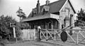
 Railway Crossing - geograph.org.uk - 274789.jpg 640 × 480; 89 KB
-
 Road to Bluehouse Farm - geograph.org.uk - 273981.jpg 640 × 480; 102 KB
-
 Sugar beet under autumn skies - geograph.org.uk - 544137.jpg 640 × 480; 201 KB
-
 The B1352 at Bradfield - geograph.org.uk - 274794.jpg 640 × 465; 71 KB
-
 The road to Jacques Hall - geograph.org.uk - 421429.jpg 640 × 447; 80 KB


_-_geograph.org.uk_-_5370634.jpg)


_heading_north_-_geograph.org.uk_-_2947424.jpg)


_-_geograph.org.uk_-_5370633.jpg)


