Category:Brockton station (MBTA)
Jump to navigation
Jump to search
railway station in Brockton, Massachusetts  | |||||
| Upload media | |||||
| Instance of | |||||
|---|---|---|---|---|---|
| Location | Brockton, Plymouth County, Massachusetts | ||||
| Transport network | |||||
| Owned by | |||||
| Date of official opening |
| ||||
| Date of official closure |
| ||||
| Connecting line |
| ||||
| Adjacent station |
| ||||
 | |||||
Subcategories
This category has the following 2 subcategories, out of 2 total.
B
Media in category "Brockton station (MBTA)"
The following 12 files are in this category, out of 12 total.
-
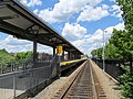
 Brockton station platform and Anglim building, June 2017.JPG 3,730 × 2,802; 1.73 MB
-
 Brockton station platform and police station, June 2017.JPG 4,320 × 3,240; 2.85 MB
-
 Brockton station platform from pedestrian crossing, June 2017.JPG 3,952 × 2,967; 2.51 MB
-
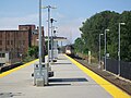
 Brockton station platform, June 2017.JPG 4,320 × 3,240; 2.75 MB
-
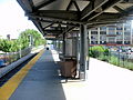 Brockton station platform.jpg 3,264 × 2,448; 1.9 MB
-
 Brockton station viaduct over Massachusetts State Route 27.jpg 1,024 × 768; 178 KB
-
 Inbound train leaving Brockton station, August 2009.jpg 3,472 × 2,604; 1.44 MB
-
 MBTA 1034 at Brockton.jpg 2,448 × 3,264; 1.59 MB
-
 Old and new mile markers at Brockton station, June 2017.JPG 2,816 × 2,116; 1.93 MB
-
 Pedestrian level crossing at Brockton station, Jule 2017.JPG 4,320 × 3,240; 3.21 MB
-
 Possible CapeFLYER signage at Brockton station, June 2017.JPG 4,320 × 3,240; 2.7 MB
-
 Station sign and downtown Brockton, June 2017.JPG 4,320 × 3,240; 4.37 MB


