Category:Bruckgut, Münchenstein
Jump to navigation
Jump to search
| Object location | | View all coordinates using: OpenStreetMap |
|---|
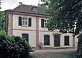
manor house with park in Münchenstein in the canton of Basel-Landschaft, Switzerland  | |||||
| Upload media | |||||
| Instance of |
| ||||
|---|---|---|---|---|---|
| Part of | |||||
| Location | Münchenstein, Arlesheim District, Basel-Landschaft, Switzerland | ||||
| Street address |
| ||||
| Architect |
| ||||
| Heritage designation | |||||
 | |||||
Media in category "Bruckgut, Münchenstein"
This category contains only the following file.
-
 Bruckgut Münchenstein 2009-06-03.jpg 1,048 × 738; 700 KB