Category:Buchboden
Jump to navigation
Jump to search
 | |||||
| Upload media | |||||
| Instance of | |||||
|---|---|---|---|---|---|
| Location | Sonntag, Bludenz District, Vorarlberg, Austria | ||||
| Elevation above sea level |
| ||||
 | |||||
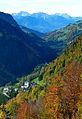
Buchboden ist eine Fraktion der Gemeinde Sonntag und liegt im westlichsten Bundesland Österreichs, Vorarlberg, im Bludenz auf etwa 900 Metern Höhe.
Subcategories
This category has the following 3 subcategories, out of 3 total.
Media in category "Buchboden"
The following 22 files are in this category, out of 22 total.
-
 Alpe Spitzegga 5.JPG 4,272 × 2,394; 1.77 MB
-
 Bad Rotenbrunnen von Wangspitze.jpg 4,608 × 2,592; 3.09 MB
-
 Bettlerspitze 2272m.JPG 4,272 × 2,848; 2.79 MB
-
 Buchboden aus dem Hutlatal.jpg 1,154 × 858; 362 KB
-
 Buchboden.jpg 704 × 1,023; 336 KB
-
 Hauptwegweiser in Bad Rotenbrunnen.jpg 1,844 × 1,373; 677 KB
-
 Jungfernspitze2212m.JPG 4,272 × 2,848; 2.33 MB
-
 Kar Laguz Alpe Madratsch.JPG 4,272 × 2,848; 2.91 MB
-
 Kessanaschlucht Tafel.jpg 657 × 945; 195 KB
-
 Klesenza Alpe.JPG 4,272 × 2,848; 2.63 MB
-
 KlesenzaAlpe Bettlerspitze.JPG 2,848 × 4,272; 3.23 MB
-
 KlesenzaAlpeRoteWand.JPG 2,846 × 3,794; 1.99 MB
-
 Klesenzatal Hutlabach.JPG 4,272 × 2,848; 5.13 MB
-
 Madratsch2287mSätteli1737m.JPG 4,272 × 2,848; 9.46 MB
-
 Pfarrer Josef Kary 1953.JPG 2,846 × 3,794; 3.79 MB
-
 Rote Wand NWseite 2704m.JPG 2,846 × 3,794; 2.75 MB
-
 Rotenbrunnenbachbett bei Badhütta.jpg 1,821 × 1,369; 679 KB
-
 Sonntag Buchboden Schrägluftbild S.jpg 4,000 × 2,396; 6.86 MB
-
 Sonntag Fontanella Ortstafeln.jpg 4,105 × 2,740; 5.1 MB
-
 Walserherbst Alpe Klesenza.jpg 1,280 × 853; 527 KB
-
 Wegweiser am Gadentalausgang.jpg 1,872 × 1,365; 661 KB
-
 Wegweiser an Sträßchen Buchboden-Bad Rot(h)enbrunnen.jpg 960 × 1,280; 76 KB


enbrunnen.jpg)