Category:Buildings in Woking
Jump to navigation
Jump to search
Subcategories
This category has the following 23 subcategories, out of 23 total.
*
- Shops in Woking (8 F)
C
- Christ Church, Woking (9 F)
D
- St Dunstan's Church, Woking (3 F)
E
- Emmanuel Chapel, Woking (4 F)
- Export House, Woking (6 F)
M
- Mayford Arms pub, Woking (8 F)
- McLaren Technology Centre (12 F)
O
- Old Woking Community Centre (2 F)
S
- Salvation Army Hall, Woking (4 F)
- Shah Jahan Mosque, Woking (20 F)
T
- The Coign Church, Woking (4 F)
- The Lightbox (3 F)
W
- Woking Palace (4 F)
- St Paul's Church, Maybury (7 F)
Media in category "Buildings in Woking"
The following 42 files are in this category, out of 42 total.
-
 Asahi House, Chertsey Road, Woking, Surrey.jpg 1,894 × 2,524; 1.44 MB
-
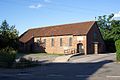
 Wanborough barn2 20060909.jpg 2,580 × 1,720; 327 KB
-
 Birch cottage.jpg 4,032 × 3,024; 5.57 MB
-
 Bishop David Brown School, Sheerwater, Woking.jpg 2,568 × 1,926; 1.67 MB
-
 Calvary Church, Goldsworth Road, Woking (June 2015).JPG 3,200 × 2,800; 1.45 MB
-

-
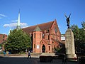
 Church (36238110876).jpg 3,648 × 5,472; 6.79 MB
-
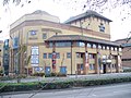 Victoria Entertainment Centre - geograph.org.uk - 1186703.jpg 640 × 480; 96 KB
-
 Courtenay Free Church, Walton Road, Maybury, Woking (June 2015) (1).JPG 3,600 × 2,400; 2.01 MB
-
 Courtenay Free Church, Walton Road, Maybury, Woking (June 2015) (2).JPG 3,800 × 2,600; 2.04 MB
-
 Fairlawn, Woking.png 1,026 × 688; 1.02 MB
-
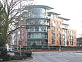
 Flats in Central Woking - geograph.org.uk - 601391.jpg 480 × 640; 87 KB
-
 Former Burton shop, Woking.jpg 2,576 × 1,932; 1.82 MB
-
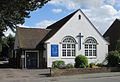
 Friends Meeting House, Park Road, Woking (June 2015).JPG 4,200 × 2,800; 1.98 MB
-
 High Living, Woking - geograph.org.uk - 601389.jpg 640 × 480; 119 KB
-
 Hoe Bridge School - geograph.org.uk - 1184843.jpg 640 × 480; 121 KB
-
 Hoe Valley School, Woking, Surrey.jpg 2,587 × 1,940; 1.56 MB
-
 Keepers Cottage, Hoe - geograph.org.uk - 1503950.jpg 640 × 480; 121 KB
-
 Lion House, Oriental Road, Woking.jpg 2,587 × 1,940; 1.53 MB
-

-
 O'Neill's - geograph.org.uk - 1188070.jpg 640 × 480; 89 KB
-
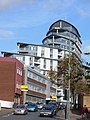
 Offices on Victoria Way - geograph.org.uk - 1775823.jpg 1,600 × 1,200; 496 KB
-
 Park Heights - geograph.org.uk - 1188127.jpg 640 × 480; 96 KB
-
 Woking, Premier Inn - geograph.org.uk - 4497218.jpg 1,989 × 1,492; 1.76 MB
-
 Public library, Woking England.jpg 3,872 × 2,592; 5.2 MB
-
-
 Surrey County History Centre, Goldsworth Road, Woking (June 2015).JPG 4,400 × 2,000; 1.39 MB
-
 The Big Apple - geograph.org.uk - 1188079.jpg 480 × 640; 65 KB
-
 The Fuel Cell - geograph.org.uk - 1188134.jpg 640 × 480; 98 KB
-
 The Inn at Maybury - geograph.org.uk - 1186205.jpg 640 × 480; 87 KB
-
 The Peacocks Centre, Woking - geograph.org.uk - 40941.jpg 427 × 640; 71 KB
-
 Architecture; a church doorway with wrought ironwork at Woki Wellcome V0024317.jpg 2,674 × 3,448; 2.36 MB
-
 Winston Churchill School, Woking, Surrey.jpg 2,574 × 1,930; 1.18 MB
-
 Woking Fire Station - geograph.org.uk - 431077.jpg 640 × 427; 194 KB
-
 Woking High School photograph.jpg 298 × 195; 24 KB
-
 Woking High School.jpeg 2,048 × 1,365; 343 KB
-
 Woking-Tallest-Buildings.svg 1,485 × 374; 5.28 MB
-
 Woking-TownSquare.jpg 1,600 × 1,200; 561 KB
-
 Wokingskyline.JPG 2,972 × 2,236; 421 KB
-
 Word of Life Pentecostal Church, Marlborough Road, Woking (June 2015).JPG 2,800 × 2,600; 1.55 MB
-
 Flats on Station Approach - geograph.org.uk - 601385.jpg 480 × 640; 118 KB
-
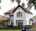
 George Bernard Shaw's house - geograph.org.uk - 22957.jpg 640 × 480; 134 KB


.JPG)

.jpg)

_(1).JPG)
_(2).JPG)


.JPG)


.JPG)


.JPG)

