Category:Woking
Jump to navigation
Jump to search
town in Surrey, England  | |||||
| Upload media | |||||
| Instance of | |||||
|---|---|---|---|---|---|
| Location | Woking, Surrey, South East England, England | ||||
| Population |
| ||||
| Area |
| ||||
| Different from | |||||
| official website | |||||
 | |||||
Woking is a town in Surrey, England.
Subcategories
This category has the following 27 subcategories, out of 27 total.
*
B
- Clematis 'Belle of Woking' (9 F)
H
- Hoe Bridge School (5 F)
M
O
P
- Pyrford Lock (10 F)
S
T
- Triggs Lock (12 F)
W
- Walsham Lock (25 F)
- Woking Civic Offices (6 F)
Media in category "Woking"
The following 126 files are in this category, out of 126 total.
-
 2005 Robin Hood 2B Plus, front right at Woking Summer Festival.jpg 3,872 × 2,592; 6.67 MB
-
 At Walsham Lock - geograph.org.uk - 951841.jpg 640 × 480; 139 KB
-
 Au Morandarte Flickr DSC01344 (11893200845).jpg 3,072 × 2,304; 2.82 MB
-
 Auburn (1250412820).jpg 3,872 × 2,592; 6.53 MB
-
 Basingstoke Canal, St John's - geograph.org.uk - 1213844.jpg 640 × 480; 116 KB
-
 Bentley's garage - geograph.org.uk - 1616741.jpg 640 × 427; 62 KB
-
 Brianna Ghey vigil in Woking, 2023-02-15 - book of condolence.jpg 4,096 × 3,072; 4.7 MB
-
 Brianna Ghey vigil in Woking, 2023-02-15 - crowd 1 (redacted).jpg 4,096 × 3,072; 2.69 MB
-
 Brianna Ghey vigil in Woking, 2023-02-15 - crowd 2 (redacted).jpg 4,096 × 3,072; 2.73 MB
-
 Brianna Ghey vigil in Woking, 2023-02-15 - sign.jpg 3,072 × 4,096; 3.5 MB
-
 Brianna Ghey vigil in Woking, 2023-02-15 - tree with ribbons 1 (redacted).jpg 3,072 × 4,096; 2.71 MB
-
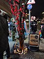 Brianna Ghey vigil in Woking, 2023-02-15 - tree with ribbons 2 (redacted).jpg 3,072 × 4,096; 3.42 MB
-
 Bridleway junction - geograph.org.uk - 1341212.jpg 640 × 427; 142 KB
-
 Carved animals, Woking.jpg 850 × 567; 740 KB
-
 Chertsey Road - geograph.org.uk - 1188087.jpg 640 × 480; 108 KB
-
 Chertsey Road Bridge - geograph.org.uk - 1186631.jpg 640 × 480; 121 KB
-
 Crastock Bridge - geograph.org.uk - 1415964.jpg 640 × 427; 119 KB
-

-
 Fide et Diligentia - geograph.org.uk - 1042281.jpg 640 × 480; 53 KB
-
 Florist Shop Old Woking UK.jpg 1,134 × 754; 110 KB
-
 Flumes in Woking Park - geograph.org.uk - 1188152.jpg 640 × 480; 89 KB
-

-
 Frying Aujourd'hui - geograph.org.uk - 601412.jpg 640 × 480; 86 KB
-
 Goldsworth Park SU9858 238.jpg 2,560 × 1,440; 918 KB
-
 Gorse Cottage, Woking 01.png 946 × 648; 917 KB
-
 Gorse Cottage, Woking 02.png 938 × 667; 916 KB
-
 Gorse Hill Hotel, Woking, Surrey.jpg 4,032 × 2,268; 2.01 MB
-
 Greenways, Woking.png 1,005 × 721; 1.02 MB
-
 Heathcot Medical Centre (2), 17 April 2020.jpg 3,456 × 4,608; 1.73 MB
-

-
 Hook Heath Golf Course (geograph 1858492).jpg 640 × 480; 137 KB
-
 Houseboat, Basingstoke Canal - geograph.org.uk - 582109.jpg 640 × 480; 141 KB
-

-
 Italia Conti - Woking 1.webp 695 × 470; 77 KB
-
 Italia Conti Woking Entrance.jpg 640 × 640; 102 KB
-
 Library book drop box, Woking England.jpg 3,872 × 2,592; 5.03 MB
-
 Lightbox gallery, Woking.jpg 850 × 567; 599 KB
-
 MayburyRoad h.g.wells house.jpg 361 × 488; 58 KB
-
 Middle Hill, Hook Heath, Surrey (1).jpg 2,561 × 1,436; 722 KB
-
 Middle Hill, Hook Heath, Surrey (2).jpg 2,597 × 1,453; 701 KB
-
 Monument Bridge, Basingstoke Canal - geograph.org.uk - 581873.jpg 640 × 529; 151 KB
-
 Muslims in Britain- Eid Ul Fitr Celebrations, 1941 D5146.jpg 536 × 800; 60 KB
-
 Muslims in Britain- Eid Ul Fitr Celebrations, 1941 D5147.jpg 794 × 800; 81 KB
-
 Muslims in Britain- Eid Ul Fitr Celebrations, 1941 D5149.jpg 1,656 × 2,480; 896 KB
-
 Muslims in Britain- Eid Ul Fitr Celebrations, 1941 D5153.jpg 761 × 800; 100 KB
-
 Muslims in Britain- Eid Ul Fitr Celebrations, 1941 D5154.jpg 538 × 800; 40 KB
-
 Muslims in Britain- Eid Ul Fitr Celebrations, 1941 D5158.jpg 546 × 800; 52 KB
-
 Muslims in Britain- Eid Ul Fitr Celebrations, 1941 D5162.jpg 755 × 800; 53 KB
-
 Muslims in Britain- Eid Ul Fitr Celebrations, 1941 D5163.jpg 800 × 528; 51 KB
-
 Muslims in Britain- Eid Ul Fitr Celebrations, 1941 D5164.jpg 800 × 536; 61 KB
-
 Muslims in Britain- Eid Ul Fitr Celebrations, 1941 D5169.jpg 764 × 800; 88 KB
-
 Muslims in Britain- Eid Ul Fitr Celebrations, 1941 D5170.jpg 553 × 800; 60 KB
-
 Muslims in Britain- Eid Ul Fitr Celebrations, 1941 D5174.jpg 800 × 536; 62 KB
-
 New Victoria Theatre, Woking.jpg 850 × 567; 634 KB
-
 Old car (1251013940).jpg 3,872 × 2,592; 5.88 MB
-
 Ordnance Survey One-Inch Sheet 114 SW London and Windsor, Published 1934.jpg 13,539 × 9,026; 14.45 MB
-
 Ordnance Survey One-Inch Sheet 114 Windsor, Published 1920.jpg 12,130 × 8,368; 14.07 MB
-
 Ordnance Survey One-Inch Sheet 169 Aldershot, Published 1971.jpg 11,011 × 13,141; 52.75 MB
-
 Ordnance Survey One-Inch Tourist Map of Dorking & Leith Hill Published 1929.jpg 13,183 × 9,778; 15.71 MB
-
 Path to Riverdene, Knaphill - geograph.org.uk - 1175013.jpg 640 × 480; 67 KB
-

-
 Polling station hours, Woking 2015.jpg 2,448 × 2,448; 917 KB
-
 Pond on Westfield Common - geograph.org.uk - 1757994.jpg 800 × 592; 207 KB
-
 Pond on Westfield Common - geograph.org.uk - 1758006.jpg 800 × 598; 156 KB
-
 Ports-direct-1849.png 1,053 × 1,490; 106 KB
-
 Public library interior, Woking England.jpg 3,872 × 2,592; 5.63 MB
-
 River Bourne by Bonsey's Common, Woking - geograph.org.uk - 168438.jpg 480 × 640; 315 KB
-
 River Wey, near Send - geograph.org.uk - 101699.jpg 640 × 405; 169 KB
-
 Scotswood Park, Sheerwater (geograph 2266357).jpg 2,560 × 1,920; 1.89 MB
-
 Siemens Desiro leaving Woking.jpg 3,092 × 2,056; 1.13 MB
-
 St Columba's House - geograph.org.uk - 1186179.jpg 640 × 480; 94 KB
-
 St. John's Lock No 10, Basingstoke Canal - geograph.org.uk - 582733.jpg 640 × 533; 182 KB
-
 St. John's Lock No 8, Basingstoke Canal - geograph.org.uk - 582200.jpg 640 × 502; 145 KB
-
 St. John's Lock No 9, Basingstoke Canal - geograph.org.uk - 582206.jpg 640 × 529; 172 KB
-
-
 Station Approach, Woking - geograph.org.uk - 601382.jpg 480 × 640; 94 KB
-
 Surrey Woking Town Council April2024.svg 360 × 185; 3 KB
-
 Talbot (1250320802).jpg 3,872 × 2,592; 6.31 MB
-
 The Ambassadors - geograph.org.uk - 1186792.jpg 640 × 480; 77 KB
-
 The Basingstoke Canal in Woking - geograph.org.uk - 45829.jpg 640 × 427; 108 KB
-
 The CHP Fuel Cell, Woking Park - geograph.org.uk - 1530280.jpg 640 × 480; 84 KB
-
 The Cricketers (side view), Westfield Road - geograph.org.uk - 1758054.jpg 1,024 × 754; 268 KB
-
 Triumph Herald (1250748826).jpg 3,872 × 2,592; 5.21 MB
-
 United Kingdom Surrey Woking 2022.svg 360 × 185; 3 KB
-
 Victoria Arch Railway Bridge, Woking - geograph.org.uk - 1340202.jpg 640 × 480; 88 KB
-
 Victoria Way - geograph.org.uk - 601369.jpg 640 × 480; 86 KB
-

-

-
 Walton Cottage, Woking.jpg 2,369 × 1,472; 798 KB
-

-
 Welcome to Maybury - geograph.org.uk - 1186318.jpg 640 × 480; 96 KB
-
 Westfield Common - geograph.org.uk - 1047554.jpg 640 × 480; 84 KB
-
 Westfield Common - geograph.org.uk - 1757960.jpg 800 × 590; 171 KB
-

-

-
 Westfield Road - geograph.org.uk - 1757855.jpg 800 × 590; 153 KB
-
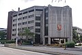 Woking Civic Offices, Victoria Way.jpg 4,288 × 2,848; 5.09 MB
-

-
 Woking Football Club - Kingfield Stadium - geograph.org.uk - 1779646.jpg 800 × 523; 104 KB
-
 Woking Football Club - The Cardinals Bar - geograph.org.uk - 1779661.jpg 800 × 594; 110 KB
-
 Woking fuel cell 2.jpg 850 × 567; 904 KB
-
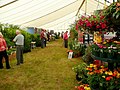 Woking Nursery Exhibition, 2009 1 - geograph.org.uk - 1392132.jpg 640 × 480; 271 KB
-
 Woking Nursery Exhibition, 2009 2 - geograph.org.uk - 1392138.jpg 640 × 480; 289 KB
-
 Woking Park Fuel Cell - geograph.org.uk - 22955.jpg 640 × 480; 148 KB
-
 Woking police station.jpg 850 × 502; 573 KB
-
 Woking Sidings - geograph.org.uk - 22964.jpg 640 × 480; 129 KB
-
 Woking Skyline Banner.JPG 2,100 × 301; 473 KB
-
 Woking skyline from Guildown in 2020 (geograph 6720429).jpg 1,024 × 759; 229 KB
-
 Woking Skyline.JPG 4,608 × 3,456; 3.8 MB
-
 Woking town centre from Fisher's Farm near Send, Surrey, January 2024.jpg 4,032 × 2,268; 1.6 MB
-
 Woking town centre from the west.jpg 1,573 × 1,180; 467 KB
-
 Woking Tyre and Exhaust Specialists - geograph.org.uk - 1213882.jpg 640 × 480; 87 KB
-
 Woking UK ward map 2024.svg 1,425 × 1,086; 297 KB
-
 Wokingpitch.jpg 500 × 375; 167 KB
-
 Burdenshott Hill - geograph.org.uk - 1415817.jpg 640 × 427; 91 KB
-
 Green algae on pond in Horsell Common - geograph.org.uk - 168455.jpg 640 × 480; 342 KB
-
 Hoebridge Golf Course - geograph.org.uk - 154071.jpg 640 × 480; 124 KB
-
 Littlewick Road, Horsell - geograph.org.uk - 166260.jpg 640 × 480; 432 KB
-
 Maybury, Shaftesbury Road - geograph.org.uk - 277474.jpg 640 × 480; 120 KB
-
 River Wey Navigation by Send - geograph.org.uk - 701151.jpg 640 × 480; 108 KB
-
 River Wey, by Pyrford - geograph.org.uk - 518318.jpg 640 × 480; 180 KB
-
 Shey Copse - geograph.org.uk - 570563.jpg 640 × 480; 149 KB
-
 Shey Copse Course - geograph.org.uk - 570555.jpg 640 × 480; 110 KB
-
 The Bourne - geograph.org.uk - 166151.jpg 640 × 480; 427 KB
-
 Westfield Avenue - geograph.org.uk - 416021.jpg 640 × 480; 150 KB
-
 Whitmoor Farm - geograph.org.uk - 53393.jpg 640 × 427; 99 KB


.jpg)
.jpg)


.jpg)
.jpg)

.jpg)
.jpg)


,_17_April_2020.jpg)

.jpg)


.jpg)
.jpg)


.jpg)


.jpg)


.jpg)


,_Westfield_Road_-_geograph.org.uk_-_1758054.jpg)
.jpg)


.jpg)


