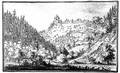
Category:Burg Tannegg
Jump to navigation
Jump to search
| Object location | | View all coordinates using: OpenStreetMap |
|---|
national heritage site in Fischingen, Switzerland  | |||||
| Upload media | |||||
| Instance of | |||||
|---|---|---|---|---|---|
| Part of | |||||
| Location |
| ||||
| Heritage designation | |||||
 | |||||
|
This is a category about a cultural property of national significance in Switzerland with KGS number 10486
|
Media in category "Burg Tannegg"
The following 2 files are in this category, out of 2 total.
-
 Burg Tannegg.png 931 × 570; 618 KB
-
 Dussnang02.JPG 1,600 × 1,200; 630 KB
