Category:Burr Trail Scenic Backway
Jump to navigation
Jump to search
scenic backway in Garfield County, Utah, United States  | |||||
| Upload media | |||||
| Instance of | |||||
|---|---|---|---|---|---|
| Location | Garfield County, Utah | ||||
| Terminus | |||||
 | |||||
English: Media related to the Burr Trail Scenic Backway, a scenic backway in eastern Garfield County, Utah, United States, that connects Utah State Route 276 (north of Bullfrog) with Utah State Route 12 in Boulder and passes though the Grand Staircase-Escalante National Monument, Capitol Reef National Park, and the Glen Canyon National Recreation Area.
Subcategories
This category has the following 2 subcategories, out of 2 total.
B
- Burr Trail campsites (4 F)
Media in category "Burr Trail Scenic Backway"
The following 18 files are in this category, out of 18 total.
-
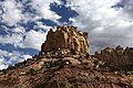 Burr Trail Formation.jpg 3,495 × 2,317; 2.22 MB
-
 BURR TRAIL SCENIC BACKWAY, UTAH AT WATERPOCKET FOLD.jpg 4,608 × 3,456; 4.03 MB
-
 Burr Trail, Capitol Reef NP - panoramio.jpg 1,280 × 960; 284 KB
-
 Capitol Reef - Burr Trail.jpg 1,136 × 852; 227 KB
-

-
 Grand Staircase 201812 0034 (29855702938).jpg 3,264 × 2,448; 2.41 MB
-
 Long Canyon, nera Boulder UT (3685467420).jpg 1,000 × 667; 328 KB
-
 Scenic Byway 12 - Approaching Long Canyon - NARA - 7721959.jpg 752 × 489; 379 KB
-

-

-

-

-
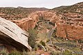
 Scenic Byway 12 - Burr Trail Overlook - NARA - 7721725.jpg 3,540 × 2,366; 8.84 MB
-

-

-

-
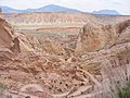
 Scenic Byway 12 - Looking Down on the Burr Trail - NARA - 7721724.jpg 2,492 × 1,868; 1.62 MB
-


.jpg)
.jpg)
.jpg)


