Category:Cambois
Jump to navigation
Jump to search
village in Northumberland, United Kingdom  | |||||
| Upload media | |||||
| Instance of | |||||
|---|---|---|---|---|---|
| Location | East Bedlington, Northumberland, North East England, England | ||||
 | |||||
English: Cambois is a village in south-east Northumberland, England. It is situated on the north side of the estuary of the River Blyth between Blyth and Ashington on the North Sea coast.
Subcategories
This category has the following 2 subcategories, out of 2 total.
C
- Cambois War Memorial (2 F)
S
Media in category "Cambois"
The following 41 files are in this category, out of 41 total.
-
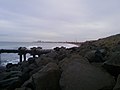
 Caller Crag - geograph.org.uk - 1085748.jpg 640 × 480; 105 KB
-
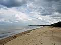
 Cambois Beach looking North - geograph.org.uk - 1744654.jpg 600 × 450; 242 KB
-
 Cambois Beach looking North - geograph.org.uk - 1744675.jpg 600 × 450; 230 KB
-
 Cambois Beach looking South - geograph.org.uk - 1744661.jpg 600 × 450; 231 KB
-
 Cambois Beach looking South - geograph.org.uk - 1744683.jpg 600 × 450; 186 KB
-
 Cambois Beach looking South - geograph.org.uk - 1744689.jpg 600 × 450; 201 KB
-
 Cambois Beach, Northumberland - geograph.org.uk - 136967.jpg 640 × 480; 73 KB
-
 Cambois Water Tower - geograph.org.uk - 742403.jpg 640 × 480; 71 KB
-
 East Bedlington, UK - panoramio - Scoobster (1).jpg 2,048 × 1,536; 415 KB
-
 East Bedlington, UK - panoramio - Scoobster.jpg 2,048 × 1,536; 495 KB
-
 East Bedlington, UK - panoramio.jpg 2,048 × 1,536; 352 KB
-
 From Sandy Bay towards Blyth - geograph.org.uk - 735112.jpg 640 × 426; 42 KB
-
 Looking from North Blyth across The Rockers - geograph.org.uk - 4824146.jpg 1,600 × 1,135; 193 KB
-
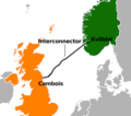 Norway United Kingdom North Sea Link.png 1,368 × 1,212; 255 KB
-
 Parked up for the weekend - geograph.org.uk - 1048958.jpg 640 × 429; 72 KB
-
 Site of Demolished Railway Bridge - geograph.org.uk - 1743152.jpg 600 × 450; 292 KB
-
 Sunrise on Cambois beach - geograph.org.uk - 2222734.jpg 4,000 × 3,000; 2.59 MB
-
 Terrace, Cambois - geograph.org.uk - 3268245.jpg 640 × 360; 188 KB
-
 The Rockers - geograph.org.uk - 4597790.jpg 4,608 × 3,456; 2.65 MB
-
 The Rockers - geograph.org.uk - 4824152.jpg 1,600 × 1,228; 206 KB
-
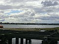
 Tidal Basin, Cambois - geograph.org.uk - 1743096.jpg 600 × 450; 211 KB
-
 Up Agate in tidal basin at Cambois - geograph.org.uk - 4821948.jpg 1,600 × 1,297; 401 KB
-
 Water Tower - geograph.org.uk - 274698.jpg 640 × 480; 122 KB
-
 Waves crashing against The Rockers - geograph.org.uk - 4821413.jpg 1,600 × 1,053; 145 KB
-
 Winning, near North Blyth geograph-2873895-by-Ben-Brooksbank.jpg 2,394 × 1,366; 1.24 MB
-
 Brock Lane East Sleekburn - geograph.org.uk - 276612.jpg 640 × 480; 122 KB
-
 Cambois beach - view north - geograph.org.uk - 1452535.jpg 640 × 360; 71 KB
-
 Cambois beach - view south - geograph.org.uk - 1452537.jpg 640 × 480; 63 KB
-
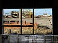 Cambois Disused Rail Depot - geograph.org.uk - 711221.jpg 640 × 480; 104 KB
-
 Cambois Fishing Fleet^ - geograph.org.uk - 742398.jpg 640 × 480; 55 KB
-
 Chemical Factory - geograph.org.uk - 287956.jpg 640 × 480; 42 KB
-
 Foundry - geograph.org.uk - 277411.jpg 640 × 480; 67 KB
-
 Freeman's Rail Crossing - geograph.org.uk - 277428.jpg 640 × 480; 70 KB
-
 Level crossing - geograph.org.uk - 523181.jpg 640 × 480; 69 KB
-
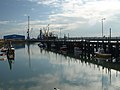
 Marina - geograph.org.uk - 523188.jpg 640 × 480; 80 KB
-
 North Seaton Colliery - geograph.org.uk - 69522.jpg 640 × 480; 62 KB
-
 Rail Depot - geograph.org.uk - 274675.jpg 640 × 480; 126 KB
-
 School - geograph.org.uk - 277410.jpg 640 × 480; 58 KB
-
 Storage units - geograph.org.uk - 523166.jpg 640 × 480; 75 KB
-
 The Buccaneer Pub and Restaurant - geograph.org.uk - 523174.jpg 640 × 480; 80 KB
-
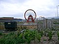 Winding Wheel - geograph.org.uk - 274667.jpg 640 × 480; 131 KB


.jpg)


