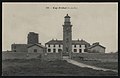
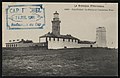
Category:Cap Fréhel lighthouse (1847)
Jump to navigation
Jump to search
| Object location | | View all coordinates using: OpenStreetMap |
|---|
lighthouse built 1847 in Côtes-d'Armor, France  | |||||
| Upload media | |||||
| Instance of | |||||
|---|---|---|---|---|---|
| Part of | |||||
| Made from material | |||||
| Location | Cap Fréhel, Côtes-d'Armor, Brittany, Q88521114, Metropolitan France, France | ||||
| Located in or next to body of water | |||||
| Architect | |||||
| Inception |
| ||||
| Dissolved, abolished or demolished date |
| ||||
| Significant event |
| ||||
| Height |
| ||||
| Replaces | |||||
| Replaced by | |||||
| Different from | |||||
 | |||||
Media in category "Cap Fréhel lighthouse (1847)"
The following 13 files are in this category, out of 13 total.
-
 Cap Fréhel - Cap – AD22 - 16FI1323.jpg 1,706 × 1,109; 271 KB
-
 Cap Fréhel - Entrée des gouffres - AD22 - 16FI1327.jpg 1,670 × 1,094; 382 KB
-
 Cap Fréhel - Extrême pointe du Cap Fréhel et phare - AD22 - 16FI3856.jpg 1,719 × 1,151; 296 KB
-
 Cap Fréhel - Phare et Houlles - AD22 - 16FI3936.jpg 1,711 × 1,174; 423 KB
-

-
 Cap Fréhel - Rochers des Houles - AD22 - 16FI3852.jpg 1,069 × 1,660; 293 KB
-
 Cap Fréhel - Vue d'ensemble du phare de Cap Fréhel - AD22 - 16FI1356.jpg 1,721 × 1,108; 273 KB
-
 Plévenon - Cap Fréhel douves et sémaphore - AD22 - 16FI1328.jpg 1,707 × 1,117; 402 KB
-
 Plévenon - Cap Fréhel falaises et phares - AD22 - 16FI1332.jpg 1,728 × 1,125; 339 KB
-
 Plévenon - Cap Fréhel phare et ancienne tour - AD22 - 16FI1324.jpg 1,702 × 1,108; 278 KB
-
 Plévenon - Cap Fréhel rochers et grottes - AD22 - 16FI1329.jpg 1,698 × 1,107; 298 KB
-
 Plévenon - Cap Fréhel tour - AD22 - 16FI1325.jpg 1,710 × 1,130; 271 KB
-
 Plévenon - Phare les Houlles et la Pointe du Jars - AD22 - 16FI3850.jpg 1,710 × 1,112; 369 KB


Categories:
- Cap Fréhel lighthouses
- Lighthouses built in 1847
- Lighthouses by height, 21 to 30 meters
- Stone lighthouses in France
- 20th-century lighthouses in Côtes-d'Armor
- Built in Côtes-d'Armor in 1847
- Lighthouses built by Léonce Reynaud
- Lighthouses in France by name
- Destroyed in France in 1944
- Lighthouses by range, 25 to 29 nm
- Landfall lights
- Lighthouse equipment by Soleil
- Destroyed lighthouses in France