Category:Careston (civil parish)
Jump to navigation
Jump to search
Scottish parish in Angus, Scotland, UK | |||||
| Upload media | |||||
| Instance of | |||||
|---|---|---|---|---|---|
| Named after | |||||
| Location |
| ||||
| Population |
| ||||
 | |||||
Media in category "Careston (civil parish)"
The following 42 files are in this category, out of 42 total.
-

-
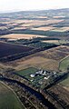 Brechin Pump Station - geograph.org.uk - 5936375.jpg 2,282 × 3,598; 1.49 MB
-
 Careston Station - geograph.org.uk - 3600461.jpg 640 × 480; 67 KB
-

-
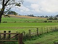
 Contented coos at North Wood near Careston - geograph.org.uk - 5900631.jpg 5,184 × 3,888; 7.44 MB
-
 Cows in pasture near North Wood by Careston - geograph.org.uk - 5901850.jpg 5,184 × 3,888; 5.68 MB
-
 Derelict gate-fencing by North Wood near Careston by Brechin - geograph.org.uk - 5900143.jpg 3,128 × 2,346; 2.68 MB
-
 Empty silage 'pit' at North Wood near Careston - geograph.org.uk - 5900638.jpg 5,184 × 3,888; 6.76 MB
-
 Farm buildings, Hillhead of Careston - geograph.org.uk - 3600363.jpg 640 × 480; 64 KB
-
 Farm track at North Wood Careston - geograph.org.uk - 5899186.jpg 4,000 × 3,000; 4 MB
-
 Farm track near Careston - geograph.org.uk - 3265419.jpg 1,200 × 797; 500 KB
-
 Farm track near Montboy - geograph.org.uk - 3265422.jpg 1,200 × 797; 457 KB
-
 Field near Careston - geograph.org.uk - 6447730.jpg 5,184 × 3,888; 7.14 MB
-
 Field of potatoes near Montboy - geograph.org.uk - 3600466.jpg 640 × 480; 93 KB
-
 Forest edge at North Wood near Careston - geograph.org.uk - 5900643.jpg 5,184 × 3,888; 5.97 MB
-
 Gateway at North Wood near Careston - geograph.org.uk - 5900634.jpg 5,184 × 3,888; 6.61 MB
-
 North Wood near Careston by Brechin - geograph.org.uk - 5899916.jpg 5,184 × 3,888; 7.32 MB
-
 North Wood, Careston - geograph.org.uk - 5899182.jpg 4,000 × 3,000; 4.19 MB
-
 Northbound A90 near Careston - geograph.org.uk - 6158176.jpg 800 × 533; 693 KB
-
 Northbound A90, Nether Careston Bus Stop - geograph.org.uk - 6158170.jpg 800 × 533; 680 KB
-
 Open gate at North Wood near Careston, Brechin - geograph.org.uk - 5900125.jpg 3,128 × 2,346; 2.84 MB
-
 Parkside - geograph.org.uk - 3600455.jpg 640 × 480; 93 KB
-
 Part of North Wood(^) near Careston - geograph.org.uk - 5900640.jpg 5,184 × 3,888; 5.79 MB
-
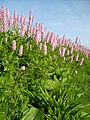 Pink flowers - geograph.org.uk - 1888407.jpg 2,112 × 2,816; 3.01 MB
-
 Road at Careston - geograph.org.uk - 6295746.jpg 4,000 × 3,000; 3.63 MB
-
 Road between Hillhead of Careston and Bracklawburn - geograph.org.uk - 6297285.jpg 4,000 × 3,000; 3.31 MB
-
 Road between the A90 and The Park - geograph.org.uk - 6295705.jpg 4,000 × 3,000; 3.82 MB
-
 Road bridge over dismantled railway - geograph.org.uk - 1888424.jpg 2,816 × 2,112; 3 MB
-
 Road through Hillhead of Careston - geograph.org.uk - 3265416.jpg 1,200 × 797; 391 KB
-
 South Drum, Careston - geograph.org.uk - 1106506.jpg 640 × 427; 63 KB
-
 Sowing field of potatoes - geograph.org.uk - 2151294.jpg 640 × 480; 88 KB
-
 Telephone box and exchange at Careston - geograph.org.uk - 3265421.jpg 1,200 × 797; 490 KB
-

-
 The Park dwelling house, Careston - geograph.org.uk - 1106526.jpg 640 × 428; 71 KB
-
 The Park, Careston, near Brechin - geograph.org.uk - 3510967.jpg 1,024 × 681; 75 KB
-
 Track at North Wood near Careston - geograph.org.uk - 5901867.jpg 5,184 × 3,888; 6.46 MB
-
 Track between arable fields near to Montboy - geograph.org.uk - 6296072.jpg 4,000 × 3,000; 3.41 MB
-
 Track out from North Wood near Careston - geograph.org.uk - 5901866.jpg 5,184 × 3,888; 7.77 MB
-
 Trailer in a field at Gateside, near Brechin - geograph.org.uk - 4523411.jpg 1,024 × 680; 161 KB
-
 View north-west from North Wood near Careston - geograph.org.uk - 5900645.jpg 5,184 × 3,888; 5.26 MB
-
-
 What a transformation^ - geograph.org.uk - 3596711.jpg 480 × 640; 111 KB


_near_Careston_-_geograph.org.uk_-_5900640.jpg)


