Category:Carnoustie
Jump to navigation
Jump to search
town in the council area of Angus, Scotland, UK  | |||||
| Upload media | |||||
| Instance of |
| ||||
|---|---|---|---|---|---|
| Location |
| ||||
| Developer | |||||
| Population |
| ||||
| Area |
| ||||
 | |||||
Български: Карну̀сти (на английски Carnoustie на гаелски Càrn Fheusda, произнася се ) е град в Източна Шотландия.
Deutsch: Carnoustie ist eine Kleinstadt in Schottland mit 10260 Einwohnern (Schätzung 2004). Im naheliegendem Links Golf Club von Carnoustie fanden 2007 zum 2. Mal nach 1999 die British Open statt.
English: Carnoustie is a town and former police burgh in the council area of Angus, Scotland. It is situated at the mouth of the Barry Burn on the North Sea coast. In the 2001 census, Carnoustie had a population of 10,561, making it the fourth largest town in Angus.
Français : Carnoustie (Càrn Fheusda en gaélique écossais) est une ville et un ancien police burgh du council area de la région d'Angus en Écosse (Royaume-Uni). La ville est située à l'embouchure de Barry Burn sur la côte est de l'Écosse. Selon le recensement britannique de 2001, Carnoustie a une population de 10,561 habitants, faisant d'elle la quatrième plus grande ville d'Angus.
Gàidhlig: 'S e baile-beag ann an Aonghas a th' ann an Càrn Fheusda. Tha e na laighe ri ceann an ear den Dùn Deagh ann am Machair Aonghais. 'S e seo na co-chomharran aige: 56° 30′ 6.05″ Tuath agus 2° 42′ 25.71″ Iar.
Svenska: Carnoustie ( skotsk gäliska: Càrn Fheusda) är en stad med 10 260 invånare (2004) i den administrativa regionen Angus i Skottland. Den ligger vid Barry Burns mynning på östkusten i Skottland, och är mest känd för sin golfbana Carnoustie Golf Links. Det finns källor som hävdar att golf spelades i Carnoustie redan 1527.
Subcategories
This category has the following 15 subcategories, out of 15 total.
- High Street, Carnoustie (2 F)
B
- Barry Burn (2 F)
- Buddon Ness (18 F)
C
- Carnoustie beach (18 F)
- Carnoustie Golf Hotel (4 F)
- Carnoustie railway station (10 F)
E
- East Haven, Angus (33 F)
G
- Golf Street railway station (2 F)
S
W
- Carnoustie War Memorial (3 F)
- West Haven, Angus (21 F)
Media in category "Carnoustie"
The following 151 files are in this category, out of 151 total.
-

-
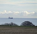 A ship approaching the Tay estuary - geograph.org.uk - 625391.jpg 640 × 602; 54 KB
-
 Barry mill barry.jpg 2,532 × 2,304; 651 KB
-
-
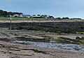
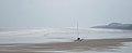
 Beach at Carnoustie in Angus - geograph.org.uk - 1897377.jpg 640 × 480; 48 KB
-
 Beach at Westhaven - geograph.org.uk - 4138748.jpg 640 × 472; 53 KB
-
 Berryfield allotments, Carnoustie - geograph.org.uk - 1278138.jpg 640 × 536; 77 KB
-
 Boats at Westhaven - geograph.org.uk - 2054145.jpg 600 × 398; 45 KB
-
 Buddonness.jpg 2,936 × 1,124; 179 KB
-
 Buddonness2.jpg 3,011 × 1,104; 186 KB
-
 Carnoustie and District.svg 1,062 × 931; 31 KB
-
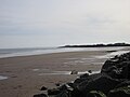
 Carnoustie Bay - geograph.org.uk - 112818.jpg 640 × 424; 41 KB
-
 Carnoustie beach - geograph.org.uk - 1994459.jpg 800 × 533; 73 KB
-
 Carnoustie beach - geograph.org.uk - 1994462.jpg 800 × 533; 106 KB
-
 Carnoustie beach - geograph.org.uk - 1994466.jpg 800 × 534; 162 KB
-
 Carnoustie Beach looking south - geograph.org.uk - 5329757.jpg 5,184 × 3,888; 3.83 MB
-
 Carnoustie Beach ML.jpg 1,936 × 785; 658 KB
-
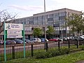
 Carnoustie Fire Station - geograph.org.uk - 1658692.jpg 640 × 480; 98 KB
-
 Carnoustie High School - geograph.org.uk - 16815.jpg 640 × 480; 147 KB
-
 Carnoustie schools2.jpg 587 × 437; 49 KB
-
 Carnoustie Scotland (18).jpg 1,024 × 768; 152 KB
-
 Carnoustie Scotland (20).jpg 1,024 × 1,365; 153 KB
-
 Carnoustie Scotland (21).jpg 1,024 × 768; 186 KB
-
 Carnoustie Scotland (30).jpg 1,024 × 1,365; 488 KB
-
 Carnoustie Scotland (7).jpg 1,024 × 1,365; 270 KB
-
 Carnoustie Scotland (9).jpg 1,024 × 1,365; 393 KB
-
 Carnoustie Sports Centre.jpg 4,694 × 3,129; 6.75 MB
-
 Carnoustie Twin Town Maule.JPG 1,600 × 1,200; 390 KB
-
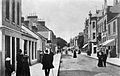 Carnoustie1900.jpg 2,172 × 1,381; 304 KB
-
 Cormorant at West Haven - geograph.org.uk - 2258389.jpg 640 × 640; 84 KB
-
 Council advertising, Carnoustie - geograph.org.uk - 1490621.jpg 640 × 480; 79 KB
-
 Crab on Carnoustie beach - geograph.org.uk - 1994471.jpg 800 × 533; 109 KB
-
 Dalhousie Court - geograph.org.uk - 1490661.jpg 640 × 480; 69 KB
-
 Dibble tree.jpg 2,304 × 3,072; 2.9 MB
-
 Erskine carnoustie.JPG 3,072 × 2,304; 2.94 MB
-
 Fisherman on the rocks, Carnoustie - geograph.org.uk - 1994468.jpg 800 × 532; 139 KB
-

-
 Ice on a birch in central Carnoustie - geograph.org.uk - 1162996.jpg 281 × 640; 45 KB
-
 Kinloch.jpg 2,475 × 1,764; 289 KB
-
 Ladybird on a sunflower - geograph.org.uk - 938092.jpg 640 × 480; 79 KB
-

-

-
 Montrose that way - geograph.org.uk - 1983158.jpg 1,024 × 683; 97 KB
-
 Mouth of Barry Burn - geograph.org.uk - 4747135.jpg 640 × 360; 55 KB
-
 National cycle network 1 - geograph.org.uk - 1983140.jpg 1,024 × 683; 59 KB
-
 National Cycle Network sign. - geograph.org.uk - 423539.jpg 480 × 640; 68 KB
-
 NCN Millennium Milepost MP1099 Carnoustie.jpeg 533 × 800; 76 KB
-
 Old steps at Barry Mill. - panoramio.jpg 2,816 × 1,880; 3.97 MB
-
 Oldbarrychurch.JPG 3,072 × 2,304; 2.87 MB
-
 Ordnance Survey One-Inch Sheet 57 Forfar & Dundee, Published 1946.jpg 12,999 × 10,644; 15.76 MB
-
 Panmureworks.JPG 2,523 × 1,557; 490 KB
-

-
 Shoreline West Haven - geograph.org.uk - 4747195.jpg 2,560 × 1,440; 1.14 MB
-

-

-

-
 Swan in the rock pools - geograph.org.uk - 532841.jpg 640 × 346; 87 KB
-
 That way to Dundee - geograph.org.uk - 1984629.jpg 1,024 × 683; 121 KB
-
 The new play park, Carnoustie - geograph.org.uk - 1203882.jpg 550 × 640; 56 KB
-
 The Nineteenth Hole^^^ - geograph.org.uk - 491298.jpg 640 × 414; 39 KB
-
 The Panmure Centre - geograph.org.uk - 534313.jpg 485 × 640; 78 KB
-
 The Park - Church Lane - geograph.org.uk - 488748.jpg 640 × 590; 65 KB
-
 The Royal Bank of Scotland - geograph.org.uk - 1983153.jpg 533 × 800; 46 KB
-
 The Royal Navy during the Second World War A24702.jpg 800 × 620; 38 KB
-
 The Station Hotel, Carnoustie - geograph.org.uk - 495119.jpg 640 × 530; 80 KB
-
 Thomas louson grave.jpg 1,680 × 2,712; 368 KB
-
 View across West Path - geograph.org.uk - 1304846.jpg 640 × 596; 87 KB
-

-
 Welcome to Carnoustie - geograph.org.uk - 16812.jpg 640 × 480; 109 KB
-
 West Haven beach at Carnoustie - geograph.org.uk - 5982662.jpg 640 × 405; 68 KB
-
 Westhaven from the east - geograph.org.uk - 544130.jpg 640 × 198; 29 KB
-
 What's it for , at Barry Mill. - panoramio.jpg 2,816 × 1,880; 3.45 MB
-

-

-
 Woodlands Primary School.png 1,081 × 593; 1.07 MB
-
 A field of turf - geograph.org.uk - 448882.jpg 640 × 480; 66 KB
-

-
 Auchrennie Farm - geograph.org.uk - 121109.jpg 640 × 424; 126 KB
-
 Avast ye scurvy preventing swabs - geograph.org.uk - 1490637.jpg 480 × 640; 131 KB
-
 Barry Links - geograph.org.uk - 1435831.jpg 640 × 480; 92 KB
-
 Barry Links - geograph.org.uk - 1435836.jpg 640 × 480; 88 KB
-
 Barry Links - geograph.org.uk - 1436017.jpg 640 × 359; 65 KB
-
 Barry Links - geograph.org.uk - 1436031.jpg 640 × 309; 59 KB
-
 Barry Links - geograph.org.uk - 1436035.jpg 640 × 480; 91 KB
-
 Barry, East end - geograph.org.uk - 448797.jpg 640 × 480; 71 KB
-
 Beach, Barry Ness - geograph.org.uk - 1436083.jpg 640 × 480; 84 KB
-
 Buckie Hillocks - geograph.org.uk - 593619.jpg 640 × 426; 47 KB
-
 Buddon Links - geograph.org.uk - 1436736.jpg 640 × 480; 96 KB
-
 Buddon Ness Lighthouses - geograph.org.uk - 495194.jpg 640 × 284; 21 KB
-
 Carnoustie - geograph.org.uk - 1436949.jpg 640 × 359; 42 KB
-
 Carnoustie bay. - geograph.org.uk - 427037.jpg 640 × 424; 86 KB
-
 Carnoustie Ladies' Golf Club - geograph.org.uk - 1490603.jpg 640 × 396; 83 KB
-
 Carnoustie Leisure Centre - geograph.org.uk - 532568.jpg 640 × 432; 42 KB
-
 Carnoustie roof tops 2. - geograph.org.uk - 431173.jpg 640 × 480; 59 KB
-
 Carnoustie rooftops - geograph.org.uk - 13793.jpg 640 × 480; 132 KB
-

-
 Clayholes - geograph.org.uk - 16817.jpg 640 × 480; 98 KB
-
 Coastal defences, Buddon Ness - geograph.org.uk - 1436840.jpg 640 × 480; 105 KB
-
 Coastal defences, Buddon Ness - geograph.org.uk - 1436853.jpg 640 × 480; 100 KB
-
 Coastal erosion, Buddon Ness - geograph.org.uk - 495200.jpg 480 × 640; 80 KB
-
 Craning above Carnoustie^ - geograph.org.uk - 478266.jpg 480 × 640; 50 KB
-
 Danger^ - geograph.org.uk - 495185.jpg 640 × 547; 90 KB
-
 Dinghies on sea defences - geograph.org.uk - 473692.jpg 640 × 370; 59 KB
-
 Driving range, Carnoustie - geograph.org.uk - 1435826.jpg 640 × 480; 56 KB
-
 Dune front, Barry Ness - geograph.org.uk - 1436086.jpg 640 × 480; 83 KB
-
-
 Dunes, Barry Links - geograph.org.uk - 1436833.jpg 640 × 359; 77 KB
-
 Dunes, Buddon Ness - geograph.org.uk - 495159.jpg 640 × 480; 100 KB
-
 Dunes, Buddon Ness - geograph.org.uk - 495222.jpg 640 × 480; 90 KB
-
 Farmland, Barry to the West. - geograph.org.uk - 448816.jpg 640 × 480; 53 KB
-
 Farmland, Mains of Ravensby - geograph.org.uk - 483871.jpg 640 × 424; 49 KB
-
 Farmland, Mains of Ravensby. - geograph.org.uk - 464114.jpg 640 × 399; 32 KB
-
 Flocking Birds at Sunset - geograph.org.uk - 494815.jpg 640 × 480; 46 KB
-
 Flowers at Carnoustie Leisure Centre - geograph.org.uk - 532574.jpg 640 × 397; 57 KB
-
 Grazing Highland Coos^ - geograph.org.uk - 494792.jpg 640 × 450; 58 KB
-
 Here's looking at you^ - geograph.org.uk - 494797.jpg 640 × 400; 56 KB
-
 High Lighthouse - geograph.org.uk - 1436059.jpg 640 × 480; 51 KB
-
 Ireland Street, Carnoustie - geograph.org.uk - 67543.jpg 640 × 480; 101 KB
-

-
 Looking towards dunes at Buddon Ness - geograph.org.uk - 494743.jpg 640 × 480; 83 KB
-
 Lower Lighthouse, Buddon Ness - geograph.org.uk - 494735.jpg 480 × 640; 58 KB
-

-
 Lower-Victoria - geograph.org.uk - 534316.jpg 640 × 428; 93 KB
-

-

-
 Monikie Burn near Muirdrum - geograph.org.uk - 17367.jpg 640 × 480; 161 KB
-
 Oak tree, Carnoustie House Ground's - geograph.org.uk - 426852.jpg 640 × 480; 130 KB
-
 Parkside Medical Centre - geograph.org.uk - 534325.jpg 640 × 384; 45 KB
-
 Pitskelly Farm - geograph.org.uk - 480695.jpg 640 × 369; 53 KB
-
 Potato boxes at Pitskelly Farm - geograph.org.uk - 480697.jpg 640 × 480; 52 KB
-

-
 Preparations for the Open Golf 2007 - geograph.org.uk - 491101.jpg 477 × 640; 56 KB
-
 Preparations for the Open Golf 2007 - geograph.org.uk - 491172.jpg 640 × 480; 78 KB
-
 Reflections on the bay - geograph.org.uk - 571879.jpg 640 × 447; 42 KB
-
 Remains of the bridge at The Fairy Steps. - geograph.org.uk - 411986.jpg 480 × 640; 107 KB
-
 Road Closed^ - geograph.org.uk - 17366.jpg 640 × 480; 167 KB
-

-
 Sailing in Carnoustie Bay - geograph.org.uk - 532827.jpg 640 × 377; 54 KB
-
 Sand dunes, Barry Ridge - geograph.org.uk - 496039.jpg 640 × 480; 54 KB
-
 Scots Pine, on Barry Ridge - geograph.org.uk - 496023.jpg 545 × 640; 112 KB
-
 Seal and pup - geograph.org.uk - 495212.jpg 640 × 449; 58 KB
-
 Station Road, Barry. - geograph.org.uk - 448757.jpg 640 × 480; 71 KB
-
 Sunday Sailing - geograph.org.uk - 495914.jpg 480 × 640; 61 KB
-
 Terrace Road at Sunset - geograph.org.uk - 695155.jpg 640 × 480; 34 KB
-
 The Aboukir - geograph.org.uk - 534306.jpg 640 × 480; 83 KB
-
 The Dibble Tree - geograph.org.uk - 411978.jpg 480 × 640; 163 KB
-
 The mouth of the Barry Burn - geograph.org.uk - 541899.jpg 640 × 480; 63 KB
-
 The old slaughter house, Barry. - geograph.org.uk - 448835.jpg 640 × 480; 83 KB
-
 Valley of the Buddon Burn. - geograph.org.uk - 464095.jpg 640 × 480; 53 KB
-
 Vegetation at the Fairy Steps - geograph.org.uk - 412004.jpg 640 × 480; 140 KB
-
 Welcome to Carnoustie - geograph.org.uk - 478301.jpg 640 × 480; 74 KB
%27_(11219043453).jpg)


.jpg)
.jpg)
.jpg)
.jpg)
.jpg)
.jpg)


_-_geograph.org.uk_-_1348285.jpg)


