Category:Catcott
Jump to navigation
Jump to search
English: Catcott is a rural village and civil parish, situated close to Edington to the east of Bridgwater on the Somerset Levels to the north of the Polden Hills in the Sedgemoor district of Somerset, England.
village located in Sedgemoor, United Kingdom  | |||||
| Upload media | |||||
| Instance of | |||||
|---|---|---|---|---|---|
| Location | Sedgemoor, Somerset, South West England, England | ||||
| Population |
| ||||
 | |||||
Subcategories
This category has the following 3 subcategories, out of 3 total.
C
- Catcott Nature Reserves (4 F)
- Catcott War Memorial (1 F)
P
- Church of St Peter, Catcott (1 F)
Media in category "Catcott"
The following 38 files are in this category, out of 38 total.
-
 Catcote war memorial - geograph.org.uk - 6244826.jpg 768 × 1,024; 243 KB
-
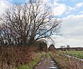
 Continuation of Little Leaze Lane - geograph.org.uk - 5251281.jpg 1,024 × 866; 265 KB
-
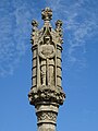 Detail of Catcote war memorial - geograph.org.uk - 6244829.jpg 768 × 1,024; 153 KB
-
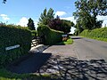
 Entrance driveway, The Brambles - geograph.org.uk - 5251310.jpg 1,024 × 838; 221 KB
-
 Farm buildings on Little Leaze Lane - geograph.org.uk - 5251266.jpg 1,024 × 768; 151 KB
-
 Farm Sheds off A39 - geograph.org.uk - 1497954.jpg 640 × 480; 205 KB
-
 Field by Nidon Rhyne - geograph.org.uk - 4996633.jpg 3,060 × 1,789; 1.29 MB
-
 Field by Nidon Rhyne - geograph.org.uk - 4996671.jpg 3,058 × 1,900; 1.29 MB
-
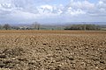
 Field of stubble - geograph.org.uk - 5251291.jpg 1,024 × 769; 279 KB
-
 Fields near Catcott - geograph.org.uk - 1660422.jpg 640 × 447; 56 KB
-
 Flooded Catcott Heath - geograph.org.uk - 149126.jpg 640 × 426; 109 KB
-
 Higher Ropes Drove - geograph.org.uk - 5251196.jpg 1,024 × 841; 327 KB
-
 King William Inn - geograph.org.uk - 2626148.jpg 800 × 600; 482 KB
-
 King William Inn, Catcott, Somerset - geograph.org.uk - 1105827.jpg 640 × 480; 62 KB
-
-
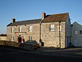
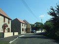
 Listed buildings in Catcott - geograph.org.uk - 4996399.jpg 3,072 × 2,048; 1.06 MB
-
 Looking across the moors from Cock Hill - geograph.org.uk - 2628494.jpg 800 × 600; 363 KB
-
 Looking east along Lippetts Way - geograph.org.uk - 4929024.jpg 3,264 × 2,448; 1.75 MB
-
 Middle Drove Rhyne - geograph.org.uk - 5251201.jpg 1,024 × 768; 217 KB
-
 Modern houses on east of Catcott - geograph.org.uk - 2626149.jpg 800 × 600; 378 KB
-
 Nidon Rhyne Drove - geograph.org.uk - 5251246.jpg 1,024 × 768; 234 KB
-
 Nidon Rhyne Drove - geograph.org.uk - 5251250.jpg 1,024 × 768; 207 KB
-
 Rhyne Drove - geograph.org.uk - 4863910.jpg 1,920 × 1,280; 787 KB
-
 Rhyne Drove - geograph.org.uk - 4873234.jpg 1,920 × 1,280; 1.09 MB
-
 Rhyne Drove - geograph.org.uk - 4996982.jpg 1,920 × 1,260; 814 KB
-
 Road entering Catcott, heading east - geograph.org.uk - 5499360.jpg 640 × 480; 179 KB
-
 Road on Catcott Heath - geograph.org.uk - 6257935.jpg 1,600 × 1,068; 656 KB
-
 Scotts Lane - geograph.org.uk - 5034531.jpg 1,024 × 768; 219 KB
-
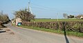
 Scotts Lane leading to Catcott from A39 - geograph.org.uk - 2628489.jpg 800 × 600; 346 KB
-
 The Crown Inn, Catcott - geograph.org.uk - 4997031.jpg 2,229 × 1,686; 424 KB
-
 The Nydon - geograph.org.uk - 4997015.jpg 1,920 × 1,280; 977 KB
-
 The Nydon, Catcott - geograph.org.uk - 4997048.jpg 2,371 × 1,239; 687 KB
-
 Tree by Rhyne Drove - geograph.org.uk - 4997009.jpg 2,983 × 1,929; 1.16 MB
-
 View down from the A39 - geograph.org.uk - 1827104.jpg 640 × 480; 96 KB
-

-
 War memorial, Catcott - geograph.org.uk - 4996425.jpg 1,920 × 1,280; 657 KB
-
 Yellow Flags - geograph.org.uk - 878331.jpg 640 × 480; 118 KB
-
 Purchase Copse - geograph.org.uk - 150881.jpg 640 × 426; 147 KB


