Category:Central Europe
Zur Navigation springen
Zur Suche springen
Region in Europa .svg) | |||||
| Medium hochladen | |||||
| Ist ein(e) | |||||
|---|---|---|---|---|---|
| Ist Teil von | |||||
| Besteht aus | |||||
 | |||||
Unterkategorien
Es werden 21 von insgesamt 21 Unterkategorien in dieser Kategorie angezeigt:
In Klammern die Anzahl der enthaltenen Kategorien (K), Seiten (S), Dateien (D)
Seiten in der Kategorie „Central Europe“
Diese Kategorie enthält nur die folgende Seite.
Medien in der Kategorie „Central Europe“
Folgende 47 Dateien sind in dieser Kategorie, von 47 insgesamt.
-
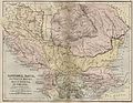
 Balkans year 925.png 472 × 605; 288 KB
-
 BalkVolkPutzger1898.jpg 2.033 × 1.890; 2,96 MB
-

-
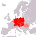
 Central Europe (countries and regions).PNG 1.218 × 1.245; 82 KB
-
 Central Europe (definitions).png 6.460 × 3.403; 1,36 MB
-
 Central Europe (MODIS 2020-11-22).jpg 3.937 × 3.189; 1,61 MB
-
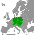
 Central Europe (proposal 1).PNG 1.218 × 1.245; 81 KB
-
 Central Europe - Envisat.jpg 2.295 × 3.000; 4,84 MB
-
 Central Europe on February 16, 2017.jpg 6.400 × 5.000; 6,77 MB
-
 Central Europemap Pannonia Dacia and others.jpg 3.717 × 2.866; 1,11 MB
-
 Centraleu2.jpg 343 × 296; 16 KB
-
 CentralEurope2.PNG 1.093 × 1.093; 155 KB
-
En-us-Central Europe.ogg 1,1 s; 13 KB
-
 Europa srodkowa-mapa.png 507 × 422; 36 KB
-
 Europe centrale, Castellan.png 839 × 854; 269 KB
-
 Europe centrale, Wackermann.png 841 × 852; 271 KB
-
 Europe midpoint.jpg 800 × 704; 146 KB
-
 Europe médiane, Czesław Miłosz.png 839 × 830; 274 KB
-
 Europe médiane.png 834 × 851; 282 KB
-
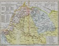
 Germanisch-Slawisch-Ungarisches Mitteleuropa um 1000.jpg 602 × 821; 574 KB
-
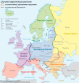 Grossgliederung Europas-ua.svg 631 × 659; 1.017 KB
-
 Handbücher der Binnenfischerei Mitteleuropas, der Seefischerei Nordeuropas.png 1.277 × 477; 1,21 MB
-
 Islamic occupation of the central part of the Hungarian Kingdom - 1629.tif 6.390 × 5.084; 52,38 MB
-
Jer-Ûrope du Mitan.ogg 1,4 s; 16 KB
-
 KaisertumOsterreich-es.svg 855 × 642; 321 KB
-
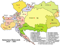 KaisertumOsterreich.png 800 × 593; 213 KB
-
 Karte von Deutschland, dem Königr. der Niederlande und der Schweiz.jpg 5.821 × 4.769; 7,38 MB
-
 Kitelepítettek emlékműve (2).jpg 4.000 × 3.000; 4,76 MB
-
 Kitelepítettek emlékműve (3).jpg 4.000 × 3.000; 4,55 MB
-
 Kitelepítettek emlékműve (4).jpg 4.000 × 3.000; 4,5 MB
-
 Kitelepítettek emlékműve.jpg 4.000 × 3.000; 4,6 MB
-
 Map of Central Europe.png 415 × 422; 12 KB
-
 Map of the Austrian Empire, 1855.jpg 640 × 522; 87 KB
-
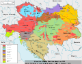 Minorités ethniques d'Autriche-Hongrie (1910).svg 1.360 × 1.052; 1,24 MB
-
 Mittel- und Südosteuropa.jpg 8.745 × 10.228; 10,38 MB
-

-
 Neutral and Non-Aligned European States.png 697 × 684; 92 KB
-
 Regnum Marianum.png 1.299 × 964; 2,1 MB
-
Ro-Europa Centrală.ogg 2,0 s; 25 KB
-
 Rough Map of German speaking countries and partitions.png 2.048 × 1.360; 92 KB
-
 Silesia-map-es.svg 547 × 508; 311 KB
-
 Silesia-map.svg 547 × 508; 306 KB
-
 Sub-regional cooperation in East Central Europe (IA subregionalcoope109452950).pdf 1.275 × 1.650, 88 Seiten; 5,27 MB
-
 Tower - Great Owl Mountains - Poland - panoramio.jpg 1.046 × 700; 871 KB
-
-
-
 Örkény István Színház.jpg 4.000 × 3.000; 5,17 MB


.PNG)
.png)
.jpg)
.PNG)


.jpg)
.jpg)
.jpg)


.svg)

._Entrance_exsample._4900_-_4700_BC.jpg)


