Category:Chester
Jump to navigation
Jump to search

This category relates to Chester in the United Kingdom.
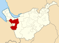
city in Cheshire, England    | |||||
| Upload media | |||||
| Instance of |
| ||||
|---|---|---|---|---|---|
| Location | Cheshire West and Chester, Cheshire, North West England, England | ||||
| Inception |
| ||||
| Significant event |
| ||||
| Population |
| ||||
| Area |
| ||||
| official website | |||||
 | |||||
Subcategories
This category has the following 43 subcategories, out of 43 total.
- Benchmarks in Chester (112 F)
!
*
- Quality images of Chester (4 F)
- Valued images of Chester (22 F)
- Videos from Chester (2 F)
A
B
C
E
F
- Food of Chester (2 F)
H
J
- Jacob's Well, Chester (2 F)
M
P
R
- RIB I 0562 (1 F)
S
- Signs in Chester (8 F)
T
- Trees in Chester (3 F)
U
Media in category "Chester"
The following 200 files are in this category, out of 964 total.
(previous page) (next page)-
 1910 Chester Heywood Guide cover.png 358 × 529; 356 KB
-
 A Footpath and the Duke's Drive - geograph.org.uk - 495529.jpg 640 × 480; 115 KB
-
 A Royal Wave (28974466938).jpg 4,896 × 3,264; 4.59 MB
-
 A view from The Meadows - geograph.org.uk - 1125713.jpg 640 × 453; 164 KB
-

-
 Abbot's Drive - geograph.org.uk - 881112.jpg 640 × 457; 277 KB
-
 Abbot's Knoll - geograph.org.uk - 1321060.jpg 640 × 457; 300 KB
-
 Abbot's Nook - geograph.org.uk - 881136.jpg 640 × 457; 426 KB
-
 Abbot's Park - geograph.org.uk - 1217085.jpg 640 × 457; 310 KB
-
 Abbot's Park - geograph.org.uk - 1336652.jpg 640 × 457; 383 KB
-
 Abbot's Park - geograph.org.uk - 827359.jpg 640 × 457; 406 KB
-
 Abbot's Park - geograph.org.uk - 838539.jpg 640 × 457; 339 KB
-
 Above the Sorting Office Door opposite Chester Station - geograph.org.uk - 4862103.jpg 2,608 × 1,959; 1.03 MB
-
 Access to the A55 from the A56 - geograph.org.uk - 1208166.jpg 640 × 426; 59 KB
-
 Access to the Kaleyards car park - geograph.org.uk - 788460.jpg 480 × 640; 166 KB
-
 Against The Grain, Hoole, Chester - geograph.org.uk - 4471502.jpg 3,648 × 2,844; 1.77 MB
-
 Alexander's Jazz Theatre Bar Rufus Court - geograph.org.uk - 103222.jpg 640 × 480; 118 KB
-
 Amazon Locker and Photo Booth, The Forum, Chester - geograph.org.uk - 5342754.jpg 4,000 × 3,000; 2.02 MB
-
 An anchor carved into city wall, Chester - geograph.org.uk - 6316826.jpg 4,160 × 3,120; 4.65 MB
-

-

-

-
 Awaiting development - geograph.org.uk - 823706.jpg 640 × 457; 300 KB
-
 B5445-A483 Junction - geograph.org.uk - 1477998.jpg 640 × 480; 128 KB
-
 BaBa Guest House, Hoole Road - geograph.org.uk - 4875305.jpg 640 × 478; 68 KB
-
 Bache Brook - geograph.org.uk - 1280324.jpg 640 × 457; 420 KB
-
 Bache roundabout - geograph.org.uk - 1336611.jpg 640 × 457; 286 KB
-
 Bache Roundabout - geograph.org.uk - 33827.jpg 640 × 480; 118 KB
-
 Back alleyway between terraces... - geograph.org.uk - 3585338.jpg 1,600 × 1,200; 569 KB
-
 Back of the Penri Chapel - geograph.org.uk - 6173048.jpg 1,024 × 768; 152 KB
-
 Barclays Bank, Hoole Road, Chester - geograph.org.uk - 3582548.jpg 1,600 × 1,233; 344 KB
-
 Barons Court - geograph.org.uk - 874269.jpg 640 × 480; 360 KB
-
 Barons Court - geograph.org.uk - 881101.jpg 640 × 457; 342 KB
-
 Barrel Well Hill - geograph.org.uk - 1336836.jpg 640 × 457; 320 KB
-
 Behind the street - geograph.org.uk - 850436.jpg 640 × 457; 376 KB
-
 Bell Meadow Business Park - geograph.org.uk - 968200.jpg 640 × 480; 69 KB
-
 Bird near the River Dee at Chester - DSC08017.JPG 1,660 × 1,249; 1.21 MB
-
 Boundary stone by Hoole Way - geograph.org.uk - 5565232.jpg 768 × 1,024; 215 KB
-
 Brick buildings by the canal - geograph.org.uk - 6173063.jpg 1,024 × 768; 190 KB
-
 Brook Lane - geograph.org.uk - 1336865.jpg 640 × 457; 272 KB
-
 Brook Lane Railway Bridge Rebuilding Work - geograph.org.uk - 5273914.jpg 4,000 × 3,000; 3.39 MB
-
 Brook Lane Railway Bridge Rebuilding Work - geograph.org.uk - 5273941.jpg 4,000 × 3,000; 2.8 MB
-
 Brook Lane Railway Bridge Rebuilding Work - geograph.org.uk - 5273943.jpg 3,984 × 2,730; 2.57 MB
-
 Brook Lane-Newton Lane junction - geograph.org.uk - 5572797.jpg 768 × 1,024; 229 KB
-
 Brook passes under Sealand Road, Chester.JPG 3,240 × 4,320; 4.54 MB
-
 Brook Street mural - geograph.org.uk - 4539039.jpg 3,240 × 4,320; 2.7 MB
-
 Browns Lane from River Lane - geograph.org.uk - 497844.jpg 640 × 480; 149 KB
-
 Building site, Chester - geograph.org.uk - 3673012.jpg 3,648 × 2,736; 4.05 MB
-
 Business premises for sale, Trafford Street - geograph.org.uk - 4416432.jpg 3,184 × 2,123; 1.39 MB
-
 Caer (HC OME I).jpg 1,016 × 551; 253 KB
-
 Canal and narrowboat, Chester, Cheshire.jpg 1,920 × 1,080; 958 KB
-
 Canal east of City Road - geograph.org.uk - 6173085.jpg 1,024 × 768; 180 KB
-
 Canal stile - geograph.org.uk - 1332644.jpg 457 × 640; 411 KB
-
 Canal-side restaurants, Chester - geograph.org.uk - 5521200.jpg 1,024 × 768; 182 KB
-
 Canalside development - geograph.org.uk - 825304.jpg 640 × 457; 331 KB
-
 Canalside living, Chester - geograph.org.uk - 3486943.jpg 1,600 × 1,200; 496 KB
-
 Canalside Redevelopment, Chester - geograph.org.uk - 2434566.jpg 800 × 533; 467 KB
-
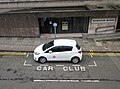 Car Club parking spot, Hamilton Place, Chester - geograph.org.uk - 4603131.jpg 2,376 × 1,764; 1.17 MB
-
 Car park - geograph.org.uk - 836717.jpg 640 × 457; 348 KB
-
 Cast Iron Cover - geograph.org.uk - 2934764.jpg 3,456 × 2,592; 3.84 MB
-
 Ceanothus at Wrexham road Park and Ride - geograph.org.uk - 801344.jpg 640 × 480; 144 KB
-
 Cemetery chapel - geograph.org.uk - 1336326.jpg 640 × 457; 346 KB
-
 Cemetery gardens - geograph.org.uk - 1336317.jpg 640 × 457; 385 KB
-
 Centurion Point sign - geograph.org.uk - 836061.jpg 640 × 480; 221 KB
-
 Changing leaves (50538092707).jpg 4,096 × 3,072; 5.77 MB
-
 Cheney Road - geograph.org.uk - 1331823.jpg 640 × 457; 323 KB
-
 Chester (52443868790).jpg 3,976 × 2,982; 5.36 MB
-
 Chester - Blue Coat Hospital, Northgate St - geograph.org.uk - 6330909.jpg 2,920 × 5,184; 5.34 MB
-
 Chester - panoramio (29).jpg 3,000 × 4,000; 3.12 MB
-
 Chester 2015 (22841506464).jpg 4,000 × 3,000; 2.15 MB
-
 Chester 2015 (23101858849).jpg 4,000 × 3,000; 2.16 MB
-
 Chester 2015 (23443655686).jpg 4,000 × 3,000; 2.17 MB
-
 Chester Business School - geograph.org.uk - 859461.jpg 640 × 457; 420 KB
-
 Chester Bypass - geograph.org.uk - 35762.jpg 480 × 640; 159 KB
-
 Chester Christmas Market 2015 - geograph.org.uk - 4764340.jpg 4,000 × 3,000; 2.87 MB
-
 Chester Christmas Market 2015 - geograph.org.uk - 4769043.jpg 5,184 × 3,456; 4.26 MB
-
 Chester Christmas Market 2018 - geograph.org.uk - 6006389.jpg 6,000 × 4,000; 3.78 MB
-
 Chester Christmas Market, Northgate Street - geograph.org.uk - 5603351.jpg 5,472 × 3,648; 2.27 MB
-
 Chester Depot - geograph.org.uk - 4561574.jpg 640 × 426; 45 KB
-
 Chester Depot - geograph.org.uk - 4561575.jpg 640 × 426; 42 KB
-
 Chester Depot - geograph.org.uk - 4561576.jpg 640 × 426; 41 KB
-
 Chester Depot - geograph.org.uk - 4561579.jpg 640 × 381; 40 KB
-
 Chester Enterprise Centre west end - geograph.org.uk - 2191840.jpg 640 × 480; 79 KB
-

-
 Chester Fire Station - geograph.org.uk - 4416629.jpg 3,184 × 2,123; 1.41 MB
-
 Chester HQ by the Grosvenor roundabout - geograph.org.uk - 1141029.jpg 640 × 480; 166 KB
-
 Chester HQ January 2009 - geograph.org.uk - 1141012.jpg 640 × 480; 125 KB
-
 Chester Lead Shot Tower - work in progress - geograph.org.uk - 6251559.jpg 4,128 × 3,096; 2.65 MB
-
 Chester library, Cheshire, UK, 2021. - Flickr - Phlips photos.jpg 1,600 × 1,600; 1.24 MB
-
 Chester Mill Hotel ^ Spa - panoramio.jpg 4,000 × 3,000; 3.94 MB
-
 Chester Police H.Q. R.I.P. ^3 - geograph.org.uk - 300904.jpg 640 × 480; 166 KB
-
 Chester Railway Station - geograph.org.uk - 6332470.jpg 2,000 × 1,164; 1.95 MB
-
 Chester Royal Mail depot - geograph.org.uk - 5366453.jpg 2,000 × 1,500; 440 KB
-
 Chester Rural District, Cheshire (1970).svg 1,410 × 1,018; 385 KB
-
 Chester Shot Tower - geograph.org.uk - 5947984.jpg 1,200 × 1,600; 319 KB
-
 Chester Shot Tower Homes - work in progress - geograph.org.uk - 6251556.jpg 4,128 × 3,096; 2.47 MB
-
 Chester side-street scene. - geograph.org.uk - 3488829.jpg 1,600 × 1,200; 486 KB
-
 Chester Town Crier.jpg 480 × 640; 97 KB
-
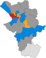
 Chester UK ward map 1980.svg 565 × 712; 227 KB
-
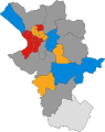
 Chester UK ward map 1982.svg 565 × 712; 228 KB
-
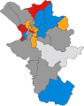
 Chester UK ward map 1983.svg 565 × 712; 227 KB
-
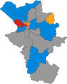
 Chester UK ward map 1984.svg 565 × 712; 228 KB
-
 Chester UK ward map 1986.svg 565 × 712; 228 KB
-
 Chester UK ward map 1987.svg 565 × 712; 228 KB
-
 Chester UK ward map 1988.svg 565 × 712; 228 KB
-
 Chester UK ward map 1990.svg 565 × 712; 228 KB
-
 Chester UK ward map 1991.svg 565 × 712; 228 KB
-
 Chester UK ward map 1992.svg 565 × 712; 227 KB
-
 Chester UK ward map 1994.svg 565 × 712; 227 KB
-
 Chester UK ward map 1995.svg 565 × 712; 227 KB
-
 Chester UK ward map 1996.svg 565 × 712; 227 KB
-
 Chester UK ward map 1998.svg 565 × 712; 227 KB
-
 Chester UK ward map 1999.svg 445 × 560; 403 KB
-
 Chester UK ward map 2000.svg 445 × 560; 396 KB
-
 Chester UK ward map 2002.svg 445 × 560; 396 KB
-
 Chester UK ward map 2003.svg 445 × 560; 396 KB
-
 Chester UK ward map 2004.svg 445 × 560; 396 KB
-
 Chester UK ward map 2006.svg 445 × 560; 396 KB
-
 Chester's Big Wheel for Christmas 2011 - geograph.org.uk - 2728750.jpg 4,000 × 3,000; 2.83 MB
-
 Chester's Old Bus Station - geograph.org.uk - 765789.jpg 640 × 480; 165 KB
-
 Chester's rubbish - geograph.org.uk - 1062519.jpg 640 × 560; 138 KB
-
 Chester, Derby Place - geograph.org.uk - 4934007.jpg 640 × 489; 446 KB
-
 Chester, looking west into Wales - geograph.org.uk - 3242372.jpg 1,600 × 1,064; 226 KB
-

-
 Chester, not all rich or tourists - geograph.org.uk - 738036.jpg 640 × 480; 60 KB
-
 Chester, UK - panoramio - IIya Kuzhekin (12).jpg 4,000 × 3,000; 4.84 MB
-
 Chester, UK - panoramio - IIya Kuzhekin (22).jpg 4,000 × 3,000; 2.8 MB
-
 Chester, UK - panoramio - IIya Kuzhekin (38).jpg 4,000 × 3,000; 2.59 MB
-
 Chester, UK - panoramio - IIya Kuzhekin (4).jpg 4,000 × 2,667; 1.97 MB
-

-
 ChesterHundeSchild-1997.jpg 1,151 × 1,800; 1.5 MB
-
-
 Christadelphian Ecclesia in Chester - geograph.org.uk - 3705980.jpg 657 × 800; 134 KB
-
 Christadelphian Hall, Egerton Street, Chester - geograph.org.uk - 3579850.jpg 1,600 × 1,200; 534 KB
-
 City Mission - gone - geograph.org.uk - 838577.jpg 640 × 457; 265 KB
-
 City Road, Chester - geograph.org.uk - 5336439.jpg 2,000 × 1,500; 417 KB
-
 Clearance completed - geograph.org.uk - 6173172.jpg 1,024 × 768; 115 KB
-
 Close up, Elizabeth II postbox on Walmoor Park - geograph.org.uk - 5193187.jpg 894 × 1,658; 289 KB
-
 Collapsed hoardings on Sealand Road - geograph.org.uk - 679308.jpg 640 × 480; 161 KB
-
-
 Concert House in Canal Street - geograph.org.uk - 837082.jpg 640 × 480; 161 KB
-
 Concrete marker post - geograph.org.uk - 1125908.jpg 640 × 480; 242 KB
-
-
-
 Countess of Chester country park, Cheshire, UK. (51227070395).jpg 6,240 × 3,510; 21.22 MB
-
 County Borough of Chester, Cheshire (1970).svg 1,410 × 1,018; 385 KB
-
 Crane Wharf - geograph.org.uk - 1332902.jpg 640 × 457; 315 KB
-
 Crane Wharf - geograph.org.uk - 1332903.jpg 640 × 457; 327 KB
-
 Crane Wharf - geograph.org.uk - 1332909.jpg 640 × 457; 268 KB
-
 Crane Wharf - geograph.org.uk - 1332913.jpg 640 × 457; 304 KB
-
 Crane Wharf - geograph.org.uk - 1332916.jpg 640 × 457; 314 KB
-
 Cranes seen from Morgans Mount.JPG 4,320 × 3,240; 5.16 MB
-
 Crewe Street Car Park, Chester - geograph.org.uk - 3307819.jpg 3,735 × 2,430; 1.41 MB
-
 Crewe Street development site - geograph.org.uk - 3818508.jpg 4,000 × 3,000; 2.3 MB
-
 Crewe Street development site - geograph.org.uk - 3818513.jpg 4,000 × 3,000; 2.43 MB
-
 Crewe Street development site - geograph.org.uk - 3818518.jpg 4,000 × 3,000; 2.86 MB
-
 Crewe Street development site - geograph.org.uk - 3818532.jpg 4,000 × 3,000; 2.53 MB
-
 Crewe Street development site - geograph.org.uk - 3818537.jpg 3,500 × 2,625; 1.43 MB
-
 Crewe Street Gospel Hall, Chester - geograph.org.uk - 3581238.jpg 1,600 × 1,215; 502 KB
-
 Crewe Street, Chester - geograph.org.uk - 3307827.jpg 4,000 × 3,000; 2.29 MB
-
 Crewe Street, Chester - geograph.org.uk - 3307835.jpg 3,835 × 2,620; 1.88 MB
-
 Crewe Street, Chester - geograph.org.uk - 3308116.jpg 4,000 × 3,000; 2.29 MB
-
 Cycle Lockers - Princess Street - geograph.org.uk - 3054902.jpg 640 × 480; 60 KB
-
 Dawson Drive - geograph.org.uk - 860454.jpg 640 × 457; 361 KB
-
 De laude Cestrie cross.gif 283 × 142; 24 KB
-
 De laude Cestrie folio1.jpg 440 × 641; 116 KB
-
 Delamere Street - geograph.org.uk - 1321005.jpg 640 × 457; 275 KB
-
 Delamere Street - geograph.org.uk - 1335438.jpg 640 × 457; 283 KB
-
 Delamere Street - geograph.org.uk - 834434.jpg 640 × 457; 262 KB
-
 Delamere Street - geograph.org.uk - 841336.jpg 640 × 452; 236 KB
-
 Deli-Vert. Faulkner Street - geograph.org.uk - 4875299.jpg 640 × 480; 67 KB
-
 Demolition on Union Street ^1 - geograph.org.uk - 484454.jpg 640 × 480; 149 KB
-
 Demolition on Union Street ^2 - geograph.org.uk - 484463.jpg 640 × 480; 143 KB
-
 Demolition on Union Street ^3 - geograph.org.uk - 484471.jpg 640 × 480; 157 KB
-
 Demolition on Union Street ^4 - geograph.org.uk - 496998.jpg 640 × 480; 106 KB
-

-
 Demolition under way - geograph.org.uk - 821096.jpg 640 × 457; 87 KB
-
 Demolition under way - geograph.org.uk - 821103.jpg 640 × 457; 109 KB
-
 Demolition under way - geograph.org.uk - 821111.jpg 640 × 457; 77 KB
-
 Demolition under way - geograph.org.uk - 821133.jpg 640 × 457; 86 KB
-
 Demolition work in City Road, Chester - geograph.org.uk - 5947536.jpg 4,000 × 3,000; 3.34 MB
-
 Demolition work in City Road, Chester - geograph.org.uk - 5947538.jpg 4,000 × 3,000; 3.03 MB
-
 Demolition work in City Road, Chester - geograph.org.uk - 5947539.jpg 4,000 × 3,000; 2.72 MB
-
 Deva Link, Chester (1).JPG 4,320 × 3,240; 4.5 MB
-
 Deva Link, Chester (2).JPG 4,320 × 3,240; 3.72 MB
-
 Deva Link, Chester (3).JPG 4,320 × 3,240; 3.81 MB
-
 Development outside the Northgate - geograph.org.uk - 1659815.jpg 640 × 480; 196 KB
-
 Development site - geograph.org.uk - 1321270.jpg 640 × 457; 326 KB
-
 Development site - geograph.org.uk - 1332601.jpg 640 × 457; 299 KB
-
 Development site - geograph.org.uk - 1332604.jpg 640 × 457; 298 KB
-
 Development site - geograph.org.uk - 836980.jpg 640 × 457; 272 KB
-
 Development Site, Chester - geograph.org.uk - 982598.jpg 640 × 480; 76 KB
-
 Development site, Trafford Street, Chester (13-01-16) - geograph.org.uk - 4800056.jpg 4,000 × 3,000; 2.79 MB
-
 Development site, Trafford Street, Chester (24-02-16) - geograph.org.uk - 4846869.jpg 3,184 × 2,123; 2.2 MB
-
 Development site, Trafford Street, Chester (31-12-15) - geograph.org.uk - 4788076.jpg 3,184 × 2,123; 2.31 MB
-
 Development site, Trafford Street, Chester (31-12-15) - geograph.org.uk - 4788078.jpg 3,184 × 2,123; 2.25 MB
-
 Development site, Trafford Street, Chester - geograph.org.uk - 4738915.jpg 3,000 × 2,250; 1.77 MB
-
 Development site, Trafford Street, Chester - geograph.org.uk - 4738935.jpg 3,000 × 2,250; 1.54 MB
-
 Development site, Trafford Street, Chester - geograph.org.uk - 4738947.jpg 3,000 × 2,250; 1.52 MB
-
 Development site, Trafford Street, Chester - geograph.org.uk - 4738968.jpg 3,000 × 2,250; 1.34 MB


.jpg)


.jpg)


.jpg)

.jpg)

.jpg)
.jpg)
.jpg)
.jpg)


.svg)


.jpg)
.jpg)
.jpg)
.jpg)
.jpg)


.jpg)
.svg)


.JPG)
.JPG)
.JPG)


_-_geograph.org.uk_-_4800056.jpg)
_-_geograph.org.uk_-_4846869.jpg)
_-_geograph.org.uk_-_4788076.jpg)
_-_geograph.org.uk_-_4788078.jpg)


