Category:Chiltern Hills
Jump to navigation
Jump to search
hills in South East England  | |||||
| Upload media | |||||
| Instance of |
| ||||
|---|---|---|---|---|---|
| Made from material | |||||
| Location | Oxfordshire, South East England, England | ||||
| Heritage designation | |||||
| Width |
| ||||
| Length |
| ||||
| Highest point |
| ||||
| Area |
| ||||
| Elevation above sea level |
| ||||
 | |||||
Subcategories
This category has the following 7 subcategories, out of 7 total.
C
- Clayfield Copse (10 F)
G
- Grim's Ditch (Chilterns) (11 F)
I
J
- Jones Hill Wood (1 F)
R
W
- Windsor Hill (3 F)
Media in category "Chiltern Hills"
The following 71 files are in this category, out of 71 total.
-
 A Chiltern Beechwood in Spring (6198994586).jpg 997 × 687; 487 KB
-

-
-
 After the Great Storm of '87 (10517986265).jpg 901 × 619; 274 KB
-
 After the Great Storm of '87 (10518109305).jpg 957 × 720; 307 KB
-
 And Then There Were Ten - red kites in the Chilterns (9877205814).jpg 1,280 × 668; 187 KB
-
 Beech Roots & Moss (5361032391).jpg 1,523 × 687; 724 KB
-
 Blow's Downs (May 2017).jpg 4,640 × 2,610; 6.56 MB
-
 Blow's Downs at Sunset.jpg 4,401 × 2,475; 2.42 MB
-
 Bluebells Carpeting an English Woodland (34146513185).jpg 1,280 × 720; 328 KB
-
 Bluebells in the Chiltern Hills England Apr2020.jpg 2,000 × 1,500; 1.44 MB
-
 Bluebells in the Chilterns (19343168410).jpg 1,280 × 720; 416 KB
-
 BottomWood 1.jpg 4,032 × 3,024; 5.18 MB
-
 Car Park at Icknield Way on the B655 - geograph.org.uk - 533547.jpg 640 × 480; 101 KB
-
 Chiltern Cottage nr. Frieth (10026472223).jpg 977 × 721; 386 KB
-
 Chiltern Hills banner.jpg 4,272 × 611; 2.51 MB
-
 Chiltern Hills winter view from Coombe Hill.jpg 1,584 × 1,980; 3.56 MB
-
 Chiltern Lane (10026260984).jpg 954 × 720; 263 KB
-
 Chilterns AONB locator map.svg 1,648 × 2,000; 1.07 MB
-
 Chilterns Beechwood (16844448498).jpg 960 × 720; 212 KB
-
 Chilterns England Rolling Countryside.jpg 512 × 683; 86 KB
-
 Chilterns fields - geograph.org.uk - 164446.jpg 640 × 480; 95 KB
-
 Common Spotted Orchid, Dactylorhiza fuchsii (5360796893).jpg 2,848 × 4,272; 3.1 MB
-
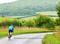 Cycling in the Chilterns (10026083305).jpg 985 × 721; 261 KB
-
 Dad and Me and Richard Jefferies (24543716955).jpg 960 × 720; 178 KB
-
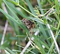 Euclidia glyphica (5361351738).jpg 2,200 × 1,975; 1.11 MB
-
 Across the top - geograph.org.uk - 1772236.jpg 1,024 × 768; 175 KB
-
 Foxgloves Edge a Woodland Ride (5361471786).jpg 4,272 × 2,848; 3.58 MB
-
 GOC Pirton 078 Chilterns (17283473286).jpg 4,204 × 2,638; 3.39 MB
-
 GOC Pirton 081 Chilterns (17121652138).jpg 4,288 × 2,687; 4.04 MB
-
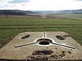
 GOC Pirton 082 Steps (16689170683).jpg 4,288 × 3,216; 5.24 MB
-
 GOC Pirton 086 Chilterns (17309427245).jpg 4,288 × 2,686; 4 MB
-
 GOC Pirton 087 Chilterns (17292999526).jpg 4,288 × 3,216; 3.78 MB
-
 GOC Pirton 088 Chilterns (16698699253).jpg 4,288 × 3,216; 3.93 MB
-
 GOC Pirton 089 View from Chilterns (17293001776).jpg 4,288 × 2,689; 3.38 MB
-
 GOC Pirton 097 View from Chilterns (17141753958).jpg 4,288 × 2,680; 3.89 MB
-
 Sheep grazing above Elvendon Lane - geograph.org.uk - 590882.jpg 640 × 477; 98 KB
-
 Greys Court, Henley-on-Thames (6228018432).jpg 4,272 × 2,848; 7.8 MB
-
 Green and Blue Landscape, Henley-on-Thames (2).jpg 4,137 × 2,763; 2.86 MB
-
 Green and Blue Landscape, Henley-on-Thames (3).jpg 4,240 × 2,832; 3.5 MB
-
 Green and Blue Landscape, Henley-on-Thames (4).jpg 4,240 × 2,832; 4.71 MB
-
 Green and Blue Landscape, Henley-on-Thames.jpg 4,240 × 2,832; 3.46 MB
-
 Harvest Home (3871884618).jpg 2,560 × 1,920; 818 KB
-
 Harvest Home- Stubble Burning (3871102283).jpg 966 × 639; 330 KB
-
 Looking across the Chilterns - geograph.org.uk - 1449866.jpg 640 × 427; 74 KB
-
 Looking Down (23458207733).jpg 1,046 × 647; 318 KB
-
 M40 Stokenchurch (16610025650).jpg 531 × 715; 274 KB
-
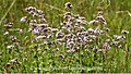 Marjoram (24683845402).jpg 1,280 × 720; 343 KB
-
 Marlow from the air 1974 (23456647534).jpg 1,048 × 643; 339 KB
-
 Moorings above Mapledurham - geograph.org.uk - 924911.jpg 640 × 427; 182 KB
-
 Ochlodes sylvanus (5360754205).jpg 4,272 × 2,848; 3.23 MB
-
 Ochlodes sylvanus (5361314392).jpg 4,053 × 1,883; 2.11 MB
-
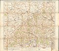
 Ordnance Survey One-Inch Sheet 105 Oxford & Henley on Thames, Published 1919.jpg 11,905 × 8,853; 41.79 MB
-
 Ordnance Survey One-Inch Sheet 159 The Chilterns, Published 1959.jpg 8,360 × 9,976; 12.12 MB
-
 Ordnance Survey One-Inch Sheet 159 The Chilterns, Published 1968.jpg 8,355 × 9,915; 11.81 MB
-
 Ordnance Survey One-Inch Special Sheet The Chilterns (dissected), Published 1932.jpg 13,966 × 12,137; 63.85 MB
-
 Ordnance Survey One-Inch Special Sheet The Chilterns, Published 1932.jpg 13,640 × 11,839; 66.19 MB
-
 Walking the Chiltern Hills by Pishill, Oxfordshire.jpg 1,632 × 1,224; 823 KB
-
 Radnage Village Sign, Sprigs Holly Lane.jpg 3,024 × 4,032; 3.05 MB
-
 River Thames by Greenlands - geograph.org.uk - 536811.jpg 640 × 480; 140 KB
-
 Road Closed (23670163833).jpg 1,280 × 720; 263 KB
-
 Rotten tree (28979439074).jpg 954 × 715; 722 KB
-
 Shirburn chalk field.jpg 3,200 × 2,399; 2.9 MB
-
 Thames vista (14147987281).jpg 4,608 × 3,456; 11.27 MB
-
 The Wild Columbine, Aquilegia vulgaris (5360840175).jpg 4,272 × 2,848; 3.15 MB
-
-
 View from Bottom Lane at Checkendon, Oxfordshire.jpg 640 × 425; 158 KB
-

-

-
 Typical Chilterns Woodland - geograph.org.uk - 143050.jpg 480 × 640; 162 KB
-
 View from Beacon Hill, Ivinghoe - geograph.org.uk - 215779.jpg 640 × 480; 91 KB
.jpg)


.jpg)
.jpg)
.jpg)
.jpg)
.jpg)

.jpg)

.jpg)


.jpg)

.jpg)

.jpg)

.jpg)
.jpg)
.jpg)
.jpg)

.jpg)
.jpg)
.jpg)
.jpg)
.jpg)
.jpg)
.jpg)
.jpg)
.jpg)

.jpg)
.jpg)
.jpg)
.jpg)

.jpg)
.jpg)

.jpg)
.jpg)
.jpg)
.jpg)

.jpg)
.jpg)


,_Published_1932.jpg)


.jpg)
.jpg)

.jpg)
.jpg)


