Category:Christmas Common
Jump to navigation
Jump to search
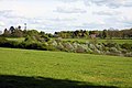
English: Christmas Common is a hamlet in Watlington civil parish aon an escarpment of the Chiltern Hills. Because of its elevation, Christmas Common has two radio masts that are prominent local landmarks.
village in Oxfordshire, England, UK  | |||||
| Upload media | |||||
| Instance of | |||||
|---|---|---|---|---|---|
| Location |
| ||||
 | |||||
Subcategories
This category has only the following subcategory.
Media in category "Christmas Common"
The following 48 files are in this category, out of 48 total.
-
-
 Eastern path into Watlington Park - geograph.org.uk - 7718.jpg 640 × 480; 189 KB
-
 Footpath in Watlington Park - geograph.org.uk - 1308431.jpg 640 × 480; 130 KB
-
 Footpath near Portways - geograph.org.uk - 1174371.jpg 640 × 480; 110 KB
-
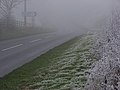 Freezing fog on the B481 - geograph.org.uk - 298646.jpg 640 × 480; 108 KB
-
 Hollandridge Lane, Christmas Common - geograph.org.uk - 819028.jpg 480 × 640; 274 KB
-
 Lodge, at Watlington Park - geograph.org.uk - 1439640.jpg 640 × 480; 111 KB
-
 Misty Christmas Common - geograph.org.uk - 1174335.jpg 640 × 480; 49 KB
-
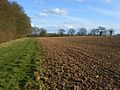
 Pasture and woodland, Greenfield - geograph.org.uk - 755911.jpg 640 × 480; 134 KB
-
 Pasture, Watlington - geograph.org.uk - 756026.jpg 640 × 480; 144 KB
-
 Pasture, Watlington - geograph.org.uk - 756034.jpg 640 × 480; 103 KB
-
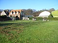
 Portobello Farm, Christmas Common - geograph.org.uk - 110090.jpg 640 × 480; 187 KB
-
-
 Road junction, Cookley Green - geograph.org.uk - 298637.jpg 640 × 480; 190 KB
-
 Shirburn Lodge - geograph.org.uk - 110549.jpg 640 × 480; 188 KB
-
 The Fox and Hounds, Christmas Common - geograph.org.uk - 1439652.jpg 640 × 480; 74 KB
-
 The Fox and Hounds, Christmas Common - geograph.org.uk - 3009438.jpg 2,560 × 1,920; 1.13 MB
-
 View north from Watlington Hill - geograph.org.uk - 1206555.jpg 640 × 428; 58 KB
-
 Watlington Park - geograph.org.uk - 1288901.jpg 640 × 427; 91 KB
-
 Christmas Common - geograph.org.uk - 298679.jpg 640 × 480; 162 KB
-
 Christmas Common - geograph.org.uk - 298761.jpg 640 × 480; 143 KB
-
 Coates Farm - geograph.org.uk - 93499.jpg 640 × 481; 74 KB
-
 Disappearing into fog on Watlington Hill - geograph.org.uk - 298740.jpg 640 × 480; 125 KB
-
 Entrance to Lower Deans Wood - geograph.org.uk - 7721.jpg 640 × 480; 213 KB
-
 Farmland, Greenfield - geograph.org.uk - 755919.jpg 640 × 480; 154 KB
-
 Field and woodland near Northend - geograph.org.uk - 681254.jpg 640 × 480; 151 KB
-
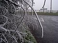
 Frost - geograph.org.uk - 298648.jpg 640 × 480; 156 KB
-
 Frost on a twig - geograph.org.uk - 298649.jpg 640 × 480; 131 KB
-
 Frosty bramble, Christmas Common - geograph.org.uk - 298675.jpg 640 × 480; 139 KB
-
 Gorse and frost, Watlington Hill - geograph.org.uk - 298737.jpg 480 × 640; 142 KB
-
 Grassland near Christmas Common - geograph.org.uk - 682228.jpg 640 × 480; 168 KB
-
 Greenfield Farm - geograph.org.uk - 114695.jpg 640 × 480; 87 KB
-
 Haws and hoars - geograph.org.uk - 298641.jpg 480 × 640; 147 KB
-
 Hawthorn in frost on Watlington Hill - geograph.org.uk - 298745.jpg 640 × 480; 217 KB
-
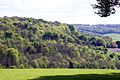
 Hillside above Watlington - geograph.org.uk - 756059.jpg 640 × 480; 192 KB
-
 Hillside above Watlington - geograph.org.uk - 756080.jpg 640 × 480; 174 KB
-
 Hillside above Watlington - geograph.org.uk - 756105.jpg 640 × 480; 129 KB
-
 Hillside above Watlington - geograph.org.uk - 756129.jpg 640 × 480; 167 KB
-
 Hillside above Watlington - geograph.org.uk - 756151.jpg 640 × 480; 168 KB
-
 Howe Wood - geograph.org.uk - 115080.jpg 640 × 480; 71 KB
-
 Howe Wood House through beeches - geograph.org.uk - 115083.jpg 640 × 480; 63 KB
-
 Road near Greenfield Manor - geograph.org.uk - 298656.jpg 480 × 640; 113 KB
-
 Shotridge Wood - geograph.org.uk - 681248.jpg 640 × 480; 99 KB
-
 Shotridge Wood, Wormsley Estate - geograph.org.uk - 110087.jpg 640 × 480; 247 KB
-
 The road from Russell's Water - geograph.org.uk - 88798.jpg 640 × 481; 86 KB
-
 The valley below Howe Wood - geograph.org.uk - 114698.jpg 640 × 480; 84 KB
-
 Track on Watlington Hill - geograph.org.uk - 298751.jpg 640 × 480; 105 KB
-
 Woodland, Christmas Common - geograph.org.uk - 298681.jpg 640 × 480; 156 KB


