Category:City of Leeds
Направо към навигацията
Направо към търсенето

metropolitan borough in West Yorkshire, England   | |||||
| Качване на файл | |||||
| Екземпляр на |
| ||||
|---|---|---|---|---|---|
| Местоположение | Западен Йоркшър, Йоркшър и Хъмбър, Англия | ||||
| Столица | |||||
| Законодателен орган |
| ||||
| Изпълнителна власт |
| ||||
| Ръководител | |||||
| Дата на създаване |
| ||||
| Население |
| ||||
| Площ |
| ||||
| Заменил |
| ||||
| Различно от | |||||
| официален уебсайт | |||||
 | |||||
Подкатегории
Показани са 61 от общо 61 подкатегории на тази категория.
Файлове в категория „City of Leeds“
Показани са 200 от общо 10 600 файла в тази категория.
(предишна страница) (следваща страница)-

-
 Approaching Grove Lane - geograph.org.uk - 2093338.jpg 800 × 600; 359 КБ
-

-

-
 Arable field on the edge of Oulton - geograph.org.uk - 5225673.jpg 2048 × 1536; 1,12 МБ
-
 Architect detail stone 1905 - geograph.org.uk - 2738005.jpg 1581 × 1637; 473 КБ
-

-
 Armley Recreation Ground - geograph.org.uk - 5621736.jpg 1024 × 768; 87 КБ
-
 Arnold Clark, New Wortley - geograph.org.uk - 4957149.jpg 1024 × 576; 156 КБ
-
 Around Leeds station - geograph.org.uk - 4950575.jpg 480 × 640; 66 КБ
-
 Arthur Court Development - Marsh - geograph.org.uk - 3916918.jpg 640 × 480; 67 КБ
-
 Artwork in window openings, Bath Road, Leeds - geograph.org.uk - 5382763.jpg 1024 × 768; 230 КБ
-
 Asymmetric power cables - geograph.org.uk - 4722002.jpg 768 × 1024; 691 КБ
-

-
 Athena Rising - geograph.org.uk - 5504427.jpg 900 × 1200; 184 КБ
-
 Attractions at the finish - geograph.org.uk - 4460058.jpg 640 × 428; 55 КБ
-
 Autumn comes to Leeds - geograph.org.uk - 5560692.jpg 1024 × 768; 756 КБ
-
 Avenue Wood - geograph.org.uk - 1998833.jpg 1024 × 681; 267 КБ
-
 Back of Providence Avenue, Leeds - geograph.org.uk - 2093217.jpg 800 × 600; 305 КБ
-
 Baildon Hill - geograph.org.uk - 5077203.jpg 1024 × 768; 103 КБ
-
 Bales alongside the cycleway at Killingbeck - geograph.org.uk - 5834240.jpg 1024 × 768; 231 КБ
-
 Bank Mills (C block) and warehouse - geograph.org.uk - 5279766.jpg 1024 × 768; 328 КБ
-
 Bank Street, Leeds - geograph.org.uk - 4896371.jpg 1280 × 720; 501 КБ
-
 Barclays Bank Chambers entrance - geograph.org.uk - 5745021.jpg 960 × 1280; 252 КБ
-
 Barrier on Thornhill Drive - geograph.org.uk - 5050755.jpg 1024 × 768; 324 КБ
-
 Basketball court, Haslewood Drive - geograph.org.uk - 4831422.jpg 1024 × 576; 173 КБ
-
 Beck - Wakefield Road - geograph.org.uk - 4943708.jpg 480 × 640; 152 КБ
-
 Beck below Great Wood Farm - geograph.org.uk - 4771448.jpg 1024 × 768; 387 КБ
-
 Beck through Backhouse Wood - geograph.org.uk - 4999577.jpg 1024 × 768; 402 КБ
-
 Beeston Bridge, Ring Road, Far Royds - geograph.org.uk - 5713012.jpg 1024 × 683; 258 КБ
-
 Behind Mill Pond Close - geograph.org.uk - 4794079.jpg 427 × 640; 108 КБ
-
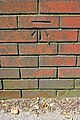
 Benchmark on Adams Court - geograph.org.uk - 5278489.jpg 683 × 1024; 334 КБ
-
 Benchmark on bay window of ^1 Foster Terrace - geograph.org.uk - 5981717.jpg 683 × 1024; 247 КБ
-
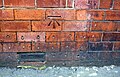
 Benchmark on canalside wall - geograph.org.uk - 3763085.jpg 1024 × 768; 440 КБ
-
 Benchmark on Hollybush Annexe - geograph.org.uk - 6069876.jpg 1024 × 683; 286 КБ
-
 Benchmark on railway bridge over canal - geograph.org.uk - 3622086.jpg 683 × 1024; 301 КБ
-
 Benchmark on wall at entrance to Lovell Park - geograph.org.uk - 5280831.jpg 683 × 1024; 236 КБ
-

-
-
 Benchmark on wall of East Field Street - geograph.org.uk - 3777654.jpg 683 × 1024; 286 КБ
-
 Benchmark on ^1 Autumn Place - geograph.org.uk - 5153189.jpg 1024 × 658; 249 КБ
-
 Benchmark on ^2 Argie Terrace - geograph.org.uk - 4724759.jpg 1024 × 683; 286 КБ
-
 Benchmark on ^2 Rosemont Grove - geograph.org.uk - 5982569.jpg 683 × 1024; 303 КБ
-
 Benchmark on ^38 Mexborough Drive - geograph.org.uk - 5022218.jpg 683 × 1024; 280 КБ
-
 Bend in the Calder - geograph.org.uk - 2014299.jpg 1024 × 768; 176 КБ
-
 Bend in the path - geograph.org.uk - 4000389.jpg 1024 × 768; 259 КБ
-
 Bend on the river Aire - geograph.org.uk - 5278886.jpg 1024 × 768; 228 КБ
-

-
 Big bollards for big boats - geograph.org.uk - 2766119.jpg 1024 × 768; 131 КБ
-
 Big screen and refreshments - geograph.org.uk - 4459993.jpg 640 × 428; 79 КБ
-
 Billing Hill - geograph.org.uk - 3638638.jpg 4608 × 3456; 3,41 МБ
-
 Billingbauk, Bramley, Leeds - geograph.org.uk - 4968320.jpg 1280 × 853; 836 КБ
-
 Bindweed and willowherb - geograph.org.uk - 4602866.jpg 1024 × 768; 215 КБ
-
 Birch copse near Crag House Farm - geograph.org.uk - 6106984.jpg 1024 × 768; 224 КБ
-
 Bishop Young Academy, Seacroft - geograph.org.uk - 5837634.jpg 1024 × 768; 157 КБ
-
 Black Gates - geograph.org.uk - 1857167.jpg 1600 × 1200; 647 КБ
-
 Black Hill Plantation - geograph.org.uk - 2768221.jpg 2592 × 3872; 2,47 МБ
-
 Blackened tree by the canal - geograph.org.uk - 5234193.jpg 1024 × 768; 218 КБ
-
 Blenheim House, Duncombe Street, Leeds - geograph.org.uk - 4919418.jpg 1024 × 768; 190 КБ
-
 Blind Lane towards West Ardsley - geograph.org.uk - 3920693.jpg 1600 × 1064; 420 КБ
-

-
 Blocked footpath off the A62, Leeds - geograph.org.uk - 6180439.jpg 2000 × 1500; 897 КБ
-
 Bluebells by the canal - geograph.org.uk - 4956025.jpg 1024 × 576; 301 КБ
-
 Bluebells in Hertford Springs wood - geograph.org.uk - 6157115.jpg 1600 × 1200; 924 КБ
-
 Bluebells in the woods - geograph.org.uk - 2120663.jpg 3264 × 2448; 1,43 МБ
-
 Boarded up pub - geograph.org.uk - 1976302.jpg 800 × 600; 149 КБ
-
 Bolton Royd school, Thornbury - geograph.org.uk - 4851922.jpg 1024 × 768; 137 КБ
-

-
 Boundary Stone on Craven Hall Hill - geograph.org.uk - 4874500.jpg 1024 × 768; 202 КБ
-
 Bowling Green - Barleyhill Road - geograph.org.uk - 4943671.jpg 640 × 480; 77 КБ
-

-
 BPL House, Apperley Bridge, Bradford - geograph.org.uk - 5011840.jpg 1280 × 853; 688 КБ
-

-
 Bracken Hill - King Lane - geograph.org.uk - 3322449.jpg 640 × 480; 67 КБ
-

-

-
 Bramley allotments - geograph.org.uk - 4991818.jpg 1024 × 768; 313 КБ
-
 Bramley Band Club - geograph.org.uk - 4598634.jpg 1024 × 768; 103 КБ
-
 Bramley Buffaloes, Rodley, Leeds - geograph.org.uk - 4880338.jpg 960 × 538; 120 КБ
-
 Bramley Children's Centre - geograph.org.uk - 4839320.jpg 1024 × 768; 165 КБ
-

-
 Bramley Commonwealth War Graves memorial - geograph.org.uk - 4616337.jpg 1024 × 768; 190 КБ
-
 Bramley Contact Centre - geograph.org.uk - 4616298.jpg 1024 × 768; 201 КБ
-
 Bramley Elderly Action, Stanningley Road - geograph.org.uk - 4661764.jpg 1024 × 768; 195 КБ
-
 Bramley Lawn, Stanningley Road - geograph.org.uk - 4661755.jpg 1024 × 768; 184 КБ
-
 Bramley parish war memorial - geograph.org.uk - 4616343.jpg 1024 × 768; 265 КБ
-

-
 Bramley Village Health and Wellbeing Centre - geograph.org.uk - 6088241.jpg 1024 × 768; 224 КБ
-
 Bramley, fire service building - geograph.org.uk - 4615497.jpg 1024 × 768; 110 КБ
-
 Branwell Park - Netherfield Road - geograph.org.uk - 3207019.jpg 640 × 435; 58 КБ
-
 Brick wall, East Field Street, Leeds - geograph.org.uk - 4829942.jpg 1024 × 768; 295 КБ
-
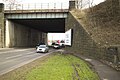
 Bridge 53(1), Leeds station - geograph.org.uk - 5704104.jpg 1024 × 768; 254 КБ
-

-
-
 Bridge at the site of Scotland Flax Mill, Leeds - geograph.org.uk - 5123091.jpg 1965 × 1467; 895 КБ
-
 Bridge on the approach to Asket Hall (side) - geograph.org.uk - 5837691.jpg 1024 × 768; 386 КБ
-
 Bridge on the approach to Asket Hall (top) - geograph.org.uk - 5837696.jpg 1024 × 768; 279 КБ
-

-
 Bridge over a dry stream - geograph.org.uk - 5129210.jpg 1024 × 768; 388 КБ
-

-
 Bridge over Eastbound M62 - geograph.org.uk - 4768160.jpg 640 × 427; 326 КБ
-

-
-

-
 Bridge over River Aire - geograph.org.uk - 2734094.jpg 640 × 480; 56 КБ
-

-

-

-
 Bridge over the M1 - geograph.org.uk - 1998843.jpg 1024 × 681; 179 КБ
-
 Bridge over the motorway east of Belle Isle - geograph.org.uk - 4280722.jpg 1600 × 1200; 528 КБ
-
 Bridge over the motorway near Newsam Green - geograph.org.uk - 5356066.jpg 1600 × 1200; 630 КБ
-
 Bridge over the Sheepscar Beck - geograph.org.uk - 5072809.jpg 800 × 800; 144 КБ
-
 Bridge over the Wyke Beck - geograph.org.uk - 5834247.jpg 768 × 1024; 347 КБ
-
 Bridge Seat, Smithy Mill Bridge Parkside Rd - geograph.org.uk - 2735898.jpg 3872 × 2592; 3,71 МБ
-
 Bridge, River Aire, Kirkstall, Leeds - geograph.org.uk - 4896282.jpg 1280 × 853; 613 КБ
-
 Brill Food - Great George Street - geograph.org.uk - 1973762.jpg 480 × 640; 65 КБ
-
-
 British Gas Training Centre, Leeds - geograph.org.uk - 5052341.jpg 1280 × 853; 489 КБ
-
 British Gas Training Centre, Leeds - geograph.org.uk - 5052342.jpg 1280 × 853; 491 КБ
-
 Brod - Great George Street - geograph.org.uk - 1973770.jpg 445 × 640; 55 КБ
-
 Brookfield Road - geograph.org.uk - 4794069.jpg 640 × 427; 83 КБ
-

-
 Broom Mills Road, off Coal Hill Lane - geograph.org.uk - 6090838.jpg 1024 × 768; 196 КБ
-

-
 BT - Parkside Lane - geograph.org.uk - 3343060.jpg 640 × 480; 67 КБ
-

-
 Builders Merchants - Whitehall Road - geograph.org.uk - 2330764.jpg 640 × 480; 56 КБ
-
 Building 3, City West Business Park - geograph.org.uk - 3579139.jpg 1024 × 682; 190 КБ
-
 Building beside the River Aire - geograph.org.uk - 5709563.jpg 640 × 427; 212 КБ
-
 Building Blocks - geograph.org.uk - 5627099.jpg 1280 × 1280; 369 КБ
-
 Building on a corner site, Holbeck Lane, Leeds - geograph.org.uk - 6180496.jpg 2000 × 1341; 620 КБ
-
 Building on Roundhay Road - geograph.org.uk - 6145910.jpg 640 × 480; 49 КБ
-

-
 Building on Woodhall Lane - geograph.org.uk - 4771511.jpg 1024 × 768; 182 КБ
-
 Building Site - Fleet Lane - geograph.org.uk - 4420053.jpg 640 × 423; 48 КБ
-
 Building Site - Pavilion Gardens - geograph.org.uk - 2253395.jpg 640 × 480; 50 КБ
-
 Building site west of Bath Road - geograph.org.uk - 5704130.jpg 1024 × 768; 133 КБ
-

-
 Building to the east of Red Lane Mill - geograph.org.uk - 5530580.jpg 1024 × 768; 610 КБ
-
 Building to the south of Highbury Works - geograph.org.uk - 5127398.jpg 1024 × 768; 200 КБ
-
 Buildings at Fishpond Lock - geograph.org.uk - 4829770.jpg 2048 × 1536; 1,05 МБ
-

-
 Buildings by Leeds Bridge - geograph.org.uk - 5626420.jpg 1115 × 1280; 418 КБ
-
 Buildings near Parkside Farm, New Farnley - geograph.org.uk - 6261813.jpg 1024 × 768; 134 КБ
-
 Buildings new and old at Haigh Farm - geograph.org.uk - 3339689.jpg 2048 × 1536; 560 КБ
-
 Bulldozer at Shippen House Farm - geograph.org.uk - 3952284.jpg 1600 × 1064; 807 КБ
-
 Bullerthorpe Lane - geograph.org.uk - 4060193.jpg 640 × 480; 269 КБ
-
 Bullocks at Barkerswell Farm - geograph.org.uk - 4716690.jpg 1024 × 768; 501 КБ
-
 Bullocks Coach on Dyer Street, Leeds - geograph.org.uk - 4116970.jpg 1600 × 1064; 576 КБ
-
 Bulrushes in the canal - geograph.org.uk - 4693651.jpg 1024 × 768; 709 КБ
-
 Bunker - geograph.org.uk - 2729982.jpg 3872 × 2592; 3,6 МБ
-
 Bunting on Lifton Place - geograph.org.uk - 4671940.jpg 1024 × 768; 168 КБ
-
 Burley Bridge Mills, Viaduct Road, Leeds - geograph.org.uk - 5121150.jpg 1280 × 853; 724 КБ
-
 Burley Park - geograph.org.uk - 5410278.jpg 3106 × 2316; 2,99 МБ
-
 Burley Road (service road) - geograph.org.uk - 4920475.jpg 1024 × 768; 222 КБ
-
 Burley Road car park - geograph.org.uk - 4920470.jpg 1024 × 768; 164 КБ
-
 Burley Road car park, paypoint - geograph.org.uk - 4920469.jpg 1024 × 768; 197 КБ
-
 Burley Willows Day Centre - geograph.org.uk - 4920511.jpg 1024 × 768; 192 КБ
-
-
 Burnshaw Mews - Martingale Drive - geograph.org.uk - 3352345.jpg 640 × 480; 69 КБ
-

-
 Burnt out car near Thornbury - geograph.org.uk - 4772905.jpg 1024 × 768; 243 КБ
-
 Burnt-out car in Halton Moor Wood - geograph.org.uk - 5916595.jpg 1024 × 768; 310 КБ
-
 Burr Tree Drive - Colton Lane - geograph.org.uk - 4464705.jpg 640 × 480; 53 КБ
-
 Burton House Burton Avenue, Hunslet Moor - geograph.org.uk - 4930729.jpg 1024 × 768; 279 КБ
-
 Burtons, Tailor Factory - geograph.org.uk - 2732187.jpg 3262 × 975; 515 КБ
-
 Bus and coach entering Leeds - geograph.org.uk - 5284971.jpg 1024 × 768; 140 КБ
-
 Bus in turning circle, Beeston - geograph.org.uk - 5294849.jpg 1024 × 768; 132 КБ
-
 Bus on Ring Road Middleton - geograph.org.uk - 5292871.jpg 1024 × 768; 136 КБ
-
 Bus shelter on Neville Parade - geograph.org.uk - 5295912.jpg 1024 × 768; 83 КБ
-
 Bus stop at Ouzlewell Green - geograph.org.uk - 6222072.jpg 1024 × 768; 167 КБ
-
 Bus stop on Cottingley drive - geograph.org.uk - 6124727.jpg 1024 × 768; 165 КБ
-
 Bus Stop, Bradford Road - geograph.org.uk - 3012337.jpg 1024 × 682; 243 КБ
-
 Bus Stops, Queenswood Drive - geograph.org.uk - 5150949.jpg 1024 × 683; 224 КБ
-
 Bus turning circle, Beeston - geograph.org.uk - 5294845.jpg 1024 × 768; 126 КБ
-
 Bus turning circle, Swarcliffe (1) - geograph.org.uk - 5294904.jpg 1024 × 768; 105 КБ
-
 Bus turning circle, Swarcliffe (2) - geograph.org.uk - 5294914.jpg 1024 × 768; 132 КБ
-
 Buses and Taxis - geograph.org.uk - 6069289.jpg 6032 × 4014; 4,76 МБ
-

-
 Buses with weight loss adverts - geograph.org.uk - 5837551.jpg 1024 × 768; 206 КБ
-
 Bushy Cliffe Wood - geograph.org.uk - 6222075.jpg 1024 × 768; 150 КБ
-
 Business park, Lotherton Way - geograph.org.uk - 3840099.jpg 2592 × 1936; 1,26 МБ
-
 Business Units by the M62 - geograph.org.uk - 3536411.jpg 3393 × 2075; 1,65 МБ
-
 Business units off Whitehall Road - geograph.org.uk - 4309582.jpg 640 × 378; 29 КБ
-
 Business units off Whitehall Road - geograph.org.uk - 4309585.jpg 640 × 304; 32 КБ
-

-
 Business units, Gower Street, Leeds - geograph.org.uk - 4773098.jpg 1024 × 768; 113 КБ
-
 Businesses on Springwell Road - geograph.org.uk - 4803628.jpg 1024 × 576; 119 КБ
-

-
 Buslingthorpe Vale (detail) - geograph.org.uk - 4726031.jpg 1024 × 768; 520 КБ
-
 Buslingthorpe Vale - geograph.org.uk - 4726030.jpg 1024 × 768; 935 КБ
-
 Busy Bees Nursery - Park Road - geograph.org.uk - 1942810.jpg 640 × 480; 109 КБ
-
 Butler Way, Leeds - geograph.org.uk - 4996700.jpg 1280 × 853; 616 КБ
-
 Buttressed wall by the canal - geograph.org.uk - 4955966.jpg 1024 × 576; 280 КБ
-
 Butts Lane - Oxford Road - geograph.org.uk - 1940446.jpg 640 × 480; 71 КБ
-
 Butts Mount - Armley Grove Place - geograph.org.uk - 2758488.jpg 640 × 480; 48 КБ
-
 B^M Stanningley Road - geograph.org.uk - 5701515.jpg 1024 × 768; 153 КБ
-
 Cabin cruiser near Aire Valley marina - geograph.org.uk - 5147836.jpg 1024 × 768; 163 КБ
-
 Cafe Rain - Church Lane - geograph.org.uk - 3028279.jpg 514 × 640; 82 КБ
-
 Cafe Village - Victoria Street - geograph.org.uk - 2354409.jpg 640 × 480; 66 КБ


_Squadron_-_Oakwood_Lane_-_geograph.org.uk_-_3667083.jpg)


_and_warehouse_-_geograph.org.uk_-_5279766.jpg)


,_Leeds_station_-_geograph.org.uk_-_5704104.jpg)


_-_geograph.org.uk_-_5837691.jpg)
_-_geograph.org.uk_-_5837696.jpg)


_-_geograph.org.uk_-_4920475.jpg)


_-_geograph.org.uk_-_5294904.jpg)
_-_geograph.org.uk_-_5294914.jpg)


_-_geograph.org.uk_-_4726031.jpg)


