Category:Wetherby
Jump to navigation
Jump to search
town in West Yorkshire, UK  | |||||
| Upload media | |||||
| Instance of | |||||
|---|---|---|---|---|---|
| Location | Leeds, West Yorkshire, Yorkshire and the Humber, England | ||||
| Different from | |||||
| Said to be the same as | Wetherby (Wikimedia duplicated page, civil parish) | ||||
| official website | |||||
 | |||||
Subcategories
This category has the following 62 subcategories, out of 62 total.
A
B
C
D
- Devil's Toe Nail, Wetherby (1 F)
E
- Eddie Brown (bus company) (5 F)
F
G
H
- Seb Hines (10 F)
I
L
M
N
O
P
- Panoramas of Wetherby (51 F)
R
S
- Stalls in Wetherby (7 F)
- Street signs in Wetherby (4 F)
T
W
- Wetherby Market (37 F)
Media in category "Wetherby"
The following 200 files are in this category, out of 365 total.
(previous page) (next page)-
 6-8 Scott Lane, Wetherby - geograph.org.uk - 5232387.jpg 1,024 × 768; 277 KB
-
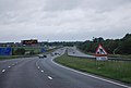
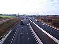
 A1 improvements Wetherby roundabout - geograph.org.uk - 611934.jpg 640 × 480; 90 KB
-
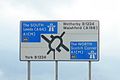 A1 signage Wetherby.jpg 1,542 × 1,028; 286 KB
-
 A1(M) - bridge to Grange Park - geograph.org.uk - 2647020.jpg 640 × 428; 74 KB
-
 A1(M) - geograph.org.uk - 3038471.jpg 640 × 430; 39 KB
-

-
 A1(M) A168 access - geograph.org.uk - 5375092.jpg 640 × 427; 205 KB
-
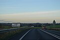
 A1(M) heading north, Wetherby - geograph.org.uk - 2515514.jpg 640 × 430; 40 KB
-
 A1(M) junction 46 - geograph.org.uk - 2647039.jpg 640 × 428; 72 KB
-
 A1(M) near Wetherby - geograph.org.uk - 2040863.jpg 640 × 480; 43 KB
-
 A1(M) near Wetherby racecourse - geograph.org.uk - 2040867.jpg 640 × 480; 58 KB
-

-
 A1(M) northbound - geograph.org.uk - 2646949.jpg 640 × 428; 70 KB
-
 A1(M) northbound - geograph.org.uk - 3038474.jpg 640 × 430; 44 KB
-

-
 A1(M) south of Wetherby - geograph.org.uk - 5395499.jpg 640 × 481; 40 KB
-
 A1(M) Underpass at Wetherby - geograph.org.uk - 4698169.jpg 1,600 × 1,067; 537 KB
-
 A1(M), Wetherby - geograph.org.uk - 3038476.jpg 640 × 430; 42 KB
-
 A168 - geograph.org.uk - 4793166.jpg 640 × 426; 27 KB
-
 A168 and motorway fence - geograph.org.uk - 5375104.jpg 640 × 427; 180 KB
-

-

-

-
 A168 approaching Wetherby - geograph.org.uk - 5798756.jpg 1,024 × 683; 207 KB
-
 A168 east of Wetherby - geograph.org.uk - 5375107.jpg 640 × 427; 205 KB
-
 A168 heading north - geograph.org.uk - 3798967.jpg 640 × 480; 61 KB
-
 A168, northbound - geograph.org.uk - 4793170.jpg 640 × 400; 23 KB
-
 A168, southbound - geograph.org.uk - 4805986.jpg 640 × 293; 22 KB
-
 A168, southbound - geograph.org.uk - 4805988.jpg 640 × 304; 17 KB
-
 A1M underpass - geograph.org.uk - 4212579.jpg 1,024 × 768; 128 KB
-
 A58 Lay By - geograph.org.uk - 256674.jpg 640 × 385; 33 KB
-
 A58 Wetherby Road - geograph.org.uk - 6174993.jpg 1,024 × 770; 134 KB
-
 A659 approaching roundabout - geograph.org.uk - 3798956.jpg 640 × 480; 48 KB
-
 A659 from Wattle Syke Roundabout - geograph.org.uk - 5652708.jpg 2,397 × 1,284; 210 KB
-
 A659, Wattle Syke - geograph.org.uk - 4806019.jpg 640 × 262; 20 KB
-
 A661 at Chatsworth Drive - geograph.org.uk - 3843493.jpg 2,592 × 1,936; 1.33 MB
-
 A661 towards Harrogate - geograph.org.uk - 3799104.jpg 640 × 480; 92 KB
-
 Access Lane heading South towards York Road - geograph.org.uk - 5874172.jpg 5,184 × 3,456; 7.36 MB
-
 Access Lane to Ingmanthorpe Hall - geograph.org.uk - 5874185.jpg 5,184 × 3,456; 6.33 MB
-
 Access to King Georges field.jpg 1,200 × 1,600; 662 KB
-

-
 Ainsty View - geograph.org.uk - 5239486.jpg 640 × 480; 85 KB
-
 Aire Road - viewed from Esk Gardens - geograph.org.uk - 5042402.jpg 640 × 480; 61 KB
-
 Aire Road, Wetherby - geograph.org.uk - 3797069.jpg 640 × 480; 81 KB
-
 Another Bridge over the Harland Way - geograph.org.uk - 4697746.jpg 1,600 × 1,067; 838 KB
-
 Appleby Way - Badger Wood Glade - geograph.org.uk - 4896550.jpg 640 × 480; 80 KB
-
 Approaching J46, A1(M) - geograph.org.uk - 3040603.jpg 640 × 430; 39 KB
-
 Approaching the A168 roundabout - geograph.org.uk - 5375096.jpg 640 × 427; 192 KB
-
 Ashby Dental Practice - Deighton Road - geograph.org.uk - 1173459.jpg 640 × 541; 223 KB
-
 Attention Dog Walker - geograph.org.uk - 4130269.jpg 1,600 × 1,064; 519 KB
-
 Autumn on the Wetherby Railway Path - geograph.org.uk - 4698184.jpg 1,600 × 935; 1.02 MB
-
 Avon Garth - Linton Lane - geograph.org.uk - 4935496.jpg 640 × 480; 91 KB
-
 B1224 approaching roundabout - geograph.org.uk - 3798545.jpg 640 × 480; 71 KB
-
 B1224 eastbound - geograph.org.uk - 4740932.jpg 640 × 480; 83 KB
-
 B1224 heading east - geograph.org.uk - 3798542.jpg 640 × 480; 71 KB
-

-
 Banished to dry land - geograph.org.uk - 917027.jpg 437 × 640; 313 KB
-

-

-

-
 Beech Spinney - Badger Wood Glade - geograph.org.uk - 5042423.jpg 640 × 449; 57 KB
-

-

-
 Blackthorn hedge in blossom - geograph.org.uk - 2890010.jpg 1,024 × 768; 161 KB
-
 Boston Rd - geograph.org.uk - 4800077.jpg 640 × 375; 62 KB
-
 Bridge ahead on The Harland Way - geograph.org.uk - 4212672.jpg 1,024 × 768; 324 KB
-
 Bridge over the A1(M), Wetherby - geograph.org.uk - 2515505.jpg 640 × 430; 41 KB
-
 Bridge over the A1(M), Wetherby - geograph.org.uk - 2515510.jpg 640 × 430; 30 KB
-
 Bridge Over The Harland Way - geograph.org.uk - 3363495.jpg 5,184 × 3,456; 6.2 MB
-
-
 Bridleway - Ainsty Road - geograph.org.uk - 1173570.jpg 640 × 480; 289 KB
-
 Bridleway - Ainsty Road - geograph.org.uk - 4895572.jpg 640 × 480; 103 KB
-
 Bridleway - Ullswater Drive - geograph.org.uk - 4934693.jpg 480 × 640; 100 KB
-
 Bridleway alongside the motorway at Wetherby - geograph.org.uk - 3218448.jpg 2,048 × 1,169; 463 KB
-
 Bridleway at Swinnow - geograph.org.uk - 5375142.jpg 640 × 427; 219 KB
-
 Bridleway at Wetherby Racecourse - geograph.org.uk - 4130261.jpg 1,600 × 1,064; 607 KB
-
 Bridleway at Wetherby Racecourse - geograph.org.uk - 4130264.jpg 1,600 × 1,064; 451 KB
-
 Bridleway at Wetherby Racecourse - geograph.org.uk - 4130266.jpg 1,600 × 1,064; 448 KB
-
 Bridleway to Sandbeck Lane - geograph.org.uk - 5375144.jpg 427 × 640; 306 KB
-
 Bridleway to Sandbeck Wood - geograph.org.uk - 5882072.jpg 1,024 × 683; 262 KB
-
 Bridleway to the B1224 - geograph.org.uk - 5375138.jpg 640 × 427; 228 KB
-
 Bridleway to the B1224 - geograph.org.uk - 5375159.jpg 640 × 427; 223 KB
-
 Brunswick Court - geograph.org.uk - 553272.jpg 640 × 480; 52 KB
-
 Brunswick Court Blue Plaque - geograph.org.uk - 553273.jpg 640 × 579; 95 KB
-
 Buildings overlooking the Wharfe - geograph.org.uk - 3795336.jpg 640 × 480; 70 KB
-
 Burnham Court - Carlton Approach - geograph.org.uk - 4934567.jpg 640 × 480; 74 KB
-
 By-passing the by-pass - geograph.org.uk - 2249192.jpg 3,264 × 2,448; 1.31 MB
-
 Car park access off Bridgefoot - geograph.org.uk - 5232992.jpg 1,024 × 768; 246 KB
-

-
 Cedar Covert - Badger Wood Glade - geograph.org.uk - 5042421.jpg 640 × 480; 70 KB
-
 County crest, West Lodge, Wetherby - geograph.org.uk - 4542083.jpg 640 × 583; 192 KB
-
 Coxwold Hill - Coxwold View - geograph.org.uk - 4895678.jpg 640 × 480; 65 KB
-
-
 Coxwold View - Barleyfields Road - geograph.org.uk - 4895673.jpg 640 × 480; 82 KB
-
 Coxwold View - Coxwold Hill - geograph.org.uk - 4896469.jpg 640 × 480; 76 KB
-

-

-
 Crossing cycle routes - geograph.org.uk - 248222.jpg 640 × 479; 128 KB
-
 Crowcroft Bank - geograph.org.uk - 2248737.jpg 2,448 × 3,264; 2.58 MB
-
 Cut Bench Mark, Wetherby Bridge - geograph.org.uk - 5860187.jpg 1,024 × 683; 391 KB
-
 Cut Bench Mark, Wetherby Parish Church - geograph.org.uk - 5880538.jpg 1,024 × 683; 374 KB
-
 Cut Bench Mark, York Road railway bridge - geograph.org.uk - 5881118.jpg 1,024 × 683; 328 KB
-
 Cycle path at Wattle Syke roundabout - geograph.org.uk - 5375084.jpg 640 × 427; 178 KB
-
 Cycle path beside the A168 - geograph.org.uk - 3798960.jpg 640 × 480; 65 KB
-
 Cycle path beside the A168 - geograph.org.uk - 3798966.jpg 640 × 480; 62 KB
-
 Cycle path beside the A168 - geograph.org.uk - 3798970.jpg 640 × 480; 67 KB
-
 Cycle path on the A168 roundabout - geograph.org.uk - 5375097.jpg 640 × 427; 301 KB
-
 Cycle Way - Barleyfields Road - geograph.org.uk - 4996087.jpg 640 × 480; 129 KB
-
 Cycle Way - Barleyfields Road - geograph.org.uk - 4996088.jpg 480 × 640; 110 KB
-
 Cycle Way - off Northfield Place - geograph.org.uk - 4996075.jpg 640 × 480; 115 KB
-
 Cycle Way - off Northfield Place - geograph.org.uk - 4996078.jpg 640 × 480; 135 KB
-
 Cyclists on the Harland Way - geograph.org.uk - 2889738.jpg 1,024 × 768; 199 KB
-
 Deerstone Ridge, Deighton Gates - geograph.org.uk - 4581430.jpg 1,920 × 1,418; 804 KB
-
-

-

-
 DFS Wetherby Cropped.jpg 2,958 × 900; 1.02 MB
-
 Dodgy theology^ - geograph.org.uk - 5232369.jpg 1,024 × 768; 389 KB
-
 Ebor Way approaching Wetherby - geograph.org.uk - 4702237.jpg 1,600 × 1,067; 896 KB
-
 Ebor Way West of Flint Mill Grange - geograph.org.uk - 4699176.jpg 1,600 × 1,067; 754 KB
-
-
 Emily Wardman.jpg 701 × 1,125; 207 KB
-
 End of the road - geograph.org.uk - 304196.jpg 1,600 × 1,200; 438 KB
-
 Entering North Yorkshire, A168 - geograph.org.uk - 4793174.jpg 640 × 426; 62 KB
-
 Entrance to former A1(M) works yard - geograph.org.uk - 5921294.jpg 1,024 × 683; 242 KB
-
 Entrance to Swinnow Hill - geograph.org.uk - 5960393.jpg 1,024 × 683; 249 KB
-

-
 Farmland and pylons - geograph.org.uk - 5375160.jpg 640 × 427; 224 KB
-
 Farmland beside Sandbeck Lane - geograph.org.uk - 5375132.jpg 640 × 427; 198 KB
-
 Farmland near Sandbeck House - geograph.org.uk - 3798540.jpg 640 × 480; 103 KB
-
 Farmland north of Walton Road - geograph.org.uk - 3799057.jpg 640 × 480; 70 KB
-
 Farmland off the B1224 - geograph.org.uk - 3798543.jpg 640 × 480; 75 KB
-
 Farmland off the B1224 - geograph.org.uk - 3798549.jpg 640 × 480; 69 KB
-
 Farmland towards the A1(M) - geograph.org.uk - 3798958.jpg 640 × 480; 64 KB
-
 Farmland, Park Hill Farm - geograph.org.uk - 3798973.jpg 640 × 480; 51 KB
-
 Farmland, Sweep Farm - geograph.org.uk - 3798965.jpg 640 × 480; 28 KB
-
 Field path in Wetherby - geograph.org.uk - 5084467.jpg 800 × 600; 154 KB
-
 Field, Wattle Syke - geograph.org.uk - 1831310.jpg 1,024 × 683; 129 KB
-
 Fire crew with a canoe - geograph.org.uk - 5232350.jpg 1,024 × 768; 286 KB
-
 Flowering magnolia - geograph.org.uk - 5232354.jpg 1,024 × 768; 405 KB
-

-
 Footbridge over the River Wharfe - geograph.org.uk - 3130931.jpg 2,048 × 1,536; 555 KB
-
 Footbridge over The River Wharfe - geograph.org.uk - 4699974.jpg 1,600 × 1,067; 682 KB
-
 Footpath - Ainsty Road - geograph.org.uk - 4896499.jpg 480 × 640; 100 KB
-
 Footpath - Aire Road - geograph.org.uk - 4895101.jpg 467 × 640; 85 KB
-
 Footpath - Aire Road - geograph.org.uk - 4895201.jpg 640 × 480; 107 KB
-
 Footpath - Esk Gardens - geograph.org.uk - 5042396.jpg 459 × 640; 90 KB
-
 Footpath - Glebe Field Drive - geograph.org.uk - 4934540.jpg 640 × 480; 135 KB
-
 Footpath - Glebe Field Drive - geograph.org.uk - 4934542.jpg 640 × 480; 144 KB
-
 Footpath - Lazenby Drive - geograph.org.uk - 4934384.jpg 640 × 480; 135 KB
-
 Footpath - Lazenby Drive - geograph.org.uk - 4934387.jpg 640 × 480; 147 KB
-
 Footpath - Shaw Barn Lane - geograph.org.uk - 4934800.jpg 480 × 640; 106 KB
-
 Footpath - Spofforth Hill - geograph.org.uk - 4934549.jpg 640 × 480; 121 KB
-
 Footpath - Third Avenue - geograph.org.uk - 4995846.jpg 480 × 640; 111 KB
-
 Footpath leading to HM Young Offender Institution - geograph.org.uk - 5874175.jpg 5,184 × 3,456; 4.98 MB
-
 Footpath off the B1224 leading to Carr Lane - geograph.org.uk - 4130251.jpg 1,600 × 1,064; 594 KB
-
 Footpath on Spring Lane - geograph.org.uk - 5960380.jpg 1,024 × 683; 219 KB
-
 Footpath over Swinnow Park - geograph.org.uk - 5874183.jpg 5,184 × 3,456; 6.55 MB
-
 Footpath to Ingmanthorpe Grange - geograph.org.uk - 5375123.jpg 640 × 427; 236 KB
-
 Footpath to the South of Sweep Farm - geograph.org.uk - 5185730.jpg 1,600 × 1,067; 725 KB
-

-
 Former church school, Church Street, Wetherby - geograph.org.uk - 5232905.jpg 1,024 × 768; 167 KB
-
 Foss Avenue - Aire Road - geograph.org.uk - 4895179.jpg 640 × 480; 54 KB
-
 Foxwood Walk - Badger Wood Glade - geograph.org.uk - 5042426.jpg 640 × 480; 62 KB
-
 From the Harland Way - geograph.org.uk - 490320.jpg 640 × 478; 137 KB
-
 Gashouse Lane plaque - geograph.org.uk - 4075152.jpg 1,280 × 1,212; 889 KB
-
 Gashouse Lane, Wetherby (2) - geograph.org.uk - 5232986.jpg 1,024 × 768; 258 KB
-
 Gated field on the Old Boston Road - geograph.org.uk - 5921303.jpg 1,024 × 683; 270 KB
-
 Gatehouse to Stockheld Park - geograph.org.uk - 3799111.jpg 640 × 480; 108 KB
-
 Georgian bath house in Wetherby.jpg 3,648 × 2,736; 3.09 MB
-
 Georgian Bath House, Wetherby - geograph.org.uk - 4542064.jpg 640 × 520; 205 KB
-
 Ginnel off Westgate - geograph.org.uk - 5232424.jpg 768 × 1,024; 243 KB
-
 Glebe Field Drive - Spofforth Hill - geograph.org.uk - 4934361.jpg 640 × 457; 57 KB
-

-
 Goldenfry Factory.jpg 3,648 × 2,736; 2.2 MB
-
 Grandstand at Wetherby Racecourse - geograph.org.uk - 4130258.jpg 1,600 × 1,064; 416 KB
-
 Grosvenor Terrace - Sandringham Road - geograph.org.uk - 4996535.jpg 640 × 480; 72 KB
-

-

-
 Harland Way Junction - geograph.org.uk - 4581978.jpg 1,920 × 1,440; 1.05 MB
-
 Harland Way Junction - geograph.org.uk - 4581983.jpg 1,920 × 2,399; 860 KB
-
 Harland Way marker post - geograph.org.uk - 4925384.jpg 1,024 × 768; 301 KB
-
 Harland Way on Quarry Hill - geograph.org.uk - 4581881.jpg 1,920 × 1,440; 1.3 MB
-
 Harland Way on Quarry Hill - geograph.org.uk - 4581920.jpg 1,920 × 1,440; 1.03 MB
-
 Harland Way on Quarry Hill - geograph.org.uk - 4581962.jpg 1,920 × 1,440; 1.13 MB
-
 Harrogate Road, Wetherby - geograph.org.uk - 5749833.jpg 2,238 × 1,636; 2.5 MB
-
 Hawthorne Avenue - Aire Road - geograph.org.uk - 4895194.jpg 640 × 463; 64 KB
-
 Heuthwaite Lane - geograph.org.uk - 2249173.jpg 2,443 × 2,177; 1.41 MB
-
 Heuthwaite Lane - geograph.org.uk - 4699173.jpg 1,600 × 1,067; 669 KB
-
 Hudson's Field, Wetherby (31st December 2017) 003.jpg 3,872 × 2,176; 4.38 MB
-
 Huge lay-by on Wetherby Road - geograph.org.uk - 1548473.jpg 640 × 411; 55 KB
-
 Huguenot Arch, North Street, Wetherby - geograph.org.uk - 5232935.jpg 1,024 × 768; 370 KB
-

-
 Ings.jpg 1,600 × 1,200; 528 KB
-
 Jubilee mast, Wetherby Bridge - geograph.org.uk - 4074932.jpg 931 × 1,280; 506 KB
-
 Junction 45 on A1(M) - geograph.org.uk - 5652723.jpg 2,330 × 1,314; 456 KB
-
 Keep Out (3723706569).jpg 1,920 × 2,560; 4.15 MB
-
 Lacy Grove - Heuthwaite Avenue - geograph.org.uk - 4995827.jpg 640 × 426; 45 KB
-
 Limestone cliff by the Wharfe - geograph.org.uk - 2248730.jpg 3,264 × 2,448; 2.92 MB
-
 Linton Avenue - Spofforth Hill - geograph.org.uk - 4934350.jpg 640 × 480; 80 KB


_-_bridge_to_Grange_Park_-_geograph.org.uk_-_2647020.jpg)
_-_geograph.org.uk_-_3038471.jpg)
_-_Tiredness_can_kill_take_a_break_-_geograph.org.uk_-_2647015.jpg)
_A168_access_-_geograph.org.uk_-_5375092.jpg)
_heading_north,_Wetherby_-_geograph.org.uk_-_2515514.jpg)
_junction_46_-_geograph.org.uk_-_2647039.jpg)
_near_Wetherby_-_geograph.org.uk_-_2040863.jpg)
_near_Wetherby_racecourse_-_geograph.org.uk_-_2040867.jpg)
_nears_York_Road_overbridge_at_Wetherby_-_geograph.org.uk_-_5395492.jpg)
_northbound_-_geograph.org.uk_-_2646949.jpg)
_northbound_-_geograph.org.uk_-_3038474.jpg)
_northbound_slip_road_at_junction_45_-_geograph.org.uk_-_5375081.jpg)
_south_of_Wetherby_-_geograph.org.uk_-_5395499.jpg)
_Underpass_at_Wetherby_-_geograph.org.uk_-_4698169.jpg)
,_Wetherby_-_geograph.org.uk_-_3038476.jpg)


_-_geograph.org.uk_-_3040603.jpg)


,_Wetherby_-_geograph.org.uk_-_2515505.jpg)
,_Wetherby_-_geograph.org.uk_-_2515510.jpg)


_works_yard_-_geograph.org.uk_-_5921294.jpg)


_-_geograph.org.uk_-_3798958.jpg)


_-_geograph.org.uk_-_5232986.jpg)


_003.jpg)


_-_geograph.org.uk_-_5652723.jpg)
.jpg)


