Category:Coquille River
Jump to navigation
Jump to search
river in the United States of America  | |||||
| Upload media | |||||
| Instance of | |||||
|---|---|---|---|---|---|
| Location | Coos County, Oregon | ||||
| Length |
| ||||
| Mouth of the watercourse | |||||
| Drainage basin |
| ||||
| Tributary |
| ||||
 | |||||
Subcategories
This category has the following 3 subcategories, out of 3 total.
B
- Bullards Bridge (6 F)
C
- Coquille River Bridge (4 F)
- Coquille River Lighthouse (89 F)
Media in category "Coquille River"
The following 20 files are in this category, out of 20 total.
-
-
 Aerial view of new channels.jpg 2,048 × 1,366; 276 KB
-
 Bandon marsh national wildlife refuge.jpg 1,050 × 840; 95 KB
-
 Bandon Oregon Bridge.jpeg 2,048 × 1,073; 715 KB
-
 Bullards Bridge from SE riverbank - Bandon, Oregon (2006).jpg 500 × 333; 106 KB
-
 Clearing debris from under Highway 42 (6732645517).jpg 704 × 480; 60 KB
-
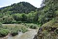
 Coquelle River at Sturdivant Park.jpg 4,288 × 2,848; 8.91 MB
-
 Coquille Myrtle Grove State Natural Site.jpg 4,288 × 2,848; 8.93 MB
-
 Coquille River (Coos County, Oregon scenic images) (cooDA0152a).jpg 324 × 488; 40 KB
-
 Coquille River (Coos County, Oregon scenic images) (cooDA0157).jpg 488 × 324; 44 KB
-
 Coquille River aerial.jpg 1,024 × 683; 522 KB
-
 Coquille River at mouth of Fahy's Creek, with Bullards Bridge.jpg 800 × 533; 421 KB
-
 Debris builds up under Oregon 42 (6726269227).jpg 704 × 480; 43 KB
-
 FMIB 33392 Fisheries of Coquille River Entrance, Oregon 1889.jpeg 1,161 × 981; 111 KB
-
 Fog and Water (Coos County, Oregon scenic images) (cooD0166).jpg 324 × 488; 13 KB
-
 Middle Fork Coquille River from bridge.jpg 4,216 × 2,848; 8.6 MB
-
 North Fork Coquille River.jpg 4,288 × 2,848; 8.41 MB
-
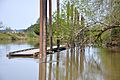
 River boat graveyard, Coquille River (6468812653).jpg 3,691 × 2,867; 1.19 MB
-

-
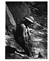 Rockworkers-Oregon-1934.jpg 579 × 719; 54 KB
.jpg)


.jpg)


_(cooDA0152a).jpg)
_(cooDA0157).jpg)


.jpg)

_(cooD0166).jpg)


.jpg)
.jpg)

.jpg)