Category:County Durham (district)
Zur Navigation springen
Zur Suche springen
Unitary Authority  | |||||
| Medium hochladen | |||||
| As en |
| ||||
|---|---|---|---|---|---|
| Näämd efter | |||||
| Steed | County Durham, Nuurd Uast Ingelun, Ingelun | ||||
| Legislatiif |
| ||||
| Grünjlaanj |
| ||||
| Iinwenertaal |
| ||||
| Grate |
| ||||
| Uun steed faan |
| ||||
| Ei ferwaksle mä | |||||
| amtelk wääbsteed | |||||
 | |||||
English: County Durham is a district, in the county of Durham, England.
Onerkategoriin
Uun detdiar kategorii stun 147 onerkategoriin faan 147 uun't gehial.
B
- Boldron (120 D)
C
D
E
- Edmondsley (124 D)
- Eldon, County Durham (59 D)
F
- Fishburn (86 D)
G
- Gilmonby (76 D)
H
- Hilton, County Durham (57 D)
- Hope, County Durham (89 D)
I
K
L
- Langleydale and Shotton (117 D)
- Little Lumley (105 D)
M
- Middridge (36 D)
- Morton Tinmouth (13 D)
N
- Nesbitt, County Durham (3 D)
- Newton Hall, County Durham (20 D)
O
- Ouston, County Durham (20 D)
- Ovington, County Durham (20 D)
P
R
S
T
U
W
- Wackerfield (29 D)
Meedien uun kategorii "County Durham (district)"
Uun detdiar kategorii stun jodiar 200 datein faan 568 uun't gehial.
(leetst sidj (turag)) (naist sidj)-
 A path leading to Castlewood House - geograph.org.uk - 2939010.jpg 800 × 600; 130 KB
-
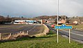
 A1(M) near Durham - geograph.org.uk - 3850048.jpg 640 × 465; 210 KB
-
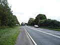
 A181 bridge over the A1(M) - geograph.org.uk - 2578334.jpg 640 × 430; 40 KB
-
 A68 near Harperley Hall - geograph.org.uk - 5849930.jpg 1.024 × 711; 134 KB
-
 A688 entering New Coundon - geograph.org.uk - 3322807.jpg 1.500 × 877; 1,09 MB
-
 A688 Tindale Crescent - geograph.org.uk - 1829174.jpg 640 × 480; 60 KB
-
-
 A688 towards Spennymoor - geograph.org.uk - 5919209.jpg 640 × 480; 80 KB
-
 A688, Tindale Crescent - geograph.org.uk - 1829189.jpg 640 × 480; 51 KB
-
 A689 approaching A68 roundabout - geograph.org.uk - 5515939.jpg 640 × 482; 83 KB
-
 A689 towards Coundongate - geograph.org.uk - 4807874.jpg 640 × 459; 64 KB
-
 A689 towards Crook - geograph.org.uk - 5515940.jpg 640 × 480; 68 KB
-
 A689, Addison Road - geograph.org.uk - 2056681.jpg 640 × 480; 52 KB
-
 A692 at County Durham boundary - geograph.org.uk - 4743068.jpg 640 × 480; 34 KB
-
 A692 at Crookgate Bank - geograph.org.uk - 4743739.jpg 640 × 481; 38 KB
-
 A692 Front Street, Hobson - geograph.org.uk - 4743743.jpg 640 × 481; 39 KB
-
 A692 towards Consett - geograph.org.uk - 2876632.jpg 640 × 480; 89 KB
-

-

-
 A694 Vindomora Road, Ebchester - geograph.org.uk - 4743762.jpg 640 × 479; 43 KB
-
 Access road to Loft House farm - geograph.org.uk - 6103917.jpg 4.608 × 3.456; 2,4 MB
-
 Access road to Pontop Pike Transmitter Station - geograph.org.uk - 2247711.jpg 1.024 × 768; 196 KB
-
 Access to Harperley Hall from A68 - geograph.org.uk - 2967027.jpg 1.094 × 863; 324 KB
-
 Across Hobson Golf Course - geograph.org.uk - 6124864.jpg 1.600 × 1.098; 624 KB
-
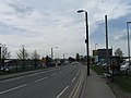
 Addison Road (A689) - geograph.org.uk - 5515993.jpg 640 × 480; 68 KB
-
 All the fun of the fair in Leeholme - geograph.org.uk - 3673998.jpg 1.635 × 1.185; 668 KB
-
 Allotment gardens near to Lintz - geograph.org.uk - 5241646.jpg 1.499 × 848; 1,24 MB
-
 An access to the Garden of Remembrance - geograph.org.uk - 3412205.jpg 1.349 × 1.299; 501 KB
-

-
 Applegarth Pond - geograph.org.uk - 2876359.jpg 4.320 × 3.240; 3,01 MB
-
 Approach to A689 roundabout - geograph.org.uk - 3674012.jpg 1.400 × 1.000; 314 KB
-
 Archway at Pontburn - geograph.org.uk - 5592161.jpg 4.608 × 3.456; 5,46 MB
-
 Archway at Pontburn - geograph.org.uk - 5947565.jpg 4.608 × 3.456; 7 MB
-
 Auckland Walk overbridge near Canney Hill - geograph.org.uk - 6129782.jpg 5.202 × 3.465; 5,55 MB
-
 Auckland Walk. Durham Road overbridge - geograph.org.uk - 6129786.jpg 5.202 × 3.465; 5,95 MB
-
 B6168 towards Mountsett - geograph.org.uk - 2876487.jpg 640 × 480; 55 KB
-
 B6282 through Leeholme - geograph.org.uk - 3673982.jpg 1.499 × 959; 257 KB
-
 B6286, Hunwick - geograph.org.uk - 5889746.jpg 640 × 480; 61 KB
-
 B6287 entering Coundon - geograph.org.uk - 4369336.jpg 1.500 × 1.125; 1,56 MB
-
 B6287, Leeholme - geograph.org.uk - 4811266.jpg 640 × 480; 52 KB
-
 B6310 at Pontburn Wood - geograph.org.uk - 4743752.jpg 640 × 480; 89 KB
-
 B6310 towards the A692 - geograph.org.uk - 2876633.jpg 640 × 480; 90 KB
-

-
 Balancing Pond in Wear Valley Crematorium grounds - geograph.org.uk - 2050912.jpg 2.048 × 1.536; 1,27 MB
-
 Bank Top Farm, Iveston - geograph.org.uk - 4772818.jpg 4.608 × 3.456; 4,46 MB
-

-
 Beeches in Pontburn Wood - geograph.org.uk - 5592189.jpg 4.368 × 3.275; 3,39 MB
-
 Bench with an arboreal view - geograph.org.uk - 2904879.jpg 1.024 × 768; 130 KB
-
 Benchmark on Whin House Sike Bridge - geograph.org.uk - 4865229.jpg 4.000 × 3.000; 4,49 MB
-
-
 Billy Hill - geograph.org.uk - 3722003.jpg 640 × 480; 60 KB
-
 Birch woodland, Pontop Pike - geograph.org.uk - 2247754.jpg 1.024 × 768; 306 KB
-
 Birks Wood Stanley Crook - geograph.org.uk - 3180339.jpg 3.872 × 2.592; 1,25 MB
-
 Bishopfield Tindale Crescent County Durham - geograph.org.uk - 1836573.jpg 2.048 × 1.536; 1.012 KB
-
 Black Byerside Wood nr Hamsterley - geograph.org.uk - 2421303.jpg 3.264 × 2.448; 1,72 MB
-
 Blakeley Hill Farm - geograph.org.uk - 2843552.jpg 3.648 × 2.736; 2,39 MB
-

-
 Blossom beside the Bowes Railway Path - geograph.org.uk - 4315567.jpg 4.348 × 3.193; 7,6 MB
-
 Bluebells in Struthers Wood - geograph.org.uk - 2808259.jpg 3.264 × 2.448; 2,59 MB
-
 Board Cottage, Iveston - geograph.org.uk - 4803365.jpg 4.564 × 3.396; 6,79 MB
-
 Boggy field near West Billingside - geograph.org.uk - 4899147.jpg 4.608 × 3.456; 5,86 MB
-
 Boundary House Farm - geograph.org.uk - 3944412.jpg 4.608 × 3.456; 5,69 MB
-
 Boundary House, Flint Hill - geograph.org.uk - 5211007.jpg 4.608 × 3.456; 5,26 MB
-
 Bowes Railway Path - geograph.org.uk - 3905954.jpg 640 × 480; 105 KB
-
 Bowes Railway Path at Dipton - geograph.org.uk - 3905951.jpg 640 × 480; 122 KB
-
 Bowes Railway Path at Mountsett - geograph.org.uk - 3905952.jpg 640 × 480; 99 KB
-
 Bowesville, Crookgate - geograph.org.uk - 3155727.jpg 4.608 × 3.456; 5,03 MB
-
 Bradley Cottages - geograph.org.uk - 4714178.jpg 1.500 × 1.125; 1,85 MB
-
 Bradley Hall - geograph.org.uk - 2340347.jpg 2.351 × 2.017; 850 KB
-
 Bradley Hall and Low Bradley - geograph.org.uk - 2340331.jpg 3.264 × 2.448; 2,59 MB
-
 Bradley Terrace - geograph.org.uk - 5211219.jpg 4.317 × 3.052; 4,14 MB
-
 Brandon to Bishop Auckland Walk - geograph.org.uk - 2760778.jpg 1.500 × 1.125; 1,83 MB
-
 Bridge carrying route of old railway - geograph.org.uk - 2804395.jpg 1.500 × 843; 1,49 MB
-
 Bridge over Auckland Walk - geograph.org.uk - 2804853.jpg 1.500 × 1.125; 2,23 MB
-
 Bridge over former railway - geograph.org.uk - 5835164.jpg 1.024 × 768; 344 KB
-
 Bridge over the Pont Burn - geograph.org.uk - 5592561.jpg 4.608 × 3.456; 5,63 MB
-
 Bridge over the Stockerley Burn - geograph.org.uk - 6283887.jpg 4.608 × 3.456; 5,1 MB
-
 Brooms Lane - geograph.org.uk - 4894645.jpg 640 × 480; 55 KB
-
 Building complex across grassed area - geograph.org.uk - 4742784.jpg 1.500 × 794; 1,09 MB
-
 Buildings at Stob House, Dipton - geograph.org.uk - 4769096.jpg 4.608 × 3.456; 4,91 MB
-
-
 Bus stop and shelter on Pont Lane - geograph.org.uk - 4894631.jpg 640 × 480; 76 KB
-
 Bus stop and shelter on the A691 - geograph.org.uk - 4896944.jpg 640 × 480; 70 KB
-
 Bus stop on the A688, New Coundon - geograph.org.uk - 4811239.jpg 640 × 480; 79 KB
-
 Business unit on West Auckland Road - geograph.org.uk - 5919222.jpg 640 × 480; 58 KB
-
 Byway alongside Scot's Bog Wood - geograph.org.uk - 4993810.jpg 4.000 × 3.000; 2,74 MB
-
 Car park for the steel furnace - geograph.org.uk - 3751992.jpg 2.000 × 1.500; 650 KB
-
 Car park off B6310 - geograph.org.uk - 4010339.jpg 640 × 480; 113 KB
-
 Car sales, New Coundon - geograph.org.uk - 4811238.jpg 640 × 480; 64 KB
-
 Cereal crop, New Coundon - geograph.org.uk - 5892306.jpg 640 × 480; 67 KB
-
 Chapel at Wear Valley Crematorium - geograph.org.uk - 3412188.jpg 1.555 × 1.169; 354 KB
-
 Chare Bank, B6309 to Whittonstall - geograph.org.uk - 4015968.jpg 1.595 × 1.078; 816 KB
-
 Children's playground, Leeholme - geograph.org.uk - 4811263.jpg 640 × 480; 83 KB
-
 Church Lane, Hunwick - geograph.org.uk - 5889863.jpg 640 × 480; 60 KB
-
 Close up, Elizabeth II postbox on Church Lane, Hunwick - geograph.org.uk - 5890788.jpg 2.227 × 3.631; 1,69 MB
-
 Close up, Elizabethan postbox, Hunwick Post Office - geograph.org.uk - 5890777.jpg 1.439 × 2.623; 763 KB
-
 Cold Knot Belt Plantation - geograph.org.uk - 2077080.jpg 2.000 × 1.026; 1,79 MB
-
 Colliery at Beamish Open Air Museum - geograph.org.uk - 4519393.jpg 1.024 × 768; 201 KB
-
 Consett and Sunderland railway path - geograph.org.uk - 3224963.jpg 640 × 480; 82 KB
-
 Consett and Sunderland railway path - geograph.org.uk - 3872012.jpg 640 × 480; 78 KB
-
 Consett and Sunderland Railway Path - geograph.org.uk - 4803055.jpg 1.500 × 754; 1,1 MB
-
 Convenience store, Leeholme - geograph.org.uk - 4811250.jpg 640 × 480; 69 KB
-
 Converted farm building, Iveston - geograph.org.uk - 4803356.jpg 4.608 × 3.456; 5,67 MB
-
 Copwell House Farm, Stoney Heap - geograph.org.uk - 4773018.jpg 4.608 × 3.456; 4,82 MB
-
 Cottage at the top of Forge Lane, Hamsterley Mill - geograph.org.uk - 4808827.jpg 4.608 × 3.456; 7,39 MB
-
 Cottages at Stockerley Burn - geograph.org.uk - 6284058.jpg 4.608 × 3.456; 4,22 MB
-
 Coundon Burn tunnel - geograph.org.uk - 2858503.jpg 4.320 × 3.240; 4,53 MB
-
 Country lane at Mountsett - geograph.org.uk - 4061301.jpg 4.608 × 3.456; 6,7 MB
-
 Country Lane near Binchester Crag - geograph.org.uk - 2056789.jpg 640 × 480; 73 KB
-
 Country Lane near Binchester Crag - geograph.org.uk - 2056796.jpg 640 × 480; 68 KB
-
 Country road - geograph.org.uk - 4728577.jpg 640 × 480; 43 KB
-
 Crookbank Farm from the north - geograph.org.uk - 4788697.jpg 4.402 × 3.162; 3,82 MB
-
 Crookfield Farm - geograph.org.uk - 4774012.jpg 4.608 × 3.456; 5,22 MB
-
 Crop field, Binchester - geograph.org.uk - 5888999.jpg 640 × 480; 52 KB
-
 Crossroads at East Castle - geograph.org.uk - 4770937.jpg 4.608 × 3.456; 4,39 MB
-
 Culvert on the Pont Burn - geograph.org.uk - 5597301.jpg 4.608 × 3.456; 5,51 MB
-

-
 Day Three-zing - Flickr - Menage a Moi.jpg 2.592 × 1.944; 2,5 MB
-
 Derwent Valley - geograph.org.uk - 2859871.jpg 640 × 480; 51 KB
-
 Derwent Walk - geograph.org.uk - 3314457.jpg 4.000 × 3.000; 5,07 MB
-
 Derwentcote Steel Furnace - geograph.org.uk - 4421012.jpg 640 × 480; 120 KB
-
 Derwentcote Steel Furnace - geograph.org.uk - 4713958.jpg 1.500 × 974; 1,75 MB
-
 Derwentcote, Hamsterley Mill - geograph.org.uk - 4808300.jpg 4.608 × 3.456; 5,75 MB
-
 Donkeys at Dipton - geograph.org.uk - 6100698.jpg 4.608 × 3.456; 3,59 MB
-
 Donkeys at Low Bradley - geograph.org.uk - 5434322.jpg 4.608 × 3.456; 5,83 MB
-
 Double bridge over Auckland way - geograph.org.uk - 5835161.jpg 1.024 × 768; 305 KB
-
 Durham Bandstand - geograph.org.uk - 6086357.jpg 1.024 × 576; 100 KB
-
 Durham Council UK ward map 2010 (blank).svg 1.425 × 934; 1,26 MB
-
 Durham Council UK ward map 2013 (blank).svg 1.425 × 934; 1,19 MB
-
 Earth mound with trig point-like object - geograph.org.uk - 4632424.jpg 1.500 × 1.125; 1,39 MB
-
 East Castle House - geograph.org.uk - 4770926.jpg 4.492 × 3.296; 4,89 MB
-
 Electricity Pylons near the A689 - geograph.org.uk - 6198409.jpg 3.072 × 2.253; 3,22 MB
-

-
 Elizabeth II postbox on Church Lane, Hunwick - geograph.org.uk - 5890786.jpg 3.648 × 2.736; 2,36 MB
-
 Elm Park - geograph.org.uk - 2412970.jpg 3.264 × 2.448; 2,16 MB
-
 Elm Park Farm - geograph.org.uk - 4810519.jpg 4.608 × 3.456; 5,08 MB
-
 Elm Park Farm from the east - geograph.org.uk - 4810491.jpg 4.608 × 3.456; 5,26 MB
-
 Elm Park House - geograph.org.uk - 4810501.jpg 4.608 × 3.456; 5,37 MB
-
 Elm Park Road - geograph.org.uk - 4894623.jpg 640 × 480; 57 KB
-

-

-
 Entering Bishop Auckland - geograph.org.uk - 5919214.jpg 640 × 480; 71 KB
-
 Entering Bradley Cottages - geograph.org.uk - 2933701.jpg 800 × 600; 110 KB
-
 Entering New Coundon - geograph.org.uk - 4811235.jpg 640 × 480; 51 KB
-

-
 Entrance porch at High Stables Farm - geograph.org.uk - 4816243.jpg 4.608 × 3.456; 5,52 MB
-
 Entrance road to Low Brooms Farm, Leadgate - geograph.org.uk - 3894056.jpg 4.608 × 3.456; 5,52 MB
-
 Factory unit, Leadgate Industrial Estate - geograph.org.uk - 4714138.jpg 1.500 × 990; 1,64 MB
-
 Fairway with sand trap - geograph.org.uk - 6124871.jpg 1.600 × 1.200; 586 KB
-
 Fallen tree beside the path - geograph.org.uk - 2874021.jpg 4.608 × 3.456; 5,54 MB
-
 Farm buildings at Binchester Crag Farm - geograph.org.uk - 4241563.jpg 1.500 × 996; 1,25 MB
-
 Farm track south of Loft House - geograph.org.uk - 6096758.jpg 4.421 × 3.315; 1,76 MB
-
 Farmhouse at Copwell House Farm - geograph.org.uk - 4773013.jpg 4.608 × 3.456; 6,36 MB
-
 Farmhouse at Crookfield Farm - geograph.org.uk - 4774019.jpg 4.608 × 3.456; 4,31 MB
-
 Farmhouse at Park Head Farm - geograph.org.uk - 2564044.jpg 3.648 × 2.736; 2,82 MB
-
 Farmhouse at Pontop Pike Farm - geograph.org.uk - 4770330.jpg 4.608 × 3.456; 6,91 MB
-
 Farmhouse at Whitehall Farm, Iveston - geograph.org.uk - 4772918.jpg 3.074 × 2.304; 2,17 MB
-
 Farmland near Old Durham - geograph.org.uk - 5862643.jpg 1.024 × 683; 219 KB
-
 Farmland off Syke Road - geograph.org.uk - 2876599.jpg 640 × 480; 73 KB
-
 Farmland, New Coundon - geograph.org.uk - 4811236.jpg 640 × 480; 83 KB
-
 Farmland, Toft Gate - geograph.org.uk - 2876585.jpg 640 × 480; 67 KB
-
 Farmyard at Crookhall Farm - geograph.org.uk - 3858502.jpg 4.522 × 3.340; 5,72 MB
-
 Fenced access road for Loft House - geograph.org.uk - 5241457.jpg 1.500 × 845; 1,33 MB
-
 Field adjacent to B6286 - geograph.org.uk - 3740090.jpg 1.500 × 1.125; 1,98 MB
-

-
 Field and wood south of Cut Throat Lane - geograph.org.uk - 4416552.jpg 640 × 480; 107 KB
-
 Field below Low Bradley - geograph.org.uk - 5434328.jpg 4.608 × 3.456; 4,86 MB
-
 Field entrance off Brooms Lane - geograph.org.uk - 4894647.jpg 640 × 480; 102 KB
-
 Field entrance off the A689 - geograph.org.uk - 4807871.jpg 640 × 480; 67 KB
-
 Field near Coundon - geograph.org.uk - 4807868.jpg 640 × 480; 61 KB
-
 Field scene from Longclose Bank - geograph.org.uk - 2421346.jpg 3.264 × 2.448; 2,15 MB
-
 Field scene just off Longclose Bank nr Medomsley - geograph.org.uk - 2421310.jpg 3.264 × 2.448; 1,38 MB
-
 Field south of Pontop Pike - geograph.org.uk - 2247718.jpg 1.024 × 768; 252 KB
-
 Field with emerging crop near to Coundon - geograph.org.uk - 4704269.jpg 1.500 × 985; 1,38 MB
-
 Field with sheep adjacent to B6286 - geograph.org.uk - 3742414.jpg 1.500 × 1.125; 1,49 MB
-
 Field, Billy Hill - geograph.org.uk - 5889978.jpg 640 × 480; 50 KB
-
 Fields in front of High Hamsterley - geograph.org.uk - 2421289.jpg 3.264 × 2.448; 1,61 MB
-
 Fields south of St Helen Auckland - geograph.org.uk - 3841824.jpg 4.119 × 2.965; 3,53 MB
-
 Fogoes Burn - geograph.org.uk - 2904865.jpg 768 × 1.024; 512 KB
-

-

-
 Football pitch, Old Durham, 1968 - geograph.org.uk - 3329861.jpg 640 × 307; 47 KB
-
 Football pitch, Old Durham, 1968 - geograph.org.uk - 3329880.jpg 640 × 369; 60 KB
-
 Footbridge across Old Durham Beck - geograph.org.uk - 2796019.jpg 1.024 × 768; 186 KB
-
 Footbridge over River Derwent - geograph.org.uk - 5741039.jpg 4.608 × 3.456; 7,62 MB
-
 Footbridge over the Pont Burn - geograph.org.uk - 5597372.jpg 4.608 × 3.456; 5,69 MB
-

-
 Footpath alongside overgrown hedge - geograph.org.uk - 5888020.jpg 1.500 × 1.001; 1,21 MB
-
 Footpath below North Road, Flint Hill - geograph.org.uk - 3905866.jpg 640 × 480; 114 KB
-
 Footpath from Flint Hill to Dipton - geograph.org.uk - 3905874.jpg 640 × 480; 131 KB
-
 Footpath near High Urpeth - geograph.org.uk - 4599323.jpg 1.500 × 1.125; 1,91 MB
-
 Footpath off Brooms Lane - geograph.org.uk - 4894644.jpg 640 × 480; 98 KB
-
 Footpath off Syke Road - geograph.org.uk - 2876592.jpg 640 × 480; 150 KB
-
 Footpath steps up to the Parklands bridge - geograph.org.uk - 2904982.jpg 1.024 × 768; 233 KB
-
 Footpath through the barley near Struthers' Wood - geograph.org.uk - 4993826.jpg 4.000 × 3.000; 2,72 MB
-
 Footpath through the barley to Struthers' Wood - geograph.org.uk - 4993817.jpg 4.000 × 3.000; 2,73 MB
-
 For sale, 6 High Friarside - geograph.org.uk - 2903238.jpg 1.024 × 768; 125 KB
-
 Ford over the Dipton Burn - geograph.org.uk - 2874086.jpg 4.608 × 3.456; 5,53 MB
-
 Forest road in Pontop Low Wood - geograph.org.uk - 5888179.jpg 1.500 × 1.001; 1,76 MB
-
 Forge Lane - geograph.org.uk - 3752010.jpg 2.000 × 1.500; 740 KB

_near_Durham_-_geograph.org.uk_-_3850048.jpg)
_-_geograph.org.uk_-_2578334.jpg)


_-_geograph.org.uk_-_5515993.jpg)


&uselang=frr&filefrom=Former+byers+at+Whitehall+Farm+-+geograph.org.uk+-+4772970.jpg#mw-category-media)
.svg)
.svg)