Category:County Tipperary
둘러보기로 이동
검색으로 이동
Counties of the Republic of Ireland: Carlow · Cavan · Clare · Cork(1) · Donegal · Dún Laoghaire-Rathdown(2) · Fingal(2) · Galway(3) · Kerry · Kildare · Kilkenny · Laois · Leitrim · Limerick · Longford · Louth · Mayo · Meath · Monaghan · Offaly · Roscommon · Sligo · South Dublin(2) · Tipperary(4) · Waterford · Westmeath · Wexford · Wicklow – Separate cities: Cork(1) · Dublin(2) · Galway(3) – Former counties: Dublin(2) · South Tipperary(4) Former counties of Northern Ireland: Antrim · Armagh · Down · Fermanagh · Londonderry · Tyrone
county in Ireland    | |||||
| 미디어 올리기 | |||||
| 다음 종류에 속함 |
| ||||
|---|---|---|---|---|---|
| 다음의 한 부분임 |
| ||||
| 위치 | 먼스터, 아일랜드 | ||||
| 정부 소재지 | |||||
| 입법부 |
| ||||
| 행정부 |
| ||||
| 인구수 |
| ||||
| 면적 |
| ||||
| 공식 웹사이트 | |||||
 | |||||
"County Tipperary" 분류에 속하는 미디어
다음은 이 분류에 속하는 파일 847개 가운데 200개입니다.
(이전 페이지) (다음 페이지)-
 Flag of county Tipperary.svg 600 × 300; 213 바이트
-
 Flag of Longford, Tipperary & Roscommon County.svg 500 × 300; 368 바이트
-
 TippWicklowRosc col.png 87 × 54; 5 KB
-
 2022-01-18 Woodhouse Motte.png 2,000 × 1,330; 3.64 MB
-
 23.10.93 Carrick-on-Suir 049 (33416131614).jpg 1,563 × 968; 1.93 MB
-
 9th Green - geograph.org.uk - 2316981.jpg 600 × 450; 262 KB
-
 A fine house near Killenaule - geograph.org.uk - 4089109.jpg 2,456 × 1,829; 988 KB
-
 A quiet spot beside Lough Derg - geograph.org.uk - 2517682.jpg 640 × 480; 87 KB
-
 A track in the Grange Deer Park - geograph.org.uk - 4089460.jpg 2,592 × 1,944; 2.23 MB
-
 A tributary of the River Sull at Clashganny West - geograph.org.uk - 5435121.jpg 1,024 × 768; 180 KB
-
 A tributary of the River Sull at Clashganny West - geograph.org.uk - 5460183.jpg 1,024 × 768; 212 KB
-
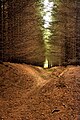
 A tunnel of trees - geograph.org.uk - 2381599.jpg 426 × 640; 103 KB
-
 A view beside the R639 (the former N8) - geograph.org.uk - 4087497.jpg 2,592 × 1,944; 1.75 MB
-
 A view from Slievenamon Bog - geograph.org.uk - 4240041.jpg 1,024 × 768; 271 KB
-
 A view over Bay Lough - geograph.org.uk - 4496386.jpg 1,200 × 900; 441 KB
-
 Access point from forest Burncourt River, Galty Mountains - geograph.org.uk - 6008307.jpg 5,184 × 2,920; 6.59 MB
-
 Access road near Monsea, Co. Tipperary - geograph.org.uk - 3580981.jpg 1,024 × 666; 233 KB
-
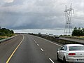
 Advertising on the N24 - geograph.org.uk - 1823097.jpg 640 × 427; 215 KB
-
 Aherlow Ladies - geograph.org.uk - 2909364.jpg 600 × 800; 335 KB
-
 Aherlow Tributary - geograph.org.uk - 2302224.jpg 600 × 450; 290 KB
-
 Along the Leinstermen Grave Trail - geograph.org.uk - 5201533.jpg 4,608 × 3,456; 3.33 MB
-
 Ancient Trackway - geograph.org.uk - 3351910.jpg 600 × 450; 219 KB
-
 Approaching Shower - geograph.org.uk - 3096400.jpg 600 × 450; 164 KB
-

-
 Approaching the Vee - geograph.org.uk - 5534360.jpg 640 × 481; 261 KB
-

-

-

-

-

-

-

-
 Aughavanlomaun standing stone with mountains beyond - geograph.org.uk - 2712331.jpg 1,600 × 1,200; 412 KB
-
 Ballingarry Creamery 2021.jpg 2,000 × 1,330; 2.66 MB
-
 Ballingarry Creamery.jpg 2,000 × 1,330; 1.5 MB
-
 Ballingarry World war one memorial, County Tipperary, Ireland.jpg 4,608 × 3,456; 7.53 MB
-
 Barrier across track off Maryville - geograph.org.uk - 5141872.jpg 2,000 × 1,333; 1.28 MB
-
 Bay Lough - geograph.org.uk - 4032472.jpg 1,024 × 768; 381 KB
-
 Bay Lough car park - geograph.org.uk - 5921539.jpg 1,024 × 681; 89 KB
-
 Bay Lough, Knockmealdown Mountains - geograph.org.uk - 6008347.jpg 5,184 × 2,920; 5.51 MB
-
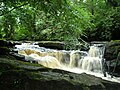 Below the Clare Glens waterfalls - geograph.org.uk - 5022002.jpg 2,048 × 1,536; 883 KB
-
 Bend on forest track below Little Rock, Devil's Bit Mountain - geograph.org.uk - 6009025.jpg 5,184 × 2,920; 5.67 MB
-
 Bikers on Slievenamon - geograph.org.uk - 2227394.jpg 600 × 450; 110 KB
-
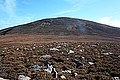
 Boulders and Burned Heath - geograph.org.uk - 2883339.jpg 640 × 480; 328 KB
-
 Boulders and Heather - geograph.org.uk - 2122670.jpg 600 × 400; 91 KB
-
 Boulders and Hill - geograph.org.uk - 5867132.jpg 800 × 600; 169 KB
-
 Boulders and Valley - geograph.org.uk - 2883325.jpg 640 × 480; 248 KB
-
 Boulders ^ Bracken - geograph.org.uk - 2123161.jpg 600 × 400; 63 KB
-
 Boundary Cairn - geograph.org.uk - 5981505.jpg 800 × 600; 320 KB
-
 Boundary wall - geograph.org.uk - 5458945.jpg 1,024 × 768; 171 KB
-
 Boundary Wall - geograph.org.uk - 5980200.jpg 800 × 562; 455 KB
-
 Bridge at Borrisokane - geograph.org.uk - 2517744.jpg 640 × 480; 91 KB
-
 Bridge on Drominagh Desmesne - geograph.org.uk - 2491880.jpg 640 × 480; 93 KB
-
 Bridge on the boundary - geograph.org.uk - 4994644.jpg 1,600 × 1,200; 862 KB
-
 Bridge over a tributary of the River Suir - geograph.org.uk - 5460178.jpg 1,024 × 768; 151 KB
-
 Bridge over the M7 near Cooleen - geograph.org.uk - 6324531.jpg 800 × 533; 606 KB
-
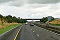 Bridge over the M7 near Lissanisky - geograph.org.uk - 6326518.jpg 800 × 533; 508 KB
-

-

-
 Bridge over the M8 - geograph.org.uk - 5897310.jpg 1,024 × 625; 96 KB
-
 Bridge over the river Aherlow - geograph.org.uk - 3115629.jpg 1,024 × 768; 251 KB
-
 Bridge over the Westbound M7 - geograph.org.uk - 6245138.jpg 800 × 533; 542 KB
-
 Bridge over the Westbound M7 near Nenagh - geograph.org.uk - 6326464.jpg 800 × 533; 516 KB
-
 Bridge over the Westbound M7, Co Tipperary - geograph.org.uk - 6289567.jpg 1,024 × 576; 691 KB
-
 Bridge Parapet - geograph.org.uk - 2155280.jpg 600 × 450; 145 KB
-
 Bridge, R692 - geograph.org.uk - 5883757.jpg 1,024 × 628; 173 KB
-
 Bulmers-Magners brewery - geograph.org.uk - 3208492.jpg 1,024 × 768; 117 KB
-
 Bulmers-Magners factory - geograph.org.uk - 1822753.jpg 640 × 429; 220 KB
-
 Cairn and Hill - geograph.org.uk - 5980204.jpg 800 × 587; 438 KB
-
 Cairn and Hills - geograph.org.uk - 5981501.jpg 800 × 600; 196 KB
-
 Cairn and Old Wall - geograph.org.uk - 3351907.jpg 600 × 450; 225 KB
-
 Cakes for Sale - geograph.org.uk - 3529739.jpg 600 × 818; 430 KB
-
 Cannon shot still lodged in main tower.jpg 4,288 × 3,216; 3.62 MB
-
 Carden's Folly near The Devil's Bit, Co. Tipperary - geograph.org.uk - 5475917.jpg 3,648 × 2,736; 3.94 MB
-
 Carden's Folly, Devil's Bit Mountain, Co Tipperary - geograph.org.uk - 6009019.jpg 5,184 × 2,920; 5.52 MB
-
 Carrigahorig, County Tipperary - geograph.org.uk - 1814286.jpg 3,888 × 2,592; 5.32 MB
-
 Castles of Munster, Ballagh, Tipperary (3) - geograph.org.uk - 4568841.jpg 683 × 1,024; 1.27 MB
-

-

-

-

-

-

-

-

-

-

-
 Castles of Munster, Clarebeg, Tipperary (4) - geograph.org.uk - 5924219.jpg 1,024 × 768; 234 KB
-
 Castles of Munster, Farranrory, Tipperary (1) - geograph.org.uk - 6277011.jpg 1,024 × 683; 1.07 MB
-
 Castles of Munster, Farranrory, Tipperary (2) - geograph.org.uk - 6277015.jpg 1,024 × 683; 1.13 MB
-

-
 Castles of Munster, Farranrory, Tipperary (4) - geograph.org.uk - 6277019.jpg 1,024 × 683; 1.02 MB
-
 Castles of Munster, Farranrory, Tipperary (5) - geograph.org.uk - 6277021.jpg 1,024 × 683; 894 KB
-

-
 Castles of Munster, Farranrory, Tipperary (7) - geograph.org.uk - 6277030.jpg 1,024 × 683; 1.17 MB
-
 Castles of Munster, Moycarkey, Tipperary (2) - geograph.org.uk - 6304816.jpg 1,024 × 683; 1.08 MB
-
 Celtic Cross near Galtymore summit - geograph.org.uk - 3433540.jpg 683 × 1,024; 139 KB
-
 Christ The King statue - geograph.org.uk - 3115601.jpg 1,024 × 768; 201 KB
-
 Christ the King Statue overlooking the Glen of Aherlow - geograph.org.uk - 2544375.jpg 1,830 × 2,440; 517 KB
-
 Church and Graveyard - geograph.org.uk - 6234491.jpg 800 × 600; 733 KB
-

-

-

-
 Ciss Ryans (1), Garrykennedy, Co. Tipperary - geograph.org.uk - 3405208.jpg 1,024 × 674; 204 KB
-

-
 Clare Falls - geograph.org.uk - 5022171.jpg 2,048 × 1,536; 976 KB
-
 Clare Glens - geograph.org.uk - 5022062.jpg 1,536 × 2,048; 893 KB
-
 Clare River and Clare Bridge - geograph.org.uk - 5022036.jpg 2,048 × 1,536; 1.2 MB
-
 Clare River in the Clare Glens - geograph.org.uk - 5022139.jpg 1,994 × 1,496; 976 KB
-
 Cliffs and Boulders - geograph.org.uk - 6408839.jpg 800 × 600; 838 KB
-
 Clonmel railway station - geograph.org.uk - 1822620.jpg 640 × 427; 209 KB
-

-

-
 Clydagh River Valley - geograph.org.uk - 2214494.jpg 600 × 450; 48 KB
-
 COA South Tipperary County Council.png 1,742 × 2,380; 580 KB
-
 Coach Road Pub - geograph.org.uk - 2909344.jpg 600 × 450; 230 KB
-
 Coalbrook, County Tipperary - geograph.org.uk - 1828445.jpg 3,825 × 2,316; 6.37 MB
-
 Coastline of Lough Derg and Portroe Church - geograph.org.uk - 3329296.jpg 5,088 × 3,392; 2.66 MB
-
 Colours of Tipperary GAA.png 2,560 × 1,715; 5 KB
-
 Colours of Tipperary.png 1,280 × 858; 5 KB
-
 Commemorative Plaque - geograph.org.uk - 5867139.jpg 800 × 600; 183 KB
-
 Community Centre - geograph.org.uk - 6234496.jpg 600 × 800; 765 KB
-
 Compsey Mill Mullinahone.png 3,008 × 2,000; 8.33 MB
-
 Cork train leaving Limerick Junction - geograph.org.uk - 5235587.jpg 1,024 × 746; 119 KB
-
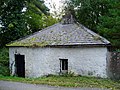
 Cottage at Curraghcloney, Ballinamult - geograph.org.uk - 2716280.jpg 1,600 × 1,200; 591 KB
-
 Cottage at Knockatullane - geograph.org.uk - 2716429.jpg 1,600 × 1,200; 663 KB
-
 Country east of Ballingarry - geograph.org.uk - 4090370.jpg 2,592 × 1,944; 2.14 MB
-
 Country east of Ballingarry - geograph.org.uk - 4090379.jpg 2,592 × 1,944; 1.74 MB
-
 Country Lane - geograph.org.uk - 5867137.jpg 800 × 600; 259 KB
-
 Crag ^ Ridge - geograph.org.uk - 4519324.jpg 640 × 480; 90 KB
-
 Crags and Hags - geograph.org.uk - 2214475.jpg 600 × 450; 50 KB
-
 Crags and Heather - geograph.org.uk - 2883310.jpg 640 × 480; 279 KB
-
 Cramps Castle - geograph.org.uk - 5883824.jpg 1,024 × 560; 84 KB
-
 Cross on Devil's Bit Mountain, Co Tipperary - geograph.org.uk - 6009035.jpg 2,920 × 5,184; 4.26 MB
-
 Crossing the railway - geograph.org.uk - 1820416.jpg 640 × 427; 206 KB
-
 Crossroads at Ballycommon - geograph.org.uk - 5133722.jpg 2,000 × 1,333; 1.13 MB
-
 Cush and Galtybeg - geograph.org.uk - 2213104.jpg 600 × 450; 71 KB
-
 Cush Mountain - geograph.org.uk - 4519221.jpg 640 × 480; 85 KB
-
 Davis Street R497 crosses the River Cauteen - geograph.org.uk - 5149534.jpg 2,000 × 1,333; 1.01 MB
-
 Dead tree north of R505 - east of Cappawhite - geograph.org.uk - 2544575.jpg 1,491 × 1,988; 572 KB
-
 Dedication stone next to Millennium Cross, Laghtea - geograph.org.uk - 2628007.jpg 3,617 × 2,376; 569 KB
-
 Derelict Cottage - geograph.org.uk - 2227375.jpg 600 × 450; 126 KB
-
 Derelict cottage at Gortaclivore, near Lisvarrinane - geograph.org.uk - 2712421.jpg 1,600 × 1,200; 524 KB
-
 Derelict cottage at Gortacullin - geograph.org.uk - 2712381.jpg 1,600 × 1,200; 523 KB
-
 Derelict cottage at Kilvilcorris - geograph.org.uk - 2716488.jpg 1,600 × 1,200; 706 KB
-
 Derelict cottage at Mohober - geograph.org.uk - 2717347.jpg 1,600 × 1,200; 777 KB
-
 Derelict cottage, Loughourna - geograph.org.uk - 5137104.jpg 2,000 × 1,333; 1.19 MB
-
 Derelict gate lodge to Ballybrado House - geograph.org.uk - 2712431.jpg 1,600 × 1,200; 628 KB
-
 Derelict house at Gortnacoolagh, near Donohill - geograph.org.uk - 2712429.jpg 1,600 × 1,200; 525 KB
-
 Derelict house at Newtown, near Lisvarrinane - geograph.org.uk - 2712419.jpg 1,600 × 1,200; 564 KB
-
 Derelict thatched former pub at Tankerstown - geograph.org.uk - 2712406.jpg 1,600 × 1,200; 432 KB
-
 Devilsbit.jpg 3,264 × 2,448; 3.1 MB
-
 Ditch digging - geograph.org.uk - 5133684.jpg 2,000 × 1,333; 1.4 MB
-
 Dormer bungalow on eastern fringe of Tipperary town - geograph.org.uk - 2544472.jpg 2,421 × 1,817; 740 KB
-
 Double rainbow over farmland - geograph.org.uk - 5132543.jpg 2,000 × 1,333; 1.13 MB
-
 Dovehill Irish Design Centre - geograph.org.uk - 4258335.jpg 2,000 × 1,216; 693 KB
-
 Drainage Channel - geograph.org.uk - 3351899.jpg 600 × 450; 284 KB
-
 Dry Channel - geograph.org.uk - 5490946.jpg 427 × 640; 180 KB
-
 Dry Stream Bed - geograph.org.uk - 2883332.jpg 640 × 480; 373 KB
-
 Dublin train arriving at Limerick Junction - geograph.org.uk - 5235643.jpg 1,024 × 747; 136 KB
-
 Eastbound M7 (Location E 160.5) - geograph.org.uk - 6324624.jpg 800 × 533; 525 KB
-
 Eastbound M7 - geograph.org.uk - 6324837.jpg 800 × 601; 514 KB
-

-
 Eastbound M7 at Junction 25 - geograph.org.uk - 6326501.jpg 800 × 533; 538 KB
-
 Eastbound M7 at Junction 26 (Nenagh) - geograph.org.uk - 6324853.jpg 800 × 533; 548 KB
-
 Eastbound M7 at Location E110 - geograph.org.uk - 6290019.jpg 800 × 533; 410 KB
-
 Eastbound M7 near Benedin - geograph.org.uk - 6326497.jpg 800 × 601; 828 KB
-
 Eastbound M7 near Junction 27 - geograph.org.uk - 6324535.jpg 800 × 533; 565 KB
-
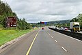
 Eastbound M7 near Nenagh - geograph.org.uk - 6326499.jpg 800 × 533; 590 KB
-
 Eastbound M7 near Southill - geograph.org.uk - 6324628.jpg 800 × 601; 427 KB
-
 Eastbound M7, Ballywilliam - geograph.org.uk - 6324646.jpg 800 × 601; 561 KB
-
 Eastbound M7, Bridge at Junction 24 - geograph.org.uk - 6326509.jpg 800 × 533; 575 KB
-
 Eastbound M7, Carrigatogher - geograph.org.uk - 6324842.jpg 800 × 533; 516 KB
-
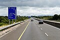
 Eastbound M7, County Tipperary - geograph.org.uk - 6290011.jpg 800 × 533; 402 KB
-
 Eastbound M7, County Tipperary - geograph.org.uk - 6324612.jpg 800 × 533; 521 KB
-
 Eastbound M7, County Tipperary - geograph.org.uk - 6326504.jpg 800 × 533; 545 KB
-

-
 Eastbound M7, Exit at Junction 24 - geograph.org.uk - 6326507.jpg 800 × 533; 568 KB
-
 Eastbound M7, Gortmore Lower - geograph.org.uk - 6324639.jpg 800 × 601; 549 KB
-

-
 Ecobooley, Killeatin, near Clogheen - geograph.org.uk - 2717563.jpg 1,600 × 1,200; 391 KB
-

-

-
 Elder ^ Ruin - geograph.org.uk - 3541305.jpg 640 × 480; 87 KB
-

-
 Entrance Gate - geograph.org.uk - 3529630.jpg 480 × 640; 113 KB
-
 Evening,vakaras - panoramio.jpg 1,600 × 1,200; 872 KB
-

-

-
 Famine Warhouse - geograph.org.uk - 4994630.jpg 1,600 × 1,102; 595 KB
-
 Farm at Edenmore - geograph.org.uk - 1822573.jpg 640 × 429; 203 KB
-
 Farm at Tankerstown - geograph.org.uk - 1820397.jpg 640 × 426; 175 KB
-
 Farm at Toureen - geograph.org.uk - 1820409.jpg 640 × 426; 181 KB
-
 Farm buildings opposite J Ryan's Bar - geograph.org.uk - 2492991.jpg 640 × 480; 89 KB
-
 Farm Entrance - geograph.org.uk - 3529726.jpg 640 × 480; 81 KB
-
 Farm gateway, Ballycraggan - geograph.org.uk - 5135745.jpg 2,000 × 1,333; 1.11 MB
-
 Farm Lane - geograph.org.uk - 2909373.jpg 600 × 450; 291 KB
-
 Farm south of R497 - geograph.org.uk - 5149649.jpg 2,000 × 1,333; 1.54 MB
-
 Farm track off R494 - geograph.org.uk - 5133768.jpg 2,000 × 1,333; 1.25 MB
-
 Farm track west of R493 - geograph.org.uk - 5132527.jpg 2,000 × 1,333; 1.43 MB


.jpg)


_-_geograph.org.uk_-_4087497.jpg)


_-_geograph.org.uk_-_5447191.jpg)
_-_geograph.org.uk_-_5447198.jpg)
_-_geograph.org.uk_-_5447209.jpg)
_-_geograph.org.uk_-_5447224.jpg)
_-_geograph.org.uk_-_5447236.jpg)


_-_geograph.org.uk_-_4568841.jpg)
_-_geograph.org.uk_-_6276763.jpg)
_-_geograph.org.uk_-_6276766.jpg)
_-_geograph.org.uk_-_6276769.jpg)
_-_geograph.org.uk_-_6276772.jpg)
_-_geograph.org.uk_-_6276773.jpg)
_-_geograph.org.uk_-_6276777.jpg)
_-_geograph.org.uk_-_6276778.jpg)
_-_geograph.org.uk_-_6276783.jpg)
_-_geograph.org.uk_-_6276787.jpg)
_-_geograph.org.uk_-_5924210.jpg)
_-_geograph.org.uk_-_5924219.jpg)
_-_geograph.org.uk_-_6277011.jpg)
_-_geograph.org.uk_-_6277015.jpg)
_-_geograph.org.uk_-_6277017.jpg)
_-_geograph.org.uk_-_6277019.jpg)
_-_geograph.org.uk_-_6277021.jpg)
_-_geograph.org.uk_-_6277027.jpg)
_-_geograph.org.uk_-_6277030.jpg)
_-_geograph.org.uk_-_6304816.jpg)


_-_geograph.org.uk_-_4571720.jpg)
_-_geograph.org.uk_-_4571725.jpg)
_-_geograph.org.uk_-_4571730.jpg)
,_Garrykennedy,_Co._Tipperary_-_geograph.org.uk_-_3405208.jpg)
_-_sign,_Garrykennedy,_Co._Tipperary_-_geograph.org.uk_-_3405218.jpg)


_-_geograph.org.uk_-_6324624.jpg)

_-_geograph.org.uk_-_6324850.jpg)

_-_geograph.org.uk_-_6324853.jpg)


