Category:County Longford
Jump to navigation
Jump to search
Counties of the Republic of Ireland: Carlow · Cavan · Clare · Cork(1) · Donegal · Dún Laoghaire-Rathdown(2) · Fingal(2) · Galway(3) · Kerry · Kildare · Kilkenny · Laois · Leitrim · Limerick · Longford · Louth · Mayo · Meath · Monaghan · Offaly · Roscommon · Sligo · South Dublin(2) · Tipperary(4) · Waterford · Westmeath · Wexford · Wicklow – Separate cities: Cork(1) · Dublin(2) · Galway(3) – Former counties: Dublin(2) · South Tipperary(4) Former counties of Northern Ireland: Antrim · Armagh · Down · Fermanagh · Londonderry · Tyrone
county in Ireland    | |||||
| Upload media | |||||
| Instance of | |||||
|---|---|---|---|---|---|
| Location |
| ||||
| Capital | |||||
| Legislative body |
| ||||
| Executive body |
| ||||
| Population |
| ||||
| Area |
| ||||
| official website | |||||
 | |||||
Subcategories
This category has the following 15 subcategories, out of 15 total.
A
C
G
H
M
P
S
T
Media in category "County Longford"
The following 200 files are in this category, out of 242 total.
(previous page) (next page)-
 County colors of Longford and Wicklow (1x2 ratio).svg 600 × 300; 213 bytes
-
 Flag of Longford, Tipperary & Roscommon County.svg 500 × 300; 368 bytes
-

-
 71-longford.png 102 × 129; 7 KB
-
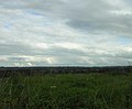
 A damp field - geograph.org.uk - 3286394.jpg 640 × 480; 259 KB
-
 A wet field, Colehill - geograph.org.uk - 3286417.jpg 640 × 360; 225 KB
-
 Abbeyderg - geograph.org.uk - 5896947.jpg 1,024 × 601; 111 KB
-
 Aghnavealogue - geograph.org.uk - 3099916.jpg 640 × 480; 284 KB
-
-
 Antley Industrial Estate - geograph.org.uk - 3097852.jpg 640 × 480; 233 KB
-

-

-
 Approaching roundabout, N55 - geograph.org.uk - 5902659.jpg 1,024 × 569; 81 KB
-

-

-

-
-
-
-
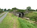
 Bend in road near Royal Canal, Island Bridge - geograph.org.uk - 5896816.jpg 1,024 × 574; 99 KB
-
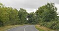
 Bend in the N55 at Leanaboy, Co Longford - geograph.org.uk - 3649230.jpg 1,024 × 767; 105 KB
-
 Big tree - geograph.org.uk - 5892918.jpg 1,024 × 666; 155 KB
-

-
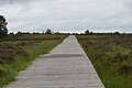 Boardwalk, Corlea - geograph.org.uk - 5896762.jpg 1,024 × 681; 118 KB
-
 Boardwalk, Corlea - geograph.org.uk - 5896773.jpg 1,024 × 681; 114 KB
-

-
 Bridge-side, Soran, Longford - geograph.org.uk - 3545916.jpg 2,592 × 1,936; 2.45 MB
-
 Businesses in Lanesborough - geograph.org.uk - 3732850.jpg 2,592 × 1,936; 1.59 MB
-
 Car park on the edge of Longford - geograph.org.uk - 4914874.jpg 1,920 × 1,080; 584 KB
-
 Car Park, Corlea Trackway - geograph.org.uk - 5893049.jpg 1,024 × 855; 95 KB
-
 Cartron Rd - geograph.org.uk - 5896926.jpg 1,024 × 717; 121 KB
-
 Castles of Leinster, Boherquill, Co. Longford (1) - geograph.org.uk - 5028993.jpg 1,024 × 704; 1.07 MB
-
 Castles of Leinster, Boherquill, Co. Longford (2) - geograph.org.uk - 5028996.jpg 683 × 1,024; 1.28 MB
-
 Castles of Leinster, Boherquill, Co. Longford (3) - geograph.org.uk - 5029001.jpg 1,024 × 683; 1.28 MB
-
 Cattle, Aghnavealogue - geograph.org.uk - 3099927.jpg 640 × 480; 253 KB
-
 Cattle, Kilcurry - geograph.org.uk - 3097864.jpg 640 × 480; 263 KB
-
 Clontymullan - geograph.org.uk - 3099953.jpg 640 × 480; 294 KB
-
 Colehill Post Office - geograph.org.uk - 3099815.jpg 640 × 360; 279 KB
-
 Colehill, County Longford - geograph.org.uk - 1827099.jpg 3,888 × 2,592; 4.89 MB
-
 Colours-of-Longford.png 100 × 67; 625 bytes
-
 Commercial peat extraction - geograph.org.uk - 1947042.jpg 640 × 480; 95 KB
-
 Corlea Raised bog - geograph.org.uk - 5896767.jpg 1,024 × 681; 113 KB
-
 Corlea Raised bog - geograph.org.uk - 5896790.jpg 1,024 × 681; 141 KB
-
 Corlea Raised bog - geograph.org.uk - 5896792.jpg 1,024 × 680; 144 KB
-
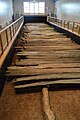
 Corlea trackway (preserved section) - geograph.org.uk - 5896746.jpg 1,024 × 681; 148 KB
-
 Corlea trackway (preserved section) - geograph.org.uk - 5896753.jpg 1,024 × 681; 182 KB
-
 Corlea trackway (preserved section) - geograph.org.uk - 5896757.jpg 681 × 1,024; 158 KB
-
 Corlea trackway (preserved section) - geograph.org.uk - 5896761.jpg 681 × 1,024; 166 KB
-

-
 Corlea Trackway Visitor Centre - geograph.org.uk - 1947084.jpg 640 × 480; 83 KB
-

-
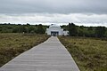
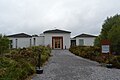 Corlea Trackway Visitors Centre - geograph.org.uk - 5893052.jpg 1,024 × 681; 152 KB
-
 Corlea Trackway Visitors Centre - geograph.org.uk - 5896750.jpg 681 × 1,024; 140 KB
-
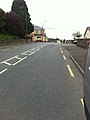
 Corner of Main Street and Richmond Street, Longford - geograph.org.uk - 3543174.jpg 2,592 × 1,936; 1.6 MB
-
 Cottage on a bend in the N55 at Toome - geograph.org.uk - 3796373.jpg 1,024 × 767; 98 KB
-
 Country Road near Longford - geograph.org.uk - 3545995.jpg 1,936 × 2,592; 2.56 MB
-
 Country roads, Soran, Longford - geograph.org.uk - 3545909.jpg 2,592 × 1,936; 2.3 MB
-
 Cows off the R194 near Longford - geograph.org.uk - 3543215.jpg 2,592 × 1,936; 1.73 MB
-
 Cows on a hillside - geograph.org.uk - 3545902.jpg 2,592 × 1,936; 1.46 MB
-
 Crossan Electricals, Main Street, Longford - geograph.org.uk - 2713328.jpg 994 × 1,024; 213 KB
-
-

-
 Currycreghan - geograph.org.uk - 5896968.jpg 1,024 × 524; 98 KB
-
 Currycreghan - geograph.org.uk - 5897011.jpg 1,024 × 632; 121 KB
-

-

-
-
 Dolmen in Berrinagh, Moyne, Co.Longford - geograph.org.uk - 2661857.jpg 640 × 480; 104 KB
-
 Dunnes Stores, Dublin Street, Longford - geograph.org.uk - 2713364.jpg 1,024 × 579; 102 KB
-
 Edge of Taghshinny - geograph.org.uk - 3097880.jpg 640 × 480; 265 KB
-

-
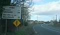
 Entering Granard on the N55 - geograph.org.uk - 2680065.jpg 1,024 × 768; 139 KB
-

-
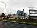
 Entrance to Lough Ree Power Station - geograph.org.uk - 3732865.jpg 1,936 × 2,592; 1.41 MB
-
 Fallen tree - geograph.org.uk - 3099943.jpg 640 × 444; 269 KB
-
 Farm building near Legan - geograph.org.uk - 3099861.jpg 640 × 480; 268 KB
-
 Farmhouse on the N55 at Garryconnell - geograph.org.uk - 3649197.jpg 1,024 × 652; 102 KB
-
 Farmhouse on the N55 at Leanaboy - geograph.org.uk - 3649233.jpg 1,024 × 585; 76 KB
-
 Farmland, Soran, Longford - geograph.org.uk - 3545925.jpg 2,592 × 1,936; 1.95 MB
-
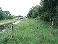
 Field between road and canal - geograph.org.uk - 3286143.jpg 640 × 480; 275 KB
-
 Fields, Streamstown - geograph.org.uk - 3097887.jpg 640 × 360; 250 KB
-
 Fortification - geograph.org.uk - 3543233.jpg 2,592 × 1,936; 1.14 MB
-
 Goldsmith The Elder - geograph.org.uk - 1853176.jpg 3,888 × 2,592; 4.82 MB
-
 Grassland, Vicarstown - geograph.org.uk - 3099852.jpg 640 × 408; 245 KB
-
 Grown out hedge, Vicarstown - geograph.org.uk - 3099841.jpg 640 × 480; 264 KB
-
 Hay shed on the N55 at Ballintober (Bonny) - geograph.org.uk - 3649526.jpg 1,024 × 702; 84 KB
-
 Hedge near Soran, Longford - geograph.org.uk - 3545866.jpg 2,592 × 1,936; 1.62 MB
-
 Homes on River Crescent - geograph.org.uk - 3545936.jpg 2,592 × 1,936; 1.56 MB
-
 House by N55 - geograph.org.uk - 5902630.jpg 1,024 × 470; 69 KB
-
 House by the R392 - geograph.org.uk - 5893041.jpg 1,024 × 494; 62 KB
-
 IRELAND, LONGFORD, 1993 -UNUSUAL STYLE SHADOW FONTS - Flickr - woody1778a.jpg 1,526 × 352; 144 KB
-
 Killeendowd - geograph.org.uk - 5897127.jpg 967 × 893; 407 KB
-
 L1056, Molly Road - geograph.org.uk - 3545966.jpg 2,592 × 1,936; 2.09 MB
-
 Leaving Longford, County Longford - geograph.org.uk - 1808907.jpg 3,613 × 2,132; 3.89 MB
-
 Lenamore - geograph.org.uk - 3286449.jpg 640 × 480; 284 KB
-
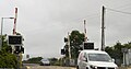 Level crossing, N55 - geograph.org.uk - 5902652.jpg 1,024 × 539; 84 KB
-
 Local road, Ballygarveybeg - geograph.org.uk - 3099974.jpg 640 × 360; 217 KB
-
 Local road, Legan - geograph.org.uk - 3099866.jpg 640 × 360; 219 KB
-
 Local road, near Legan - geograph.org.uk - 3099855.jpg 640 × 360; 236 KB
-

-

-

-

-

-
 Longford - St Mel's Cathedral - geograph.org.uk - 4638862.jpg 1,024 × 768; 162 KB
-
 Longford - St Mel's Cathedral, Interior - geograph.org.uk - 4638856.jpg 1,024 × 768; 152 KB
-
 Longford - St Mel's Cathedral, Stained glass - geograph.org.uk - 4638852.jpg 768 × 1,024; 113 KB
-
 Longford -View N into Main St - geograph.org.uk - 4638846.jpg 1,024 × 768; 126 KB
-
-
 Longford Coat of Arms.png 1,184 × 1,221; 346 KB
-
 Longford county arms.png 270 × 352; 76 KB
-
 Longford Post Office, Main Street, Longford - geograph.org.uk - 2713338.jpg 1,024 × 664; 127 KB
-
 Lough Nabelwy, - geograph.org.uk - 3584261.jpg 2,560 × 1,920; 1.56 MB
-
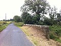
 Low bridge at Cartronawar, Co Longford - geograph.org.uk - 4638890.jpg 1,024 × 768; 207 KB
-
 Low bridge at Cooleeny, Co Longford - geograph.org.uk - 4638884.jpg 1,024 × 768; 229 KB
-
 Low bridge on N63, Killashee St, SW of Longford - geograph.org.uk - 4638749.jpg 1,024 × 768; 160 KB
-
 Lurgan, Co. Longford - geograph.org.uk - 3099892.jpg 640 × 360; 203 KB
-

-
 Market Square, Longford - geograph.org.uk - 2705747.jpg 1,024 × 768; 168 KB
-
 McGuinness-1917 elections.jpg 629 × 364; 66 KB
-

-
 Minor road junction on the N55 at Carrickbeg - geograph.org.uk - 3792786.jpg 1,024 × 532; 95 KB
-

-

-
 N55 - geograph.org.uk - 5897108.jpg 1,024 × 539; 126 KB
-
 N55 - geograph.org.uk - 5902637.jpg 1,024 × 557; 96 KB
-
 N55 - geograph.org.uk - 5902642.jpg 1,024 × 635; 82 KB
-
 N55 - geograph.org.uk - 5902647.jpg 1,024 × 489; 122 KB
-
 N55, Ballintober - geograph.org.uk - 5897102.jpg 1,024 × 587; 111 KB
-
 N55, Carrickboy - geograph.org.uk - 5897075.jpg 1,024 × 541; 70 KB
-
 N55, northbound - geograph.org.uk - 5897090.jpg 1,024 × 455; 86 KB
-
 N55, northbound - geograph.org.uk - 5902615.jpg 1,024 × 769; 204 KB
-
 N55, northbound - geograph.org.uk - 5902625.jpg 1,024 × 652; 95 KB
-
-

-
 Oak planks, Corlea Trackway - geograph.org.uk - 5896755.jpg 1,024 × 681; 189 KB
-
 Oak planks, Corlea Trackway - geograph.org.uk - 5896756.jpg 1,024 × 681; 153 KB
-
 Old peat diggings - geograph.org.uk - 5896768.jpg 1,024 × 681; 155 KB
-
 Outside The Corlea Trackway Visitors Centre - geograph.org.uk - 5893050.jpg 1,024 × 681; 201 KB
-
-
 Paul and Vincent Mills, Edgeworsthstown - geograph.org.uk - 2713435.jpg 1,024 × 747; 73 KB
-
 Peat bogs east of Lough Rea - geograph.org.uk - 1965497.jpg 640 × 527; 47 KB
-
 Peat workings E of Corlea, Co Longford - geograph.org.uk - 4638734.jpg 1,024 × 768; 150 KB
-
 Peat workings, Aghnavealogue - geograph.org.uk - 3286459.jpg 640 × 480; 279 KB
-
 Private roadway from Corn Hill, Co Longford - geograph.org.uk - 4638866.jpg 1,024 × 768; 170 KB
-
 R194 at Ballinalee - geograph.org.uk - 3549283.jpg 1,936 × 2,592; 1.97 MB
-
 R194 entering Ballinalee - geograph.org.uk - 3547053.jpg 2,592 × 1,936; 1.57 MB
-
 R392 - geograph.org.uk - 5893039.jpg 1,024 × 522; 67 KB
-
 R392 - geograph.org.uk - 5893042.jpg 1,024 × 687; 167 KB
-
 R392, R397 junction - geograph.org.uk - 5892930.jpg 1,009 × 552; 197 KB
-
 R395 - geograph.org.uk - 5902675.jpg 1,024 × 864; 162 KB
-
 R395 - geograph.org.uk - 5902682.jpg 1,024 × 537; 122 KB
-
 R395 - geograph.org.uk - 5902688.jpg 1,024 × 572; 85 KB
-
 R395 - geograph.org.uk - 5902701.jpg 1,024 × 631; 165 KB
-
 R395 - geograph.org.uk - 5902705.jpg 1,024 × 719; 219 KB
-
 R395 - geograph.org.uk - 5903308.jpg 1,024 × 666; 131 KB
-
 R395, Co. Longford - geograph.org.uk - 5903310.jpg 1,024 × 761; 137 KB
-
 R395, eastbound - geograph.org.uk - 5902678.jpg 1,024 × 859; 188 KB
-
 R395, eastbound - geograph.org.uk - 5902686.jpg 1,024 × 750; 251 KB
-
 R395, eastbound - geograph.org.uk - 5902690.jpg 1,024 × 657; 160 KB
-
 R399 - geograph.org.uk - 3099826.jpg 640 × 480; 246 KB
-
 R399 - geograph.org.uk - 3286424.jpg 640 × 360; 247 KB
-
 R692 - geograph.org.uk - 5893045.jpg 1,024 × 426; 76 KB
-
 Raised bog, Corlea - geograph.org.uk - 5896763.jpg 1,024 × 681; 180 KB
-
 Ratharney, Co. Longford - geograph.org.uk - 3286435.jpg 640 × 480; 230 KB
-
 Ratharney, County Longford - geograph.org.uk - 1827107.jpg 3,841 × 2,479; 5.46 MB
-
 Retail park at Straid - geograph.org.uk - 2713474.jpg 1,024 × 554; 104 KB
-
 Richmond Street, Longford - geograph.org.uk - 2713316.jpg 1,024 × 767; 116 KB
-
 Road realignment, N55 - geograph.org.uk - 3097871.jpg 640 × 480; 286 KB
-
 Road to Hawkswood - geograph.org.uk - 3546008.jpg 2,592 × 1,936; 2.47 MB
-
 Road to Kenagh - geograph.org.uk - 5896812.jpg 1,024 × 794; 171 KB
-
 Roadside flowers - geograph.org.uk - 308870.jpg 640 × 480; 168 KB
-
 Roadside of L1063 - geograph.org.uk - 3546004.jpg 2,592 × 1,936; 1.64 MB
-

-
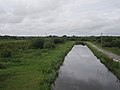 Royal Canal - geograph.org.uk - 3286390.jpg 640 × 480; 225 KB
-
 Royal Canal - geograph.org.uk - 3286398.jpg 640 × 480; 213 KB
-
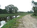
 Royal Canal at Cloonbreany, Co. Longford - geograph.org.uk - 1991591.jpg 640 × 480; 148 KB
-

-
 Royal Canal at Foygh, Co. Longford - geograph.org.uk - 1991547.jpg 640 × 480; 125 KB
-
 Royal Canal at Foygh, Co. Longford - geograph.org.uk - 1991577.jpg 640 × 480; 139 KB
-
-
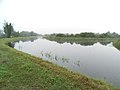
 Royal Canal at Meelick, Co. Longford - geograph.org.uk - 2003167.jpg 640 × 480; 124 KB
-
 Royal Canal at Mosstown, Co. Longford - geograph.org.uk - 1991586.jpg 640 × 480; 149 KB
-

-

-

-

-
 Royal Canal in Ballyclare, Co. Longford - geograph.org.uk - 2003205.jpg 640 × 480; 147 KB
-
 Royal Canal in Begnagh, Co. Longford - geograph.org.uk - 2003214.jpg 640 × 480; 144 KB
-
 Royal Canal in Begnagh, Co. Longford - geograph.org.uk - 2004400.jpg 640 × 480; 143 KB
-
 Royal Canal in Cloonbreany, Co. Longford - geograph.org.uk - 1991566.jpg 640 × 480; 147 KB
-
-
-
 Royal Canal in Corragarrow, Co. Longford - geograph.org.uk - 2003216.jpg 640 × 480; 141 KB
-
 Royal Canal in Kilcurry, Co. Longford - geograph.org.uk - 1991413.jpg 640 × 480; 136 KB
-
 Royal Canal in Moneyfad, Co. Longford - geograph.org.uk - 1991535.jpg 640 × 480; 130 KB
-

-
 Royal Canal in Toome, Co. Longford - geograph.org.uk - 1991475.jpg 640 × 480; 132 KB
-
 Royal Canal near Island Bridge - geograph.org.uk - 1948841.jpg 640 × 480; 89 KB
-
 Rural Irish Road, Kenagh - geograph.org.uk - 5896823.jpg 1,024 × 546; 89 KB
.svg)


_-_geograph.org.uk_-_5028993.jpg)
_-_geograph.org.uk_-_5028996.jpg)
_-_geograph.org.uk_-_5029001.jpg)


_-_geograph.org.uk_-_5896746.jpg)
_-_geograph.org.uk_-_5896753.jpg)
_-_geograph.org.uk_-_5896757.jpg)
_-_geograph.org.uk_-_5896761.jpg)
,_Co_Longford_-_geograph.org.uk_-_4638741.jpg)

,_Co_Longford_-_geograph.org.uk_-_4638738.jpg)


_at_Longford_-_geograph.org.uk_-_2713460.jpg)


_-_geograph.org.uk_-_3649526.jpg)


