Category:County Kildare
Jump to navigation
Jump to search
Counties of the Republic of Ireland: Carlow · Cavan · Clare · Cork(1) · Donegal · Dún Laoghaire-Rathdown(2) · Fingal(2) · Galway(3) · Kerry · Kildare · Kilkenny · Laois · Leitrim · Limerick · Longford · Louth · Mayo · Meath · Monaghan · Offaly · Roscommon · Sligo · South Dublin(2) · Tipperary(4) · Waterford · Westmeath · Wexford · Wicklow – Separate cities: Cork(1) · Dublin(2) · Galway(3) – Former counties: Dublin(2) · South Tipperary(4) Former counties of Northern Ireland: Antrim · Armagh · Down · Fermanagh · Londonderry · Tyrone
county in Ireland   | |||||
| Upload media | |||||
| Instance of | |||||
|---|---|---|---|---|---|
| Part of |
| ||||
| Location | Leinster, Ireland | ||||
| Capital | |||||
| Legislative body |
| ||||
| Executive body |
| ||||
| Population |
| ||||
| Area |
| ||||
| official website | |||||
 | |||||
Subcategories
This category has the following 20 subcategories, out of 20 total.
A
E
G
H
L
- Lock 14, Grand Canal (1 F)
- Lock 15, Grand Canal (1 F)
M
N
P
- Post boxes in County Kildare (4 F)
- Punchestown Racecourse (6 F)
S
T
Media in category "County Kildare"
The following 200 files are in this category, out of 382 total.
(previous page) (next page)-
 Colours of Kildare.png 100 × 67; 617 bytes
-
 Colours of Kildare.svg 100 × 67; 194 bytes
-
 Flag of county Kildare.svg 600 × 300; 160 bytes
-
 Kildare col.png 87 × 54; 5 KB
-
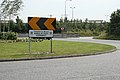
 A bend in the road, County Kildare - geograph.org.uk - 1884222.jpg 3,888 × 2,592; 3.54 MB
-
 A very low bridge at Oghill near Monasterevin - geograph.org.uk - 4638635.jpg 1,024 × 768; 231 KB
-
 Access road through fields - geograph.org.uk - 1221598.jpg 640 × 480; 93 KB
-
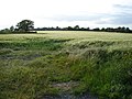 Almost golden - geograph.org.uk - 2436386.jpg 2,048 × 1,536; 1.45 MB
-
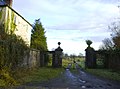
 Ancient entrance Donadea House - geograph.org.uk - 3273127.jpg 640 × 511; 282 KB
-
 Approaching the bend - geograph.org.uk - 2436416.jpg 2,048 × 1,536; 1.41 MB
-
 Art work along the M7 E20 - geograph.org.uk - 4150927.jpg 1,600 × 1,200; 1.16 MB
-
 Athy lough - geograph.org.uk - 502683.jpg 640 × 480; 73 KB
-
 Ballindoolin house Co Kildare - geograph.org.uk - 4588569.jpg 4,000 × 3,000; 7 MB
-
 Balliore Village Square from Main Street.jpg 4,032 × 3,024; 3.76 MB
-
 Ballitore Village Square.jpg 4,032 × 3,024; 3.66 MB
-
 Ballycane Road, Naas - geograph.org.uk - 3682214.jpg 2,592 × 1,936; 1.42 MB
-
 Ballymore Eustace, County Kildare (2) - geograph.org.uk - 1884770.jpg 3,603 × 2,367; 4.17 MB
-
 Ballymore Eustace, County Kildare (3) - geograph.org.uk - 1884775.jpg 3,888 × 2,592; 4.82 MB
-
 Ballymore Eustace, County Kildare - geograph.org.uk - 1884734.jpg 3,888 × 2,592; 4.21 MB
-
 Big andy.jpg 2,448 × 3,264; 1.19 MB
-
 Blackchurch Inn and Restaurant - geograph.org.uk - 813465.jpg 640 × 480; 81 KB
-
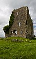
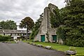
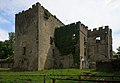
 Blackhall Castle - geograph.org.uk - 2329540.jpg 3,264 × 2,448; 2.6 MB
-
 Blackhall Castle - geograph.org.uk - 2329541.jpg 1,200 × 1,600; 630 KB
-
 Blue doors - geograph.org.uk - 2436437.jpg 2,048 × 1,536; 1.27 MB
-
 Bollards near the footbridge - geograph.org.uk - 2444663.jpg 2,048 × 1,536; 1.38 MB
-
-
 Bonynge Bridge on the Grand Canal in Co. Kildare - geograph.org.uk - 2987644.jpg 1,024 × 768; 237 KB
-
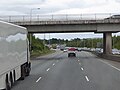 Bridge over Naas Road at Junction 7 - geograph.org.uk - 6071493.jpg 800 × 600; 440 KB
-
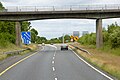
 Bridge over the M7 at Junction 10 - geograph.org.uk - 6070105.jpg 800 × 534; 530 KB
-
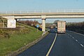
 Bridge over the M7 near Naas - geograph.org.uk - 6070108.jpg 800 × 533; 539 KB
-
 Bridge over the M7 near Naas - geograph.org.uk - 6070122.jpg 800 × 533; 513 KB
-
 Bridge over the M7, west of Naas - geograph.org.uk - 6070085.jpg 800 × 533; 517 KB
-
 Bridge over the M9 - geograph.org.uk - 6078034.jpg 800 × 533; 545 KB
-
 Bridge over the M9 at Belan Lower - geograph.org.uk - 6076493.jpg 800 × 535; 446 KB
-
 Bridge over the M9 near Belan - geograph.org.uk - 6075712.jpg 800 × 533; 457 KB
-
 Bridge over the M9 near Halfmiletown - geograph.org.uk - 6077729.jpg 800 × 533; 528 KB
-

-
 Bridge over the M9 near Stonehouse - geograph.org.uk - 6075748.jpg 800 × 533; 489 KB
-
 Bridge over the northbound M7 - geograph.org.uk - 6070091.jpg 800 × 533; 552 KB
-

-

-
 Bundle of Sticks, County Kildare - geograph.org.uk - 1853224.jpg 3,888 × 2,592; 5.22 MB
-
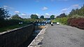 Canal Lock - geograph.org.uk - 4669534.jpg 1,632 × 918; 460 KB
-
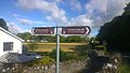 Canal Trail Sign - geograph.org.uk - 4664861.jpg 2,048 × 1,156; 369 KB
-
 Canoeing on the River Liffey - geograph.org.uk - 2436406.jpg 2,048 × 1,536; 1.46 MB
-
 Carton House - geograph.org.uk - 3272393.jpg 640 × 441; 248 KB
-
 Castles of Leinster, Ballyteige, Co. Kildare (1) - geograph.org.uk - 5029009.jpg 1,024 × 688; 657 KB
-
 Castles of Leinster, Ballyteige, Co. Kildare (2) - geograph.org.uk - 5029011.jpg 1,024 × 689; 623 KB
-
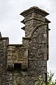
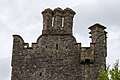
 Castles of Leinster, Blackhall, Kildare (1) - geograph.org.uk - 2495140.jpg 1,024 × 818; 818 KB
-
 Castles of Leinster, Blackhall, Kildare (2) - geograph.org.uk - 2495151.jpg 1,024 × 740; 978 KB
-
 Castles of Leinster, Blackhall, Kildare (3) - geograph.org.uk - 2495162.jpg 714 × 1,024; 1.16 MB
-
 Castles of Leinster, Bolton, Co. Kildare - geograph.org.uk - 5029043.jpg 1,024 × 698; 805 KB
-
 Castles of Leinster, Carrick, Kildare (1) - geograph.org.uk - 4074421.jpg 1,024 × 696; 724 KB
-
 Castles of Leinster, Carrick, Kildare (2) - geograph.org.uk - 4074425.jpg 1,024 × 671; 574 KB
-
 Castles of Leinster, Carrick, Kildare (3) - geograph.org.uk - 4074430.jpg 634 × 1,024; 890 KB
-
 Castles of Leinster, Carrick, Kildare (4) - geograph.org.uk - 4074440.jpg 1,024 × 658; 546 KB
-
 Castles of Leinster, Castle Rag, Co. Kildare (1) - geograph.org.uk - 5029061.jpg 1,024 × 683; 799 KB
-
 Castles of Leinster, Castle Rag, Co. Kildare (2) - geograph.org.uk - 5029066.jpg 1,024 × 683; 849 KB
-
-

-
 Castles of Leinster, Castle Roe, Co. Kildare (1) - geograph.org.uk - 5029051.jpg 1,024 × 698; 955 KB
-
 Castles of Leinster, Castle Roe, Co. Kildare (2) - geograph.org.uk - 5029056.jpg 683 × 1,024; 1.29 MB
-
 Castles of Leinster, Donadea, Kildare (1) - geograph.org.uk - 2494096.jpg 1,024 × 698; 943 KB
-
 Castles of Leinster, Donadea, Kildare (2) - geograph.org.uk - 2494108.jpg 1,024 × 707; 760 KB
-
-

-

-
-

-

-
-

-

-

-
 Castles of Leinster, Grange, Kildare (1) - geograph.org.uk - 1952784.jpg 1,024 × 720; 670 KB
-
 Castles of Leinster, Grange, Kildare (2) - geograph.org.uk - 1952792.jpg 1,024 × 702; 780 KB
-
 Castles of Leinster, Grange, Kildare (3) - geograph.org.uk - 1952804.jpg 1,024 × 678; 680 KB
-
-
 Castles of Leinster, Kinnafad, Kildare - geograph.org.uk - 4074471.jpg 1,024 × 683; 790 KB
-
 Castles of Leinster, Rathcoffey, Kildare (1) - geograph.org.uk - 2494126.jpg 1,024 × 666; 517 KB
-
 Castles of Leinster, Rathcoffey, Kildare (2) - geograph.org.uk - 2494135.jpg 1,024 × 697; 448 KB
-
 Castletown Estate (and parts of D comper) - Early OS map (out of copyright).jpg 2,500 × 2,300; 1.97 MB
-
 Castletown House - geograph.org.uk - 3288245.jpg 800 × 464; 71 KB
-
 Castletown House 2018.jpg 1,600 × 777; 273 KB
-
 Cattle on Commons Lower - geograph.org.uk - 2436429.jpg 2,048 × 1,536; 1.39 MB
-
 Cemetery and Church - geograph.org.uk - 902619.jpg 640 × 473; 57 KB
-
 Chapel Street. Ballymore Eustace - geograph.org.uk - 4619199.jpg 1,024 × 768; 159 KB
-
 Cherryville Jct signal cabin - geograph.org.uk - 2301856.jpg 640 × 404; 82 KB
-
 Cherryville Junction - geograph.org.uk - 5349253.jpg 3,868 × 2,901; 3.73 MB
-
 Clane Electoral Area June 2009.png 1,131 × 737; 75 KB
-
 Clane, County Kildare - geograph.org.uk - 1884196.jpg 3,888 × 2,592; 4.11 MB
-
 Cliff at Lyons.jpg 2,432 × 696; 385 KB
-
 Cloncurry Cemetery - geograph.org.uk - 5644907.jpg 1,024 × 683; 224 KB
-
 Cloudsoverkildare.jpg 1,520 × 2,688; 917 KB
-
 Cokildarewinter.jpg 3,072 × 2,048; 1.38 MB
-
 Conneff Park.jpg 3,264 × 2,448; 2.94 MB
-
 Connolly's Folly - geograph.org.uk - 3269560.jpg 587 × 640; 264 KB
-
 Convenient gap - geograph.org.uk - 2436435.jpg 1,536 × 2,048; 1.34 MB
-
 Country Road L4052 - geograph.org.uk - 3309191.jpg 1,020 × 680; 493 KB
-
 County Kildare Coat of Arms.png 1,341 × 1,189; 419 KB
-
 County Kildare Flag.jpg 720 × 423; 61 KB
-

-
 Dining Room, Elise Sandes Soldiers Home, Curragh Camp (6683286357).jpg 2,493 × 1,890; 1.9 MB
-
 Dongan family tomb.jpg 3,264 × 2,448; 2.73 MB
-

-
 Embassy Office Park - geograph.org.uk - 3687043.jpg 2,592 × 1,936; 1.71 MB
-
 Enfield M4 Service Area - geograph.org.uk - 5901554.jpg 4,000 × 3,000; 2.7 MB
-
 Enfield Services on M4 heading west - geograph.org.uk - 4571200.jpg 3,264 × 2,448; 2.48 MB
-
 ESB Power station on the Straffan Road - geograph.org.uk - 3282001.jpg 1,024 × 682; 91 KB
-
 Fields in Kildare.jpg 3,264 × 2,448; 2.87 MB
-
 Filling station on the N7 - E20 near junction7 - geograph.org.uk - 4153296.jpg 1,600 × 1,274; 1.15 MB
-
 Flat as a pancake - geograph.org.uk - 4662365.jpg 3,749 × 2,178; 7.44 MB
-

-
 Frosty Fields at Kilmacredock - geograph.org.uk - 3309187.jpg 1,024 × 468; 93 KB
-
 Gand Canal West of Allenwood, Co. Kildare - geograph.org.uk - 2500283.jpg 1,024 × 768; 239 KB
-
 Gantry on the M9 near Kilgowan - geograph.org.uk - 6069915.jpg 800 × 534; 474 KB
-
 Golden Falls Lake - geograph.org.uk - 1615541.jpg 640 × 480; 61 KB
-
 Good grazing - geograph.org.uk - 4662323.jpg 4,000 × 2,070; 4.02 MB
-
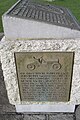 Gordon Bennett Race 1903, Plaque - geograph.org.uk - 5223091.jpg 1,488 × 2,240; 416 KB
-
 Grand Canal - Naas branch - geograph.org.uk - 626774.jpg 640 × 480; 100 KB
-

-

-
 Grand Canal east of Robertstown, Co. Kildare - geograph.org.uk - 2987660.jpg 1,024 × 768; 265 KB
-
 Grand Canal east of Robertstown, Co. Kildare - geograph.org.uk - 2987666.jpg 1,024 × 768; 262 KB
-
 Grand Canal east of Robertstown, Co. Kildare - geograph.org.uk - 2987671.jpg 1,024 × 768; 238 KB
-
 Grand Canal east of Sallins, Co. Kildare - geograph.org.uk - 2479023.jpg 640 × 480; 134 KB
-
 Grand Canal in Barrattstown, Co. Kildare - geograph.org.uk - 2479039.jpg 640 × 480; 135 KB
-
 Grand Canal in Barrettstown, Co. Kildare - geograph.org.uk - 2479036.jpg 640 × 480; 144 KB
-
 Grand Canal in Clonkeen, Co. Kildare - geograph.org.uk - 2500072.jpg 1,024 × 768; 237 KB
-
 Grand Canal in Clonkeen, Co. Kildare - geograph.org.uk - 2500076.jpg 640 × 480; 65 KB
-
 Grand Canal in Clonkeen, Co. Kildare - geograph.org.uk - 2500082.jpg 1,024 × 768; 260 KB
-
 Grand Canal in Downings South, Co. Kildare - geograph.org.uk - 2987631.jpg 768 × 1,024; 295 KB
-
 Grand Canal in Goatstown, Co. Kildare - geograph.org.uk - 2987615.jpg 1,024 × 768; 216 KB
-
 Grand Canal in Goatstown, Co. Kildare - geograph.org.uk - 2987624.jpg 1,024 × 768; 251 KB
-
 Grand Canal in Landenstown, Co. Kildare - geograph.org.uk - 2479099.jpg 640 × 480; 140 KB
-
 Grand Canal in Landenstown, Co. Kildare - geograph.org.uk - 2987606.jpg 1,024 × 768; 247 KB
-
 Grand Canal in Ticknevin, Co. Kildare - geograph.org.uk - 2500238.jpg 1,024 × 768; 236 KB
-
 Grand Canal Naas Branch, Lock No. 2 - geograph.org.uk - 1953985.jpg 640 × 480; 81 KB
-
 Grand Canal near Allenwood, Co. Kildare - geograph.org.uk - 2522194.jpg 1,024 × 768; 253 KB
-
 Grand Canal near Hamilton's Bridge, Co. Kildare - geograph.org.uk - 2500244.jpg 1,024 × 768; 237 KB
-
 Grand Canal near Ticknevin, Co. Kildare - geograph.org.uk - 2500097.jpg 1,024 × 768; 237 KB
-
 Grand Canal, Robertstown - geograph.org.uk - 5223173.jpg 2,240 × 1,488; 1.52 MB
-
 Grand Canal, Robertstown - geograph.org.uk - 5223179.jpg 2,240 × 1,488; 1.52 MB
-
 Grand Canal, Robertstown - geograph.org.uk - 5223185.jpg 2,240 × 1,488; 1.52 MB
-
 Grounds of St. John's Church of Ireland, Kill - geograph.org.uk - 3687065.jpg 2,592 × 1,936; 1.48 MB
-

-
 Heading Out Punchestown Ireland Black And White Street Photography (222228249).jpeg 2,000 × 1,125; 431 KB
-
 High Lodge - geograph.org.uk - 3293552.jpg 1,040 × 772; 613 KB
-
 HouseInKilkea.JPG 3,888 × 2,592; 6.21 MB
-
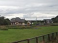 Houses near the River Morell - geograph.org.uk - 4102117.jpg 1,738 × 1,304; 417 KB
-
 Hyundai dealership, Naas - geograph.org.uk - 3682162.jpg 2,592 × 1,936; 1.24 MB
-
 IMG Curragh Racecourse from the Curragh.jpg 3,888 × 2,592; 2.86 MB
-
 IMG CurraghPlain.jpg 3,888 × 2,592; 3.57 MB
-
 Ireland - Plains of South Kildare.jpg 3,888 × 2,592; 3.03 MB
-
 Japanese gardens - geograph.org.uk - 413103.jpg 640 × 480; 133 KB
-
 Jigginstown House ruin, Co. Kildare (1) - geograph.org.uk - 5029819.jpg 640 × 427; 428 KB
-
 JoeGreen.JPG 2,665 × 2,313; 3.41 MB
-
 John and Andrew Fox's house, after eviction, Clongorey, Co.Kildare (37067412301).jpg 2,000 × 1,503; 1.74 MB
-
 Joinville Football Club.jpg 3,264 × 2,448; 1.59 MB
-
 Kathleen Lonsdale house Plaque.jpg 968 × 1,296; 212 KB
-
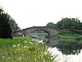
 Kellystown Bridge - geograph.org.uk - 3269558.jpg 568 × 640; 369 KB
-
 Kildare colours.PNG 200 × 100; 791 bytes
-
 Kildare couty arms.png 270 × 353; 68 KB
-
 Kildare Curragh wSigns.jpg 1,500 × 900; 321 KB
-
 Kildare-Wicklow Dáil constituency 1921-1923.png 728 × 928; 49 KB
-

-
-

-
 Liffey Weir at Straffen - geograph.org.uk - 3273159.jpg 640 × 510; 422 KB
-
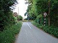
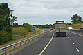
 Limerick Road, Naas - geograph.org.uk - 1537593.jpg 640 × 480; 61 KB
-

-

-

-
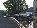
 Lock 17 - geograph.org.uk - 626528.jpg 640 × 480; 110 KB
-

-
-

-
 Loughlinstown Road - geograph.org.uk - 2436396.jpg 2,048 × 1,536; 1.37 MB
-
 Lullymore, County Kildare - geograph.org.uk - 1815666.jpg 3,888 × 2,592; 3.76 MB
-
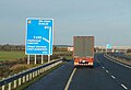
 M7 Motorway approaching Junction 9 - geograph.org.uk - 6070289.jpg 800 × 533; 561 KB
-
 M7 motorway IE.png 500 × 250; 11 KB
-
 M7 Motorway, Exit at Junction 10 - geograph.org.uk - 6070103.jpg 800 × 600; 585 KB
-
 M7 near Junction 10 - geograph.org.uk - 6070100.jpg 800 × 534; 517 KB
-
 M7, Junction 14 Services at Mayfield - geograph.org.uk - 5577280.jpg 4,000 × 3,000; 2.7 MB
-

-

-
 M8 motorway IE.png 500 × 250; 12 KB
-
 M9 crossing Greese River - geograph.org.uk - 6075705.jpg 800 × 533; 434 KB
-
 M9 merging with the M7 - geograph.org.uk - 6070075.jpg 800 × 534; 538 KB
-
 M9 motorway IE.png 500 × 250; 12 KB
-
 M9 Motorway passing LRI N29 - geograph.org.uk - 6076746.jpg 800 × 533; 419 KB
-
 M9 near Belan - geograph.org.uk - 6075962.jpg 800 × 533; 405 KB
-
 M9 near to Castledermot - geograph.org.uk - 6077407.jpg 800 × 533; 485 KB
-
 M9 Northbound at junction 4 - geograph.org.uk - 4800332.jpg 1,200 × 799; 265 KB
-
 M9 Northbound towards junction 4 - geograph.org.uk - 4800314.jpg 1,200 × 799; 270 KB
-
 M9 Northbound towards junction 4 - geograph.org.uk - 4800324.jpg 1,200 × 799; 277 KB
-
 M9 Northbound towards junction 4 - geograph.org.uk - 4800328.jpg 1,200 × 799; 284 KB
-
 M9 Northbound towards junction 4 - geograph.org.uk - 4800334.jpg 1,200 × 824; 247 KB
-
 M9 Northbound, Co Kildare - geograph.org.uk - 6069910.jpg 800 × 534; 480 KB
-
 M9nearCastledermot.JPG 3,888 × 2,592; 5.34 MB


_-_geograph.org.uk_-_1884770.jpg)
_-_geograph.org.uk_-_1884775.jpg)


_-_geograph.org.uk_-_5029009.jpg)
_-_geograph.org.uk_-_5029011.jpg)
_-_geograph.org.uk_-_2495140.jpg)
_-_geograph.org.uk_-_2495151.jpg)
_-_geograph.org.uk_-_2495162.jpg)

_-_geograph.org.uk_-_4074421.jpg)
_-_geograph.org.uk_-_4074425.jpg)
_-_geograph.org.uk_-_4074430.jpg)
_-_geograph.org.uk_-_4074440.jpg)
_-_geograph.org.uk_-_5029061.jpg)
_-_geograph.org.uk_-_5029066.jpg)
_-_geograph.org.uk_-_5029029.jpg)
_-_geograph.org.uk_-_5029031.jpg)
_-_geograph.org.uk_-_5029051.jpg)
_-_geograph.org.uk_-_5029056.jpg)
_-_geograph.org.uk_-_2494096.jpg)
_-_geograph.org.uk_-_2494108.jpg)
_(1)_-_geograph.org.uk_-_5029090.jpg)
_(10)_-_geograph.org.uk_-_5029120.jpg)
_(2)_-_geograph.org.uk_-_5029099.jpg)
_(3)_-_geograph.org.uk_-_5029103.jpg)
_(4)_-_geograph.org.uk_-_5029107.jpg)
_(5)_-_geograph.org.uk_-_5029109.jpg)
_(6)_-_geograph.org.uk_-_5029112.jpg)
_(7)_-_geograph.org.uk_-_5029114.jpg)
_(8)_-_geograph.org.uk_-_5029115.jpg)
_(9)_-_geograph.org.uk_-_5029118.jpg)
_-_geograph.org.uk_-_1952784.jpg)
_-_geograph.org.uk_-_1952792.jpg)
_-_geograph.org.uk_-_1952804.jpg)
,_Kildare_-_geograph.org.uk_-_5029078.jpg)

_-_geograph.org.uk_-_2494126.jpg)
_-_geograph.org.uk_-_2494135.jpg)
_-_Early_OS_map_(out_of_copyright).jpg)


.jpg)


.jpeg)


_-_geograph.org.uk_-_5029819.jpg)

.jpg)


_on_the_M7_-_geograph.org.uk_-_6070116.jpg)


