Category:County Clare
Jump to navigation
Jump to search
Counties of the Republic of Ireland: Carlow · Cavan · Clare · Cork(1) · Donegal · Dún Laoghaire-Rathdown(2) · Fingal(2) · Galway(3) · Kerry · Kildare · Kilkenny · Laois · Leitrim · Limerick · Longford · Louth · Mayo · Meath · Monaghan · Offaly · Roscommon · Sligo · South Dublin(2) · Tipperary(4) · Waterford · Westmeath · Wexford · Wicklow – Separate cities: Cork(1) · Dublin(2) · Galway(3) – Former counties: Dublin(2) · South Tipperary(4) Former counties of Northern Ireland: Antrim · Armagh · Down · Fermanagh · Londonderry · Tyrone
county in Ireland    | |||||
| Upload media | |||||
| Instance of | |||||
|---|---|---|---|---|---|
| Location |
| ||||
| Capital | |||||
| Legislative body |
| ||||
| Executive body |
| ||||
| Population |
| ||||
| Area |
| ||||
| official website | |||||
 | |||||
Subcategories
This category has the following 20 subcategories, out of 20 total.
A
- Athlunkard (3 F)
C
- Countryside in County Clare (24 F)
E
G
H
K
- Kilnamona (14 F)
M
N
P
- Post boxes in County Clare (6 F)
S
T
Media in category "County Clare"
The following 200 files are in this category, out of 1,985 total.
(previous page) (next page)-
 "Dolmen" at Tullagh Lower - geograph.org.uk - 3567130.jpg 640 × 480; 66 KB
-
 "No swimming" - geograph.org.uk - 5525962.jpg 480 × 640; 302 KB
-
 "Respect your water" - geograph.org.uk - 5525706.jpg 480 × 640; 335 KB
-

-

-
 "Vision's of Ireland" - geograph.org.uk - 1844053.jpg 640 × 426; 201 KB
-

-

-
 1km to Junction6, N18 - geograph.org.uk - 5981923.jpg 1,024 × 471; 83 KB
-
 20120817 04 Ireland - Co. Clare - Broadford (7957910996).jpg 3,648 × 2,736; 1,019 KB
-
 20120817 12 Ireland - Co. Clare - Ballyvaughan (7957909914).jpg 3,648 × 2,736; 1.5 MB
-
 2result1 (10597649523).jpg 4,288 × 2,848; 4.18 MB
-
 3 Cows.jpg 14,999 × 10,715; 52.39 MB
-
 3 Shots On Shannon Estary Ii (190459433).jpeg 2,048 × 987; 381 KB
-
 3 Shots On Shannon Estray I (190456141).jpeg 2,048 × 986; 382 KB
-
 3 Shots On Shannon Estray Iii (190461365).jpeg 2,048 × 979; 331 KB
-

-

-
 A damp day on the N68 - geograph.org.uk - 5929337.jpg 1,024 × 696; 84 KB
-
 A damp start on the Burren Way^ - geograph.org.uk - 4933225.jpg 2,592 × 1,944; 1.71 MB
-
 A field beside the R487 - geograph.org.uk - 4947870.jpg 2,592 × 1,944; 1.74 MB
-
 A field in the Burren - geograph.org.uk - 3592180.jpg 2,592 × 1,936; 1.88 MB
-
 A grey day in County Clare - geograph.org.uk - 4679263.jpg 4,320 × 2,313; 1.83 MB
-
 A journey through shannon river to atlantic,kilkee cliffs - panoramio (3).jpg 3,888 × 2,592; 2.9 MB
-
 A journey through shannon river to atlantic. - panoramio.jpg 3,888 × 2,592; 2.47 MB
-
 A pink house - geograph.org.uk - 5949051.jpg 1,024 × 629; 114 KB
-
 A rather unexciting field - geograph.org.uk - 4680153.jpg 4,320 × 3,240; 3.7 MB
-
 A rural view from the R463 road - geograph.org.uk - 2624342.jpg 1,024 × 686; 232 KB
-
 A temporary long way round - geograph.org.uk - 3685450.jpg 1,024 × 683; 105 KB
-
 A wet day on the N68, Darragh - geograph.org.uk - 5929324.jpg 1,024 × 667; 88 KB
-
 A wet day, N68 - geograph.org.uk - 5929382.jpg 962 × 737; 196 KB
-

-
 Abandoned factory at Cloondrinagh - geograph.org.uk - 1872777.jpg 640 × 427; 180 KB
-
 Access to R1772 - geograph.org.uk - 1843997.jpg 640 × 427; 213 KB
-
 Across the square - geograph.org.uk - 1844472.jpg 640 × 427; 204 KB
-
 Across to Aughinish Island - geograph.org.uk - 4683828.jpg 4,000 × 3,000; 2.67 MB
-
 Adelphi House - geograph.org.uk - 4535146.jpg 640 × 480; 65 KB
-
 Ailie River - geograph.org.uk - 3566570.jpg 640 × 480; 127 KB
-
 Aille River - geograph.org.uk - 3566572.jpg 640 × 480; 127 KB
-
 Aille River - geograph.org.uk - 3566751.jpg 640 × 480; 108 KB
-
 Aille River - geograph.org.uk - 3566753.jpg 640 × 480; 138 KB
-
 Aille River valley - geograph.org.uk - 5962414.jpg 1,024 × 681; 141 KB
-
 Aillnagroagh Cliffs - geograph.org.uk - 5814104.jpg 640 × 480; 144 KB
-
 Air Lingus cargo - geograph.org.uk - 1873884.jpg 640 × 427; 224 KB
-
 Airport perimeter gate - geograph.org.uk - 1874071.jpg 640 × 428; 223 KB
-
 Ali G - geograph.org.uk - 5943060.jpg 1,024 × 681; 156 KB
-
 Alone with a crow - geograph.org.uk - 2175322.jpg 427 × 640; 211 KB
-
 Along the Flaggy Shore - geograph.org.uk - 4680219.jpg 4,320 × 3,240; 4.19 MB
-
 Along the L1014 - geograph.org.uk - 3587055.jpg 2,592 × 1,936; 2.22 MB
-
 Alternative fuel at Booltiagh - geograph.org.uk - 1844463.jpg 640 × 427; 208 KB
-
 Amazing limestone outcrops - geograph.org.uk - 4695678.jpg 4,000 × 2,000; 1.79 MB
-
 An Branán Mór - geograph.org.uk - 3566889.jpg 480 × 640; 100 KB
-
 An Branán Mór - geograph.org.uk - 4261864.jpg 530 × 800; 508 KB
-
 An Branán Mór - geograph.org.uk - 4262004.jpg 800 × 530; 594 KB
-
 An Chathair Mhór, Cahermore - geograph.org.uk - 3612833.jpg 640 × 480; 120 KB
-
 Animal pens at Ing West - geograph.org.uk - 1876356.jpg 640 × 426; 199 KB
-
 Annagh - geograph.org.uk - 1471999.jpg 640 × 457; 165 KB
-
 Another last resting place - geograph.org.uk - 1831553.jpg 640 × 427; 197 KB
-
 Antonow-załadunek. - panoramio.jpg 1,600 × 1,200; 324 KB
-
 Approach to Junction 11 of the N18 near to Ballygireen - geograph.org.uk - 2545102.jpg 2,089 × 1,567; 795 KB
-
 Approaching Boolinrudda - geograph.org.uk - 1840408.jpg 640 × 427; 234 KB
-
 Approaching Clooneenagh Cross - geograph.org.uk - 4946612.jpg 2,592 × 1,944; 1.35 MB
-
 Approaching Inagh - geograph.org.uk - 1849604.jpg 640 × 426; 145 KB
-
 Approaching the end of the R480 - geograph.org.uk - 5974989.jpg 1,024 × 620; 156 KB
-
 Approaching the main road - geograph.org.uk - 2181283.jpg 640 × 427; 234 KB
-
 Approaching the R483 - geograph.org.uk - 4946100.jpg 2,592 × 1,944; 1.3 MB
-
 Archaeological dig at Caherconnell - geograph.org.uk - 3567543.jpg 640 × 480; 112 KB
-
 Arched doorway to St Caimin's Church - geograph.org.uk - 5528137.jpg 480 × 640; 348 KB
-

-

-
 Ardcroney Church - geograph.org.uk - 4299448.jpg 800 × 530; 598 KB
-
 Ash tree at Cottage Cross - geograph.org.uk - 2020104.jpg 2,000 × 1,500; 1.73 MB
-
 Back road to Ennistimon - geograph.org.uk - 4681822.jpg 3,240 × 4,320; 5.22 MB
-
 Ballingady West - geograph.org.uk - 5949049.jpg 1,024 × 846; 147 KB
-
 Ballyallia Lough - geograph.org.uk - 4677456.jpg 4,000 × 3,000; 2.1 MB
-
 Ballybeg Shrine with new stone work - geograph.org.uk - 4829591.jpg 361 × 640; 35 KB
-
 Ballycorick Bridge - geograph.org.uk - 1863530.jpg 640 × 427; 169 KB
-
 Ballycorick Creek - geograph.org.uk - 2178967.jpg 640 × 427; 192 KB
-
 Ballycorick Creek - geograph.org.uk - 2178973.jpg 640 × 426; 206 KB
-

-

-

-

-
 Ballyellery - geograph.org.uk - 5949076.jpg 1,024 × 767; 128 KB
-
 Ballyganner Castle, Site of - geograph.org.uk - 2333899.jpg 512 × 640; 135 KB
-
 Ballyvaghan - Plants along Sea Wall near Oceanville B^B - geograph.org.uk - 3771695.jpg 3,008 × 1,525; 4.05 MB
-
 Ballyvaghan Pier - Wild Plant, Stones ^ Water - geograph.org.uk - 3771737.jpg 1,917 × 1,916; 3.11 MB
-
 Ballyvaughan Bay - geograph.org.uk - 4932183.jpg 2,592 × 1,944; 1.73 MB
-
 Ballyvaughan community hall - geograph.org.uk - 5527912.jpg 4,093 × 3,069; 2.53 MB
-
 Ballyvaughan Harbour - geograph.org.uk - 1942639.jpg 1,952 × 2,608; 831 KB
-
 Ballyvaughan Harbour - geograph.org.uk - 4297742.jpg 800 × 530; 418 KB
-
 Ballyvaughan Harbour - geograph.org.uk - 4297746.jpg 800 × 530; 409 KB
-
 Ballyvaughan Quay - geograph.org.uk - 4932173.jpg 2,592 × 1,944; 1.79 MB
-
 Bandstand, Kilkee - geograph.org.uk - 5943040.jpg 1,024 × 681; 130 KB
-
 Bandstand, Kilkee - geograph.org.uk - 5943056.jpg 1,024 × 681; 110 KB
-
 Barn and silo at Ardeamush - geograph.org.uk - 3566555.jpg 640 × 480; 114 KB
-
 Barn by R480 - geograph.org.uk - 5966941.jpg 1,024 × 589; 98 KB
-
 Barn by R480 - geograph.org.uk - 5970102.jpg 1,024 × 487; 58 KB
-
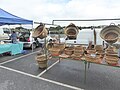 Basket maker at Killaloe Farmers Market - geograph.org.uk - 5526006.jpg 640 × 480; 261 KB
-
 Bathers by the Shannon at Doonass - geograph.org.uk - 2020149.jpg 3,648 × 2,736; 4.47 MB
-
 Beach at Carricknola - geograph.org.uk - 4682403.jpg 4,320 × 3,240; 2.22 MB
-
 Beach at Spanish Point, West Clare - geograph.org.uk - 4686374.jpg 640 × 427; 61 KB
-
 Beautiful day in the Burren - geograph.org.uk - 5587009.jpg 1,536 × 2,048; 1.78 MB
-

-
 Ben Dash transmitter - geograph.org.uk - 1851617.jpg 428 × 640; 163 KB
-
 Best to heed the warning sign - geograph.org.uk - 4695541.jpg 4,000 × 3,000; 2.56 MB
-
 Big hole on the coast - geograph.org.uk - 1828570.jpg 427 × 640; 239 KB
-
 Big pit, Caherconnell - geograph.org.uk - 5969926.jpg 1,024 × 681; 298 KB
-

-
 Binroe Castle, Site of - geograph.org.uk - 2334151.jpg 512 × 640; 39 KB
-
 Bishop's Island - geograph.org.uk - 4688690.jpg 4,278 × 3,182; 2.03 MB
-
 Bishop's Quarter Beach - geograph.org.uk - 6121867.jpg 5,184 × 3,888; 6.03 MB
-
 Black Head lighthouse - geograph.org.uk - 4683841.jpg 3,000 × 4,000; 2.27 MB
-
 Black Hill looking north.JPG 1,632 × 1,224; 483 KB
-
 Black Hill, between Moy and Milltown Malbay.JPG 1,632 × 1,224; 221 KB
-
 Boardwalk leading to SE summit of Moylussa - view E - geograph.org.uk - 5611745.jpg 5,184 × 2,920; 6.53 MB
-
 Boat at Crovraghan Pier - geograph.org.uk - 1864437.jpg 640 × 427; 229 KB
-

-
 Boats at Mountshannon - geograph.org.uk - 5528473.jpg 640 × 480; 213 KB
-
 Boats at the old pier, Ballyvaughan, Co. Clare - geograph.org.uk - 3062357.jpg 1,024 × 676; 130 KB
-
 Boats in Kincora Harbour, Killaloe, Co. Clare - geograph.org.uk - 2725471.jpg 1,024 × 675; 225 KB
-
 Boleybeg Lough - geograph.org.uk - 1845656.jpg 640 × 428; 202 KB
-
 Breaghva Bridge - geograph.org.uk - 1872811.jpg 640 × 426; 217 KB
-
 Bridge over the M18 - geograph.org.uk - 5981945.jpg 1,024 × 681; 91 KB
-
 Bridge over the M18 - geograph.org.uk - 5981955.jpg 1,024 × 547; 90 KB
-
 Bridge, L2002 - geograph.org.uk - 5940150.jpg 1,024 × 681; 129 KB
-

-
 Buildings associated with Loop Head Lighthouse - geograph.org.uk - 5940276.jpg 1,024 × 572; 111 KB
-
 Bullaun stones on Inis Cealtra - geograph.org.uk - 5528123.jpg 640 × 481; 390 KB
-
 Bungalow and stone barns at Caherkinalia - geograph.org.uk - 3566569.jpg 640 × 480; 110 KB
-
 Bungalow at Cloghaun - geograph.org.uk - 3584436.jpg 640 × 480; 100 KB
-
 Bungalows at Drummin - geograph.org.uk - 4681876.jpg 4,320 × 2,160; 1.9 MB
-
 Bunratty Castle - geograph.org.uk - 5738167.jpg 3,672 × 4,896; 5.21 MB
-
 Bunratty House in the Folk Park - geograph.org.uk - 5951026.jpg 2,000 × 1,500; 1.06 MB
-

-

-
 Burren - Huge Home along R480 - geograph.org.uk - 3773117.jpg 2,923 × 1,869; 3.42 MB
-

-

-
 Burren - Poulnabrone Dolmen - Distant View from Path - geograph.org.uk - 3772615.jpg 2,000 × 2,000; 3.41 MB
-
 Burren - Poulnabrone Dolmen - View to Northeast - geograph.org.uk - 3772649.jpg 2,560 × 1,707; 3.71 MB
-
 Burren - Poulnabrone Dolmen - View to Northwest - geograph.org.uk - 3772624.jpg 2,560 × 1,707; 3.81 MB
-
 Burren - Poulnabrone Dolmen Area - Celtic Designer - geograph.org.uk - 3773113.jpg 1,793 × 2,965; 3.17 MB
-
-
 Burren - Poulnabrone Dolmen Area - Colourful Stone Wall - geograph.org.uk - 3772552.jpg 2,703 × 1,802; 5.46 MB
-

-

-

-

-

-

-
-

-
 Burren - R480 - Stone Wall at Sharp Turn in R480 - geograph.org.uk - 3772467.jpg 3,008 × 1,763; 5.32 MB
-
 Burren - Stone Wall at Poulnabrone Dolmen Parking Area - geograph.org.uk - 3772493.jpg 2,838 × 1,892; 4.45 MB
-
 Burren Cottages along N67 just north of Bealaglugga - geograph.org.uk - 3770629.jpg 2,132 × 1,421; 2.04 MB
-
-
 Burren karst meadow landscape - geograph.org.uk - 2554946.jpg 3,596 × 2,341; 1.53 MB
-
 Burren landscape - geograph.org.uk - 3611981.jpg 640 × 480; 134 KB
-
 Burren landscape - geograph.org.uk - 3611982.jpg 640 × 480; 115 KB
-
 Burren landscape - geograph.org.uk - 3612821.jpg 640 × 480; 127 KB
-
 Burren landscape - geograph.org.uk - 3612822.jpg 640 × 480; 137 KB
-
 Burren landscape - geograph.org.uk - 3613797.jpg 640 × 480; 109 KB
-
 Burren landscape - geograph.org.uk - 4683786.jpg 4,000 × 3,000; 2.44 MB
-
 Burren landscape at Carroweragh - geograph.org.uk - 3566587.jpg 640 × 480; 79 KB
-
 Burren Scenery - HDR (10294282015).jpg 1,800 × 1,200; 1.4 MB
-
 Burren Walking Centre - geograph.org.uk - 3601741.jpg 2,592 × 1,936; 1.56 MB
-
 Burren Way plan - geograph.org.uk - 4932178.jpg 2,592 × 1,944; 1.42 MB
-
 Bus stop at Parkroe - geograph.org.uk - 2028763.jpg 2,000 × 1,497; 1.92 MB
-
 Bush walks with Bertie Ahern and Romano Prodi in Ireland.jpg 514 × 347; 66 KB
-
 By the N67 on a bend - geograph.org.uk - 5943762.jpg 1,024 × 575; 82 KB
-
 Byre dwelling, Bunratty Folk Park - geograph.org.uk - 5951095.jpg 2,000 × 1,500; 1.09 MB
-
 Byrnes, Ennistymon - geograph.org.uk - 5949023.jpg 1,024 × 573; 115 KB
-
 Caher River - geograph.org.uk - 4680266.jpg 4,320 × 3,240; 3.88 MB
-
 Caher River - geograph.org.uk - 4680267.jpg 4,320 × 3,240; 2.86 MB
-
 Caher valley at Derrynavagh - geograph.org.uk - 68060.jpg 640 × 427; 105 KB
-
 Cahercloggaun Tower House, Site of - geograph.org.uk - 2333713.jpg 512 × 640; 150 KB
-
 Cahercommaun Fort - geograph.org.uk - 5967131.jpg 1,024 × 681; 158 KB
-
 Cahercommaun Fort - geograph.org.uk - 5967136.jpg 1,024 × 681; 220 KB
-
 Cahercommaun Fort - geograph.org.uk - 5967198.jpg 1,024 × 681; 182 KB
-
 Cahercommaun Fort - geograph.org.uk - 5967206.jpg 1,024 × 681; 176 KB
-
 Cahercommaun Ringfort - geograph.org.uk - 6100849.jpg 1,024 × 768; 230 KB
-
 Cahercommaun turning, Tullycommon - geograph.org.uk - 5966997.jpg 1,024 × 681; 169 KB
-
 Caherconnell - geograph.org.uk - 5969909.jpg 1,024 × 681; 160 KB
-
 Caherconnell Fort - geograph.org.uk - 5969928.jpg 1,024 × 681; 222 KB
-
 Caherconnell Fort - geograph.org.uk - 5969956.jpg 1,024 × 681; 241 KB
-
 Caherconnell Fort - geograph.org.uk - 6121840.jpg 5,184 × 3,888; 7.65 MB
-
 Caherconnell Ringfort - geograph.org.uk - 6100855.jpg 1,024 × 768; 205 KB
-
 Cahermacnaughten - geograph.org.uk - 3567335.jpg 640 × 480; 98 KB
-
 Caherogan River - geograph.org.uk - 1830001.jpg 640 × 426; 207 KB
-
 Caherrush Tower House, Site of - geograph.org.uk - 2342057.jpg 640 × 512; 107 KB
-
 Cahiracon Quay - geograph.org.uk - 1864492.jpg 640 × 427; 205 KB
-
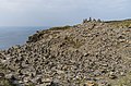
 Cairns, Cliffs of Moher - geograph.org.uk - 4261872.jpg 800 × 530; 513 KB
-
 Cairns, Cliffs of Moher - geograph.org.uk - 4261900.jpg 800 × 530; 554 KB
-
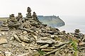
 Cairns, Cliffs of Moher - geograph.org.uk - 4261903.jpg 800 × 530; 475 KB
-
 Caiseal Óir - geograph.org.uk - 4301816.jpg 800 × 530; 502 KB
-
 Canal at Killaloe - geograph.org.uk - 5141788.jpg 2,000 × 1,333; 1.12 MB
-
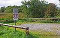
 Car park at Knockaphort Pier, Co. Clare - geograph.org.uk - 3529312.jpg 1,024 × 674; 295 KB
-
-
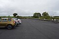 Car park, Caherconnell - geograph.org.uk - 5969908.jpg 1,024 × 681; 98 KB


.jpg)
.jpg)
.jpg)

.jpeg)
.jpeg)
.jpeg)


.jpg)


,_Livestock_in_Field_below_surrounded_by_Stone_Walls_-_geograph.org.uk_-_3770619.jpg)


.jpg)


_-_geograph.org.uk_-_3077408.jpg)