Category:County Mayo
Jump to navigation
Jump to search
Counties of the Republic of Ireland: Carlow · Cavan · Clare · Cork(1) · Donegal · Dún Laoghaire-Rathdown(2) · Fingal(2) · Galway(3) · Kerry · Kildare · Kilkenny · Laois · Leitrim · Limerick · Longford · Louth · Mayo · Meath · Monaghan · Offaly · Roscommon · Sligo · South Dublin(2) · Tipperary(4) · Waterford · Westmeath · Wexford · Wicklow – Separate cities: Cork(1) · Dublin(2) · Galway(3) – Former counties: Dublin(2) · South Tipperary(4) Former counties of Northern Ireland: Antrim · Armagh · Down · Fermanagh · Londonderry · Tyrone
county in Ireland     | |||||
| Upload media | |||||
| Instance of | |||||
|---|---|---|---|---|---|
| Location |
| ||||
| Capital | |||||
| Legislative body |
| ||||
| Executive body |
| ||||
| Population |
| ||||
| Area |
| ||||
| Different from | |||||
| official website | |||||
 | |||||
Subcategories
This category has the following 23 subcategories, out of 23 total.
A
B
C
- Cemeteries in County Mayo (8 F)
- Countryside in County Mayo (28 F)
G
H
M
- Murrisk Loop (8 F)
N
P
- Post boxes in County Mayo (3 F)
R
S
T
W
Media in category "County Mayo"
The following 200 files are in this category, out of 1,783 total.
(previous page) (next page)-
 Flag of county Mayo.svg 600 × 300; 213 bytes
-
 "Blowhole", Dun na mBo-Doonamo Point - geograph.org.uk - 1855582.jpg 640 × 480; 74 KB
-
 "Mansion" at Oilligh - geograph.org.uk - 1854935.jpg 640 × 480; 84 KB
-
 "The Beehive", Annagh Head - geograph.org.uk - 1855554.jpg 640 × 480; 104 KB
-
 "The struggle goes on" - geograph.org.uk - 1853305.jpg 640 × 480; 72 KB
-
 "Wind trees", Muingelly - geograph.org.uk - 1881642.jpg 640 × 480; 148 KB
-
 'Fairy Fort', Garrynagran - geograph.org.uk - 1816582.jpg 640 × 480; 86 KB
-
-

-

-
 0493 shellhq 18may.jpg 796 × 427; 75 KB
-
 20120819 24 Ireland - Co. Mayo - Enriff River (7961572560).jpg 3,648 × 2,736; 1.3 MB
-
 20120819 29 Ireland - Co. Mayo - Carrowkennedy (7961571460).jpg 3,648 × 2,736; 765 KB
-
 20120819 45 Ireland - Co. Mayo - Westport Harbour (7961570802).jpg 3,648 × 2,736; 1.08 MB
-
 20120819 48 Ireland - Co. Mayo - Westport Harbour (7961569762).jpg 3,648 × 2,736; 877 KB
-
 20120819 52 Ireland - Co. Mayo - Westport Harbour (7961568970).jpg 3,648 × 2,736; 954 KB
-
 20120820 10 Ireland - Co. Mayo - Lough Cullin (7961568210).jpg 3,648 × 2,736; 889 KB
-
 20120820 11 Ireland - Co. Mayo - Lough Conn (7961567404).jpg 3,648 × 2,736; 911 KB
-
 20120820 20 Ireland - Co. Mayo going to Co. Sligo (7961566524).jpg 3,648 × 2,736; 1.39 MB
-
 20120820 21 Ireland - Co. Mayo going to Co. Sligo (7961565312).jpg 3,648 × 2,736; 1.16 MB
-
 2013.07.08-1B.Prebaun.jpg 3,648 × 2,736; 4.32 MB
-
 Flag of County Mayo.jpg 1,920 × 1,080; 559 KB
-
 A 'do-er-upper' at Dooega - geograph.org.uk - 5115139.jpg 640 × 480; 180 KB
-
 A bend in the R312, Beltra - geograph.org.uk - 3087020.jpg 640 × 480; 256 KB
-
 A bit of history - geograph.org.uk - 4961641.jpg 4,000 × 2,664; 4.09 MB
-

-
 A farm track - geograph.org.uk - 3084524.jpg 640 × 360; 195 KB
-
 A fresh batch - geograph.org.uk - 3989002.jpg 4,000 × 2,664; 2.24 MB
-
 A grey day in Doolough - geograph.org.uk - 5997525.jpg 1,024 × 547; 77 KB
-

-
 A lane near Louisburgh - geograph.org.uk - 4892175.jpg 1,920 × 1,080; 658 KB
-
 A lane near Louisburgh - geograph.org.uk - 4892189.jpg 1,920 × 1,080; 637 KB
-

-
 A little lake - geograph.org.uk - 3982719.jpg 4,000 × 2,664; 2.6 MB
-
 A minor crossroads near Valley - geograph.org.uk - 4077768.jpg 2,592 × 1,944; 1.41 MB
-
 A minor road heading north from Achill - geograph.org.uk - 5109645.jpg 640 × 480; 153 KB
-
 A minor road to Keel - geograph.org.uk - 5112348.jpg 640 × 480; 127 KB
-
 A misty day on the Partry Mountains - geograph.org.uk - 6007896.jpg 1,024 × 612; 89 KB
-
 A nondescript road near Knock Airport - geograph.org.uk - 5110574.jpg 640 × 480; 158 KB
-
 A pasture with a view - geograph.org.uk - 3987224.jpg 1,024 × 674; 99 KB
-
 A path above Keem Strand - geograph.org.uk - 5110610.jpg 480 × 640; 155 KB
-
 A pattern of peat - geograph.org.uk - 4963872.jpg 4,000 × 2,664; 2.84 MB
-

-
 A prospect of Lough Mask - geograph.org.uk - 2412233.jpg 640 × 480; 80 KB
-

-
 A quiet lane - geograph.org.uk - 3982620.jpg 4,000 × 2,664; 2.99 MB
-
 A road in Killavally-Killawalla - geograph.org.uk - 2557675.jpg 1,024 × 764; 161 KB
-
 A road in Killavally-Killawalla - geograph.org.uk - 2557736.jpg 1,024 × 768; 153 KB
-
 A road junction - geograph.org.uk - 5803060.jpg 640 × 360; 75 KB
-
 A scene at Aghareville - geograph.org.uk - 4082761.jpg 2,592 × 1,944; 1.16 MB
-
 A small Irishism - geograph.org.uk - 5525599.jpg 4,320 × 3,240; 4.16 MB
-
 A small river, Knockbaun - geograph.org.uk - 3087092.jpg 640 × 480; 294 KB
-
 A small stream nears the sea - geograph.org.uk - 4077760.jpg 2,592 × 1,944; 1.24 MB
-

-
 A striking modern bungalow at Raigh - geograph.org.uk - 2443074.jpg 640 × 480; 80 KB
-
 A very fine sheep - geograph.org.uk - 2412213.jpg 640 × 480; 146 KB
-

-
 A View from Croagh Patrick Mountain,Westport,Co.Mayo,Ireland - panoramio.jpg 3,888 × 2,592; 2.17 MB
-
 A view from Mweelin - geograph.org.uk - 5113919.jpg 640 × 480; 141 KB
-
 A view of Lough Feeagh in Co. Mayo - geograph.org.uk - 4242134.jpg 1,024 × 768; 250 KB
-
 A view of some of Nephin - Neifinn - geograph.org.uk - 3085398.jpg 640 × 360; 186 KB
-
 A view south from Dookinelly - geograph.org.uk - 5113853.jpg 640 × 480; 139 KB
-

-

-
 A worked peat bog south of Croagh Patrick - geograph.org.uk - 2521886.jpg 1,024 × 768; 98 KB
-
 Aasleagh - geograph.org.uk - 3483961.jpg 634 × 426; 58 KB
-
 Aasleagh Falls - geograph.org.uk - 3982340.jpg 2,664 × 4,000; 4.22 MB
-
 Aasleagh Falls - geograph.org.uk - 4895270.jpg 1,920 × 1,080; 665 KB
-
 Aasleagh Falls - geograph.org.uk - 5525585.jpg 4,320 × 3,240; 3.05 MB
-
 Aasleagh Falls in 1985 - geograph.org.uk - 2857762.jpg 780 × 527; 87 KB
-
 Aasleagh Falls in Spate - geograph.org.uk - 2779138.jpg 640 × 480; 395 KB
-
 Aasleagh Falls on the Wild Atlantic Way - geograph.org.uk - 5525557.jpg 3,240 × 4,320; 2.58 MB
-
 Abandoned building - geograph.org.uk - 5115165.jpg 640 × 480; 150 KB
-
 Abandoned cottage - geograph.org.uk - 3264010.jpg 640 × 480; 76 KB
-

-

-
 Abandoned house at Carrownagreggaun - geograph.org.uk - 2414952.jpg 640 × 480; 111 KB
-
 Abandoned potato ridges - geograph.org.uk - 5802993.jpg 640 × 427; 96 KB
-
 Abandoned potato ridges near Devlin - geograph.org.uk - 5803323.jpg 640 × 360; 112 KB
-
 Abhainn Dubh - geograph.org.uk - 1878787.jpg 640 × 420; 37 KB
-
 Above Lough Nafooey - geograph.org.uk - 4324720.jpg 800 × 530; 469 KB
-
 Access road to National Park Centre - geograph.org.uk - 5808227.jpg 640 × 480; 116 KB
-
 Achill Bridge on an overcast day - geograph.org.uk - 5015055.jpg 4,032 × 3,024; 2.29 MB
-
 Achill Henge - geograph.org.uk - 4235449.jpg 1,024 × 422; 98 KB
-
 Achill Island Looking out to Ashlean Bay - geograph.org.uk - 4679281.jpg 1,632 × 918; 257 KB
-
 Achill Sound bus services - geograph.org.uk - 5110533.jpg 3,888 × 5,184; 5.34 MB
-
 Achillbeg Island from Achill - geograph.org.uk - 4077827.jpg 2,592 × 1,944; 1.2 MB
-
 Achillbeg Lighthouse.jpg 640 × 427; 360 KB
-

-
 Across the Owenmore River - geograph.org.uk - 4084979.jpg 2,592 × 1,944; 1.32 MB
-
 Adding to the lough - geograph.org.uk - 5525546.jpg 3,240 × 4,320; 5.15 MB
-
 Aerialblue9.jpg 1,708 × 1,152; 1.44 MB
-
 Against the dumpers - geograph.org.uk - 3284471.jpg 640 × 480; 215 KB
-
 Aghamore graveyard - geograph.org.uk - 4058384.jpg 2,592 × 1,944; 1.71 MB
-
 Aille River at Arderry Btrdge - geograph.org.uk - 2443725.jpg 640 × 480; 120 KB
-
 Aille River at Sraheen - geograph.org.uk - 2443454.jpg 640 × 480; 110 KB
-
 Aillie River at Gleenagashleeny - geograph.org.uk - 2427367.jpg 640 × 480; 112 KB
-
 All your farming needs - geograph.org.uk - 4962711.jpg 4,000 × 2,664; 4.43 MB
-

-
 Along the Greenway - geograph.org.uk - 4479151.jpg 2,664 × 4,000; 4.69 MB
-
 Along the N5 - geograph.org.uk - 3989015.jpg 4,000 × 2,664; 1.92 MB
-
 Along the quay, Ballina - geograph.org.uk - 6217238.jpg 1,024 × 685; 450 KB
-
 Along the R 335 - geograph.org.uk - 3987212.jpg 4,000 × 2,664; 2.64 MB
-
 Along the R314 Road at Rathglass East - geograph.org.uk - 2543694.jpg 999 × 564; 242 KB
-
 Altar stone - geograph.org.uk - 4961621.jpg 2,664 × 4,000; 5.72 MB
-
 Altar stone at Carrowkeel - geograph.org.uk - 2414087.jpg 640 × 480; 112 KB
-
 An Cheibh Bheag on the Wild Atlantic Way - geograph.org.uk - 5522788.jpg 3,240 × 4,320; 2.13 MB
-
-
 Angler's loo - geograph.org.uk - 1852339.jpg 640 × 480; 118 KB
-
 Another ruin - geograph.org.uk - 5522800.jpg 4,320 × 3,240; 3.39 MB
-
 Another traffic hold-up along the N59 - geograph.org.uk - 6217174.jpg 1,024 × 686; 329 KB
-
 Approach to Knock airport, 2003 - geograph.org.uk - 3164342.jpg 640 × 423; 42 KB
-
 Approaching a T Junction - geograph.org.uk - 5803022.jpg 640 × 427; 86 KB
-
 Approaching a T Junction - geograph.org.uk - 5803030.jpg 640 × 427; 83 KB
-
 Approaching Ballyhaunis - geograph.org.uk - 4482217.jpg 4,000 × 2,664; 4.62 MB
-
 Approaching Dooagh - geograph.org.uk - 5112043.jpg 640 × 480; 174 KB
-
 Approaching Newport - geograph.org.uk - 4479154.jpg 4,000 × 2,664; 6.78 MB
-
 Approaching Shrule Turlough - geograph.org.uk - 4746377.jpg 3,264 × 2,448; 3.27 MB
-
 Approaching the top of Nephin from the SW - geograph.org.uk - 5221403.jpg 5,184 × 2,920; 5.11 MB
-
 Approaching Westport - geograph.org.uk - 4477562.jpg 4,000 × 2,664; 3.09 MB
-
 Approaching Westport - geograph.org.uk - 4477580.jpg 4,000 × 2,664; 3.71 MB
-
 Archway at Burriscarra Friary - geograph.org.uk - 2410675.jpg 480 × 640; 124 KB
-
 Arm of Tullaghan Bay - geograph.org.uk - 1879022.jpg 640 × 480; 85 KB
-
 Arm of Tullaghan Bay - geograph.org.uk - 1879026.jpg 640 × 480; 112 KB
-
 Arrested development, Monamore - geograph.org.uk - 3285393.jpg 640 × 480; 247 KB
-
 Art in the landscape - geograph.org.uk - 3980441.jpg 4,000 × 2,664; 2.46 MB
-
 Ascending the eastern ridge of Slievemore, Achill Island - geograph.org.uk - 5609601.jpg 5,184 × 2,920; 5.13 MB
-
 Ashford Castle, Irland.jpg 2,735 × 1,823; 1.67 MB
-

-
 At Blacksod Point - geograph.org.uk - 1855161.jpg 640 × 480; 90 KB
-
 At ease - geograph.org.uk - 5408118.jpg 4,608 × 3,456; 7.4 MB
-

-
 Bachelors Walk, Ballina - geograph.org.uk - 6215658.jpg 1,024 × 685; 403 KB
-
 Back Road - geograph.org.uk - 3982602.jpg 4,000 × 2,664; 3.08 MB
-

-
 Balally House - geograph.org.uk - 2428113.jpg 640 × 480; 120 KB
-
 Ballinloughaun - geograph.org.uk - 3085385.jpg 640 × 480; 258 KB
-
 Ballinloughaun - geograph.org.uk - 3085389.jpg 640 × 360; 196 KB
-
 Ballinloughaun - geograph.org.uk - 3085390.jpg 640 × 360; 207 KB
-
 Ballintubber Abbey - geograph.org.uk - 4966055.jpg 4,000 × 2,664; 3.13 MB
-
 Ballycroy - geograph.org.uk - 5808225.jpg 640 × 427; 109 KB
-
 Ballycroy National Park Centre - geograph.org.uk - 4973040.jpg 3,249 × 1,984; 1.03 MB
-
 Ballycurrin light house - geograph.org.uk - 3068773.jpg 1,024 × 768; 141 KB
-
 Ballycurrin Lighthouse - a lake lighthouse - geograph.org.uk - 4778105.jpg 2,048 × 1,536; 233 KB
-
 Ballyglass Bridge over the N5 - geograph.org.uk - 2722572.jpg 1,024 × 592; 111 KB
-
 Ballyglass Harbour - geograph.org.uk - 1880779.jpg 640 × 480; 89 KB
-
 BangorErrisChurch.jpg 960 × 720; 121 KB
-

-
 Barn at Ballynaglea - geograph.org.uk - 2414980.jpg 640 × 480; 125 KB
-
 Barn at Carrowslattery - geograph.org.uk - 2414933.jpg 640 × 480; 91 KB
-
 Barn at Killadoon - geograph.org.uk - 1393084.jpg 640 × 480; 93 KB
-
 Barns at Bohaun North - geograph.org.uk - 2427382.jpg 640 × 480; 111 KB
-
 Barranagh Island - geograph.org.uk - 1855177.jpg 640 × 480; 62 KB
-
 Bawn Strand near Westport, Co Mayo - geograph.org.uk - 3472616.jpg 3,864 × 2,832; 5.53 MB
-
 Bay at Barriscarra - geograph.org.uk - 2414081.jpg 640 × 480; 101 KB
-
 Bay at Illanbaun-An tOileán Bán - geograph.org.uk - 1880653.jpg 640 × 480; 105 KB
-
 Belderg Harbour (1) - geograph.org.uk - 5521491.jpg 4,320 × 3,240; 3.76 MB
-
 Belderg Harbour (2) - geograph.org.uk - 5521493.jpg 4,213 × 3,160; 3.86 MB
-
 Belderg Harbour (3) - geograph.org.uk - 5521495.jpg 4,320 × 3,240; 2.2 MB
-
 Belderg Harbour (4) - geograph.org.uk - 5521497.jpg 4,320 × 3,240; 3.27 MB
-
 Belderg Harbour (5) - geograph.org.uk - 5521499.jpg 4,320 × 3,240; 2.57 MB
-
 Belderg Harbour (6) - geograph.org.uk - 5521500.jpg 4,320 × 3,240; 2.21 MB
-
 Bellacorick (turf-burning) Power Station geograph-3182466-by-Ben-Brooksbank.jpg 2,401 × 1,447; 3.4 MB
-
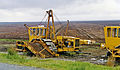 Bellacorick turf-cutting geograph-3182487-by-Ben-Brooksbank.jpg 2,338 × 1,367; 2.74 MB
-
 Bellacorick Wind Farm geograph-3182498-by-Ben-Brooksbank.jpg 2,218 × 1,318; 2.72 MB
-
 Bellaveeny, Co Mayo - geograph.org.uk - 6217165.jpg 1,024 × 685; 418 KB
-
 Belleek Park campsite - geograph.org.uk - 3281528.jpg 640 × 480; 266 KB
-
 Belleek Woods - geograph.org.uk - 3268043.jpg 640 × 480; 349 KB
-
 Belnaglea from Darby Point - geograph.org.uk - 4077821.jpg 2,592 × 1,944; 1.17 MB
-
 Below the falls - geograph.org.uk - 5525593.jpg 4,320 × 3,240; 3.9 MB
-
 Beltra Lough - geograph.org.uk - 3087034.jpg 640 × 360; 195 KB
-
 Beltra Lough - geograph.org.uk - 3284450.jpg 640 × 360; 194 KB
-
 Ben Goram from the R335 - geograph.org.uk - 5803214.jpg 640 × 360; 65 KB
-
 Ben Gorm eastern summit with view NW - geograph.org.uk - 5610534.jpg 5,184 × 2,920; 4.49 MB
-
 Ben Gorm summit with view NW - geograph.org.uk - 5610535.jpg 5,184 × 2,920; 4.48 MB
-
 Bends on the R300 near Lough Mask - geograph.org.uk - 4914865.jpg 1,920 × 1,080; 653 KB
-
 Bertra Beach Tombolo - geograph.org.uk - 2519767.jpg 1,024 × 765; 120 KB
-
 Bertra Strand shingle bar in Clew Bay - geograph.org.uk - 2519172.jpg 1,024 × 763; 94 KB
-
 Bertra.jpg 1,600 × 1,200; 984 KB
-
 Beside Clew Bay - geograph.org.uk - 4479467.jpg 4,000 × 2,664; 3.59 MB
-
 Between Newport and Castlebar - geograph.org.uk - 3982540.jpg 4,000 × 3,000; 3.11 MB
-
 Between Westport and Castlebar - geograph.org.uk - 5408120.jpg 3,500 × 2,625; 4.92 MB
-
 Between Westport and Castlebar - geograph.org.uk - 5411868.jpg 2,269 × 3,000; 6.29 MB
-
 Big blue tractor - geograph.org.uk - 3989158.jpg 4,000 × 2,664; 4.54 MB
-
 Birreencorragh, the north ridge - geograph.org.uk - 1878696.jpg 640 × 424; 49 KB
-
 Birreencorragh, the north ridge - geograph.org.uk - 1878701.jpg 640 × 402; 52 KB
-
 Blacksod Fishing Port - geograph.org.uk - 4678947.jpg 1,632 × 918; 406 KB
-
 Bleanaskill Cemetery - geograph.org.uk - 5115197.jpg 640 × 480; 179 KB
-
 Board and cabin - geograph.org.uk - 5521518.jpg 4,320 × 3,240; 2.22 MB
-
 Boat mooring on Doo Lough, N of Glenummera River - geograph.org.uk - 5609583.jpg 5,184 × 2,920; 6.09 MB
-
 Bog and conifers - geograph.org.uk - 3093897.jpg 640 × 360; 212 KB
-
 Bog Oak - geograph.org.uk - 3982573.jpg 3,000 × 4,000; 6.61 MB
-
 Boggy field, Roycarter - geograph.org.uk - 1878600.jpg 640 × 480; 98 KB
-
 Boghadoon - geograph.org.uk - 3085929.jpg 640 × 480; 261 KB
-
 Boghadoon - geograph.org.uk - 3085934.jpg 640 × 480; 268 KB
-
 Boghadoon - geograph.org.uk - 3085936.jpg 640 × 480; 315 KB
-
 Boghadoon River - geograph.org.uk - 3085923.jpg 640 × 480; 306 KB
-
 Bogland at Roycarter - geograph.org.uk - 1878587.jpg 640 × 480; 97 KB
-
 Bogs of Boggy - geograph.org.uk - 3086842.jpg 640 × 480; 255 KB
-
 Breaghwy Church - geograph.org.uk - 2506969.jpg 640 × 480; 71 KB


_near_Cong_-_geograph.org.uk_-_2408852.jpg)


.jpg)
.jpg)
.jpg)
.jpg)
.jpg)
.jpg)
.jpg)
.jpg)
.jpg)


_-_geograph.org.uk_-_5609550.jpg)


_-_geograph.org.uk_-_2057459.jpg)


_-_geograph.org.uk_-_2528276.jpg)


_-_geograph.org.uk_-_5521491.jpg)
_-_geograph.org.uk_-_5521493.jpg)
_-_geograph.org.uk_-_5521495.jpg)
_-_geograph.org.uk_-_5521497.jpg)
_-_geograph.org.uk_-_5521499.jpg)
_-_geograph.org.uk_-_5521500.jpg)
_Power_Station_geograph-3182466-by-Ben-Brooksbank.jpg)


