Category:County Westmeath
Saltar para a navegação
Saltar para a pesquisa
Condados da república da Irlanda: Carlow · Cavan · Clare · Cork(1) · Donegal · Dún Laoghaire-Rathdown(2) · Fingal(2) · Galway(3) · Kerry · Kildare · Kilkenny · Laois · Leitrim · Limerick · Longford · Louth · Mayo · Meath · Monaghan · Offaly · Roscommon · Sligo · South Dublin(2) · Tipperary(4) · Waterford · Westmeath · Wexford · Wicklow – Cidades separadas: Cork(1) · Dublin(2) · Galway(3) – Ex-condados: Dublin(2) · South Tipperary(4) Ex-condados da Irlanda do Norte: Antrim · Armagh · Down · Fermanagh · Londonderry · Tyrone
county in Ireland formerly known as Meath    | |||||
| Carregar ficheiro | |||||
| Instância de | |||||
|---|---|---|---|---|---|
| Localização | Leinster, República da Irlanda | ||||
| Capital | |||||
| Órgão legislativo |
| ||||
| Órgão executivo |
| ||||
| Data de criação ou fundação |
| ||||
| População |
| ||||
| Área |
| ||||
 | |||||
Subcategorias
Esta categoria contém as seguintes 22 subcategorias (de um total de 22).
A
C
E
G
H
- Hill of Uisneach (3 F)
M
N
P
R
S
- St Brigid's Well, Cullion (37 F)
- Symbols of County Westmeath (3 F)
T
W
Á
Páginas na categoria "County Westmeath"
Esta categoria só contém a seguinte página.
Multimédia na categoria "County Westmeath"
Esta categoria contém os seguintes 200 ficheiros (de um total de 552).
(página anterior) (página seguinte)-

-
 'Musical Wall' - geograph.org.uk - 892453.jpg 640 × 426; 103 kB
-
-
 A bend in the N52 at Killynan (Pratt) - geograph.org.uk - 3814884.jpg 1 024 × 702; 107 kB
-

-
 A dangerous bend on the N55 at Creggy - geograph.org.uk - 3796333.jpg 1 024 × 767; 123 kB
-
 A distant view of the Gothic Arch - geograph.org.uk - 5988421.jpg 640 × 480; 282 kB
-
 A farm road, Sallymount - geograph.org.uk - 3107644.jpg 640 × 480; 284 kB
-

-
 A mossy wall - geograph.org.uk - 3287004.jpg 640 × 480; 392 kB
-
 A pile of peat - geograph.org.uk - 3106626.jpg 640 × 360; 188 kB
-
 A sharp bend, Clonnageeragh - geograph.org.uk - 3107639.jpg 640 × 392; 250 kB
-
 Addingstow Cross - geograph.org.uk - 5913279.jpg 1 024 × 480; 102 kB
-

-
 An extraordinary tree - geograph.org.uk - 5988467.jpg 480 × 640; 408 kB
-
 Anglers on Lough Lene - geograph.org.uk - 5984179.jpg 640 × 480; 238 kB
-
 Anglers on Lough Lene - geograph.org.uk - 5984217.jpg 640 × 480; 273 kB
-
 Another farm track - geograph.org.uk - 4703395.jpg 640 × 480; 83 kB
-
 AntiWindFarmRochfortbridge.jpg 720 × 960; 43 kB
-

-
 Approaching Glasson - geograph.org.uk - 3096101.jpg 640 × 480; 242 kB
-
-

-

-

-
 Athlone Business Park - geograph.org.uk - 4144607.jpg 2 034 × 1 528; 839 kB
-
 Athlone Castle - geograph.org.uk - 1965508.jpg 480 × 640; 60 kB
-
 Athlone COA.png 2 157 × 2 094; 720 kB
-

-
 Athlone to Mullingar Greenway at Tully - geograph.org.uk - 5609538.jpg 5 184 × 2 920; 6,13 MB
-
 Athlone, Castle Inn - geograph.org.uk - 1965506.jpg 640 × 480; 69 kB
-
 Athlone, County Westmeath - geograph.org.uk - 1809540.jpg 3 875 × 1 890; 2,95 MB
-
 Athlone, County Westmeath - geograph.org.uk - 1828094.jpg 3 875 × 2 053; 3,63 MB
-
 Autumn on the Royal Canal - geograph.org.uk - 5989744.jpg 640 × 480; 412 kB
-
 Ballyglass Cross.JPG 1 936 × 1 444; 668 kB
-
 Ballynagall - geograph.org.uk - 3106688.jpg 640 × 360; 234 kB
-
 Ballynagall, County Westmeath - geograph.org.uk - 1821046.jpg 3 159 × 2 148; 4,66 MB
-
 Ballynascarry walled garden - geograph.org.uk - 5637349.jpg 3 200 × 2 400; 784 kB
-
 Barns by N51 - geograph.org.uk - 5913256.jpg 1 024 × 653; 123 kB
-

-
 Belvedere House, Mullingar - geograph.org.uk - 2497014.jpg 640 × 504; 301 kB
-
 Belvidere Church of Ireland at Moyliskor - geograph.org.uk - 3816497.jpg 795 × 936; 425 kB
-
 Ben Lough - geograph.org.uk - 5937510.jpg 637 × 478; 298 kB
-
 Ben Lough Middle - geograph.org.uk - 5937509.jpg 637 × 478; 249 kB
-
 Bend in the N52 at Turin, Co Westmeath - geograph.org.uk - 3814901.jpg 1 024 × 922; 145 kB
-

-
 Beside the N55 - geograph.org.uk - 3095637.jpg 640 × 480; 272 kB
-
 Birdcage in the Visitor Centre - geograph.org.uk - 5988408.jpg 480 × 640; 335 kB
-
 Black Quarter - geograph.org.uk - 3800155.jpg 480 × 640; 61 kB
-
 Black River - geograph.org.uk - 3101283.jpg 640 × 360; 260 kB
-
 Boat House - geograph.org.uk - 2197344.jpg 600 × 487; 70 kB
-
 Boeuf de Mullingar.JPG 2 816 × 2 112; 1,15 MB
-
 Bog and peat extraction - geograph.org.uk - 3106637.jpg 640 × 360; 201 kB
-
 Bog Bridge - geograph.org.uk - 5985871.jpg 640 × 480; 281 kB
-
 Bog Bridge - geograph.org.uk - 5985875.jpg 640 × 480; 287 kB
-
 Bog road, Kilshallow - geograph.org.uk - 3103102.jpg 640 × 480; 298 kB
-
 Bog Walk Way - geograph.org.uk - 3101306.jpg 640 × 441; 258 kB
-
 Bratty Road - geograph.org.uk - 5984091.jpg 640 × 480; 262 kB
-
 Bridge - panoramio (73).jpg 4 912 × 3 264; 8,84 MB
-
 Bridge buttress - geograph.org.uk - 3103071.jpg 640 × 480; 303 kB
-

-
 Bridge on the Athlone to Mullingar Cycleway - geograph.org.uk - 5243795.jpg 1 024 × 768; 267 kB
-
 Bridge on the Athlone to Mullingar Cycleway - geograph.org.uk - 5292402.jpg 1 024 × 768; 231 kB
-

-
 Bridge over the N6 at Junction 8 - geograph.org.uk - 3805480.jpg 1 024 × 768; 106 kB
-
 Bridge over the Royal Canal - geograph.org.uk - 2508781.jpg 640 × 480; 96 kB
-

-

-
 Bungalow at Balnavine - geograph.org.uk - 5939716.jpg 637 × 478; 270 kB
-
 Bungalow at Mearscourt - geograph.org.uk - 5985945.jpg 640 × 480; 268 kB
-
-
 Bungalow near Glenidan - geograph.org.uk - 5940729.jpg 637 × 478; 265 kB
-

-
 Bungalows at Ankerland - geograph.org.uk - 5939712.jpg 637 × 478; 282 kB
-
 Bungalows at Kilpatrick - geograph.org.uk - 5987209.jpg 640 × 480; 240 kB
-
 Bungalows on Old Glenview Road - geograph.org.uk - 5984085.jpg 640 × 480; 231 kB
-
 Bungalows on the road to Teevrevagh - geograph.org.uk - 5984095.jpg 640 × 480; 295 kB
-
 Canal Basin at Ballynacarrigy - geograph.org.uk - 5987139.jpg 640 × 480; 238 kB
-
 Canal bridge at Ballina - geograph.org.uk - 5989728.jpg 640 × 480; 275 kB
-
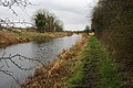 Canal towpath - geograph.org.uk - 730205.jpg 640 × 426; 96 kB
-
 Canalside building at Ballynarrigy - geograph.org.uk - 5987137.jpg 640 × 480; 250 kB
-
 Canalside picnic table at Ballynacarrigy - geograph.org.uk - 5987136.jpg 640 × 480; 315 kB
-
 Car showroom - geograph.org.uk - 3095650.jpg 640 × 480; 234 kB
-
 Carrick - geograph.org.uk - 5940737.jpg 637 × 478; 299 kB
-
 Carrick - geograph.org.uk - 5940752.jpg 637 × 478; 270 kB
-
 Castledaly Manor - Entrance drive - geograph.org.uk - 1606750.jpg 640 × 427; 77 kB
-
 Castlepollard - Baile na gCros - geograph.org.uk - 3073789.jpg 640 × 480; 288 kB
-
 Castlepollard - geograph.org.uk - 5907698.jpg 1 024 × 890; 190 kB
-
 Castlepollard - The Square, N side - geograph.org.uk - 6330828.jpg 5 184 × 2 920; 5,69 MB
-
 Castlepollard - The Square, NW corner - geograph.org.uk - 6330826.jpg 5 184 × 2 920; 4,3 MB
-
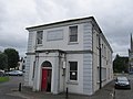 Castlepollard Town Hall - geograph.org.uk - 3107623.jpg 640 × 480; 236 kB
-
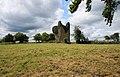
 Castles of Leinster, Carrick, Westmeath - geograph.org.uk - 2494714.jpg 1 024 × 671; 697 kB
-
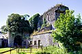
 Castles of Leinster, Donore, Westmeath (1) - geograph.org.uk - 2493590.jpg 1 024 × 714; 734 kB
-
 Castles of Leinster, Donore, Westmeath (10) - geograph.org.uk - 2493830.jpg 1 024 × 683; 1 000 kB
-
 Castles of Leinster, Donore, Westmeath (11) - geograph.org.uk - 2493847.jpg 683 × 1 024; 775 kB
-
 Castles of Leinster, Donore, Westmeath (2) - geograph.org.uk - 2493604.jpg 1 024 × 718; 775 kB
-
 Castles of Leinster, Donore, Westmeath (3) - geograph.org.uk - 2493615.jpg 683 × 1 024; 1,26 MB
-
 Castles of Leinster, Donore, Westmeath (4) - geograph.org.uk - 2493625.jpg 1 024 × 701; 1,35 MB
-
 Castles of Leinster, Donore, Westmeath (5) - geograph.org.uk - 2493635.jpg 683 × 1 024; 1,28 MB
-
 Castles of Leinster, Donore, Westmeath (6) - geograph.org.uk - 2493719.jpg 683 × 1 024; 1,22 MB
-
 Castles of Leinster, Donore, Westmeath (7) - geograph.org.uk - 2493725.jpg 683 × 1 024; 1,3 MB
-
 Castles of Leinster, Donore, Westmeath (8) - geograph.org.uk - 2493820.jpg 683 × 1 024; 1,12 MB
-
 Castles of Leinster, Donore, Westmeath (9) - geograph.org.uk - 2493825.jpg 1 024 × 683; 1,12 MB
-

-
 Castles of Leinster, Killagh, Co. Westmeath (1) - geograph.org.uk - 5028954.jpg 1 024 × 683; 874 kB
-
 Castles of Leinster, Killagh, Co. Westmeath (2) - geograph.org.uk - 5028964.jpg 1 024 × 592; 1 014 kB
-

-

-
 Castles of Leinster, Killeenbrack, Co. Westmeath (3) - geograph.org.uk - 5028946.jpg 1 024 × 683; 1,23 MB
-
 Castles of Leinster, Killeenbrack, Co. Westmeath (4) - geograph.org.uk - 5028948.jpg 828 × 1 024; 1,49 MB
-
 Castles of Leinster, Laragh, Co. Westmeath - geograph.org.uk - 5028928.jpg 1 024 × 683; 1,08 MB
-
 Castles of Leinster, Martinstown, Westmeath (1) - geograph.org.uk - 2494728.jpg 1 024 × 661; 953 kB
-
 Castles of Leinster, Martinstown, Westmeath (2) - geograph.org.uk - 2494736.jpg 1 024 × 683; 895 kB
-
 Castles of Leinster, Newcastle, Co. Westmeath (1) - geograph.org.uk - 5028979.jpg 683 × 1 024; 1 017 kB
-
 Castles of Leinster, Newcastle, Co. Westmeath (2) - geograph.org.uk - 5028981.jpg 1 024 × 683; 1,06 MB
-
 Castles of Leinster, Newcastle, Westmeath (1) - geograph.org.uk - 4074482.jpg 1 024 × 683; 825 kB
-
 Castles of Leinster, Newcastle, Westmeath (2) - geograph.org.uk - 4074484.jpg 1 024 × 683; 1,07 MB
-
 Castles of Leinster, Rattin, Westmeath (1) - geograph.org.uk - 2495874.jpg 1 024 × 700; 765 kB
-
 Castles of Leinster, Rattin, Westmeath (2) - geograph.org.uk - 2495881.jpg 1 024 × 707; 840 kB
-

-
 Castles of Leinster, Taghmon, Westmeath - geograph.org.uk - 2494719.jpg 1 024 × 683; 642 kB
-
-
-
 Cattle grazing - geograph.org.uk - 3287462.jpg 640 × 480; 299 kB
-
 Cattle near Castlepollard - geograph.org.uk - 3073797.jpg 640 × 480; 322 kB
-
 Cattle, Ballynagall - geograph.org.uk - 3106697.jpg 640 × 360; 245 kB
-
 Cattle, Brackagh - geograph.org.uk - 3096761.jpg 640 × 360; 203 kB
-
 Cattle, Coolamber - geograph.org.uk - 3103065.jpg 640 × 480; 297 kB
-
 Caution cyclists merging^ - geograph.org.uk - 5989725.jpg 640 × 480; 327 kB
-
 Church and graveyard - geograph.org.uk - 770821.jpg 640 × 426; 77 kB
-
 Church St, R195 - geograph.org.uk - 5907708.jpg 1 024 × 566; 93 kB
-
 Church, Boherquill - geograph.org.uk - 3103010.jpg 640 × 480; 274 kB
-
 Church, Rathowen - geograph.org.uk - 3286998.jpg 640 × 480; 239 kB
-
 Cleared woodland, Ballygarveybeg - geograph.org.uk - 3099968.jpg 640 × 360; 208 kB
-
 Cloghan Inn at Cloghan Cross Roads on the N52 - geograph.org.uk - 3814841.jpg 1 024 × 752; 130 kB
-
 Clonaboy - geograph.org.uk - 3101266.jpg 640 × 360; 222 kB
-
 Clonaboy - geograph.org.uk - 3101271.jpg 640 × 360; 216 kB
-
 Cornamaddy National School, Blyry - geograph.org.uk - 3805426.jpg 1 024 × 562; 88 kB
-
 Corralanna - geograph.org.uk - 3103115.jpg 640 × 480; 264 kB
-

-
 Country road at Gillardstown - geograph.org.uk - 5984160.jpg 640 × 480; 264 kB
-
 Country road at Paddinstown Upper - geograph.org.uk - 5985952.jpg 640 × 480; 281 kB
-

-
 Culvin - geograph.org.uk - 3101674.jpg 640 × 480; 312 kB
-
 Curraghmore Roundabout at Junction 15 on the N4 - geograph.org.uk - 3645141.jpg 1 024 × 684; 105 kB
-
 Curristown - geograph.org.uk - 5989740.jpg 640 × 480; 248 kB
-
 Cut grass - geograph.org.uk - 3096757.jpg 640 × 360; 206 kB
-
 Damp Day Lough Owel - geograph.org.uk - 5999867.jpg 800 × 600; 351 kB
-
 Dangerous bend on the N52 at Williamstown - geograph.org.uk - 3813966.jpg 1 024 × 830; 176 kB
-

-
 Derelict farm house at Balrath North - geograph.org.uk - 3815822.jpg 1 024 × 608; 116 kB
-
 Derelict fuel pumps - geograph.org.uk - 5987141.jpg 640 × 480; 359 kB
-
 Derravaragh 1 - Flickr - Fiona MacGinty.jpg 800 × 600; 110 kB
-

-
 Disused House - geograph.org.uk - 3817443.jpg 600 × 450; 84 kB
-
 Disused Railway Line and New Path - geograph.org.uk - 4705844.jpg 1 280 × 720; 571 kB
-
 Diversion on the Royal Canal - geograph.org.uk - 2508817.jpg 640 × 480; 100 kB
-
 Drainage ditch - geograph.org.uk - 4703405.jpg 640 × 480; 75 kB
-
 Drive, Crumlin House - geograph.org.uk - 3286975.jpg 640 × 480; 305 kB
-
 Driveway at Loughanavagh - geograph.org.uk - 5984167.jpg 480 × 640; 304 kB
-
 Driveway at Rathtrim - geograph.org.uk - 5987143.jpg 480 × 640; 245 kB
-
 Drumcree, County Westmeath - geograph.org.uk - 1823074.jpg 2 994 × 1 949; 1,05 MB
-
 Electricity sub-station alongside the R916 - geograph.org.uk - 3805513.jpg 1 024 × 549; 91 kB
-
 Emo Garage, Glasson - geograph.org.uk - 3805627.jpg 1 024 × 679; 101 kB
-
 Entering Castlepollard, R395 - geograph.org.uk - 5907694.jpg 1 024 × 450; 172 kB
-
 Entering Clonmellon from the south along the N52 - geograph.org.uk - 3656664.jpg 1 024 × 767; 116 kB
-

-
 Entering the village of Ballynahown on the N62 - geograph.org.uk - 3661033.jpg 1 024 × 666; 131 kB
-
-
 Entrance to plantation - geograph.org.uk - 5985866.jpg 640 × 480; 312 kB
-
 Exit Seven, County Westmeath - geograph.org.uk - 1810367.jpg 3 888 × 2 160; 5,53 MB
-

-
 Farm at Collinstown - geograph.org.uk - 5984233.jpg 640 × 480; 234 kB
-
 Farm at Derrynagarragh - geograph.org.uk - 5984171.jpg 640 × 480; 249 kB
-
 Farm at Randoon - geograph.org.uk - 5984172.jpg 640 × 480; 261 kB
-
 Farm at Relick - geograph.org.uk - 5985877.jpg 640 × 480; 238 kB
-
 Farm at Templanstown - geograph.org.uk - 5937137.jpg 637 × 478; 273 kB
-
 Farm buildings at Balgarrett - geograph.org.uk - 5987266.jpg 640 × 480; 260 kB
-
 Farm buildings at Lisnacask - geograph.org.uk - 5985948.jpg 640 × 480; 257 kB
-
 Farm buildings at Mearscourt - geograph.org.uk - 5985941.jpg 640 × 480; 268 kB
-
 Farm drive near Garlandstown - geograph.org.uk - 5984156.jpg 640 × 480; 262 kB
-
 Farm near Kilpatrick - geograph.org.uk - 5984207.jpg 640 × 480; 248 kB
-
 Farm on the slopes of the Ben of Fore - geograph.org.uk - 5937505.jpg 637 × 478; 315 kB
-
 Farm track - geograph.org.uk - 3073821.jpg 640 × 360; 234 kB
-

-
 Farmland near Castlepollard - geograph.org.uk - 3107600.jpg 640 × 360; 227 kB
-
 Fearmore - geograph.org.uk - 3101869.jpg 640 × 480; 273 kB
-
 Field and houses - geograph.org.uk - 4144526.jpg 2 592 × 1 221; 702 kB
-
 Field at Bellany - geograph.org.uk - 5984164.jpg 640 × 480; 199 kB
-
 Field at Tonashammer - geograph.org.uk - 5937157.jpg 637 × 478; 299 kB
-
 Field by Castlepollard - geograph.org.uk - 3073794.jpg 640 × 480; 252 kB
-
 Field near the railway - geograph.org.uk - 4143566.jpg 1 778 × 1 331; 669 kB
-
 Field with cattle at Derrynagarragh - geograph.org.uk - 5984170.jpg 640 × 480; 306 kB
-
 Field with cattle near Castlegaddery - geograph.org.uk - 5985921.jpg 640 × 480; 250 kB
-
 Field with sheep near Rathconrath - geograph.org.uk - 5987147.jpg 640 × 480; 262 kB
-
 Field, Glasson - geograph.org.uk - 3096123.jpg 640 × 480; 281 kB
-
 Field, Lisdisson - geograph.org.uk - 3096480.jpg 640 × 480; 303 kB
-
 Fields and trees near Drumhurlin Bridge - geograph.org.uk - 5984206.jpg 640 × 480; 269 kB
-
 Fields and woods near Gillardstown - geograph.org.uk - 5984157.jpg 640 × 480; 325 kB
-
 Fields near Cartron - geograph.org.uk - 5987279.jpg 640 × 480; 272 kB


_-_geograph.org.uk_-_3814884.jpg)


.jpg)


_-_geograph.org.uk_-_2493590.jpg)
_-_geograph.org.uk_-_2493830.jpg)
_-_geograph.org.uk_-_2493847.jpg)
_-_geograph.org.uk_-_2493604.jpg)
_-_geograph.org.uk_-_2493615.jpg)
_-_geograph.org.uk_-_2493625.jpg)
_-_geograph.org.uk_-_2493635.jpg)
_-_geograph.org.uk_-_2493719.jpg)
_-_geograph.org.uk_-_2493725.jpg)
_-_geograph.org.uk_-_2493820.jpg)
_-_geograph.org.uk_-_2493825.jpg)

_-_geograph.org.uk_-_5028954.jpg)
_-_geograph.org.uk_-_5028964.jpg)
_-_geograph.org.uk_-_5028939.jpg)
_-_geograph.org.uk_-_5028943.jpg)
_-_geograph.org.uk_-_5028946.jpg)
_-_geograph.org.uk_-_5028948.jpg)

_-_geograph.org.uk_-_2494728.jpg)
_-_geograph.org.uk_-_2494736.jpg)
_-_geograph.org.uk_-_5028979.jpg)
_-_geograph.org.uk_-_5028981.jpg)
_-_geograph.org.uk_-_4074482.jpg)
_-_geograph.org.uk_-_4074484.jpg)
_-_geograph.org.uk_-_2495874.jpg)
_-_geograph.org.uk_-_2495881.jpg)


_-_geograph.org.uk_-_5614549.jpg)


_-_geograph.org.uk_-_3805509.jpg)


