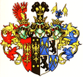
Category:County of Rietberg
Jump to navigation
Jump to search
former state of the Holy Roman Empire | |||||
| Upload media | |||||
| Instance of | |||||
|---|---|---|---|---|---|
| Location | Lower Rhenish–Westphalian Circle | ||||
| Inception |
| ||||
| Dissolved, abolished or demolished date |
| ||||
 | |||||
Subcategories
This category has the following 5 subcategories, out of 5 total.
Media in category "County of Rietberg"
The following 7 files are in this category, out of 7 total.
-
Amt Reckenberg.jpg 248 × 227; 103 KB
-
Cirksena-Grafen von Ostfriesland und Rietberg-Wappen.png 1,064 × 996; 1.65 MB
-
Grafschaft Rietberg.jpg 828 × 920; 50 KB
-
Locator County of Rietberg (1560).svg 3,821 × 3,455; 374 KB
-
Rietberg-Grafen-Wappen.jpg 640 × 962; 387 KB
-
Rietberg-Wappen 262 4.png 663 × 856; 273 KB
-
Wappenkaunitzrietberg.png 400 × 420; 241 KB


