Category:Cumberland County, Tennessee
Jump to navigation
Jump to search
Counties of Tennessee: Anderson · Bedford · Benton · Bledsoe · Blount · Bradley · Campbell · Cannon · Carroll · Carter · Cheatham · Chester · Claiborne · Clay · Cocke · Coffee · Crockett · Cumberland · Davidson · Decatur · DeKalb · Dickson · Dyer · Fayette · Fentress · Franklin · Gibson · Giles · Grainger · Greene · Grundy · Hamblen · Hamilton · Hancock · Hardeman · Hardin · Hawkins · Haywood · Henderson · Henry · Hickman · Houston · Humphreys · Jackson · Jefferson · Johnson · Knox · Lake · Lauderdale · Lawrence · Lewis · Lincoln · Loudon · Macon · Madison · Marion · Marshall · Maury · McMinn · McNairy · Meigs · Monroe · Montgomery · Moore · Morgan · Obion · Overton · Perry · Pickett · Polk · Putnam · Rhea · Roane · Robertson · Rutherford · Scott · Sequatchie · Sevier · Shelby · Smith · Stewart · Sullivan · Sumner · Tipton · Trousdale · Unicoi · Union · Van Buren · Warren · Washington · Wayne · Weakley · White · Williamson · Wilson
county in Tennessee, United States   | |||||
| Upload media | |||||
| Instance of | |||||
|---|---|---|---|---|---|
| Named after |
| ||||
| Location | Tennessee | ||||
| Capital | |||||
| Inception |
| ||||
| Population |
| ||||
| Area |
| ||||
| Different from | |||||
| official website | |||||
 | |||||
Subcategories
This category has the following 12 subcategories, out of 12 total.
C
- Crab Orchard, Tennessee (9 F)
- Cumberland County Pride 2023 (1 F)
G
- Grassy Cove (11 F)
M
O
P
- Pleasant Hill, Tennessee (4 F)
T
Media in category "Cumberland County, Tennessee"
The following 21 files are in this category, out of 21 total.
-
 Adams-Creek-view-Cumberland-tn1.jpg 4,000 × 3,000; 4.53 MB
-
 Baptisia tinctoria.jpg 2,436 × 2,304; 1.12 MB
-
 Bowman-Loop-Road-tn1.jpg 4,000 × 3,000; 4.98 MB
-
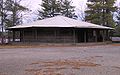 Camp-nakanawa-wigwam-tn1.jpg 2,048 × 1,285; 1.19 MB
-
 Catoosa Savanna.jpg 3,072 × 2,304; 5.45 MB
-
 Crossville-tennessee-memorial2.jpg 1,197 × 646; 226 KB
-
 Crossvillesign clean edge 1by1-33.jpg 652 × 869; 383 KB
-
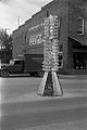 Crossvillesign clean edge.jpg 652 × 980; 423 KB
-
 Crossvillesign, Signs, Crossville, Tennessee 8a17089a.tif 3,065 × 4,287; 25.06 MB
-
 Crossvillesign-edit.png 2,888 × 4,112; 10.91 MB
-
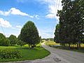
 Cumberland-County-US127-tn1.jpg 4,000 × 3,000; 4.01 MB
-
 Cumberland-County-Woody-tn1.jpg 4,000 × 2,670; 3.96 MB
-
 Daddys Creek, Tennessee.JPG 3,072 × 2,304; 2.73 MB
-
 FEMA - 7204 - Photograph by Liz Roll taken on 11-13-2002 in Tennessee.jpg 3,008 × 2,000; 1.41 MB
-
 Lake-mayland-camp-nakanawa-tn1.jpg 2,035 × 1,424; 1.22 MB
-
 Malaxis.jpg 2,988 × 5,312; 2.42 MB
-
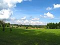
 Northern-Cumberland-County-tn1.jpg 4,000 × 3,000; 4.62 MB
-
 Oenothera fruticosa Cumberland Plateau.jpg 2,304 × 3,072; 2.02 MB
-
 Polygala curtissii.jpg 2,341 × 2,125; 651 KB
-
 Symphyotrichum dumosum.jpg 3,072 × 2,304; 1.58 MB
-
 USA Cumberland County, Tennessee.csv age pyramid.svg 520 × 600; 7 KB


