Category:DEM maps of Brandenburg
Jump to navigation
Jump to search
Federal states of Germany:
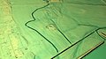
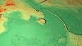
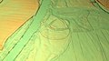
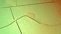
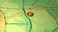
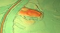
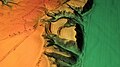
Deutsch: Das digitale Höhenmodell (DHM) (englisch digital elevation model (DEM)) bzw. digitale Geländemodell (DGM) (engl. digital terrain model (DTM)) basiert auf den numerischen Daten der Geländehöhen. Daraus lassen sich z. B. 3D-Ansichten erstellen.

Media in category "DEM maps of Brandenburg"
The following 36 files are in this category, out of 36 total.
-
 Botscheberg Geländemodell.jpg 1,920 × 1,080; 1 MB
-
 Burg Landin Geländemodell.jpg 1,920 × 1,080; 1,012 KB
-
 Burg Wildberg (Brandenburg) Geländemodell.jpg 1,920 × 1,080; 901 KB
-
 Burgwall Alt Rathenow Geländemodell.jpg 1,920 × 1,080; 1.05 MB
-
 Burgwall Bamme Geländemodell.jpg 1,920 × 1,080; 981 KB
-
 Burgwall Biesenthal Geländemodell.jpg 1,920 × 1,080; 1.24 MB
-
 Burgwall Bärwalde Geländemodell.jpg 1,920 × 1,080; 1.02 MB
-
 Burgwall Drense Geländemodell.jpg 1,920 × 1,080; 917 KB
-
 Burgwall Garzin Geländemodell.jpg 1,920 × 1,080; 959 KB
-
 Burgwall Gehren Geländemodell.jpg 1,920 × 1,080; 1.09 MB
-
 Burgwall Hohennauen-Witzke Geländemodell.jpg 1,920 × 1,080; 865 KB
-
 Burgwall Klessener Zootzen Geländemodell.jpg 1,920 × 1,080; 1.11 MB
-
 Burgwall Knoblauch Geländemodell.jpg 1,920 × 1,080; 923 KB
-
 Burgwall Körzin Geländemodell.jpg 1,920 × 1,080; 953 KB
-
 Burgwall Leegebruch Geländemodell.jpg 1,920 × 1,080; 1.05 MB
-
 Burgwall Liebenberg Geländemodell.jpg 1,920 × 1,080; 840 KB
-
 Burgwall Lossow Geländemodell.jpg 1,920 × 1,080; 1.13 MB
-
 Burgwall Lychen Geländemodell.jpg 1,920 × 1,080; 507 KB
-
 Burgwall Netzeband Geländemodell.jpg 1,920 × 1,080; 859 KB
-
 Burgwall Parey Geländemodell.jpg 1,920 × 1,080; 914 KB
-
 Burgwall Reckahn Geländemodell.jpg 1,920 × 1,080; 1.01 MB
-
 Burgwall Riewend Geländemodell.jpg 1,920 × 1,080; 1.01 MB
-
 Burgwall Stremmewiese Geländemodell.jpg 1,920 × 1,080; 1.01 MB
-
 Burgwall Tietzow Geländemodell.jpg 1,920 × 1,080; 1.02 MB
-
 Burgwall Waldsieversdorf Geländemodell.jpg 1,920 × 1,080; 1.04 MB
-
 Burgwall Wildberg (Temnitztal) Geländemodell.jpg 1,920 × 1,080; 977 KB
-
 Motte von Mahlenzien Geländemodell.jpg 1,920 × 1,080; 1 MB
-
 Niederungsburg Naugarten Geländemodell.jpg 1,920 × 1,080; 716 KB
-
 Pilatsch (Burgwall) Geländemodell.jpg 1,920 × 1,080; 793 KB
-
 Reitweiner Wallberge Geländemodell.jpg 1,920 × 1,080; 1.26 MB
-
 Räuberberg (Görsdorf) Geländemodell.jpg 1,920 × 1,080; 978 KB
-
 Römerschanze bei Potsdam Geländemodell.jpg 1,920 × 1,080; 1,007 KB
-
 Schloss Beuthen Geländemodell.jpg 1,920 × 1,080; 1,023 KB
-
 Slawenburg Lübben Geländemodell.jpg 1,920 × 1,080; 894 KB
-
 Turmhügel Schöna Geländemodell.jpg 1,920 × 1,080; 850 KB
-
 Utzenberg Geländemodell.jpg 1,920 × 1,080; 1,007 KB


_Gel%C3%A4ndemodell.jpg)


_Gel%C3%A4ndemodell.jpg)


_Gel%C3%A4ndemodell.jpg)

_Gel%C3%A4ndemodell.jpg)


