Category:Dalavich
Jump to navigation
Jump to search
village in Argyll and Bute, Scotland, UK | |||||
| Upload media | |||||
| Instance of | |||||
|---|---|---|---|---|---|
| Location |
| ||||
 | |||||
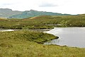
English: Dalavich is a village in Argyll and Bute, Scotland. It lies on the western bank of Loch Awe and has a population of around 70.
Media in category "Dalavich"
The following 35 files are in this category, out of 35 total.
-
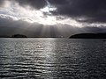 A stormy view of Loch Awe - geograph.org.uk - 3296796.jpg 1,600 × 1,200; 405 KB
-
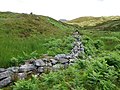 Boundary wall - geograph.org.uk - 495405.jpg 640 × 480; 95 KB
-
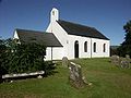 Dalavich Church.jpg 640 × 480; 123 KB
-
 Dalavich Panorama.jpg 3,430 × 564; 1.28 MB
-
 Garden at Dalavich - geograph.org.uk - 3247559.jpg 1,600 × 1,200; 493 KB
-
 Kilmun - geograph.org.uk - 40083.jpg 640 × 463; 67 KB
-
 Loch Awe - geograph.org.uk - 3861903.jpg 1,600 × 1,200; 398 KB
-
 Loch Awe from Dalavich - geograph.org.uk - 3861911.jpg 1,600 × 1,200; 282 KB
-
 Wooden holiday cottages at Lochaweside - geograph.org.uk - 3004758.jpg 1,600 × 1,200; 736 KB
-
 A claggy day on Beinn Bhreac - geograph.org.uk - 1037294.jpg 640 × 359; 60 KB
-
 A headwater of the Allt Blarghour - geograph.org.uk - 1037311.jpg 640 × 480; 82 KB
-
 Alltan Airigh Mhic Choinnich - geograph.org.uk - 1037301.jpg 640 × 359; 67 KB
-
 Ardchonnel Burn - geograph.org.uk - 495374.jpg 430 × 640; 96 KB
-
 Confluence of unnamed burns - geograph.org.uk - 495430.jpg 430 × 640; 96 KB
-
 Confluence on Kames River - geograph.org.uk - 495414.jpg 640 × 430; 95 KB
-
 Crag above Ardchonnel - geograph.org.uk - 495379.jpg 640 × 430; 94 KB
-
 Creag an Airgid - geograph.org.uk - 495385.jpg 640 × 430; 94 KB
-
 Dalavich Post Office - geograph.org.uk - 40100.jpg 640 × 480; 72 KB
-
 Eas Clann Donnuill - geograph.org.uk - 495419.jpg 430 × 640; 97 KB
-
 Edge of the forest - geograph.org.uk - 495382.jpg 640 × 430; 93 KB
-
 Ford on Ardchonnel Burn - geograph.org.uk - 495372.jpg 640 × 430; 95 KB
-
 Forest boundary - geograph.org.uk - 495396.jpg 640 × 430; 95 KB
-
 Hill track from Ardchonnel - geograph.org.uk - 495521.jpg 640 × 430; 97 KB
-
 Houses near Dalavich - geograph.org.uk - 709378.jpg 640 × 480; 87 KB
-
 Kames River - geograph.org.uk - 495411.jpg 640 × 430; 96 KB
-
 Loch avich - geograph.org.uk - 686867.jpg 640 × 417; 40 KB
-
 Lochan Allt an Sgadain - geograph.org.uk - 495494.jpg 640 × 430; 95 KB
-
 Lochan Dubh Mhuilinn - geograph.org.uk - 495499.jpg 640 × 430; 97 KB
-
 Lochan Long - geograph.org.uk - 495449.jpg 640 × 430; 92 KB
-
 Moorland and unnamed lochan - geograph.org.uk - 495515.jpg 640 × 430; 93 KB
-
 River bend - geograph.org.uk - 495426.jpg 640 × 430; 95 KB
-
 Rough grazing above Ardchonnel - geograph.org.uk - 495368.jpg 640 × 430; 94 KB
-
 Small ruin - geograph.org.uk - 495433.jpg 640 × 480; 96 KB
-
 Small waterfall - geograph.org.uk - 495392.jpg 430 × 640; 96 KB
-
 Summit of Beinn Bhreac - geograph.org.uk - 495470.jpg 640 × 430; 93 KB


