Category:Delaware County, New York
Salti al navigilo
Salti al serĉilo
Counties of New York (state): Albany · Allegany · Bronx · Broome · Cattaraugus · Cayuga · Chautauqua · Chemung · Chenango · Clinton · Columbia · Cortland · Delaware · Dutchess · Erie · Essex · Franklin · Fulton · Genesee · Greene · Hamilton · Herkimer · Jefferson · Kings · Lewis · Livingston · Madison · Monroe · Montgomery · Nassau · New York · Niagara · Oneida · Onondaga · Ontario · Orange · Orleans · Oswego · Otsego · Putnam · Queens · Rensselaer · Richmond · Rockland · Saratoga · Schenectady · Schoharie · Schuyler · Seneca · St. Lawrence · Steuben · Suffolk · Sullivan · Tioga · Tompkins · Ulster · Warren · Washington · Wayne · Westchester · Wyoming · Yates
kantono en Nov-Jorkio, Usono   | |||||
| Alŝuti plurmedion | |||||
| Estas | |||||
|---|---|---|---|---|---|
| Nomita laŭ | |||||
| Loko | Nov-Jorkio, Usono | ||||
| Ĉefurbo |
| ||||
| Dato de fondo aŭ kreo |
| ||||
| Loĝantaro |
| ||||
| Areo |
| ||||
| Alia ol | |||||
| oficiala retejo | |||||
 | |||||
Subkategorioj
Ĉi tiu kategorio havas la 22 jenajn subkategoriojn, el 22 entute.
A
B
C
- Campbell Covered Bridge (1 D)
- Cannonsville Reservoir (8 D)
- Catskill Scenic Trail (4 D)
H
N
P
S
T
Dosieroj en kategorio “Delaware County, New York”
La jenaj 72 dosieroj estas en ĉi tiu kategorio, el 72 entute.
-
 Agloe.svg 703 × 825; 470 KB
-
 Bridge Street Laundromat, Sidney, New York.jpg 6 000 × 4 000; 10,38 MB
-
 Charles D Cook.jpg 396 × 500; 60 KB
-
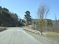 Delaware County Route 33 - New York - 4353538607.jpg 1 024 × 768; 314 KB
-
 Delaware County Route 33 - New York - 4353538959.jpg 1 024 × 768; 316 KB
-
 Delaware County Route 33 - New York - 4353539115.jpg 1 024 × 768; 306 KB
-
 Delaware County Route 33 - New York - 4353539961.jpg 1 024 × 768; 302 KB
-
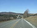
 Delaware County Route 33 - New York - 4353540303.jpg 1 024 × 768; 308 KB
-
 Delaware County Route 33 - New York - 4353540737.jpg 1 600 × 1 200; 575 KB
-
 Delaware County Route 33 - New York - 4353541039.jpg 1 600 × 1 200; 549 KB
-
 Delaware County Route 33 - New York - 4353541255.jpg 1 600 × 1 200; 399 KB
-
 Delaware County Route 33 - New York - 4354284956.jpg 640 × 480; 32 KB
-
 Delaware County Route 33 - New York - 4354285294.jpg 1 024 × 768; 312 KB
-
 Delaware County Route 33 - New York - 4354285862.jpg 1 024 × 768; 304 KB
-
 Delaware County Route 33 - New York - 4354286344.jpg 1 024 × 768; 316 KB
-
 Delaware County Route 33 - New York - 4354286698.jpg 1 024 × 768; 317 KB
-
 Delaware County Route 33 - New York.jpg 640 × 480; 44 KB
-
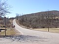
 Delaware County Route 37 - New York - 4353613335.jpg 1 024 × 768; 179 KB
-
 Delaware County Route 37 - New York - 4353613501.jpg 1 024 × 768; 186 KB
-
 Delaware County Route 37 - New York - 4354358850.jpg 1 024 × 768; 182 KB
-
 Delaware County Route 37 - New York - 4354359284.jpg 1 024 × 768; 172 KB
-
 Delaware County Route 37 - New York.jpg 1 024 × 768; 158 KB
-
 Delaware County, NY, wikivoyage banner.jpg 1 600 × 246; 413 KB
-
 Deposit Station site from trackside.jpg 3 264 × 2 448; 2,35 MB
-
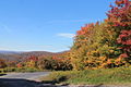 Fall Colors (15449383875).jpg 1 400 × 932; 928 KB
-
 FLT M27 0.8 mi - Register near Getter Hill Rd - panoramio.jpg 1 536 × 2 048; 850 KB
-
 FLT M27 10.7 mi - Cold Spring Lean-to ADA accessible outhouse - panoramio.jpg 1 536 × 2 048; 750 KB
-

-

-

-
 FLT M27 11.5 mi - Register near NY 8 - panoramio.jpg 1 536 × 2 048; 864 KB
-
 FLT M27 11.6 mi - DEC Kiosk at NY 8 DEC parking lot - panoramio.jpg 1 536 × 2 048; 743 KB
-
 FLT M27 12.4 mi - Puncheon over reliable stream, 3x12x16', cabled - panoramio.jpg 1 536 × 2 048; 678 KB
-
 FLT M27 12.42 mi - Puncheon over reliable stream, 2x12x8', cabled - panoramio.jpg 1 536 × 2 048; 737 KB
-
 FLT M27 14.0 mi - Piped spring N of trail - panoramio.jpg 1 536 × 2 048; 943 KB
-
 FLT M27 14.8 mi - Register near Dry Brook Rd - panoramio.jpg 1 536 × 2 048; 794 KB
-

-

-
 FLT M27 15.1 mi - Cistern E of Dry Brook on blue trail - panoramio.jpg 2 048 × 1 536; 876 KB
-

-
 FLT M27 15.5 mi - Dry Brook Lean-to ADA accessible outhouse - panoramio.jpg 1 536 × 2 048; 726 KB
-

-
 FLT M27 15.7 mi - Rocky Point scenic rocks atop hill - panoramio.jpg 1 536 × 2 048; 831 KB
-

-

-

-
 FLT M27 3.9 mi - DEC Kiosk at Beales Pond Rd DEC parking lot - panoramio.jpg 1 536 × 2 048; 636 KB
-
 FLT M27 6.2 mi - Register near Shear Rd - panoramio.jpg 1 536 × 2 048; 675 KB
-

-

-

-
 FLT M29 0.05 mi - Register near DOT Tower Rd - panoramio.jpg 1 536 × 2 048; 902 KB
-
 Former site of Arena, New York (408326476).jpg 2 848 × 2 136; 1,51 MB
-
 Former site of Arena, New York (408326479).jpg 2 848 × 2 136; 1,43 MB
-
-
 Hardenburgh Falls.JPG 4 320 × 3 240; 2,63 MB
-
 Looking down the steps of the waterfall - panoramio.jpg 3 872 × 2 592; 4,4 MB
-
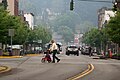
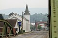 Main Street, Sidney, New York.jpg 6 000 × 4 000; 9,58 MB
-
 Map of New York highlighting Delaware County.svg 6 599 × 5 030; 112 KB
-
 On the Delaware, six miles east of Deposit (NYPL b11708205-G91F078 010F).tiff 2 988 × 1 728; 14,77 MB
-
 Shin Hopple, New York (408259220).jpg 2 848 × 2 136; 1,46 MB
-
 Shin Hopple, New York (408259225).jpg 2 848 × 2 136; 1,46 MB
-
 Shin Hopple, New York (408306143).jpg 2 848 × 2 136; 1,41 MB
-
 Sidney Plains Pioneer Cemetery.jpg 6 000 × 4 000; 9,72 MB
-
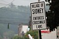
 Sidney, New York sign.jpg 6 000 × 4 000; 10,45 MB
-
 Sidney, New York.jpg 6 000 × 4 000; 10,56 MB
-
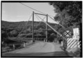
 Sidney-Unadilla Bridge.jpg 6 000 × 4 000; 10,53 MB
-
 Stone in Pioneer Cemetery.JPG 5 616 × 3 744; 6,5 MB
-
 The Ohio farmer (1908) (14591362739).jpg 2 120 × 1 426; 597 KB
-
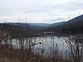
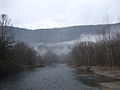
 The Upper Delaware Valley - panoramio.jpg 3 872 × 2 592; 3,76 MB
-
 USA Delaware County, New York age pyramid.svg 520 × 600; 7 KB
-
 Village of Sidney, New York crosswalk sign.jpg 6 000 × 4 000; 8,77 MB


.jpg)


.jpg)
.jpg)


.jpg)
.jpg)
.jpg)


_(14591362739).jpg)


