Category:Deutschkreutz
Jump to navigation
Jump to search
municipality in Oberpullendorf District, Burgenland, Austria   | |||||
| Upload media | |||||
| Instance of |
| ||||
|---|---|---|---|---|---|
| Location | |||||
| Population |
| ||||
| Area |
| ||||
| Elevation above sea level |
| ||||
| official website | |||||
 | |||||
Subcategories
This category has the following 17 subcategories, out of 17 total.
!
B
- Bahnhof Deutschkreutz (9 F)
D
- Denkmal für die Juden von Zelem (15 F)
F
- FC Deutschkreutz (3 F)
G
H
J
- Jewish cemetery in Deutschkreutz (11 F)
P
S
W
- Weingut 2Leser (4 F)
- Weingut Gager (2 F)
- Weingut Hans Igler (2 F)
Media in category "Deutschkreutz"
The following 54 files are in this category, out of 54 total.
-
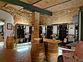 20230901.Gebietsvinothek Deutschkreutz.-011.jpg 9,248 × 6,936; 16.19 MB
-
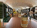
 20230901.Gebietsvinothek Deutschkreutz.-012.jpg 9,248 × 6,936; 14.87 MB
-
 20230901.Gebietsvinothek Deutschkreutz.-013.jpg 9,248 × 6,936; 16.54 MB
-
 20230901.Gebietsvinothek Deutschkreutz.-014.jpg 6,936 × 9,248; 14.66 MB
-
 20230901.Gebietsvinothek Deutschkreutz.-015.jpg 6,936 × 9,248; 14.26 MB
-
 20230901.Gebietsvinothek Deutschkreutz.-016.jpg 9,248 × 6,936; 13.71 MB
-
 20230901.Weingut 2Leser Deutschkreutz.-011.jpg 9,248 × 6,936; 22.59 MB
-
 20230901.Weingut 2Leser Deutschkreutz.-012.jpg 9,248 × 6,936; 13 MB
-
 20230901.Weingut 2Leser Deutschkreutz.-013.jpg 6,936 × 9,248; 15.91 MB
-
 20230901.Weingut 2Leser Deutschkreutz.-014.jpg 5,186 × 4,074; 3.3 MB
-
 Austria-Hungary border – Deutschkreutz–Kópháza (01).jpg 3,000 × 2,000; 1.04 MB
-
 Austria-Hungary border – Deutschkreutz–Kópháza (02).jpg 3,000 × 2,000; 1.61 MB
-
 AUT Deutschkreutz COA.jpg 209 × 240; 14 KB
-
 AUT Deutschkreutz COA.svg 512 × 590; 2 KB
-
 Bernsteinstraße-Radweg - Deutschkreutz.jpg 5,436 × 2,494; 3.44 MB
-
 Blaufränkischland - panoramio.jpg 5,669 × 1,541; 7.05 MB
-
 Christa Krammer 2009.jpg 597 × 738; 102 KB
-
 Deutschkreutz - Figurenbildstock heilige Maria (Frauensäule) (01).jpg 2,000 × 3,000; 972 KB
-
 Deutschkreutz - Figurenbildstock, Gruberkreuz (01).jpg 2,000 × 3,000; 1.67 MB
-
 Deutschkreutz - Figurenbildstock, hl. Johannes Nepomuk (01).jpg 2,000 × 3,000; 1.85 MB
-
 Deutschkreutz - Gemeindeamt (01).jpg 3,000 × 2,000; 1.37 MB
-
 Deutschkreutz - Gemeindeamt (02).jpg 3,000 × 2,000; 1.31 MB
-
 Deutschkreutz - Gemeindeamt (03).jpg 3,000 × 2,000; 1.21 MB
-
 Deutschkreutz - Hausberg Schlösselberg (01).jpg 3,000 × 2,000; 1.45 MB
-
 Deutschkreutz - Kaiserin Elisabeth Denkmal (01).jpg 2,000 × 3,000; 1.92 MB
-
 Deutschkreutz - Kreuz am Schlossweg (01).jpg 2,000 × 3,000; 1.31 MB
-
 Deutschkreutz - Kriegerdenkmal (bei der Pfarrkirche) (01).jpg 2,000 × 3,000; 1.15 MB
-
 Deutschkreutz - Maria Immaculata (Reitschulgasse) (01).jpg 2,000 × 3,000; 1.09 MB
-
 Deutschkreutz - Pest- und Dreifaltigkeitssäule am Weinbergweg (01).jpg 2,000 × 3,000; 964 KB
-
 Deutschkreutz 294A1504 Burgenland.jpg 5,001 × 3,334; 5.81 MB
-
 Deutschkreutz 4957.JPG 5,184 × 3,456; 2.82 MB
-
 Deutschkreutz 4958.JPG 5,184 × 3,456; 2.72 MB
-
 Deutschkreutz im Bezirk OP.png 645 × 645; 24 KB
-
 Deutschkreutz Wetterhaeuschen.jpg 3,864 × 5,152; 4.48 MB
-
 Deutschkreutz, the Karrnergasse.JPG 2,551 × 1,465; 3.14 MB
-
 Deutschkreutz-Europaschule 4956.JPG 5,184 × 3,456; 2.44 MB
-
 Deutschkreutz-Juvina-Brunnengebäude-(220912).jpg 2,544 × 1,420; 3.14 MB
-
 Deutschkreutz-Storchennest 4961.JPG 3,456 × 5,184; 2.5 MB
-
 Deutschkreutz-Storchennest 4962.JPG 5,184 × 3,456; 1.93 MB
-
 Deutschkreutz-Storchennest 4965.JPG 5,184 × 3,456; 2.95 MB
-
 Deutschkreutz-Trafik 4971.JPG 5,184 × 3,456; 1.85 MB
-
 Dusevne Peszne.jpg 127 × 201; 6 KB
-
 Hundeklo-Deutschkreutz 4967.JPG 3,456 × 5,184; 1.95 MB
-
 Interiors of cafés in Deutschkreutz 01.jpg 6,000 × 4,000; 12.58 MB
-
 Karoly kilato 09 (cropped).jpg 1,857 × 599; 612 KB
-
 Karoly kilato 09.jpg 5,184 × 3,456; 6.86 MB
-
 LMB - Fußschale.jpg 3,384 × 2,892; 5.47 MB
-
 LMB - Krug.jpg 2,040 × 3,790; 4.49 MB
-
 LMB - Römisches Glas 1.jpg 3,000 × 4,000; 5.49 MB
-
 LMB - Römisches Glas 2.jpg 2,218 × 3,723; 4.54 MB
-
 Map at deutschkreutz.png 400 × 240; 3 KB
-
 Tag der Begegnung 1990 in Deutschkreutz.jpg 563 × 759; 352 KB
-
 Vinothek Region Rotweinstraße Mittelburgenland 01.jpg 6,000 × 4,000; 11.7 MB
-
 Weingut Hans Igler Schaflerhof.jpg 3,222 × 1,911; 6.32 MB


.jpg)
.jpg)


_(01).jpg)
.jpg)
.jpg)
.jpg)
.jpg)
.jpg)
.jpg)
.jpg)
.jpg)
_(01).jpg)
_(01).jpg)
.jpg)


.jpg)


.jpg)