Category:Dilston, Northumberland
Jump to navigation
Jump to search
village and former civil parish in Corbridge, Northumberland, England  | |||||
| Upload media | |||||
| Instance of |
| ||||
|---|---|---|---|---|---|
| Location | Corbridge, Northumberland, North East England, England | ||||
 | |||||
Subcategories
This category has the following 2 subcategories, out of 2 total.
D
- Dilston Castle (8 F)
- Dilston Chapel (7 F)
Media in category "Dilston, Northumberland"
The following 66 files are in this category, out of 66 total.
-
 A corner of Dilston Physic Garden - geograph.org.uk - 1723411.jpg 640 × 480; 140 KB
-
 A forest path in Seventy Acre Wood - geograph.org.uk - 1264881.jpg 480 × 640; 128 KB
-
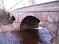 A695 Road Bridge at Dilston over the Devil's Water - geograph.org.uk - 1716468.jpg 1,600 × 1,200; 565 KB
-
 A695 west of Dilston - geograph.org.uk - 4745059.jpg 640 × 481; 29 KB
-
 Arable field in winter - geograph.org.uk - 1736763.jpg 640 × 480; 118 KB
-
 Bridge at Dilston - geograph.org.uk - 1723404.jpg 640 × 480; 134 KB
-

-

-
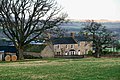
 Converted farm buildings, Dilston - geograph.org.uk - 1021641.jpg 640 × 480; 81 KB
-
 Devil's Water - geograph.org.uk - 1723405.jpg 640 × 480; 120 KB
-
 Devil's Water at Dilston - geograph.org.uk - 1723413.jpg 640 × 480; 129 KB
-
 Devil's Water at Dilston Haughs (2) - geograph.org.uk - 2124167.jpg 480 × 640; 111 KB
-
 Devil's Water at Dilston Haughs (3) - geograph.org.uk - 2124175.jpg 640 × 480; 117 KB
-
 Devil's Water, Dilston - geograph.org.uk - 2026958.jpg 1,024 × 768; 296 KB
-
 Devil's Water, Dilston - geograph.org.uk - 2061117.jpg 600 × 450; 394 KB
-
 Dilston Bridge - geograph.org.uk - 4282269.jpg 640 × 480; 279 KB
-
 Dilston Crossing - geograph.org.uk - 5403695.jpg 6,000 × 4,000; 5.16 MB
-
 Dilston Hall - geograph.org.uk - 2061123.jpg 600 × 450; 294 KB
-
 Dilston Hall - geograph.org.uk - 2325657.jpg 640 × 480; 118 KB
-
 Dilston House - geograph.org.uk - 2741980.jpg 3,054 × 2,436; 1.34 MB
-
 Dilston Mill - geograph.org.uk - 3110221.jpg 3,888 × 2,592; 1.96 MB
-
 Dilston Park - geograph.org.uk - 1723400.jpg 640 × 442; 103 KB
-
 Dilston Park - geograph.org.uk - 1723401.jpg 640 × 480; 86 KB
-
 Dilston Park - geograph.org.uk - 3110222.jpg 3,888 × 2,592; 1.88 MB
-
 Dilston Park South Farm - geograph.org.uk - 5405487.jpg 6,000 × 4,000; 4.5 MB
-
 Dilston Park, near Corbridge - geograph.org.uk - 124211.jpg 640 × 311; 60 KB
-
 Dilston Physic Garden - geograph.org.uk - 1723412.jpg 640 × 480; 140 KB
-
 Dilston Scout Camp - geograph.org.uk - 2061104.jpg 600 × 450; 334 KB
-
 Dilston scout camp site - geograph.org.uk - 1723409.jpg 640 × 480; 106 KB
-
 Dilston Scout Camp Site - geograph.org.uk - 361431.jpg 640 × 480; 141 KB
-
 Dilston Weir - geograph.org.uk - 1710453.jpg 1,600 × 1,200; 546 KB
-
 Dilston Weir and Fish Ladder on Devil's Water - geograph.org.uk - 1721058.jpg 1,600 × 1,200; 531 KB
-
 Drive of Giant Redwoods, Dilston Hall - geograph.org.uk - 2026645.jpg 1,024 × 768; 297 KB
-
 Earl's Bridge, Dilston - geograph.org.uk - 2061113.jpg 600 × 450; 367 KB
-

-

-
 Excavated remains of Dilston Hall - geograph.org.uk - 2028879.jpg 1,024 × 768; 273 KB
-
 Falls on the Devil's Water - geograph.org.uk - 1736773.jpg 640 × 480; 121 KB
-
 Falls on the Devil's Water - geograph.org.uk - 1736775.jpg 640 × 480; 155 KB
-
 Farmland at Dilston Park - geograph.org.uk - 1721075.jpg 1,600 × 1,200; 507 KB
-
 Farmland at Dilston Park - geograph.org.uk - 1721114.jpg 1,600 × 1,200; 686 KB
-
 Farmland at East Haugh, Dilston - geograph.org.uk - 1710472.jpg 1,600 × 1,200; 643 KB
-
 Farmland west of Dilston Park (2) - geograph.org.uk - 2124202.jpg 640 × 480; 79 KB
-
 Farmland west of Dilston Park (3) - geograph.org.uk - 2124209.jpg 640 × 480; 75 KB
-
 Farmland west of Dilston Park (4) - geograph.org.uk - 2124214.jpg 640 × 480; 76 KB
-
 Farmland west of Dilston Park - geograph.org.uk - 2124199.jpg 640 × 480; 78 KB
-
 Farmland, Dilston Park (2) - geograph.org.uk - 2099459.jpg 640 × 480; 80 KB
-
 Farmland, Dilston Park - geograph.org.uk - 2099454.jpg 640 × 480; 77 KB
-
 Grazing near Dilston - geograph.org.uk - 3434623.jpg 640 × 531; 34 KB
-
-
 Lord's Bridge over Devil's Water, Dilston - geograph.org.uk - 2026925.jpg 1,024 × 768; 371 KB
-
 Lord's Bridge, Devils Water, Dilston - geograph.org.uk - 1710426.jpg 1,600 × 1,200; 681 KB
-
 Mencap National College, Dilston Hall - geograph.org.uk - 2036755.jpg 1,024 × 768; 264 KB
-

-

-
 Official paranoia - geograph.org.uk - 1723407.jpg 640 × 480; 101 KB
-

-
 Poppy field at Dilston - geograph.org.uk - 1336568.jpg 640 × 480; 117 KB
-

-
 River Tyne - geograph.org.uk - 1260635.jpg 640 × 379; 69 KB
-
 Sheep near Dilston - geograph.org.uk - 5403700.jpg 6,000 × 4,000; 5.83 MB
-
 The Dipton Burn - geograph.org.uk - 1763986.jpg 600 × 450; 448 KB
-

-

-
 The path to Dilston - geograph.org.uk - 1723402.jpg 640 × 480; 168 KB
-
 The River Tyne and Dilston Haughs - geograph.org.uk - 1815460.jpg 640 × 480; 85 KB


_-_geograph.org.uk_-_1021642.jpg)


_-_geograph.org.uk_-_2124167.jpg)
_-_geograph.org.uk_-_2124175.jpg)


_-_geograph.org.uk_-_2124202.jpg)
_-_geograph.org.uk_-_2124209.jpg)
_-_geograph.org.uk_-_2124214.jpg)

_-_geograph.org.uk_-_2099459.jpg)


_-_geograph.org.uk_-_1021648.jpg)


