Category:Dorfbrunnen, Mattstetten
Jump to navigation
Jump to search
| Object location | | View all coordinates using: OpenStreetMap |
|---|
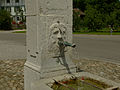
fountain in Mattstetten in the canton of Bern, Switzerland  | |||||
| Upload media | |||||
| Instance of | |||||
|---|---|---|---|---|---|
| Part of | |||||
| Made from material | |||||
| Location | Mattstetten, Bern-Mittelland administrative district, Bernese Mittelland administrative region, Bern, Switzerland | ||||
| Street address |
| ||||
| Architectural style |
| ||||
| Heritage designation | |||||
| Inception |
| ||||
 | |||||
Media in category "Dorfbrunnen, Mattstetten"
The following 4 files are in this category, out of 4 total.
-
 Brunnen Jegenstorfstrasse Mattstetten.jpg 1,670 × 1,670; 3.64 MB
-
 Dorfbrunnen Mattstetten2.jpg 4,348 × 2,899; 1.47 MB
-
 Dorfbrunnen Mattstetten3.jpg 4,320 × 3,240; 2.28 MB
-
 Dorfbrunnen Mattstetten5.jpg 4,112 × 3,084; 1.52 MB


