Category:Duchy of Burgundy
Jump to navigation
Jump to search
Internationalization
English: Duchy of Burgundy
Français : Duché de Bourgogne
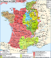
historic principality  .svg)  A Burgundi Hercegség területei 1465–1477 között | |||||
| Upload media | |||||
| Instance of | |||||
|---|---|---|---|---|---|
| Location |
| ||||
| Capital | |||||
| Inception |
| ||||
| Dissolved, abolished or demolished date |
| ||||
| Religion or worldview | |||||
 | |||||
Subcategories
This category has the following 7 subcategories, out of 7 total.
Media in category "Duchy of Burgundy"
The following 74 files are in this category, out of 74 total.
-
 AltaYBajaBorgoñaSiglosIXX.svg 1,002 × 1,014; 1.17 MB
-
 Ancient Flag of the Duchy of Burgundy.svg 600 × 360; 9 KB
-
 Armoiries de Jacques de Clèves-Nevers.svg 600 × 660; 1.1 MB
-
 Austria-Burgundy Arms.svg 600 × 660; 28 KB
-
 Bandera de Borgoña.svg 1,000 × 600; 106 KB
-
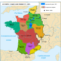
 Bourgogne in XI-XII century.png 931 × 647; 294 KB
-
 Burgundies 3.png 479 × 487; 128 KB
-
 Burgundy Chateau Rent 63-2.tif 915 × 1,057; 1.53 MB
-
 C. 1184 Eastern France, Champagne and Burgundy.jpg 1,840 × 1,119; 2.05 MB
-
 C. 1184 France and English Possesions.jpg 1,328 × 1,305; 2.25 MB
-
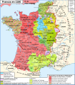
 C. 1279 France.jpg 2,979 × 3,931; 4.38 MB
-
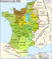
 C. 1429 France.jpg 3,890 × 3,010; 4.27 MB
-
 C. 1450 Burgundy Bourbon and Savoy.jpg 1,307 × 1,040; 1.38 MB
-
 C. 1453 France.jpg 1,458 × 1,202; 1.55 MB
-
 C. 1490 France and England.jpg 811 × 1,252; 1.26 MB
-
 C. 1494 France.jpg 1,379 × 1,337; 1.24 MB
-
 C. 1575 France (Northern).jpg 2,206 × 1,275; 3.11 MB
-
 C. 1575 France (Southern).jpg 1,980 × 1,381; 2.99 MB
-
 Carte Bourgogne 1656 Zeiller 14385.jpg 3,581 × 2,705; 6.35 MB
-
 Carte-Royaume-dArles.png 1,500 × 1,529; 412 KB
-
 Coat of arms of the House of Gonzaga (1565).svg 165 × 205; 245 KB
-
 D159- N° 345. Duché de Bourgogne. - liv3-ch08.png 1,015 × 1,723; 240 KB
-
 Duchy of Burgundy (XIV–XV centuries)-ka.svg 1,300 × 1,265; 1.77 MB
-
 Duchy of Burgundy.png 891 × 899; 24 KB
-
 Duché et Comté de Bourgogne au XIVe siecle-es.svg 829 × 639; 63 KB
-
 Duché et Comté de Bourgogne au XIVe siecle-pt.svg 829 × 639; 63 KB
-
 Duché et Comté de Bourgogne au XIVe siecle.svg 829 × 639; 53 KB
-
 Flag map of the Duchy of Burgundy (918–1482).png 330 × 275; 56 KB
-
 Flag of the Duchy of Burgundy.png 198 × 131; 892 bytes
-
 Flag of the Duchy of Burgundy.svg 450 × 300; 379 bytes
-
 Blason famille it Gonzaga10.svg 600 × 660; 456 KB
-

-

-
 Karte Hoch Niederburgund-FR.png 2,000 × 2,126; 549 KB
-
 Karte Hoch und Niederburgund EN.png 2,000 × 2,126; 538 KB
-
 Karte Hoch und Niederburgund-el.png 1,310 × 1,338; 200 KB
-
 Karte Hoch- und Niederburgund.png 2,000 × 2,126; 549 KB
-
 Karte Königreich Arelat DE.png 1,500 × 1,529; 414 KB
-
 La Bourgogne aux XI et XIIe siècles-es.svg 1,050 × 1,450; 515 KB
-
 La Bourgogne aux XI et XIIe siècles.svg 1,050 × 1,450; 302 KB
-
 Le royaume des Francs sous Hugues Capet-be.svg 1,796 × 1,796; 1.36 MB
-
 Le royaume des Francs sous Hugues Capet-en.svg 1,796 × 1,796; 1.37 MB
-
 Le royaume des Francs sous Hugues Capet-es.svg 1,916 × 1,916; 1.37 MB
-
 Le royaume des Francs sous Hugues Capet-fr.svg 1,796 × 1,796; 1.38 MB
-
 Le royaume des Francs sous Hugues Capet-ka.svg 1,796 × 1,800; 1.23 MB
-
 Le royaume des Francs sous Hugues Capet-ru.svg 1,796 × 1,796; 1.07 MB
-
 Map France 1030-br.svg 989 × 1,126; 741 KB
-
 Map France 1030-ca.svg 1,053 × 1,199; 4.9 MB
-
 Map France 1030-de.svg 988 × 1,124; 1.49 MB
-
 Map France 1030-es.svg 1,053 × 1,199; 4.12 MB
-
 Map France 1030-fr.svg 989 × 1,126; 718 KB
-
 Map France 1030-ru.svg 988 × 1,124; 789 KB
-
 Map France 1030-uk.svg 988 × 1,124; 789 KB
-
 Map France 1180-br.svg 988 × 1,124; 1.9 MB
-
 Map France 1180-de.svg 988 × 1,124; 1.94 MB
-
 Map France 1180-es.svg 988 × 1,124; 1.97 MB
-
 Map France 1180-fr.svg 988 × 1,124; 1.88 MB
-
 Map France 1180-ru.svg 988 × 1,124; 1.88 MB
-
 Map France 1180-uk.svg 988 × 1,124; 1.68 MB
-
 Map Kingdom Arelat AR.png 1,454 × 1,485; 856 KB
-
 Map Kingdom Arelat EN.png 1,310 × 1,338; 209 KB
-
 Map Kingdom Arelat-el.png 1,310 × 1,338; 227 KB
-
 Map of the Duchy of Burgundy by Abraham Ortelius.jpeg 3,033 × 2,360; 2.17 MB
-
 Monnaie - Bourgogne - btv1b113349655 (1 of 2).jpg 2,150 × 2,150; 579 KB
-
 Monnaie - Bourgogne - btv1b113349655 (2 of 2).jpg 2,150 × 2,150; 537 KB
-

-

-
 Ortelius - Burgundy 1588.jpeg 3,469 × 2,456; 2.18 MB
-
 Provinces of France.png 894 × 899; 39 KB
-
 Vöcklabruck - Stadttürme, Freskenbeschreibung.JPG 4,227 × 2,818; 8.97 MB
-
 Vöcklabruck Unterer-Stadtturm Maximilian.jpg 2,031 × 854; 598 KB
-
 Wappen röm.kaiser.JPG 920 × 780; 279 KB
-
-


.jpg)
.jpg)


.svg)

-ka.svg)


.png)


,_RP-P-OB-205.531.jpg)
,_RP-P-OB-84.368.jpg)


.jpg)
.jpg)
.jpg)
.jpg)


,_RP-P-OB-205.132.jpg)
,_RP-P-OB-205.133.jpg)