Category:Dunsink (townland)
Jump to navigation
Jump to search
townland in Blanchardstown, County Dublin, Ireland  | |||||
| Upload media | |||||
| Instance of | |||||
|---|---|---|---|---|---|
| Location | County Dublin, Leinster, Ireland | ||||
 | |||||
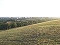
Dunsink is a townland in the civil parish of Castleknock, in the ancient barony of Castleknock. It is located close to the residential area of Blanchardstown. The townland is bordered to the north by the townland of Cappoge; to the south-east by the townland of Scribblestown; to the south by the river Tolka and to the west by the M50 motorway. The townland is bisected from west to east by Dunsink Lane. It is noted for containing the largest landfill site in Ireland and for the oldest observatory in Ireland - Dunsink Observatory.
Media in category "Dunsink (townland)"
This category contains only the following file.
-
 M50 from Dunsink Tiphead - geograph.org.uk - 511078.jpg 640 × 480; 142 KB
