Category:Dunton Green
Jump to navigation
Jump to search
English: Dunton Green is a small village (forming a northern suburb of Sevenoaks) and civil parish in the Sevenoaks District of Kent, England, lying in the valley of the River Darent, three miles north of Sevenoaks. The original ecclesiastical parish of Dunton Green was part of Otford parish. The parish church is dedicated to St John the Divine.
Norsk bokmål: Dunton Green er en landsby og et verdslig sogn i Kent i England. Den ligger i dalen Darent renner gjennom, omkring fem km nord for Sevenoaks.
village in the United Kingdom  | |||||
| Upload media | |||||
| Instance of | |||||
|---|---|---|---|---|---|
| Location | Sevenoaks, Kent, South East England, England | ||||
| Population |
| ||||
 | |||||
Subcategories
This category has the following 4 subcategories, out of 4 total.
Media in category "Dunton Green"
The following 200 files are in this category, out of 227 total.
(previous page) (next page)-
 A bend in Morants Court Rd (A224) - geograph.org.uk - 2054096.jpg 640 × 430; 167 KB
-
 A busy M25 northbound - geograph.org.uk - 3485354.jpg 1,600 × 988; 268 KB
-

-
 A224 bridge over the M25 - geograph.org.uk - 3731051.jpg 640 × 393; 50 KB
-
 A224 bridge, M25 - geograph.org.uk - 2739399.jpg 640 × 373; 51 KB
-
 A228 off Morants Court Cross - geograph.org.uk - 2055273.jpg 640 × 430; 144 KB
-

-
 Approaching junction 5, M25 - geograph.org.uk - 3008585.jpg 800 × 600; 82 KB
-
 Ascending on the M25 - geograph.org.uk - 3307290.jpg 640 × 430; 51 KB
-
 Barretts Road, Dunton Green - geograph.org.uk - 4466198.jpg 2,272 × 1,704; 764 KB
-
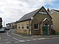 Bethel Free Church, Dunton Green - geograph.org.uk - 1450159.jpg 640 × 480; 67 KB
-

-
 Bridge over the M25 - geograph.org.uk - 2739394.jpg 640 × 430; 46 KB
-
 Bridge over the M25 - geograph.org.uk - 3307292.jpg 640 × 430; 54 KB
-
 Bridge over the M25 - geograph.org.uk - 5724513.jpg 640 × 426; 45 KB
-
 Bridge over the M25, Polhill - geograph.org.uk - 3156772.jpg 2,048 × 1,536; 1.5 MB
-
 Bridge over the M26 - geograph.org.uk - 3206238.jpg 4,000 × 3,000; 4.18 MB
-
 Bridge over the River Darenth at Sevenoaks Wildlife Reserve - geograph.org.uk - 6422352.jpg 4,000 × 3,000; 4.86 MB
-
 Bridleway under the M25 - geograph.org.uk - 1977971.jpg 640 × 428; 181 KB
-
 Bus shelter, A224 - geograph.org.uk - 2054075.jpg 640 × 430; 127 KB
-
 Bus Stop, Bradbourne Vale Rd (A25) - geograph.org.uk - 1720305.jpg 640 × 427; 88 KB
-
 Car Dealer, Dunton Green - geograph.org.uk - 1306137.jpg 640 × 480; 95 KB
-
 Car Dealer, Dunton Green, Kent - geograph.org.uk - 1238881.jpg 640 × 500; 84 KB
-
 Car Dealers, Riverhead, Sevenoaks - geograph.org.uk - 786256.jpg 640 × 480; 74 KB
-
 Cattle by Rye Lane - geograph.org.uk - 1720477.jpg 640 × 427; 61 KB
-
 Cattle by the Darent Valley Path - geograph.org.uk - 1720542.jpg 640 × 427; 66 KB
-

-
 Chipstead Lake - geograph.org.uk - 1399066.jpg 640 × 480; 57 KB
-
 Church of St John the Divine, Dunton Green - geograph.org.uk - 3457442.jpg 2,048 × 1,536; 1.43 MB
-
 Congestion on the M26 - geograph.org.uk - 1984980.jpg 3,488 × 2,616; 2.18 MB
-
 Crescent Cottages, Dunton Green - geograph.org.uk - 4466195.jpg 2,272 × 1,704; 741 KB
-
 Daffodils at Sevenoaks Wildlife Reserve - geograph.org.uk - 6422552.jpg 3,518 × 2,730; 2.15 MB
-
 Darent Valley Path - geograph.org.uk - 1720423.jpg 640 × 427; 101 KB
-
 Darent Valley Path and River Darent - geograph.org.uk - 6294573.jpg 1,024 × 768; 331 KB
-
 Darent Valley Path goes under the M26 - geograph.org.uk - 2054013.jpg 640 × 430; 174 KB
-

-
 Darent Valley Path heading north - geograph.org.uk - 1720400.jpg 640 × 427; 141 KB
-
 Darent Valley Path heading north - geograph.org.uk - 2054060.jpg 640 × 430; 144 KB
-
 Darent Valley Path heading south - geograph.org.uk - 2054061.jpg 640 × 430; 149 KB
-
 Darent Valley Path in Dunton Green - geograph.org.uk - 6294559.jpg 4,160 × 3,120; 2.05 MB
-
 Darent Valley Path off the A224 - geograph.org.uk - 2054070.jpg 640 × 430; 188 KB
-
 Darenth Valley Path enters Crown Meadow - geograph.org.uk - 1450199.jpg 480 × 640; 112 KB
-
 Darenth Valley Path in Crown Meadow - geograph.org.uk - 1450201.jpg 640 × 480; 137 KB
-

-
 Demolition Site, Dunton Green Depot - geograph.org.uk - 1720430.jpg 640 × 427; 55 KB
-
 Donnington Manor Hotel - geograph.org.uk - 1578239.jpg 640 × 427; 54 KB
-
 Donnington Manor Hotel - geograph.org.uk - 1917348.jpg 1,024 × 683; 204 KB
-
 Donnington Manor Hotel - geograph.org.uk - 3608358.jpg 640 × 480; 70 KB
-
 Donnington Manor Hotel - geograph.org.uk - 6846787.jpg 1,024 × 683; 264 KB
-
 Donnington Manor, Dunton Green - geograph.org.uk - 3205401.jpg 4,000 × 3,000; 4.25 MB
-
 Donnington Manor, Dunton Green - geograph.org.uk - 3205403.jpg 4,000 × 3,000; 4.01 MB
-
 Donnington Road, Dunton Green - geograph.org.uk - 4466219.jpg 2,272 × 1,704; 711 KB
-
 Double Barn, Rye Lodge Farm - geograph.org.uk - 1720498.jpg 640 × 427; 63 KB
-
 Dunton Green - geograph.org.uk - 5109937.jpg 640 × 426; 97 KB
-
 Dunton Green Chalk Quarry - geograph.org.uk - 2265043.jpg 640 × 426; 80 KB
-
 Dunton Green Depot, Demolished - geograph.org.uk - 1720449.jpg 640 × 413; 51 KB
-
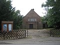 Dunton Green Free Church - geograph.org.uk - 1448110.jpg 640 × 480; 85 KB
-

-
 Dunton Green Village Sign - geograph.org.uk - 1448115.jpg 640 × 480; 72 KB
-
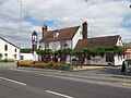
 Dunton Green, Rose ^ Crown - geograph.org.uk - 1861069.jpg 800 × 600; 95 KB
-
 Entering Dunton Green, Rye Lane - geograph.org.uk - 1720482.jpg 640 × 405; 76 KB
-
 Entrance to Crown Meadow - geograph.org.uk - 1450191.jpg 640 × 480; 100 KB
-

-

-
 Farmland near Twitton - geograph.org.uk - 3899449.jpg 640 × 347; 37 KB
-
 Farmland seen from the railway line - geograph.org.uk - 3899448.jpg 640 × 347; 30 KB
-
 Farmland south of Twitton - geograph.org.uk - 3449793.jpg 640 × 393; 33 KB
-
 Field by main line - geograph.org.uk - 5949428.jpg 1,024 × 681; 99 KB
-
 Filston Lane, Twitton - geograph.org.uk - 1584222.jpg 640 × 480; 74 KB
-
 Footpath SR105 passes under M26 - geograph.org.uk - 4947550.jpg 4,288 × 3,216; 2.63 MB
-

-

-
 Heading east on the M26 - geograph.org.uk - 2728600.jpg 640 × 428; 55 KB
-
 Hedge and ditch north of the A25 - geograph.org.uk - 1720339.jpg 640 × 427; 70 KB
-
 House on Rye Lane - geograph.org.uk - 1720484.jpg 640 × 562; 67 KB
-
 Houses on London Road, Dunton Green - geograph.org.uk - 5000016.jpg 2,048 × 1,536; 1.49 MB
-
 Houses on Rye Lane - geograph.org.uk - 4946830.jpg 4,288 × 3,216; 2.75 MB
-

-

-
 Ivy House Lane, Dunton Green - geograph.org.uk - 4466211.jpg 2,272 × 1,704; 1,005 KB
-
 Kingswood Road, Dunton Green - geograph.org.uk - 5044275.jpg 3,264 × 2,448; 1.67 MB
-
 Kissing gate on the Darent Valley Path - geograph.org.uk - 1720466.jpg 640 × 427; 157 KB
-
 Kissing gate, Darent Valley Path - geograph.org.uk - 1720399.jpg 640 × 427; 152 KB
-
 Lake Outflow, Bradbourne Lakes Park - geograph.org.uk - 1720117.jpg 640 × 427; 98 KB
-
 Large tree by Rye Lane - geograph.org.uk - 1720473.jpg 640 × 427; 67 KB
-
 London bound train - geograph.org.uk - 1720537.jpg 640 × 427; 59 KB
-
 London Road (A224) Bridge over the M26 - geograph.org.uk - 3688347.jpg 640 × 480; 251 KB
-
 London Road - geograph.org.uk - 1917325.jpg 1,024 × 683; 197 KB
-
 London Road bridge in Dunton Green - geograph.org.uk - 1448121.jpg 640 × 480; 94 KB
-

-
 London Road, Dunton Green - geograph.org.uk - 1306121.jpg 640 × 480; 100 KB
-
 London Road, Dunton Green - geograph.org.uk - 3156753.jpg 2,048 × 1,536; 1.48 MB
-
 London Road, Dunton Green - geograph.org.uk - 4466184.jpg 2,272 × 1,704; 1.06 MB
-
 London Road, Dunton Green - geograph.org.uk - 4466190.jpg 2,272 × 1,704; 777 KB
-
 London Road, Dunton Green - geograph.org.uk - 4466208.jpg 2,272 × 1,704; 777 KB
-
 London Road, Dunton Green - geograph.org.uk - 4466212.jpg 2,272 × 1,704; 781 KB
-
 London Road, Dunton Green - geograph.org.uk - 4466220.jpg 2,272 × 1,704; 807 KB
-
 London Road, Dunton Green - geograph.org.uk - 5000045.jpg 2,048 × 1,536; 1.49 MB
-
 London Road, Dunton Green, Kent - geograph.org.uk - 1238876.jpg 640 × 480; 59 KB
-
 Long Meadow, Dunton Green - geograph.org.uk - 1398851.jpg 640 × 480; 58 KB
-
 Looking to Hangman Down - geograph.org.uk - 3360601.jpg 640 × 426; 45 KB
-
 M25 - geograph.org.uk - 2739392.jpg 640 × 393; 52 KB
-
 M25 - skirting Star Hill - geograph.org.uk - 3107803.jpg 800 × 548; 63 KB
-
 M25 approaching A21 junction - geograph.org.uk - 3458445.jpg 1,722 × 1,102; 864 KB
-
 M25 ascending Polhill - geograph.org.uk - 3731085.jpg 640 × 482; 53 KB
-
 M25 beneath Hangman Down Shaw - geograph.org.uk - 3107839.jpg 800 × 574; 76 KB
-
 M25 climbing Polhill - geograph.org.uk - 5724517.jpg 640 × 426; 47 KB
-
 M25 clockwise - geograph.org.uk - 4231805.jpg 640 × 411; 40 KB
-
 M25 clockwise - geograph.org.uk - 4231821.jpg 640 × 432; 51 KB
-
 M25 from Morants Court Road - geograph.org.uk - 3205407.jpg 4,000 × 3,000; 4.31 MB
-
 M25, southbound - geograph.org.uk - 3731048.jpg 640 × 430; 47 KB
-
 M26 bridge over Rye Lane - geograph.org.uk - 3206252.jpg 4,000 × 3,000; 4.02 MB
-
 M26 looking west - geograph.org.uk - 3206244.jpg 4,000 × 3,000; 4.33 MB
-
 M26 Motorway - geograph.org.uk - 4466204.jpg 2,272 × 1,704; 747 KB
-
 M26 Motorway - geograph.org.uk - 4466215.jpg 2,272 × 1,704; 748 KB
-
 M26 Motorway - geograph.org.uk - 4946849.jpg 3,216 × 4,288; 2.9 MB
-

-

-
 M26 over the railway - geograph.org.uk - 2728595.jpg 640 × 428; 52 KB
-
 Milton Road, Dunton Green - geograph.org.uk - 4466189.jpg 2,272 × 1,704; 788 KB
-
 Morants Court Rd (A224) - geograph.org.uk - 2054090.jpg 640 × 430; 130 KB
-
 Morants Court Rd (A224) - geograph.org.uk - 2054132.jpg 640 × 430; 164 KB
-
 Morants Court Road bridge over the M25 - geograph.org.uk - 1948234.jpg 554 × 640; 118 KB
-

-
 Motorway Bridge - geograph.org.uk - 4946853.jpg 4,288 × 3,216; 2.55 MB
-
 Near Twitton - geograph.org.uk - 3913464.jpg 640 × 430; 41 KB
-
 Neck and Back Pain Clinic - geograph.org.uk - 1578233.jpg 640 × 427; 82 KB
-
 New houses on London Road, Dunton Green - geograph.org.uk - 4998230.jpg 2,048 × 1,536; 1.5 MB
-
 New housing development - geograph.org.uk - 4685249.jpg 640 × 426; 86 KB
-
 New housing, Dunton Green - geograph.org.uk - 5174520.jpg 640 × 426; 62 KB
-

-
 North Downs Way near Donnington Manor Hotel - geograph.org.uk - 6846789.jpg 1,024 × 683; 196 KB
-
 North Downs Way on London Road - geograph.org.uk - 1578240.jpg 640 × 427; 106 KB
-
 Pedestrian Tunnel to Dunton Green railway station - geograph.org.uk - 4946825.jpg 3,216 × 4,288; 2.72 MB
-
 Pilgrim's Way West going under the railway - geograph.org.uk - 3156740.jpg 2,048 × 1,536; 1.49 MB
-
 Pilgrims Way West - geograph.org.uk - 4455227.jpg 640 × 426; 49 KB
-
 Ploughed Field - geograph.org.uk - 4319162.jpg 640 × 480; 63 KB
-
 Polhill by the M25 bridge link road - geograph.org.uk - 3156776.jpg 2,048 × 1,536; 1.51 MB
-
 Polhill, near Halstead - geograph.org.uk - 4720768.jpg 2,272 × 1,704; 785 KB
-
 Railway bridge - Darent Valley Path - geograph.org.uk - 1720593.jpg 640 × 427; 141 KB
-

-
 Railway bridge over Darenth Valley Path - geograph.org.uk - 1448007.jpg 640 × 480; 128 KB
-
 Railway north from Dunton Green - geograph.org.uk - 1249081.jpg 640 × 480; 207 KB
-

-
 Reflections in the West Lake at Sevenoaks Wildlife Reserve - geograph.org.uk - 5828943.jpg 4,000 × 3,000; 4.95 MB
-
 River Darent - geograph.org.uk - 1720419.jpg 640 × 427; 140 KB
-
 River Darent at Sevenoaks Wildlife Reserve - geograph.org.uk - 2434580.jpg 1,280 × 960; 649 KB
-
 River Darent at Sevenoaks Wildlife Reserve - geograph.org.uk - 3050643.jpg 4,000 × 3,000; 4.35 MB
-
 River Darenth at Sevenoaks Wildlife Reserve - geograph.org.uk - 6422346.jpg 4,000 × 3,000; 4.98 MB
-
 Roofscape, Dunton Green - geograph.org.uk - 3924464.jpg 640 × 386; 57 KB
-
 Rose and Crown, A224 - geograph.org.uk - 2054068.jpg 640 × 430; 121 KB
-
 Rose ^ Crown, Dunton Green - geograph.org.uk - 4466206.jpg 2,272 × 1,704; 676 KB
-
 Roundabout on the A224 London Road - geograph.org.uk - 1448104.jpg 640 × 480; 64 KB
-
 Rye Lane - geograph.org.uk - 1720511.jpg 640 × 427; 65 KB
-
 Rye Lane, near Dunton Green - geograph.org.uk - 5044270.jpg 3,264 × 2,448; 3.07 MB
-
 Rye Lodge Farm, Rye Lane - geograph.org.uk - 1720503.jpg 640 × 427; 61 KB
-
 Rye Wood - geograph.org.uk - 1720545.jpg 640 × 427; 61 KB
-
 Ryewood - geograph.org.uk - 4946837.jpg 4,288 × 3,216; 2.44 MB
-

-

-
 Sevenoaks Wildlife Reserve - geograph.org.uk - 1720415.jpg 640 × 427; 83 KB
-
 Sevenoaks Wildlife Reserve - geograph.org.uk - 1720459.jpg 640 × 427; 125 KB
-
 Sevenoaks, Breething Road - geograph.org.uk - 6586635.jpg 7,129 × 4,752; 5.59 MB
-
 Sevenoaks, Pounsley Road - geograph.org.uk - 6586669.jpg 4,950 × 3,301; 5.86 MB
-
 Sevenoaks, Public footpath - geograph.org.uk - 6586674.jpg 5,791 × 3,861; 7.82 MB
-
 Sevenoaks, Rye Lane - geograph.org.uk - 6586652.jpg 6,454 × 4,303; 6.82 MB
-
 Sevenoaks, The Coopers - geograph.org.uk - 6586659.jpg 6,599 × 4,399; 5.46 MB
-
 Sheep by Rye Lane - geograph.org.uk - 1720487.jpg 640 × 427; 61 KB
-
 Sheep by the Darent Valley Path - geograph.org.uk - 1720546.jpg 640 × 427; 83 KB
-
 Sheep grazing by the M26 - geograph.org.uk - 1720533.jpg 640 × 427; 69 KB
-
 Sheep on the Darent Valley Path - geograph.org.uk - 1720540.jpg 640 × 427; 73 KB
-
 Shops on London Road - geograph.org.uk - 1917315.jpg 1,024 × 683; 195 KB
-
 Shops on London Road, Dunton Green - geograph.org.uk - 3457678.jpg 2,048 × 1,536; 1.54 MB
-
 Shops on London Road, Dunton Green - geograph.org.uk - 4998225.jpg 2,048 × 1,536; 1.5 MB
-
 Snipe Bog Lake at Sevenoaks Wildlife Reserve - geograph.org.uk - 5847365.jpg 3,272 × 2,454; 1.64 MB
-
 Snipe Bog Lake at Sevenoaks Wildlife Reserve - geograph.org.uk - 5847368.jpg 4,000 × 3,000; 4.56 MB
-
 Snipe Bog Lake at Sevenoaks Wildlife Reserve - geograph.org.uk - 5847370.jpg 3,347 × 2,510; 2.23 MB
-
 Snow at Dunton Green Station - geograph.org.uk - 5752539.jpg 640 × 426; 91 KB
-
 Southbound on the M25 - geograph.org.uk - 1948223.jpg 640 × 412; 92 KB
-
 Static Caravan Park, Rye Lane - geograph.org.uk - 1720517.jpg 640 × 427; 62 KB
-
 Static Caravan Site, Rye Lane - geograph.org.uk - 1720508.jpg 640 × 427; 42 KB
-
 Station Rd - geograph.org.uk - 1720467.jpg 640 × 427; 96 KB
-
 Station Road, Dunton Green - geograph.org.uk - 4466193.jpg 2,272 × 1,704; 724 KB
-
 Stile just south of the M26 - geograph.org.uk - 2054014.jpg 640 × 430; 161 KB
-

-
 Stream flowing out of Bradbourne Lakes - geograph.org.uk - 1720119.jpg 640 × 427; 136 KB
-
 Technical Treatments Ltd industrial building - geograph.org.uk - 4946832.jpg 4,288 × 3,216; 2.73 MB
-
 Telephone Box, Dunton Green - geograph.org.uk - 1306167.jpg 640 × 480; 136 KB
-
 Thatched House at Dunton Green - geograph.org.uk - 6433062.jpg 914 × 608; 199 KB
-
-
 The Dukes Head, Dunton Green - geograph.org.uk - 4466202.jpg 2,272 × 1,704; 663 KB
-
 The Dukes Head, Dunton Green - geograph.org.uk - 6846805.jpg 1,024 × 683; 149 KB
-
 The M25 heading clockwise - geograph.org.uk - 6865328.jpg 4,800 × 3,600; 902 KB
-
 The M25 heading clockwise - geograph.org.uk - 6865329.jpg 4,800 × 3,600; 1.28 MB
-
 The M25 heading south - geograph.org.uk - 1948219.jpg 640 × 430; 127 KB
-
 The Miners Arms, Dunton Green - geograph.org.uk - 4466186.jpg 2,272 × 1,704; 751 KB
-

-
 The North Downs Way towards Otford - geograph.org.uk - 1578243.jpg 640 × 427; 89 KB
-
 The old Dunton Green Depot Site - geograph.org.uk - 1720447.jpg 640 × 427; 78 KB
-

_-_geograph.org.uk_-_2054096.jpg)

_heading_north_west_from_Dunton_Green_-_geograph.org.uk_-_2054081.jpg)


_entering_Riverhead_-_geograph.org.uk_-_1720362.jpg)


_-_geograph.org.uk_-_1720305.jpg)


_-_geograph.org.uk_-_2054116.jpg)


_Bridge_over_the_M26_-_geograph.org.uk_-_3688347.jpg)


_-_geograph.org.uk_-_2054090.jpg)
_-_geograph.org.uk_-_2054132.jpg)


