Category:Eglwyseg Crags
Jump to navigation
Jump to search
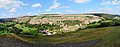
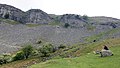
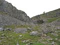
English: The Eglwyseg valley is an area to the north east of Llangollen in Denbighshire, Wales, United kingdom
rock formation in Wales ,_Wales_04.jpg) ,_Clwydian_Range_and_Dee_Valley_AONB,_Wales_18.jpg) ,_Clwydian_Range_and_Dee_Valley_AONB,_Wales_40.jpg) ,_Clwydian_Range_and_Dee_Valley_AONB,_Wales_10.jpg) | |||||
| Upload media | |||||
| Instance of | |||||
|---|---|---|---|---|---|
| Location | Denbighshire, Wales | ||||
 | |||||
Subcategories
This category has the following 6 subcategories, out of 6 total.
A
- Aerial images of the Eglwyseg Crags (238 F)
C
- Craig Arthur, Eglwyseg (45 F)
- Craig y Moch (45 F)
D
- Dinbren-Uchaf crags (48 F)
P
- Plas yn Eglwyseg (65 F)
T
- Tan y Castell crags (57 F)
Media in category "Eglwyseg Crags"
The following 67 files are in this category, out of 67 total.
-
 Castell Dinas Bran, Llangollen - AUOB (Dyffryn Ddyfrdwy (Dee Valley); Wales 15.jpg 3,840 × 2,160; 2.48 MB
-
 Castell Dinas Bran, Llangollen - AUOB (Dyffryn Ddyfrdwy (Dee Valley); Wales 23.jpg 3,840 × 2,160; 2.19 MB
-

-
 Craig Arthur - geograph.org.uk - 2981096.jpg 640 × 480; 85 KB
-
 Craig Arthur - geograph.org.uk - 2981140.jpg 640 × 480; 110 KB
-
 Craig Arthur - geograph.org.uk - 6151223.jpg 1,024 × 683; 225 KB
-
 Craig Arthur in distance - geograph.org.uk - 2981132.jpg 640 × 480; 87 KB
-
 Craig y Forwyn - geograph.org.uk - 2485545.jpg 2,592 × 1,944; 2.33 MB
-
 Craig y Forwyn - geograph.org.uk - 3043816.jpg 1,600 × 1,200; 656 KB
-
 Craig y Forwyn and Craig y Cythraul - geograph.org.uk - 2485532.jpg 2,592 × 1,944; 2.05 MB
-
-
 Creigiau Eglwyseg - geograph.org.uk - 2227432.jpg 2,288 × 1,712; 822 KB
-
 Creigiau Eglwyseg - geograph.org.uk - 2564789.jpg 1,024 × 680; 256 KB
-
 Creigiau Eglwyseg - geograph.org.uk - 2564988.jpg 1,024 × 680; 173 KB
-
 Creigiau Eglwyseg - geograph.org.uk - 2807037.jpg 640 × 480; 77 KB
-
 Creigiau Eglwyseg - geograph.org.uk - 2807058.jpg 640 × 480; 119 KB
-
 Creigiau Eglwyseg - geograph.org.uk - 3563047.jpg 3,216 × 2,136; 3.56 MB
-
 Creigiau Eglwyseg - geograph.org.uk - 3749178.jpg 640 × 480; 114 KB
-
 Creigiau Eglwyseg - geograph.org.uk - 3749180.jpg 640 × 480; 106 KB
-
 Creigiau Eglwyseg - geograph.org.uk - 3960097.jpg 640 × 480; 101 KB
-

-
 Creigiau Eglwyseg from the gully - geograph.org.uk - 3749165.jpg 640 × 480; 101 KB
-
 Creigiau Eglwyseg from the gully - geograph.org.uk - 3749170.jpg 640 × 480; 110 KB
-
 Creigiau Eglwyseg from the gully - geograph.org.uk - 3749174.jpg 640 × 480; 90 KB
-

-

-

-

-
 Creigiau Eglwyseg, from just west of Dergoed - geograph.org.uk - 5396802.jpg 4,271 × 2,435; 3.66 MB
-
 Creigiau Trefor Rocks - geograph.org.uk - 3960069.jpg 640 × 480; 87 KB
-
 Dry waterfall at Eglwyseg Crags - geograph.org.uk - 186307.jpg 640 × 495; 105 KB
-
 Eglwyseg (2011.10.16).jpg 4,256 × 2,832; 13.73 MB
-
 Eglwyseg 1.jpg 4,608 × 3,456; 3.17 MB
-
 Eglwyseg 2.jpg 4,608 × 3,456; 4.05 MB
-

-

-
 Eglwyseg Crags from Offa's Dyke Path.jpg 1,836 × 1,033; 919 KB
-

-

-
 Eglwyseg Crags, above Rock Farm - geograph.org.uk - 186290.jpg 640 × 480; 112 KB
-
 Eglwyseg Crags, above Rock Farm - geograph.org.uk - 186302.jpg 480 × 640; 115 KB
-

-

-
 Eglwyseg.jpg 1,200 × 900; 356 KB
-
 Green oasis - geograph.org.uk - 5121829.jpg 640 × 480; 90 KB
-

-
 Limestone scree - geograph.org.uk - 6018628.jpg 5,184 × 3,888; 4.69 MB
-
 Limestone scree near Bryn-goleu - geograph.org.uk - 6151166.jpg 1,024 × 683; 258 KB
-

-
 Limestone with heather - geograph.org.uk - 5123385.jpg 640 × 480; 98 KB
-
 Looking over Craig Arthur to Cyrn-y-Brain - geograph.org.uk - 3278794.jpg 1,024 × 784; 261 KB
-
 Offa's Dyke path above Tan-y-graig - geograph.org.uk - 6151229.jpg 1,024 × 683; 229 KB
-
 Offa's Dyke path above Ty Canol - geograph.org.uk - 6151244.jpg 1,024 × 683; 212 KB
-
 Offa's Dyke path above Ty-brith - geograph.org.uk - 6151197.jpg 1,024 × 683; 209 KB
-
 Offa's Dyke path below Craig Arthuir - geograph.org.uk - 6151248.jpg 1,024 × 683; 224 KB
-
 Offa's Dyke Path below Craig Arthur - geograph.org.uk - 6199473.jpg 1,024 × 768; 351 KB
-
 On Offa's Dyke Path below Eglwyseg Mountain - geograph.org.uk - 6083998.jpg 5,184 × 2,920; 6.52 MB
-
 Road approaching Rock Farm at Bryn Goleu - geograph.org.uk - 5396788.jpg 3,303 × 2,631; 6.18 MB
-
 Scree shadows - geograph.org.uk - 5121860.jpg 640 × 480; 78 KB
-
 Sheep farm at Plas yn Eglwyseg - geograph.org.uk - 5997280.jpg 5,184 × 3,888; 4.3 MB
-

-
 Stream running off Eglwyseg Rocks - geograph.org.uk - 756597.jpg 640 × 480; 132 KB
-
 Through limestone scree - geograph.org.uk - 6017367.jpg 5,184 × 3,888; 5.09 MB
-
 Tumulus above Eglwyseg Rocks - geograph.org.uk - 756611.jpg 640 × 480; 55 KB
-
 View of Eglwyseg Rocks - geograph.org.uk - 756594.jpg 640 × 480; 81 KB
-
 View to Creigiau Eglwyseg - geograph.org.uk - 2564963.jpg 1,024 × 680; 207 KB
-

;_Wales_15.jpg)
;_Wales_23.jpg)
,_Cymru_(Wales)_and_surrounding_views_and_flora_12.jpg)


,_Wales_26.jpg)
,_Wales_21.jpg)
,_Cymru_(Wales)_and_surrounding_views_and_flora_31.jpg)


.jpg)


,_Cymru_(Wales)_and_surrounding_views_and_flora_11.jpg)
,_Cymru_(Wales)_and_surrounding_views_and_flora_28.jpg)

,_Wales_25.jpg)
,_Cymru_(Wales)_and_surrounding_views_and_flora_37.jpg)


_from_Castell_Dinas_Br%C3%A2n,_Sir_Ddinbych_(Denbighshire),_Cymru_(Wales).jpg)