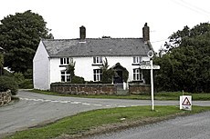
Category:English Frankton
Jump to navigation
Jump to search
Cymraeg: Pentref gwledig yn Swydd Amwythig, gorllewin canolbarth Lloegr yw English Frankton. Mae'r pentref wedi ei uno a phentrefi bychain Petton a Cockshutt i ffurfio plwyf sifil (yr uned leiaf o lywodraeth leol yn Lloegr) Cockshutt-cum-Petton.
village in Shropshire, United Kingdom | |||||
| Upload media | |||||
| Instance of | |||||
|---|---|---|---|---|---|
| Location | Cockshutt cum Petton, Shropshire, West Midlands, England | ||||
 | |||||
Media in category "English Frankton"
The following 19 files are in this category, out of 19 total.
-
Cottage at Pikes End - geograph.org.uk - 598855.jpg 640 × 480; 81 KB
-
English Frankton Road - geograph.org.uk - 672694.jpg 448 × 640; 103 KB
-
Farm buildings at Pikes End Farm - geograph.org.uk - 598848.jpg 640 × 480; 60 KB
-
Fields and trees looking good - geograph.org.uk - 598947.jpg 640 × 480; 67 KB
-
Footpath down farm access track - geograph.org.uk - 598962.jpg 640 × 480; 93 KB
-
Give Way - geograph.org.uk - 672701.jpg 640 × 398; 79 KB
-
Lane at Pikes End - geograph.org.uk - 1439518.jpg 640 × 426; 411 KB
-
Lane through English Frankton - geograph.org.uk - 1439549.jpg 640 × 426; 351 KB
-
Lane through Garden Plantation - geograph.org.uk - 598901.jpg 640 × 480; 133 KB
-
Sharp bend on a narrow lane - geograph.org.uk - 1439553.jpg 640 × 426; 390 KB
-
The Grange - geograph.org.uk - 593453.jpg 640 × 480; 112 KB
-
The Way To Loppington - geograph.org.uk - 672717.jpg 640 × 427; 47 KB
-
Tree lined lane - geograph.org.uk - 1439511.jpg 640 × 426; 475 KB
-
Trees on ancient parkland - geograph.org.uk - 598917.jpg 640 × 480; 127 KB
-
Which Way^ - geograph.org.uk - 672710.jpg 640 × 398; 58 KB
-
Winter wheat near English Frankton - geograph.org.uk - 598970.jpg 640 × 480; 51 KB
-
English Frankton - geograph.org.uk - 226745.jpg 640 × 426; 112 KB
-
English Frankton - geograph.org.uk - 226746.jpg 640 × 426; 117 KB


