Category:Ercall Magna
Jump to navigation
Jump to search
English: Ercall Magna is a civil parish in the Telford and Wrekin district, in the county of Shropshire, England.
civil parish in Telford and Wrekin, Shropshire, England | |||||
| Upload media | |||||
| Instance of | |||||
|---|---|---|---|---|---|
| Location | Telford and Wrekin, Shropshire, West Midlands, England | ||||
| Population |
| ||||
 | |||||
Subcategories
This category has the following 6 subcategories, out of 6 total.
Media in category "Ercall Magna"
The following 95 files are in this category, out of 95 total.
-
 A442 at Cold Hatton Heath - geograph.org.uk - 4990282.jpg 1,306 × 979; 487 KB
-
 Agricultural fuel pump at Tern Farm - geograph.org.uk - 6244078.jpg 1,102 × 1,469; 726 KB
-
 Along the lane south of Hilbrae - geograph.org.uk - 4990817.jpg 1,306 × 979; 566 KB
-
 An oak tree at a footpath junction - geograph.org.uk - 5498625.jpg 1,102 × 1,469; 675 KB
-
 Ancient chapel at Poynton near High Ercall - geograph.org.uk - 6832984.jpg 5,184 × 2,912; 4.27 MB
-
 Arable field and New House Farm - geograph.org.uk - 5791242.jpg 1,024 × 680; 273 KB
-
 Arable land, Ellerdine Heath - geograph.org.uk - 4588431.jpg 800 × 451; 374 KB
-
 Autumn colours on the way into Heath Lanes - geograph.org.uk - 5996989.jpg 1,469 × 1,102; 817 KB
-
 B5062 towards High Ercall - geograph.org.uk - 5605705.jpg 1,469 × 1,102; 538 KB
-
 Baled straw outside Heath Lanes - geograph.org.uk - 5996988.jpg 1,632 × 1,224; 555 KB
-
 Barley field - geograph.org.uk - 4062272.jpg 640 × 360; 228 KB
-
 Barley, Ellerdine Heath - geograph.org.uk - 4588421.jpg 800 × 451; 359 KB
-
 Barn Cottage - geograph.org.uk - 5995370.jpg 1,763 × 1,322; 963 KB
-
 Barns and store-houses at Tern Farm - geograph.org.uk - 6244075.jpg 1,469 × 1,102; 497 KB
-
 Between Ellerdine and Ellerdine Heath - geograph.org.uk - 5996852.jpg 1,102 × 1,469; 648 KB
-
 Birches Pool Melverley Farm - geograph.org.uk - 3582530.jpg 2,642 × 1,256; 1.02 MB
-
 Bottom Pool Melverley Farm Fishery - geograph.org.uk - 5568048.jpg 2,000 × 1,312; 978 KB
-
 Coming into Ellerdine Heath - geograph.org.uk - 5995366.jpg 1,469 × 1,102; 764 KB
-
 Concrete pad in corner of a field - geograph.org.uk - 5605690.jpg 1,469 × 1,102; 508 KB
-
 Cottages at the lane to Moortown - geograph.org.uk - 5605717.jpg 1,469 × 1,102; 575 KB
-
 Crudgington Bridge - geograph.org.uk - 5605686.jpg 1,469 × 1,102; 600 KB
-
 Dead tree in the valley of the Roden - geograph.org.uk - 5498669.jpg 1,469 × 1,102; 663 KB
-

-
 Disused farm diesel pump - geograph.org.uk - 5996980.jpg 1,836 × 2,448; 1.8 MB
-
 Dried-up pool at Hilbrae - geograph.org.uk - 4990285.jpg 1,469 × 1,102; 562 KB
-
 Ellerdine Heath Methodist Chapel - geograph.org.uk - 5995375.jpg 1,469 × 1,102; 645 KB
-
 Ercall Mill House - geograph.org.uk - 5498693.jpg 1,469 × 1,102; 667 KB
-
 Ex-council housing, Heath Lanes - geograph.org.uk - 5996996.jpg 1,469 × 1,102; 389 KB
-
 Farm track into fields - geograph.org.uk - 6244072.jpg 1,102 × 1,469; 529 KB
-
 Field edge view from Cotwall Triangulation Pillar - geograph.org.uk - 5232708.jpg 4,000 × 3,000; 4.03 MB
-
 Field edge view from Cotwall Triangulation Pillar - geograph.org.uk - 5232713.jpg 4,000 × 3,000; 3.23 MB
-
 Field edge view from Oakhouse Farm Triangulation Pillar - geograph.org.uk - 5232694.jpg 4,000 × 3,000; 4.22 MB
-
 Field north of the Roden - geograph.org.uk - 5498686.jpg 1,469 × 1,102; 623 KB
-
 Field of potatoes - geograph.org.uk - 5791244.jpg 1,024 × 680; 285 KB
-
 Field, Poynton Green - geograph.org.uk - 4588774.jpg 800 × 451; 355 KB
-
 Footpath to Poynton - geograph.org.uk - 2030111.jpg 640 × 480; 297 KB
-
 Glasshouse crops 1.jpg 2,048 × 1,536; 488 KB
-
 Glasshouse crops 2.jpg 2,048 × 1,536; 438 KB
-
 Glasshouse crops 3.jpg 2,048 × 1,536; 694 KB
-
 Glasshouse crops 4.jpg 2,048 × 1,536; 548 KB
-
 Glasshouse crops 5.jpg 1,536 × 2,048; 465 KB
-
 Glaziers paradise - geograph.org.uk - 809968.jpg 640 × 480; 73 KB
-
 Good luck with that footpath - geograph.org.uk - 5996985.jpg 1,469 × 1,102; 549 KB
-
 Green lane to nowhere - geograph.org.uk - 1029005.jpg 640 × 480; 83 KB
-
 Harvesting barley - geograph.org.uk - 4588602.jpg 800 × 451; 331 KB
-
 Hedges, a gate and a bridge over a field drain - geograph.org.uk - 5498621.jpg 1,469 × 1,102; 628 KB
-
 High Ercall - St Michael's Church - geograph.org.uk - 6832975.jpg 5,184 × 2,912; 4.82 MB
-
 Hilbrae railway bridge - geograph.org.uk - 4990303.jpg 1,306 × 979; 580 KB
-
 House at the end of Shop Lane, Cold Hatton - geograph.org.uk - 5168672.jpg 1,600 × 1,066; 680 KB
-
 Junction of lanes just north of Ellerdine Heath - geograph.org.uk - 5995379.jpg 1,469 × 1,102; 822 KB
-
 Junction of roads at Ellerdine Heath - geograph.org.uk - 5232697.jpg 4,000 × 3,000; 3.79 MB
-
 Just leaving Heath Lanes - geograph.org.uk - 5995359.jpg 1,469 × 1,102; 662 KB
-
 Keep locked - geograph.org.uk - 4357034.jpg 800 × 600; 507 KB
-
 Laneside Pool Melverley Farm Fishery - geograph.org.uk - 5573559.jpg 2,000 × 1,414; 818 KB
-
 Lower Grounds farm - geograph.org.uk - 5498645.jpg 1,469 × 1,102; 647 KB
-
 Minor lane at Hilbrae - geograph.org.uk - 4990289.jpg 1,306 × 979; 588 KB
-
 Moortown Lane - geograph.org.uk - 5605711.jpg 1,469 × 1,102; 709 KB
-
 Moortown Lane - geograph.org.uk - 5605726.jpg 1,469 × 1,102; 702 KB
-
 Narrow lane just south of Casta - geograph.org.uk - 5995361.jpg 1,102 × 1,469; 599 KB
-
 New House Farm from the south - geograph.org.uk - 5996818.jpg 2,938 × 2,203; 1.98 MB
-
 Oak tree and cow parsley - geograph.org.uk - 5791238.jpg 1,024 × 680; 269 KB
-
 Oakhouse Farm trig - geograph.org.uk - 5996832.jpg 1,469 × 1,102; 757 KB
-
 Oil seed rape field ^ may blossom south of Roden, Shropshire - geograph.org.uk - 6832979.jpg 5,184 × 2,912; 5.74 MB
-

-

-
 Old pump at Tern Farm - geograph.org.uk - 1028128.jpg 640 × 480; 128 KB
-
 On a lane just north of Ellerdine Heath - geograph.org.uk - 5996848.jpg 1,102 × 1,469; 652 KB
-
 OS benchmark - Ellerdine Heath, Red House Farm - geograph.org.uk - 4990313.jpg 979 × 1,306; 738 KB
-
 OS Flush Bracket S4740 in Oakhouse Farm trig - geograph.org.uk - 5996839.jpg 1,102 × 1,469; 910 KB
-

-
 Perimeter poplars - geograph.org.uk - 4357024.jpg 800 × 600; 414 KB
-
 Red House Farm - geograph.org.uk - 4990306.jpg 1,306 × 979; 455 KB
-
 River Roden below the Ercall Mill bridge - geograph.org.uk - 5498697.jpg 1,102 × 1,469; 917 KB
-
 River Tern south of Crudgington Bridge - geograph.org.uk - 5605642.jpg 1,632 × 1,224; 648 KB
-
 Road junction east of Hilbrae - geograph.org.uk - 4990293.jpg 1,306 × 979; 502 KB
-
 Road junction in Cold Hatton - geograph.org.uk - 4990835.jpg 1,469 × 1,102; 502 KB
-
 Signpost in a 'Ghost' town - geograph.org.uk - 1029004.jpg 640 × 480; 121 KB
-
 Station Cottage, Ellerdine Halt - geograph.org.uk - 4990321.jpg 1,306 × 979; 582 KB
-
 Stubble field with The Wrekin in the distance - geograph.org.uk - 6244065.jpg 1,306 × 979; 414 KB
-
 Tern Lane near The Cottage - geograph.org.uk - 6244067.jpg 1,102 × 1,469; 537 KB
-
 The B5062 south of Moortown - geograph.org.uk - 5605693.jpg 1,469 × 1,102; 602 KB
-
 The former railway line - geograph.org.uk - 4990298.jpg 979 × 1,306; 444 KB
-
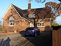 The Old School House, Heath Lanes - geograph.org.uk - 5999124.jpg 1,469 × 1,102; 651 KB
-
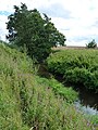
 The River Roden - geograph.org.uk - 5498665.jpg 1,306 × 979; 848 KB
-
 The River Roden - geograph.org.uk - 5498690.jpg 1,102 × 1,469; 851 KB
-
 The road towards the A442 - geograph.org.uk - 5996814.jpg 1,469 × 1,102; 571 KB
-
 The Shropshire Way south of High Ercall - geograph.org.uk - 5498630.jpg 1,469 × 1,102; 652 KB
-
 The smell of water - geograph.org.uk - 5498655.jpg 1,632 × 1,224; 948 KB
-
 The valley of the Roden - geograph.org.uk - 5498651.jpg 1,469 × 1,102; 610 KB
-
 Towards Tern Farm from Tern Lane - geograph.org.uk - 6244064.jpg 1,306 × 979; 454 KB
-
 Warehouses, High Ercall - geograph.org.uk - 4065128.jpg 640 × 480; 258 KB
-
 Water meadows in the valley of the Roden - geograph.org.uk - 5498666.jpg 1,469 × 1,102; 594 KB
-
 Water meadows of the River Roden - geograph.org.uk - 5498679.jpg 1,469 × 1,102; 716 KB
-
 Wheat, Pool Farm - geograph.org.uk - 4065138.jpg 640 × 480; 257 KB
-
 Winter wheat near Ellerdine Heath - geograph.org.uk - 5995362.jpg 1,469 × 1,102; 697 KB


